In this article
You are forty-five minutes north of New York City, standing in front of a mountain that tops out under 1,300 feet, and every instinct you have says this is a walk. Then you meet the stone steps.
One hiker who described himself as reasonably fit did the full loop and called it roughly three hours of uphill with almost no flat ground, followed by an hour of stairs on the way down, and said he hurt for days afterward. The reason the Bear Mountain hike difficulty ratings contradict each other so badly, AllTrails says Hard, the New York–New Jersey Trail Conference says Easy, is that they are rating two different trails to the same summit in Bear Mountain State Park, New York. Here is the honest verdict on both, and how to pick the one you actually came for.
The two routes to the same Hudson Valley summit, side by side:
| Route | Distance | Elevation Gain | Difficulty | Time | Who It’s For |
|---|---|---|---|---|---|
| Bear Mountain Loop Trail (Major Welch up, Appalachian Trail down) | 3.8 miles | ~1,100 ft, nearly all in under a mile | Hard (AllTrails) | 3–4 hours | Hikers fine with sustained climbing and occasional hands-on scrambling |
| All Persons Trail / Summit Loop | 0.75 mi out-and-back, or 1.3 mi full loop | Minimal, 8% max grade | Easy (NYNJTC) | Under 1 hour | Families with strollers, wheelchair users, anyone who wants the view without the terrain |
How Hard Is the Bear Mountain Hike, Really
The honest answer for the route almost everyone means: it is hard, and the number that makes it sound easy is the one people fixate on. The Bear Mountain Loop Trail, Major Welch Trail up and Appalachian Trail down, runs about 3.8 miles. AllTrails rates it Hard.
Other guides call it moderately strenuous. Hike the Hudson Valley scores it an 8 out of 10 for ruggedness.
That spread is not sloppiness on anyone’s part. It is what happens when a short trail delivers a long day.
The elevation gain is the part that catches people. Roughly 1,100 feet, and almost every foot of it arrives in well under a mile of climbing. You do not take this mountain in even bites across a 3.8-mile loop.
You take the whole thing in the first hour, on a blue-blazed trail that leaves Hessian Lake and starts going up immediately and does not really stop. If you have ever done a switchback climb where the grade eases every few minutes and you catch your breath on the flats, this is not that. There are almost no flats.
Current trail conditions matter more here than on most Northeast routes, because the ascent has been rerouted twice since 2023. If you want to know whether the route is even open right now, the Major Welch Trail’s current status and detour is worth two minutes before you drive up, because the answer has changed more than once since 2023.
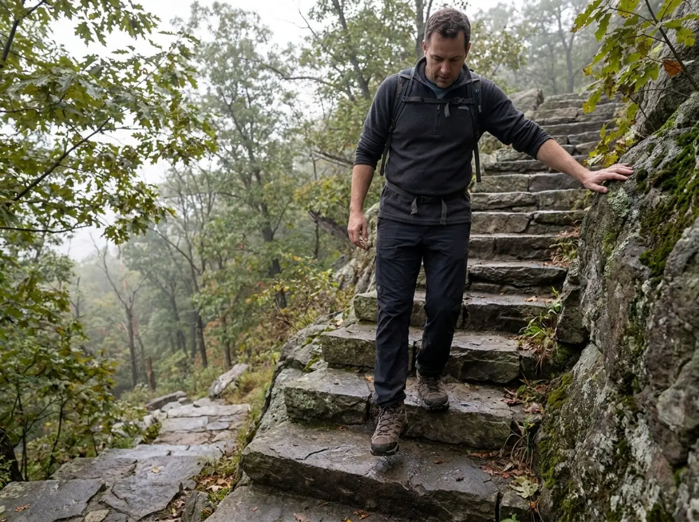
Plan on three to four hours of moving time. The most useful breakdown available comes from a hiker who did the full loop and wrote it up plainly: about three hours climbing with little flat ground, then roughly an hour of stone steps on the way down, some of them very steep. He described himself as reasonably fit, finished the loop, and said he hurt for days after. He also said he did not think he would be back.
That is the single most honest sentence written about this trail anywhere, and it is buried in a comment section while the guides at the top of the search results lead with the Hudson River views.
Budget four hours even if you think you are fast. Not because you will need all of it, but because the number people miss is the descent. Almost everyone plans the climb and treats the way down as free time. On this mountain it is the half that runs long.
So why does 1,289 feet mislead so many people? Because summit elevation is the wrong unit here. Next to the Catskills or the Whites, that number reads like a hill.
But you are starting near river level, which means the full 1,100 feet of gain is real, and it is packed into a stretch of trail where the tread is broken rock and exposed bedrock rather than dirt. Grade and tread decide how a hike feels. Altitude decides how it sounds in a caption.
The Two Routes to the Same Summit
Here is what most people standing in the parking lot do not know: there are two ways to the top of this mountain, and one of them is officially rated Easy. Not easier. Easy. They both reach the Perkins Memorial Tower area and the same main overlook.
Almost no article ranking for this question mentions the second one exists, which means readers either grind out a route they were not ready for or write off Bear Mountain State Park entirely because they heard about the thousand steps.
That gap hurts one group in particular. The first-time hiker planning an NYC day trip picks this mountain precisely because it is close and famous, arrives with no sense of which of the two trails they booked their morning around, and finds out on the bedrock. A beginner hiker who knew both options existed would simply have chosen differently.
The Bear Mountain Loop Trail (the hard answer)
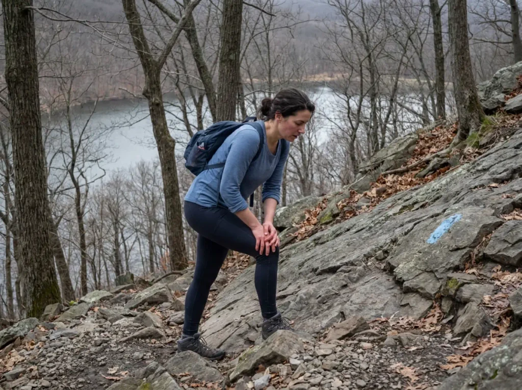
The Major Welch Trail leaves from near Hessian Lake and climbs the west face, blue-blazed the whole way. It is a rugged climb: steep, rocky, and in a few places it puts you on open bedrock slabs where you will use your hands. That is not a formality. There are sections where the tread stops being a trail and becomes a slanted piece of the mountain with blazes painted on it.
The descent takes the white-blazed trail, the Appalachian Trail itself, from Perkins Memorial Tower down the famous stone staircase. Different problem entirely: no route-finding, no scrambling, just a long sustained sequence of irregular stone edges taken at whatever pace your knees allow.
Who it suits: hikers who are comfortable with a full hour of continuous climbing and who do not mind occasionally putting a palm on rock. If both of those sound fine, you will enjoy this loop. It is a genuinely good trail, and the view from the tower earns the work.
The All Persons Trail and Summit Loop (the easy answer)
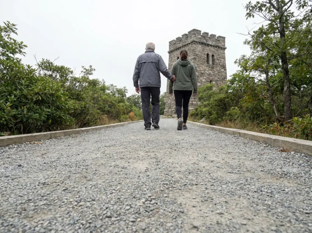
The All Persons Trail runs 0.75 miles out-and-back, or 1.3 miles if you do the full summit loop. The tread is ADA accessible crushed gravel with a maximum grade of 8%, and the New York–New Jersey Trail Conference rates it Easy. Those numbers come straight from the official All Persons Trail and Summit Loop description from the New York–New Jersey Trail Conference, which is the source almost nobody writing about Bear Mountain difficulty bothers to read.
The path runs through low mountain laurel and thin oak the whole way, which is pleasant rather than scenic until the last hundred yards.
The part that changes the whole calculation: it reaches the same summit area and the same main overlook as the hard loop. Not a lesser viewpoint. Not a consolation lookout partway up. The same view, on gravel, at 8% grade.
Who it suits: families pushing strollers, wheelchair users, anyone hiking with older relatives, anyone recovering from a knee or ankle problem, and anyone who came to the Hudson Valley for the overlook rather than for a workout. That is a much larger group than the search results would suggest.
How to pick between them
Start from what you actually want out of the day, because the view is close to identical on both routes. What differs is the effort and the exposure to technical terrain.
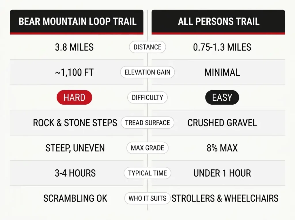
The honest decision rule is to pick by the slowest person in your group and by what the rock is doing that day, not by pride. A mixed group with one member who is unsure will have a better morning on the gravel than a worse one on the slabs, and everybody gets the same photo at the top. If you tend to talk yourself into routes and then regret them at the halfway point, sorting a trail by your actual hiking level is a habit worth building before you drive anywhere.
Why the Descent Hurts More Than the Climb
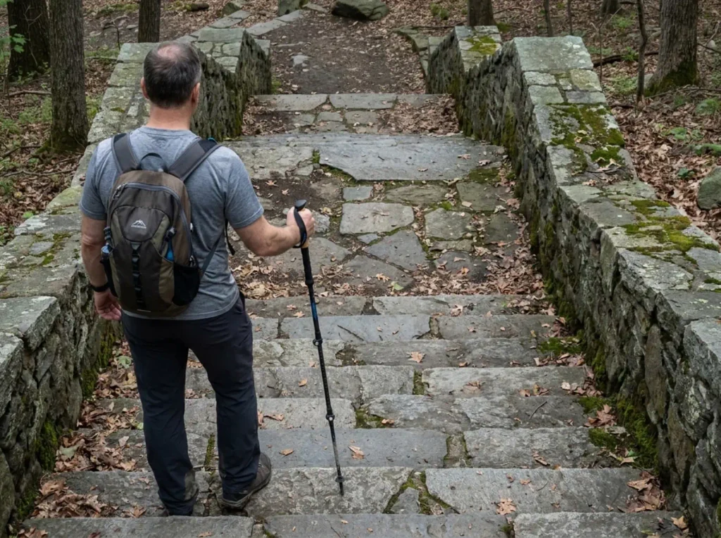
Everyone braces for the climb. Nobody braces for an hour of stairs going down, and that is the part people are still feeling on Tuesday.
Over a thousand stone steps, and why the count is disputed
The Appalachian Trail descent carries what NYNJTC describes as over 1,000 hand-hewn stone steps, built in stages between 2010 and 2018 by professional trail crews, AmeriCorps members and volunteers across a project that ran roughly thirteen years end to end. This is not a set of steps somebody stacked. It is native stone, cut and placed, and it is the largest trail-construction effort of its kind in the region.
The exact count is genuinely disputed, which tells you something. One hiker physically counted the steps on the AT section and got 716. The thousand-plus figure is a widely repeated round estimate that probably folds in the stairs on the Major Welch side too. The honest framing is hundreds of them, roughly a thousand, on the descent alone.
Another hiker started counting on the way down with his son and gave up somewhere around 200. That detail says more about what the section feels like than any precise number would.
If you have done the stone-step descent at Kaaterskill Falls, you already have the reference point. Bear Mountain’s is longer, and it comes at the end of a day rather than partway through.
Technical, not aerobic
The difficulty profile here is unusual, and it is the reason the ratings never agree. Going up, you get short bursts of rock scrambling on exposed bedrock. Coming down, you get sustained knee-loading on irregular stone for an hour.
Neither of those is a cardio problem. Your lungs are not the limiting factor on this mountain.
The practical consequence catches people out constantly: a fit runner can have a rough day here while a slower, careful hiker gets through fine. If you are curious where hands-on scrambling sits on the risk scale, the Major Welch sections are firmly in the territory where balance and judgment matter more than raw fitness level.
Bad knees will punish you on the descent regardless of how strong your legs are. Discomfort on steep rock will punish you on the ascent regardless of your mile time. Fitness is not the variable most people think it is.
Take the steps at a shorter stride than feels natural and let your quads absorb the drop instead of locking your knees. Long steps down stone feel faster and cost you three days of soreness. The hikers who come off this descent fine are the ones who looked slow doing it.
What “the stairs” and “the scramble” mean locally
Spend any time around this mountain and you will hear regulars split the loop into two named halves. The stairs means the AT stone-step descent. The scramble means the Major Welch ascent.
Two sections, two entirely different problems, and treating them as one hike is how people mis-plan the day. When someone asks how hard Bear Mountain is, the useful counter-question is which half they are worried about.
What to Bring for the Bear Mountain Loop
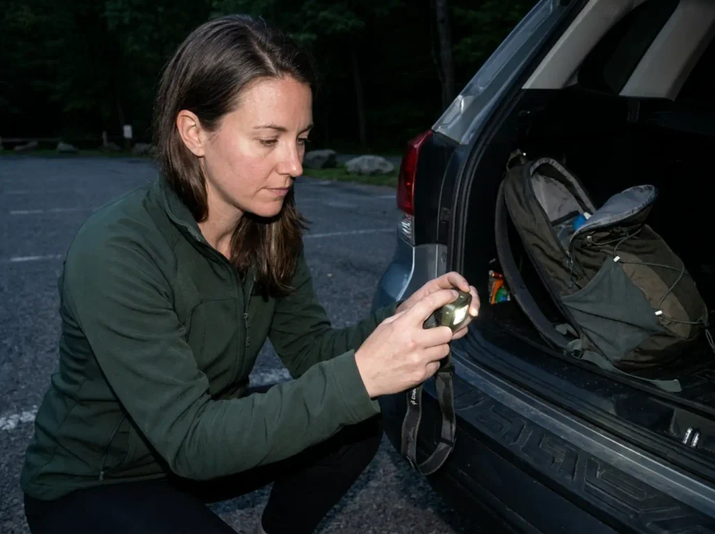
The gear conversation for this trail is short. This is not a backpacking trip. It is a four-hour day hike with a knee-punishing descent that runs longer than people budget for, and three or four items carry the entire load.
Trekking poles are the highest-value thing you can put in your hands on this trail. Not a nice-to-have. The clearest field advice on Bear Mountain is a hiker crediting a walking stick directly with getting his knees down the stone steps intact. Here is where people go wrong: they skip poles because the hike is “only 3.8 miles,” and then they meet the descent. A collapsible pair like the Cascade Ultra Light 100% Carbon Fiber Trekking Poles (check them here) covers this at a budget-friendly price and packs down small enough to stow when you do not want them. If your knees already complain on descents, training your knees for descents like this one does more for your Bear Mountain day than any piece of gear will.
One caveat that matters here specifically: poles help enormously going down and get in the way going up. On the bedrock slabs of Major Welch you want both hands free. Collapse them, strap them to your pack, and pick them back up at the tower. That is not a small detail, and when poles should come off and go on your pack is a distinction plenty of hikers learn the awkward way, mid-slab, with a pole dangling from one wrist.
Hiking boots with real ankle support are the second call. The Major Welch ascent is loose, uneven rock and the descent is a thousand irregular stone edges, which is exactly the terrain that rolls an ankle when you are tired. A mid-cut waterproof boot with a Vibram outsole, like the Merrell Moab 3 Mid Waterproof (men’s · women’s), is the sensible mid-range default for this loop. Trail runners are fine for experienced hikers in dry conditions and are the wrong tool the moment the rock is wet. Whichever you wear, check whether your boots still have the tread for it before you go, because worn rubber on damp bedrock is a different hike than the one you planned.
A headlamp, because the three-hour climb plus the hour of stairs routinely runs past what people budgeted. Getting caught partway down the stone steps in fading light is the completely avoidable version of a bad day, and phone flashlights are useless when you want both hands on a pole. The Black Diamond Spot 400 (check it here) runs 400 lumens with spot and flood modes and holds a charge long enough that you can leave it in your pack all season and forget about it.
A layering system that survives a windy summit is the item people skip because the hike is short. The tower sits exposed, and a shirt soaked through on a 1,100-foot climb turns cold the moment you stop moving at the top. Cotton kills is a blunt phrase for a real mechanism: cotton holds sweat against your skin and keeps pulling heat out of you long after you have stopped working. Synthetic or wool base layers dry instead. Add waterproof layers in a pack you are carrying anyway, because Hudson Highlands weather turns over faster than the drive up would suggest.
A real daypack for water, layers and food. Three to four hours in exposed terrain with a windy summit is not a stroll to an overlook, and a 20 to 25-liter pack with a hydration sleeve covers it comfortably. The Osprey Talon 22 / Tempest 20 (men’s · women’s) sits at the premium end but carries a trekking-pole attachment, which is precisely the feature you want on a trail where the poles need to come off for twenty minutes and go back on afterward. Any 20 to 25-liter pack works; that one just happens to solve this trail’s specific problem.
Conditions, Closures, and the Season You Pick
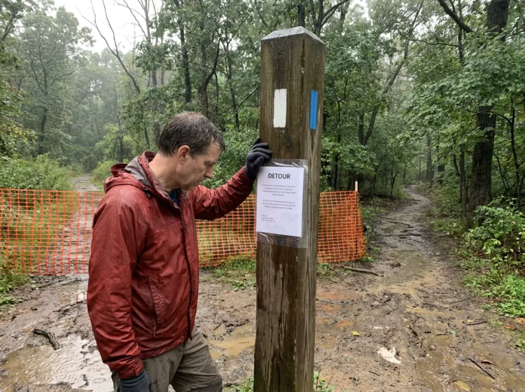
Difficulty on this mountain is not a fixed property. The same 3.8-mile loop is a meaningfully different hike in January than it is in July, and parts of it have been closed, rebuilt or rerouted within the last three years. If you found a blog post from 2021 and are about to drive two hours on the strength of it, read this section first.
Winter and wet rock change the rating
The Major Welch ascent includes exposed bedrock slabs, not stairs. Dry, they are an interesting bit of scrambling. Wet or iced, they move from awkward to hazardous, and there is no railing and no alternative line. Winter on this route is a real decision, not a seasonal footnote, and it is the single biggest reason the difficulty rating you read online may not match the trail you find.
Ice on trail is the specific hazard, not snow. Snow on the stone steps is manageable and even helpful, since it fills the irregular edges that punish knees the rest of the year. A thin glaze on the open slabs of the ascent is the opposite, because there is nothing to grab and nothing to stop a slide. Winter hiking here is entirely reasonable with traction on your boots and entirely unreasonable without it, and that distinction is the whole of the seasonal decision. Snowshoeing is a poor fit for this particular loop, where the problem is grade and rock rather than depth, though it works well on the flatter trails elsewhere in the park.
Shoulder season is the underrated window. Late March and early November give you bare rock, thin crowds and a clear scenic overlook from the tower, since the leaves that block the panoramic views in August are down. The trade is mud on the lower approach and a shorter afternoon.
Perkins Memorial Drive is open to vehicles roughly April through late November, weather permitting, and closed to cars in winter. Hikers can still walk the road. That closure changes the summit completely: in season you share the tower with people who parked forty feet away, and in February you may have it to yourself. Some hikers pick their month for exactly that reason.
What the 2023 storm changed
On July 9, 2023, a storm dropped roughly ten inches of rain on the park. The storm damage reached nearly every trail across its 42-mile system and the resulting trail closures shut Bear Mountain State Park for two months. The Appalachian Trail and Major Welch sections reopened for Memorial Day weekend 2024 after about $40 million in repairs, which you can read in the state’s own account of the 2023 storm repairs and reopening.
Reopened does not mean restored to the original routing. Major Welch, the AT and the Suffern–Bear Mountain Trail all carry active detours near the Bear Mountain Inn, tied to construction scheduled to run through Summer 2027. Older write-ups describe a start that no longer exists on the ground. This is not unique to Bear Mountain either, Breakneck Ridge is closed on a much longer timeline, and the two closures together have pushed a lot of traffic onto trails that were not built for it.
Follow the signage on the ground, not the written description you memorized at home. One recent hiker reported downed trees near the water tanks on the Major Welch approach with a marked detour around them. The blazes and the signs are current. Your saved article is not.
If your date does not work out, or the lot is full when you arrive, the nearby Cold Spring trails people fall back on sit close enough that a change of plan costs you twenty minutes of driving rather than the whole day.
Parking, Crowds, and Sharing the Mountain
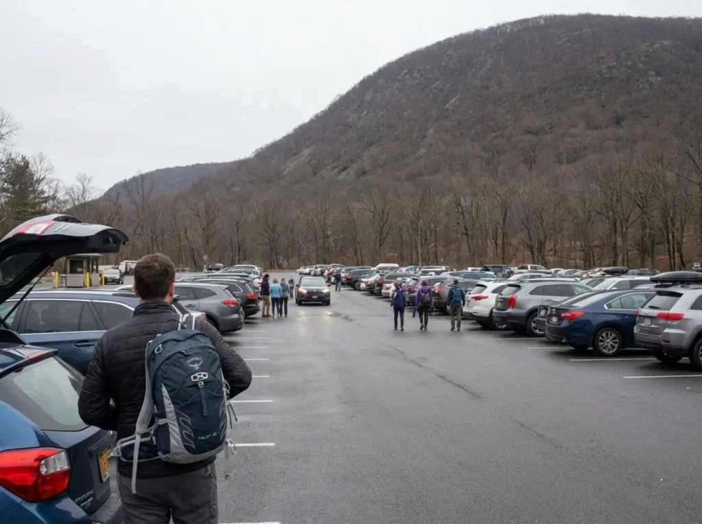
The most common complaint about Bear Mountain is not the trail. It is the lot. People drive up from the city on a Saturday morning, sit in a queue, discover the booth wants ten dollars cash they did not bring, and start the hardest climb of their month already irritated.
The parking reality
Parking at the main lot is $10, cash only. There is no card reader at the booth. Bring the cash or plan on a detour to find an ATM, which on a busy morning costs you the parking spot you were queuing for. Fees, hours and regulations are on NYS Parks’ official Bear Mountain State Park page, and they are worth a glance before you leave since they do change.
The fix is simple and everybody who hikes here regularly does it: arrive before the booths open around 8am. You beat the crowd and the fee window in one move, and you get the Major Welch climb done before the sun is on the west face.
The parking fee is the smaller problem; the queue is the real one. The lot fills on weekends and a crowded summit is the default rather than the exception. This is a park forty-five minutes from New York City on a nice Saturday. Treat it accordingly.
The summit you are sharing
Because Perkins Memorial Drive delivers cars to the tower in season, the summit crowd is mixed in a way that surprises first-timers. Regulars call the drive-up visitors cheaters, mostly affectionately. You will finish a thousand stone steps of climbing and find someone in sandals eating an ice cream beside a parked sedan.
Worth reframing rather than resenting. That same road access is what makes the All Persons Trail viable for people who could not otherwise reach that overlook at all. A summit that is easy to get to is a summit more people get to see, which is the whole point of building an ADA-compliant trail to it.
Bears, snakes, and the boring safety basics
Black bears live in the park and throughout the surrounding Hudson Highlands and Harriman State Park area. Standard Northeast food-storage and encounter protocol applies, and it matters most around Hessian Lake and the Bear Mountain Inn, where food odors concentrate and bears learn fast. Bear safety here is routine rather than dramatic. If you want the short version of what to actually do in a black bear encounter, it is worth knowing before you need it rather than after.
Timber rattlesnakes and copperheads are present in the region’s rocky terrain. This is a scrambling-etiquette point more than an alarm: look before you put a hand on a warm ledge during the ascent. That is good practice on any rocky Northeast trail and costs you nothing. Should the unlikely happen, the walk-out versus wait protocol for a snakebite is one of those things worth reading once in your life at home.
One last regulation: no overnight camping in Bear Mountain State Park. This is a day-use mountain, full stop. The park is run by the Palisades Interstate Park Commission, and the trails themselves are maintained by the New York-New Jersey Trail Conference and its volunteers, which is worth remembering on a busy Saturday. Leave No Trace on a mountain this heavily used is less about wilderness ethics than about basic arithmetic: a thousand people a day each leaving one orange peel is not a trail anyone wants to walk.
Bear Mountain is one trail in a region full of them, and the difficulty question you are asking here repeats itself at every trailhead between the Hudson and the Shawangunks. Our full guide to hiking this corner of the Hudson Valley covers the same honest-difficulty framing across the rest of the region, which is useful the moment you start planning a second trip.
Conclusion
There is no single Bear Mountain difficulty rating because there is no single Bear Mountain hike. The loop is hard, the All Persons Trail is genuinely easy, and both of them end at the same view. Once you know that, the contradictory ratings stop being confusing and start being useful.
The descent is what hurts. Bring a pole, shorten your stride on the stone steps, and stop treating 1,289 feet as a number that tells you anything about the day ahead.
Check current conditions before you drive. Detours near the Inn run through Summer 2027, and the mountain in February is not the mountain in July.
Pick your route before you get in the car, not in the parking lot. Decide which of the two hikes you are actually there to do, then check the current trail alerts for the one you picked.
Frequently Asked Questions
01How hard is the Bear Mountain hike in New York?
The main Bear Mountain Loop Trail is rated Hard: about 3.8 miles with roughly 1,100 feet of gain packed into under a mile of climbing, plus a stone-step descent most hikers find harder than the ascent. Plan three to four hours. The separate All Persons Trail reaches the same summit area and is rated Easy.
02How long does it take to hike Bear Mountain?
Three to four hours for the full loop is realistic for most hikers. Field accounts describe roughly three hours climbing with little flat ground and about an hour descending the stone steps. The All Persons Trail summit loop takes well under an hour.
03Is the Bear Mountain hike good for beginners?
The full loop is a stretch for a true first hike. The scrambling sections and the long stone-step descent are what catch people out, not the distance. A beginner who wants the summit view should take the All Persons Trail instead: ADA-compliant crushed gravel with a maximum 8% grade.
04What is the easiest trail to the top of Bear Mountain?
The All Persons Trail and Summit Loop, rated Easy by the New York–New Jersey Trail Conference: 0.75 miles out-and-back, or 1.3 miles for the full loop, on crushed gravel with an 8% maximum grade. It is wheelchair and stroller accessible and reaches the main overlook.
05Do I need to pay to hike Bear Mountain?
Parking at the main lot is $10, cash only. Arriving before the booths open around 8am often means uncontested access, and it beats the weekend crowd that fills the lot by mid-morning.
Risk Disclaimer: Hiking, trekking, backpacking, and all related outdoor activities involve inherent
risks which may result in serious injury, illness, or death. The information provided on The Hiking Tribe is for
educational and informational purposes only. While we strive for accuracy, information on trails, gear, techniques,
and safety is not a substitute for your own best judgment and thorough preparation. Trail conditions, weather, and
other environmental factors change rapidly and may differ from what is described on this site. Always check with
official sources like park services for the most current alerts and conditions. Never undertake a hike beyond your
abilities and always be prepared for the unexpected. By using this website, you agree that you are solely
responsible for your own safety. Any reliance you place on our content is strictly at your own risk, and you assume
all liability for your actions and decisions in the outdoors. The Hiking Tribe and its authors will not be held
liable for any injury, damage, or loss sustained in connection with the use of the information herein.
Affiliate Disclosure: We are a participant in the Amazon Services LLC Associates Program, an
affiliate advertising program designed to provide a means for us to earn advertising fees by advertising and linking
to Amazon.com. As an Amazon Associate, we earn from qualifying purchases. We are also an official affiliate partner
of Black Diamond Equipment via the AvantLink network. If you click on a Black Diamond affiliate link and make a
purchase, we may earn a commission at no additional cost to you. We also participate in other affiliate programs and
may receive a commission on products purchased through our links. Additional terms are found in the terms of
service.