In this article
It’s Sunday afternoon on Route 9D and the shoulder outside Breakneck Ridge is a parking lot, cars nosed into the guardrail for half a mile while a shuttle bus tries to squeeze past. Twenty minutes east, a hiker pulls into the Catfish Loop trailhead at Fahnestock State Park and counts two other cars. That’s not hypothetical: The Highlands Current documented exactly that split on a weekend when Breakneck, Bull Hill and Mount Beacon were all mobbed at once.
Locals have known about this release valve for years and almost nobody writing about the region says it out loud. Here’s what the park actually is, which trail fits the time you’ve got, the 2026 camping situation that will wreck a trip if you miss it, and what happens here after the beach closes.
What Fahnestock State Park Actually Is
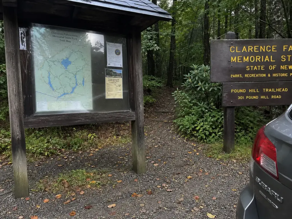
Most people meet this park as a green blob on the map between the Taconic State Parkway and U.S. Route 9 and file it away as a picnic area with a lake attached. The size is the part that surprises everyone. Clarence Fahnestock Memorial State Park covers around 15,000 acres, which makes it one of the largest state parks in the Hudson Valley, and it spans three towns.
Where It Sits and How to Get There
The park crosses Putnam Valley, Kent NY and Carmel NY, with the bulk of the acreage in northern Putnam County between the Taconic and Route 9, and a slice reaching north into Dutchess County. The main address is 1498 Route 301 in Carmel, the entrance you want for Canopus Lake, the beach and the campground.
From New York City that’s roughly an hour and change without traffic, the same driving band as Cold Spring NY or Beacon. Because the Taconic and Route 9 bracket the park, several trailheads are a short detour off a road you’re already on, and the Taconic Outdoor Education Center sits inside the park for groups that want a programmed weekend instead of a self-guided one. Check current fees and hours on the official NY State Parks page before you drive up, because those windows shift by season.
The Doctor the Park Is Named For
Dr. Ernest Fahnestock donated the original 2,400 acres in 1929 in memory of his brother, Dr. Clarence Fahnestock, a Manhattan physician who died of pneumonia in 1918 while treating soldiers during World War I. The park has grown roughly sixfold since.
The other name on this land is the Civilian Conservation Corps. CCC crews built much of the original infrastructure in the 1930s, and you can feel it underfoot. Stone work, sensible drainage, benched trail beds that still shed water ninety years later.
How Big 15,000 Acres Actually Feels
In practical terms: somewhere between 50 and 77 miles of blazed trail depending on who’s counting, including about nine miles of the white blaze of the Appalachian Trail. Water is scattered through all of it. Canopus Lake gets the attention, but Stillwater Lake, Hidden Lake and Pelton Pond are all in here too, which is why so many routes end up circling something.
You can hike here every other weekend for a year and still find junctions you haven’t taken. That scale means picking your trailhead before you leave the house instead of from the parking lot, and it means checking the elevation gain on whatever day hike you pick, because the profile here is deceptive. It’s the same trip-planning approach that works for Sam’s Point: with a big New York state park, the decision that matters happens at the kitchen table.
Why Fahnestock Stays Empty While Breakneck Fills Up
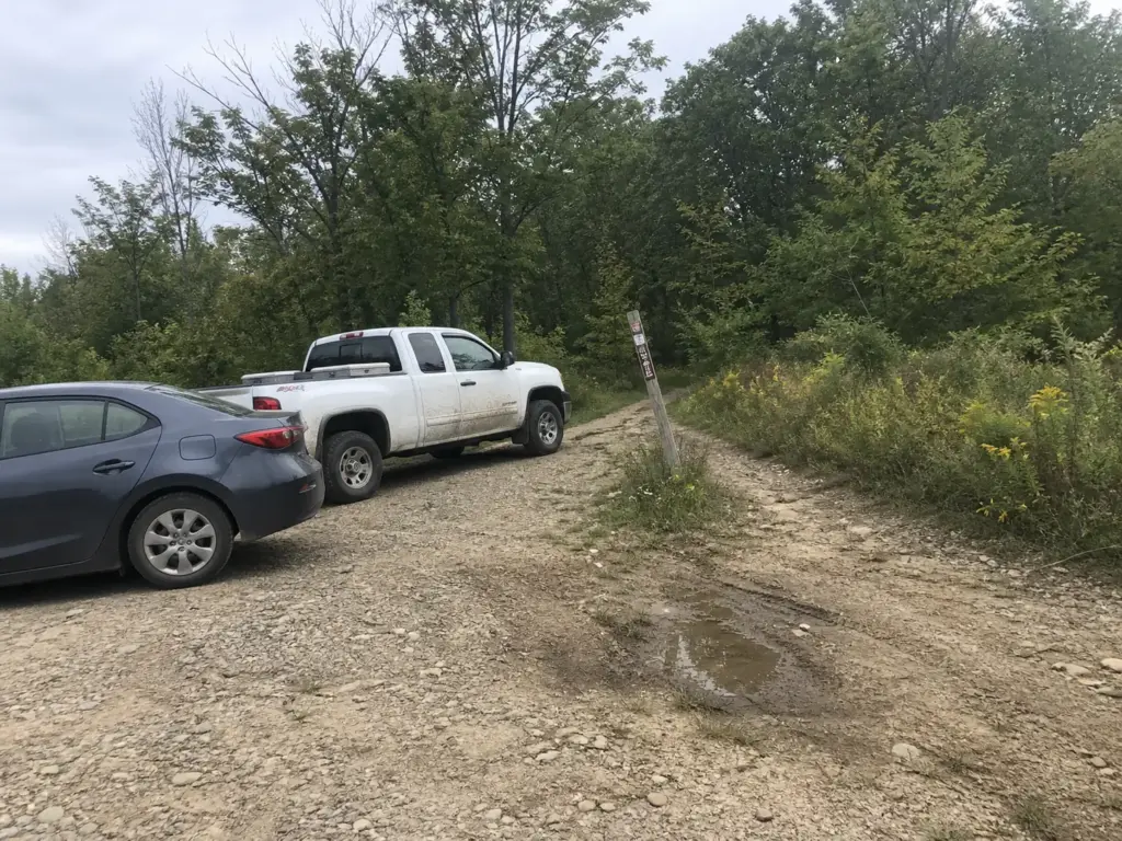
Everybody in the Hudson Valley knows the Breakneck problem. The shuttle crowds, the queue at the first scramble where twenty people wait their turn on one rock step, the cars strung down Route 9D. What almost nobody connects to that picture is the 15,000-acre park sitting twenty minutes east with similar terrain and no line.
The Two-Cars-Versus-Mobbed Weekend
The evidence here isn’t vibes. The Highlands Current counted two cars at the Catfish Loop trailhead on a Sunday afternoon while Breakneck Ridge, Mount Taurus (Mt Taurus on older maps, Bull Hill to everyone who hikes it) and Mount Beacon were all packed the same weekend. Same region, same day, opposite experience.
That gap has held up for a decade, and not because Fahnestock is a secret. It’s that Breakneck has one thing this park doesn’t, and that one thing is what people drive up for.
What You Give Up (and What You Get)
The honest trade: you give up the river. Breakneck’s payoff is the scramble and the Hudson panorama, that sequence of rock steps opening onto the river bending around Storm King. Fahnestock has none of it. What it has instead is shaded rolling forest, pond after pond, and stretches where you won’t pass anyone for two hours.
What you get in exchange is everything logistical. No shuttle, no parking-shoulder gamble, no queue at a bottleneck, and a network big enough that you set your own distance instead of committing to one fixed out-and-back. If you want the classic Highlands view day, Bull Hill and the Cornish Estate ruins out of Cold Spring deliver the river and the ruins without the Breakneck line, which is the other move locals make.
Treat Fahnestock as your programmed fallback, not your plan B. Load the Route 301 entrance into your phone before you leave, so that when you crest the hill on 9D and see the shoulder full, you keep driving instead of circling for twenty minutes and going home frustrated.
When Breakneck Is Still the Right Call
Two readers should ignore everything above. If it’s your first trip to the Highlands and you came for the view, go to Breakneck. If you want the scramble specifically, the hands-on-rock part, Fahnestock won’t scratch that itch.
None of this argues Breakneck is a bad hike. It argues it’s the wrong default for the tenth trip. If you’re going anyway, go knowing everything Breakneck Ridge actually demands of you, because what turns people around on that trail is underestimating it, not the crowds.
Pick Your Fahnestock Hike by How Much Time You Have
Trail aggregators hand you ten trails behind a signup wall and let you sort it out. What a hiking buddy actually does is ask how long you’ve got and name one route. So here’s the decision tree the SERP won’t give you.
Two Hours or Less
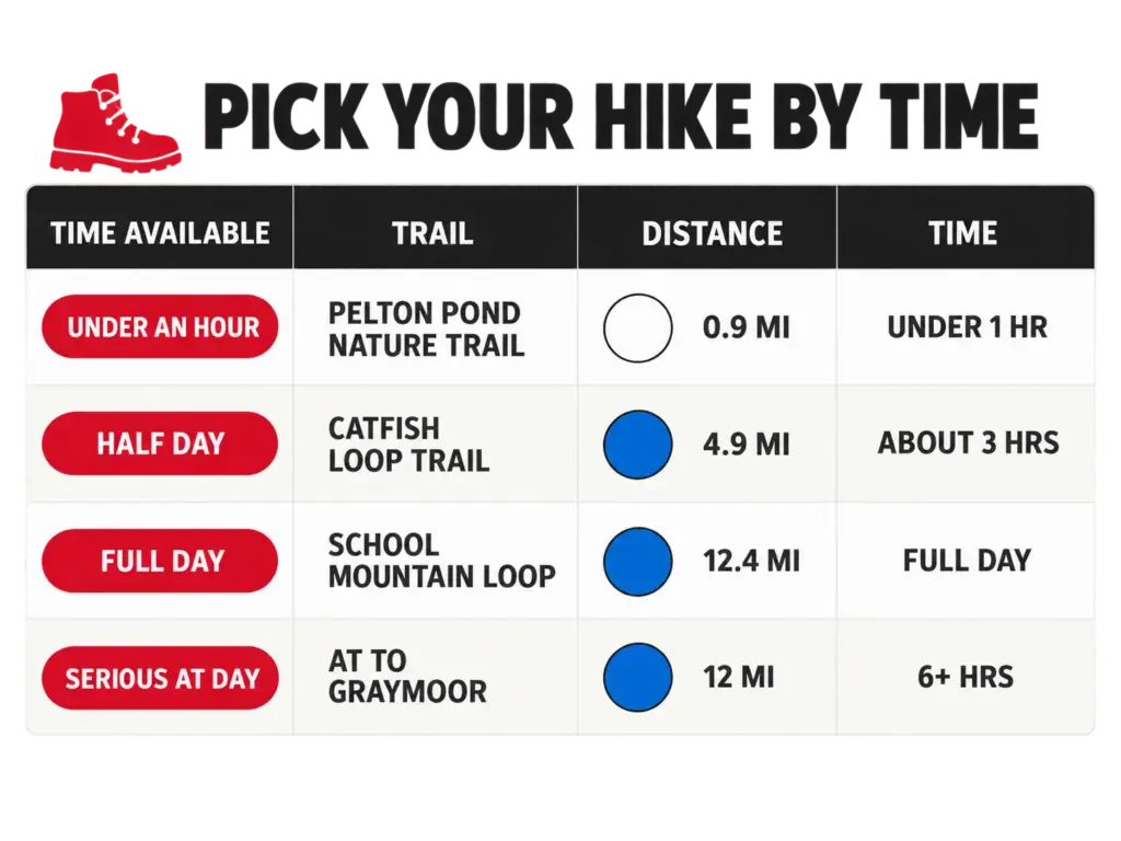
The Pelton Pond Nature Trail is the flat one, about 0.9 mile, and it’s dog-free. That combination makes it the after-work walk and the small-kids option, and the pond keeps a four-year-old interested the whole way around. Two other short legs sit in the same range: the Hubbard Loop Trail at roughly 0.9 mile on a yellow blaze, and the Round Hill Bypass at about 0.8 mile on green.
The Hubbard-Perkins side has seen real money spent on it recently. The Open Space Institute’s trail restoration work at Fahnestock documents the rebuilt tread and new crossings, which is why sections that used to be a mess now drain properly.
Half a Day on the Loop Trails
Two good answers here. The combined School Mountain Road to Fahnestock Trail (blue blaze) to Round Hill Bypass (green blaze) loop runs about 4.4 miles and packs real variety of trail character into one circuit. Or take the Catfish Loop Trail at roughly 4.9 miles, the one with the crowd-count receipts attached.
Both are lollipop loops, worth knowing because trail descriptions here assume you already do. A lollipop walks out on one trail, circles a loop at the far end, and returns the way it came. When a description says “4.4-mile loop” and the map shows an obvious dead end, that’s why.
Keep linking trail off that same School Mountain and Fahnestock combination and it stretches to roughly 12.4 miles. That’s a full day without touching the AT. The Three Lakes Loop is the other name you’ll see on maps for stringing the park’s water together on one circuit.
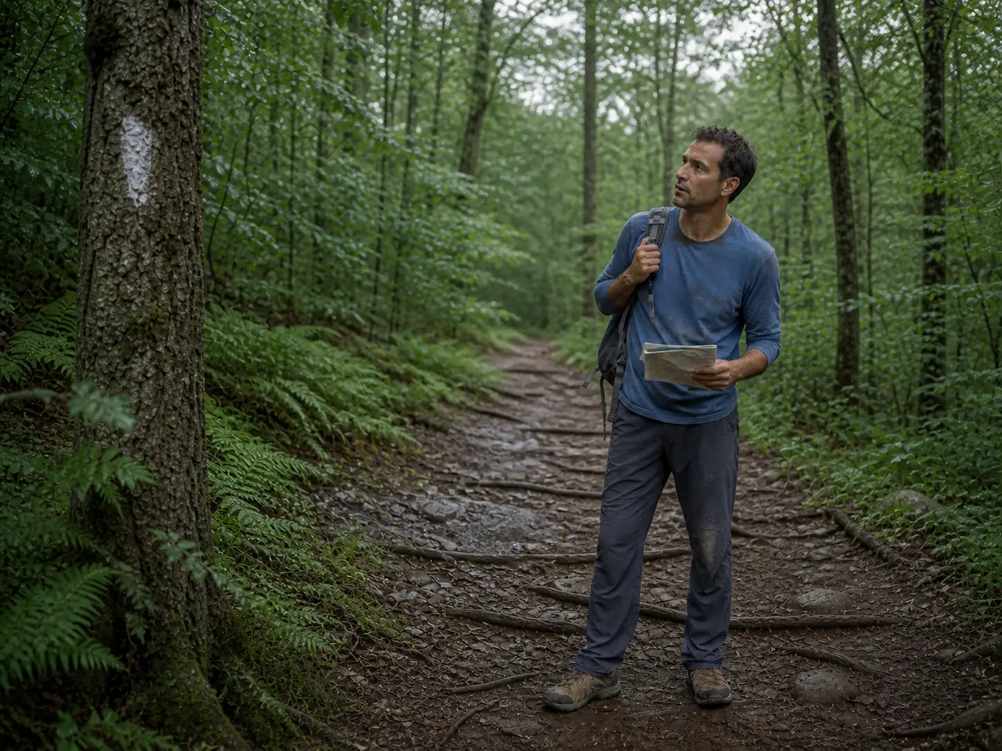
Navigation here runs on blaze colors, not trail names. White is the Appalachian Trail, blue is the Fahnestock Trail, green is the Round Hill Bypass Trail, yellow is the Hubbard Loop. Junction signage leans on the colors, so the paper that matters is a map that shows them.
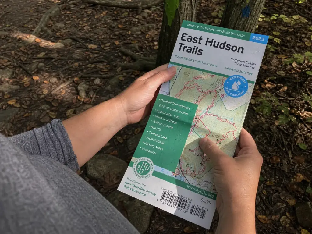
The New York-New Jersey Trail Conference East Hudson Trails Map comes from the organization that maintains these trails, printed on waterproof stock, and it covers Hudson Highlands State Park Preserve and Fahnestock on one continuous sheet. That last part is the reason to carry it over a generic topo: a Breakneck-morning-into-Fahnestock-afternoon day is one map, not two, with no cell signal required at the junction where it matters.
The Full Appalachian Trail Section
The AT stretch from Canopus Lake to Graymoor runs 12 miles with about 2,030 feet of gain, rated hard, and takes most people six to six and a half hours. A real workout and a legitimate section hike day.
Set expectations before you start. This is mostly wooded walking past small ponds, with no big summit vista at the end to pay you back. The reward is the miles and the quiet, which is a fine reason to go if you know it going in and a letdown if you pictured a payoff view. Anyone piecing together AT miles through the Hudson Valley usually links this to the Appalachian Trail’s stretch over Bear Mountain next, the section immediately south, which has the views this one doesn’t.
Canopus Hill’s viewpoints are a leaf-off feature. Fall through spring, when the trees are bare, the views open up through the trunks. In full summer leaf-out that same stretch is a green tunnel with nothing to see sideways, so if the view is why you picked this route, go in November instead of July.
What the Trails Are Actually Like Underfoot
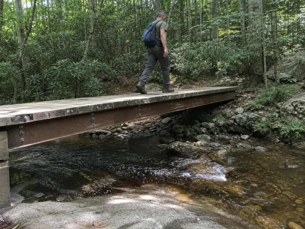
Here’s the thing nobody writes about this park: the bridges. You cross a creek on a footbridge that a group of West Point cadets designed and built as a capstone project, and there’s no sign anywhere telling you that.
The Bridges West Point Built
Stream crossings across the park use wooden and steel footbridges built by West Point cadets as civil engineering capstone projects. The detail lands especially well with kids and first-timers: a creek crossing that was going to be forgotten in ten minutes becomes the thing they tell someone about later.
Some of that infrastructure exists because of Hurricane Irene. A key crossing on the Hubbard-Perkins loop washed out in August 2011 and was rebuilt afterward, part of it in steel I-beam construction, which is why the footing on those crossings feels overbuilt for a state park in the good way. The Open Space Institute’s restoration effort rebuilt more than a dozen miles of trail here and added new bridges, several with West Point.
Footing, Shade and What Rain Does to It
Honest read on the terrain: well shaded, rolling rather than steep, rocky and root-heavy in long stretches, lightly trafficked. Not a scramble park, and it doesn’t pretend to be. The elevation comes in repeated small climbs rather than one sustained grind, easier on the lungs and harder on the knees than people expect. Some of the wider tread you’ll walk is old bridle path, since parts of the network double as equestrian trail, which is why a few stretches feel more like a road than a footpath.
Rain changes the calculation more than the grade does. Wet roots on a rolling descent are the most common way people go down here, and the bridge approaches hold water because they sit at the low point of every drainage by definition. Poles earn their keep on exactly those two things.
One more thing about this place. A hiking forum trip report describes an eight-hour, fifteen-mile day here, well off any “10 best” list, and calls it worth every minute. The park rewards people willing to link trails instead of walking the named loop and going home. It has the same low-key, big-acreage feel as Sterling Forest, where the point is less the destination than the fact that you can walk all day.
Canopus Lake, the Beach and the Camping Situation
This is the half of the park that gets people in the car, and where the most expensive mistake of the season is sitting.
The 2026 Campground Closure, Up Front
The main campground has been closed since September 2, 2025 and stays closed for the entire 2026 season while a new bathhouse gets built. If you were planning to camp here this year, that’s the whole answer. The Group Wilderness Campground remains open, and it’s the only camping this park has in 2026.
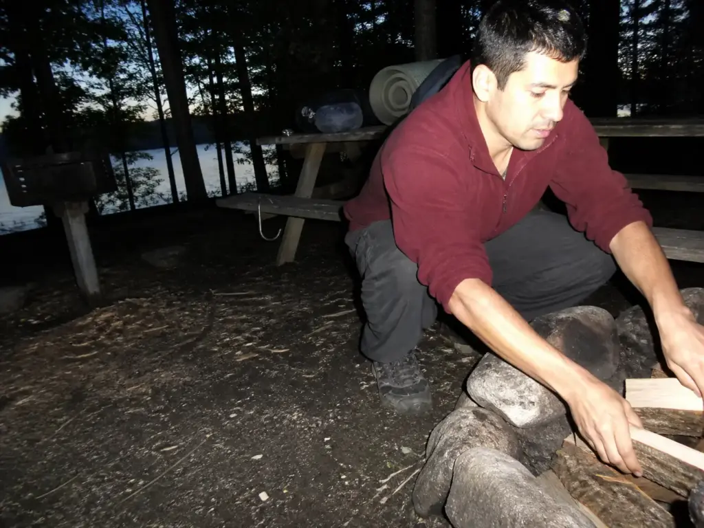
For a future year: the main campground normally runs about 80 sites, each with a picnic table, charcoal grill and fire ring, no RV hookups and no dump station. Rustic tent and small-rig camping, booked through ReserveAmerica.
The Group Wilderness site is more primitive than the drive-in campground, which changes what you pack. If that’s your fallback this season, the gear that makes a first backcountry night comfortable is the list to work from, because everything you’d get away with forgetting at a drive-in site matters when the car isn’t twenty feet away.
Beach Hours and Boat Rentals
The lifeguarded beach at Canopus Lake runs on three overlapping windows, and mixing them up is the second-most-common mistake here. Swimming is 10am to 5:45pm. The beach is open 9am to 6pm. Rowboat rental and kayak rental run 9am to 5pm, last boat out at 4pm.
That 4pm cutoff is the one that gets people. Rolling in at 4:30 on a long summer evening feels early. The beach is open, the water is warm, and the rental window closed half an hour ago.
Fishing the Ponds and Lakes
The fishing here is good and underrated, spread across four ponds and two lakes. Largemouth bass and smallmouth bass, chain pickerel and yellow perch are the resident warm-water crowd, and the state stocks brook trout and rainbow trout on top. A New York State fishing license applies, and there’s a boat launch on Canopus Lake if you’d rather bring your own hull than rent one.
The pond-heavy layout is what separates this from a single-lake park. You can walk to water nobody bothered to walk to that morning, which is the whole game with pressured public fisheries. Ice fishing happens here in a hard winter too, on the same water the rental fleet works in July.
What to Bring and What Trips People Up
Every item in this section is something people find out at the gate or at the trailhead, and every one of them is avoidable by reading one paragraph first.
Fees, Passes and the Empire Pass Exception
The vehicle entry fee is $10 per car, charged weekends and holidays from May 24 through June 20, then daily from June 21 through Labor Day. Straightforward enough. Here’s the part that stings: Fahnestock does not accept the Empire Pass. It’s one of the exceptions, so the $10 applies whether or not the sticker is on your windshield.
People find this out at the booth, car full of kids, holding a pass they bought specifically so they’d never have this conversation. Budget the fee, bring a card, and confirm the current fee schedule and pet rules before a trip, because these windows move year to year.
Dogs, Hours and Park Rules
The pet policy is two pets maximum, six-foot leash, proof of rabies vaccination in the car. Pets are banned from the beach, buildings and playgrounds. The dog is welcome on the trails and not at the lake, which catches out families every summer who planned a beach-plus-trail day around one animal. The Pelton Pond Nature Trail is dog-free too, so that short loop is off the table if the dog is with you.
Outside the beach and winter-park windows, the park keeps dawn to dusk hours. Campground quiet hours are 10pm to 7am. And since a lot of this park sees almost no foot traffic, Leave No Trace matters more here than it does on a trail with a ranger at the bottom: whatever you carry past the trailhead comes back out with you, because nobody is sweeping these loops behind you.
Ticks, Bugs and the Gear That Handles This Terrain
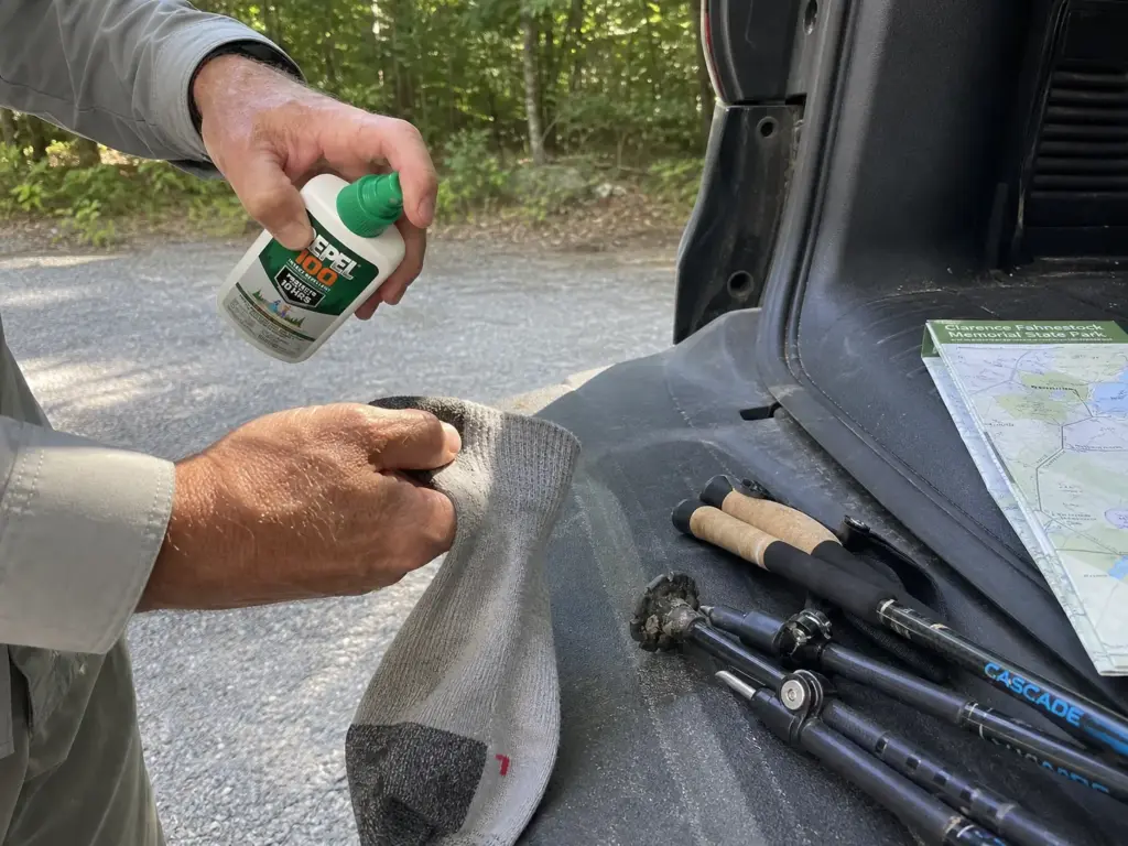
This is a pond-heavy, wet, well-shaded park in a region with a well-documented tick problem. Repellent isn’t the optional item you throw in if there’s room. It goes on in the parking lot before you take a step, and the tick check back at the car isn’t negotiable either.
A high-DEET formula is the right tool here. Repel 100 runs a DEET base rated for around ten hours against ticks, mosquitoes and chiggers, which covers a full day on the AT section with margin left. The budget-friendly 4oz pump bottle lasts a season.
Treat pant cuffs and sock tops first, then everything else, because that’s where ticks actually board you. The fuller version is the same tick routine that New York hikers use downstate, and it transfers to the Hudson Valley unchanged.
The other thing this terrain asks for is poles. Rooty rolling descents and wet bridge approaches are exactly where a third and fourth point of contact stop a slip from becoming a fall, and both are everywhere here.
Carbon fiber earns its place for a simple reason: on a rolling 12-mile day you plant a pole thousands of times, and the weight you swing is the weight that wears you out. The CASCADE Ultra Light carbon fiber poles sit mid-range and collapse short enough to strap to a daypack for the flat stretches. Aluminum costs less and does the same job with more swing weight, a fair trade if you’re only out for the 4.4-mile loop.
Three mistakes keep repeating at this park, and all three happen before you ever set foot on a trail: booking a 2026 campsite that doesn’t exist, showing up after the 4pm rental cutoff, and expecting the Empire Pass to work. Check those three things the night before and you’ve eliminated most of what goes wrong here.
Beyond those three items, a full day-hike kit that covers the rest of it is worth walking through once, because a park this big means longer days than you planned for more often than you’d think.
Fahnestock in Winter and the Rest of the Year
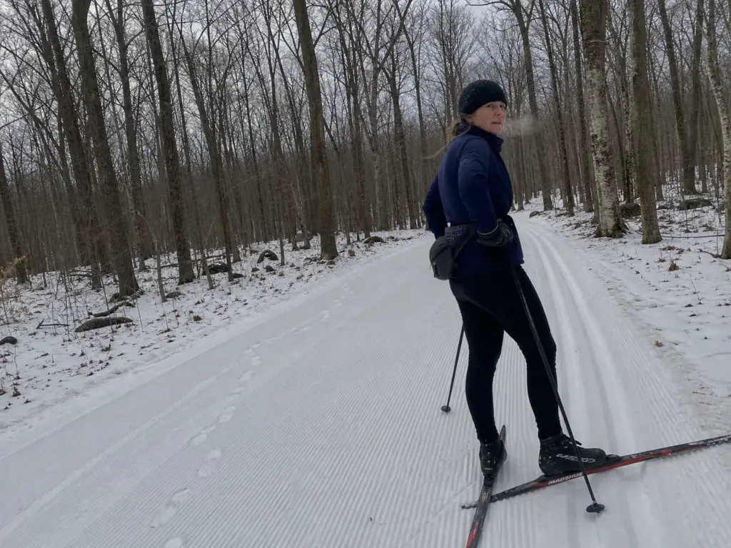
Most guides to this park quietly stop at Labor Day. That’s a mistake, because the winter operation here is one of the better Nordic setups within ninety minutes of New York City and hardly anyone writing about Fahnestock mentions it exists.
The Winter Park Nobody Mentions
Fahnestock Winter Park runs about 20 km of machine-groomed cross-country ski trails set for both skate and classic, plus a snowshoe network and a tubing hill for sledding with kids who have no interest in skiing. Open 9am to 4:30pm daily in season, with rentals on site, so you don’t need to own a thing to try it.
The pricing is genuinely low for what you get. A day pass runs about $12 for adults and $10 for youth and seniors for skiing or snowshoeing, tubing cheaper still, as of the current season. Groomed track at that price ninety minutes from the city is close to unheard of. Confirm on Fahnestock Winter Park’s official trail and pricing page before you go, since pricing and the operating window shift with the snow year.
Fall, Leaf-Off and the Best Views of the Year
Fall is the sleeper season. Leaf-off opens the Canopus Hill viewpoints that summer hides completely, and the shaded-tunnel problem on the AT section disappears at the same time. Views and cooler walking in the same window, which is not a trade you usually get to skip.
Fall is also when the birding picks up, since this park sits in a designated bird conservation area and leaf-off makes the canopy readable for the first time all year. If a bigger fall trip is what you’re planning, the Adirondacks a few hours further north is the natural escalation. Fahnestock is the Saturday. That’s the long weekend.
Hunting Seasons and Shoulder-Season Awareness
Spring turkey season, archery season and muzzleloading run in designated areas. That doesn’t close the trails and isn’t a reason to stay home, but it changes what you wear. Blaze orange in the shoulder seasons, and check current season dates before any day off the marked trail.
The seasonal read locals use is simple enough to remember: summer is the lake, fall is the views, winter is the ski trails, and spring is mud plus the best solitude of the year.
The Short Version
Fahnestock is the Hudson Highlands without the queue. You trade the river vista for a trail you have to yourself, and most weekends that’s the better deal.
Match the trail to your clock. Under an hour is Pelton Pond. Half a day is the 4.4-mile School Mountain loop or Catfish. A serious day is the AT to Graymoor, twelve miles and no summit view at the end.
Check two things before you turn the key: the main campground is closed for all of 2026, and your Empire Pass does not work here.
Next time you drive up 9D and see the Breakneck shoulder packed solid, don’t turn around. Keep going another twenty minutes, park at Catfish Loop, and count how many cars are already there.
Frequently Asked Questions
01Can you swim in the lake at Fahnestock State Park?
Yes. Canopus Lake has a lifeguarded swimming beach with a designated season. Swimming runs 10am to 5:45pm while the beach itself is open 9am to 6pm, and rowboat and kayak rentals operate 9am to 5pm with the last boat going out at 4pm. Dogs are not allowed on the beach.
02Can I camp in Fahnestock State Park?
Not in the main campground during 2026. It closed on September 2, 2025 for new bathhouse construction and stays closed for the full season. The Group Wilderness Campground is still open. In a normal year the main campground has about 80 sites with picnic tables, grills and fire rings, no RV hookups, booked through ReserveAmerica.
03What town is Fahnestock State Park in?
It spans three of them. The park crosses Putnam Valley, Kent and Carmel, with most of its acreage in northern Putnam County between the Taconic State Parkway and U.S. Route 9, and a portion extending into Dutchess County. The main entrance address is on Route 301 in Carmel.
04Can seniors get into New York state parks for free?
New York’s Golden Park Program gives state residents aged 62 and over free vehicle entry to most state parks Monday through Friday, excluding holidays. There is nothing to buy or apply for. Your New York driver license or non-driver ID is the pass. Weekends and holidays still carry the standard vehicle fee.
05Does the Empire Pass work at Fahnestock State Park?
No. Fahnestock is one of the New York state parks that does not accept the Empire Pass, so the $10 per-vehicle fee applies during the fee season regardless of whether you hold one. Budget for the daily fee and check the official park page before you go, since fee windows shift year to year.
Risk Disclaimer: Hiking, trekking, backpacking, and all related outdoor activities involve inherent
risks which may result in serious injury, illness, or death. The information provided on The Hiking Tribe is for
educational and informational purposes only. While we strive for accuracy, information on trails, gear, techniques,
and safety is not a substitute for your own best judgment and thorough preparation. Trail conditions, weather, and
other environmental factors change rapidly and may differ from what is described on this site. Always check with
official sources like park services for the most current alerts and conditions. Never undertake a hike beyond your
abilities and always be prepared for the unexpected. By using this website, you agree that you are solely
responsible for your own safety. Any reliance you place on our content is strictly at your own risk, and you assume
all liability for your actions and decisions in the outdoors. The Hiking Tribe and its authors will not be held
liable for any injury, damage, or loss sustained in connection with the use of the information herein.
Affiliate Disclosure: We are a participant in the Amazon Services LLC Associates Program, an
affiliate advertising program designed to provide a means for us to earn advertising fees by advertising and linking
to Amazon.com. As an Amazon Associate, we earn from qualifying purchases. We are also an official affiliate partner
of Black Diamond Equipment via the AvantLink network. If you click on a Black Diamond affiliate link and make a
purchase, we may earn a commission at no additional cost to you. We also participate in other affiliate programs and
may receive a commission on products purchased through our links. Additional terms are found in the terms of
service.