In this article
You drop a pin on Breakneck Ridge, catch the early train out of Grand Central Terminal, walk up Route 9D with your pack on, and find a fence. No sign-in kiosk, no line of hikers waiting their turn at the first rock face, just construction fencing and a trailhead that isn’t a trailhead anymore.
The closure status on this page was checked against the NY-NJ Trail Conference’s live alert page, not copied from a press release written two years ago, and it reflects conditions as of August 2026. That one fact reshuffles everything about hiking in Cold Spring NY right now. Here’s what’s actually open, which trail fits which kind of hiker, and the logistics of train, parking and timing that decide whether your day trip from NYC works or falls apart before you take a step.
What’s Actually Open for Hiking in Cold Spring NY Right Now
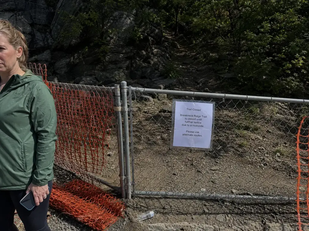
Breakneck Ridge is closed. So is the Wilkinson Memorial Trailhead, so is Lower Brook, and so is the Metro-North Breakneck Ridge Station that used to drop hikers a hundred yards from the first scramble. All four, still shut as of August 2026, with an expected reopening around mid-2027. You can confirm it yourself on the NY-NJ Trail Conference’s official closure alert for Breakneck Ridge, which is the page to re-check before any trip, because this article will age and that page won’t.
That last part about the train station is the piece people miss. Plenty of hikers hear “Breakneck is closed” and file it as one trail being off the table, but the station going dark changes the whole shape of a car-free trip. If your plan involved riding past Cold Spring and hopping off at the flag stop, that plan is gone until construction wraps.
The work itself is the 0.7-mile Breakneck Connector and Bridge project, part of the larger Hudson Highlands Fjord Trail build. It cleared its environmental review in early 2026 and construction has been active since.
That matters more than it sounds like it should. A paperwork closure has holes in it. An active construction site does not.
There is no locals-only way in, no unmarked herd path around the fencing, no “we parked down the road and just walked up.” Every season a handful of people talk themselves into trying, and the outcome is always the same: a long walk back to the car with nothing to show for it.
Screenshot the Trail Conference alert page the night before you go, with the date visible. Half the bad information about this closure circulates as confidently-worded posts on hiking groups written by people quoting a headline from 2025. A dated screenshot on your phone settles the argument at the trailhead.
Here’s what stays open through all of it: the Washburn Trail, the Cornish Trail out to the Cornish Estate ruins, the Notch Trail, and Little Stony Point. That is not a consolation list. Washburn takes you up the same ridge system with the same Hudson River views, and the Cornish ruins are the single most photographed thing in the area that isn’t a summit. If you want the trail’s full detail for the day it reopens, we keep the full Breakneck Ridge breakdown updated separately, and it’s worth reading before you plan a 2027 trip.
The honest framing is that this is a temporary reshuffle, not a loss. The trail network around Cold Spring was always bigger than one famous scramble, and Breakneck’s fame did a lot of work convincing day-trippers otherwise. If you want to leave the immediate area entirely, Fahnestock State Park, twenty minutes east, absorbs a lot of the displaced weekend traffic and has the parking capacity Cold Spring doesn’t. The closure has quietly done what trail managers spent years asking for: spread people out.
The Trails Around Cold Spring, Ranked by What They Ask of You
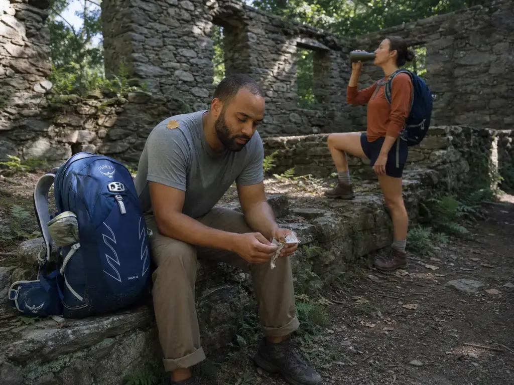
A difficulty rating on a trail app tells you almost nothing. Moderate covers a flat five-miler and a two-mile grind up loose rock, and the app will happily give both the same orange badge. The question you actually care about is different: three hours in, are you going to be having a good day or a bad one? So here’s the roundup sorted by what each trail demands from you, not by what a database thinks of it.
Bull Hill — the Full Loop vs the Short Loop
Bull Hill, which shows up on older maps and in most conversations as Mount Taurus, is the headline hike now. The Full Loop runs roughly five miles with about 1,300 feet of elevation gain, and the climbing is sustained rather than clever. You go up the Washburn Trail, and Washburn does not do many switchbacks in the lower section. It just goes.
The footing is the part people underestimate. This is Hudson Highlands rock: loose fractured stone over bedrock, ankle-turning size, all through the steep sections. You’re watching your feet a lot more than you’re watching the view. Budget four hours if you’re fit and taking photos, closer to five if you’re not or if there’s a group.
The Short Loop is the better call more often than people admit. You take the lower Washburn stretch up to the old quarry ruins overlook and the table rocks, get most of the river view, and come back down in about three miles. The full summit of Bull Hill is wooded. The best views on that mountain are not at the top, they’re on the way up.
Worth knowing before you pick: the Short Loop can also be run as a straight out and back on Washburn, which is the simplest option if you’re new to the area and don’t want to be reading blazes at a junction with tired legs.
The Bull Hill Full Loop and the Cornish Estate ruins connect without backtracking. Come down the Notch Trail side and pick up the Cornish Trail instead of retracing Washburn, and the ruins land on your route home. Most first-timers do them as two separate out-and-backs on two separate visits and burn an extra hour plus a second parking hunt.
The Cornish Estate Ruins and the Flatter Options
Hikers call it The Ruins. On maps it’s the Cornish Estate, sometimes Northgate, a Gilded Age estate whose main house burned in 1956 and has been slowly losing its argument with the forest ever since. The Cornish Trail in from Route 9D is close to flat, wide, and about three miles round trip to the main house and back.
This is the trail to take when you want the day to be interesting without being hard. Stone walls, an intact greenhouse frame, the shell of the main house with trees growing through the floor plan, a dairy barn, a pool. It reads more like an archaeology walk than a hike, which makes it the right answer for a mixed group where one person wants a workout and another wants a nice Saturday.
Two practical notes. The standing walls are old unstable masonry, so look and photograph rather than climb. And the flat, easy character works against it on fall weekends, because flat and easy means everybody’s cousin is also there.
Little Stony Point and Constitution Marsh
Little Stony Point is the smallest commitment on this list and the one that saves the most days. Under a mile of loop trail around a small peninsula, right at river level, with a beach, a short bluff climb, and a straight-on view of Storm King across the water. It’s what you do when the main lot is full, when you’ve got two hours instead of five, or when you’re with people who agreed to a hike without fully understanding what they agreed to.
If you want river access without any trail at all, Dockside Park and Foundry Dock Park sit right at the edge of town by the station, which makes them the natural meeting point when half your group is hiking and half isn’t.
Constitution Marsh is a different day entirely. Boardwalk out over a tidal marsh, run by the Audubon Center, quiet in a way none of the ridge trails are. Bring binoculars instead of poles. One rule to know before you drive over: no dogs, at all, no exceptions beyond certified service animals. That trips up more visitors than anything else in the area, and it’s worth reading the full breakdown in the kids and dogs section below before you load the car.
Worth the Extra Drive — Anthony’s Nose and Storm King
Anthony’s Nose sits about twenty minutes south at the Bear Mountain Bridge, and it delivers the best effort-to-payoff ratio in the region. A short, steep climb for about half its length, and the view down the Hudson at the bridge is the postcard shot. Parking is its own competition, but the hike is short enough that spots turn over faster than they do at Bull Hill.
Further afield in Putnam County and just over the line, Mount Beacon gives you the biggest NYC skyline view in the area on a clear day, and the West Point Foundry Preserve is a flat industrial-history walk from the Cold Spring station itself if the weather falls apart.
Storm King Mountain across the river is the other one worth the drive, especially now. It has the exposed-rock character and the big open river views that Breakneck people are missing, without the closure, and it’s a real hike with real gain rather than a scenic pullout.
If you’re building a broader picture of the region rather than picking one trail, our full guide to hiking the region covers the wider Hudson Valley and Shawangunk network the same way this covers Cold Spring, with the parking and difficulty honesty built in.
Parking at the Trailheads and the Metro-North Reality
Everyone tells you the lot fills early. Almost nobody tells you why, and the why is what lets you plan around it.
Why One Lot Serves Three Trails
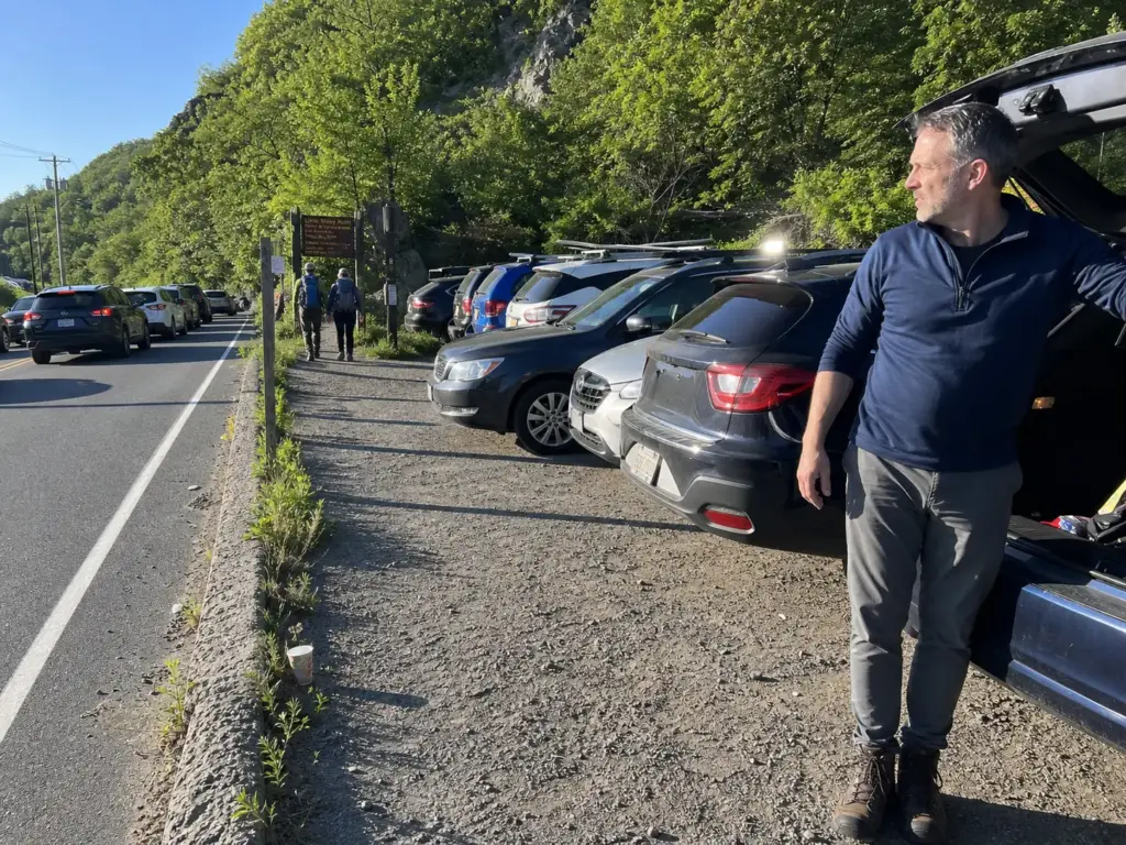
The roadside lot on Route 9D north of town is not the Bull Hill lot. It’s the Bull Hill lot and the Washburn lot and the overflow for Little Stony Point, all at once. Three separate hikes, three separate audiences, one pinch point of maybe a few dozen spaces plus whatever the shoulder absorbs.
That’s the mechanism. The lot doesn’t fill because Cold Spring is popular in some abstract way. It fills because on a clear October Saturday you have Full Loop hikers arriving at 7:30 for a five-hour day, Short Loop hikers arriving at 9 for a three-hour day, and Little Stony Point families arriving at 10 for a two-hour day, and none of the first group has left yet when the third group shows up.
The demand stacks. The capacity doesn’t. That’s also why fall foliage season is the worst possible time to gamble on a late arrival: peak color pulls in a fourth audience that isn’t hiking at all, just driving up for the leaves and the town.
The practical threshold, cross-referenced from enough trip reports to trust it: treat 8 to 9am as the hard cutoff on fall weekends. After that the lot is closed to new cars and the 9D shoulder overflow is gone too, and you’re doing laps on a two-lane road with nowhere to turn around.
Summer weekends run maybe an hour later. Weekdays you can show up whenever you like. Hudson Highlands State Park Preserve’s official park page carries the current hours and access guidance, and it’s the source to check if anything changes.
If crowded-trailhead math is a recurring problem for your trips, it’s worth seeing how other Hudson Valley spots handle it. Kaaterskill Falls, where the parking situation is its own puzzle, has the same demand with a completely different layout, and Minnewaska’s reservation system shows what a managed lot looks like when an agency decides to solve the problem with a booking page instead of a first-come scramble. Cold Spring has neither. It’s pure arrival time.
Taking the Train and Walking In
The alternative almost nobody mentions in the trail guides: you don’t need the lot. The Bull Hill loops, the Cornish Estate Trail and Little Stony Point are all roughly a 25-minute walk from the Cold Spring station, straight up Route 9D from town. That’s it. That’s the whole workaround.
It reframes the entire day. The hiker who pulls up at 10am on a Saturday, sees a full lot and a coned-off shoulder, and drives home has effectively been beaten by a 25-minute walk they didn’t know existed. Park in town, or better, don’t bring a car at all.
The Metro-North Hudson Line from Grand Central runs about an hour and fifteen minutes to Cold Spring, and the ride up along the river is genuinely one of the better parts of the day. From the platform you’re in the middle of town, ten minutes from coffee, twenty-five from a trailhead.
Just remember the Breakneck Ridge Station is closed along with the trail, so the flag stop that used to serve hikers isn’t an option. It’s the single most useful thing to know about this hiking trail near NYC right now, and it’s the detail most out-of-date guides still get wrong.
The Cold Spring Trolley runs weekends only, Memorial Day through Veterans Day weekend, and it’s two dollars for adults. Useful in season. Do not build a February or a Tuesday around it.
What a Day Trip Actually Costs
Nobody adds this up, so here it is. As of 2026, a Metro-North ticket from Grand Central to Cold Spring runs $15.25 off-peak each way and $20.75 at peak, which puts a round trip at about $30.50 off-peak or $41.50 if you’re riding peak trains both directions. Add $2 per adult for the trolley if it’s running and you use it. Hudson Highlands State Park doesn’t charge an entrance fee for these trailheads.
So roughly $30 to $45 per person for the transportation, plus whatever you spend on lunch in town, which for most people is the larger number. Split among two or three people, driving is cheaper. Solo, the train wins once you price gas plus the hour of your life spent looking for parking.
Check the return train schedule before you start walking uphill, not after you finish. Hudson Line service thins out considerably in the middle of the day, and there’s a specific kind of misery in coming off Bull Hill at 3:40 to find the next southbound train is at 5:12 and the town has run out of things you want to do.
The Scramble Sections and When They Turn Risky
Every guide to this area says the same thing: rock scrambling, wear sturdy shoes, be careful. That advice is not wrong and it is not useful, because it names the wrong variable.
Wet Rock, Ice, and the Turn-Around Call
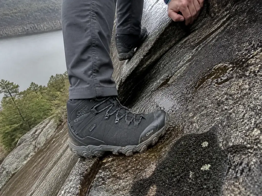
Steepness is not what decides whether a scramble section goes well. Surface condition is. The same forty feet of exposed rock is a fun hands-and-feet problem when it’s dry and a serious hazard when it’s wet, and the difference between those two states is a two-hour rain shower that happened before you arrived.
This is the thing experienced hikers in the Highlands treat as settled and everyone else has to learn: dry rock in the Hudson Highlands has excellent friction. Wet rock in the Hudson Highlands, particularly the smoother slabs with a thin film of lichen or algae, has almost none. Your boot doesn’t skid dramatically. It just stops holding, quietly, usually right when you’ve committed weight to it.
Freeze-thaw season is its own category. A face that drains fine in October holds a clear glaze in February, and the glaze is the part you can’t see. Meltwater runs down the rock during a sunny afternoon, refreezes overnight, and you get a transparent layer over stone that looks bare. February and March in the Highlands are when people who hike this area regularly carry microspikes for trails that don’t look like they need microspikes.
The turn-around call is simpler than people make it. If you come to an exposed section and the rock is wet, you don’t need to evaluate your ability. You need to evaluate whether there’s a way around, and if there isn’t, you turn around.
Notice this section says nothing about difficulty ratings. A trail rated moderate difficulty with wet exposed rock is a worse proposition than a trail rated hard that’s bone dry, which is roughly the argument behind how Bear Mountain’s difficulty actually breaks down when you look past the label.
Picture the version where it goes wrong, because competitors never narrate it. You’re two-thirds of the way up an exposed stretch, the sky has been gray for twenty minutes, and the rain starts. Not a downpour, just enough.
Going up means more exposed rock getting slicker by the minute. Going down means reversing moves you made when the rock was dry, facing outward, on your heels. The correct decision was made forty minutes earlier at the base of the section, when the forecast said 40 percent and you decided that was fine.
Hands Free — What That Actually Means
The Scramble is what the community calls these hands-and-feet sections, and the term gets used generically, including on Bull Hill’s rockier stretches, not just on Breakneck-style terrain. The actual requirement on any of them isn’t sturdy shoes. It’s hands free.
That means trekking poles get stowed on your pack, not carried. Collapsed and strapped down, before you start the section, not halfway up when you realize you need both hands. A pole dangling from a wrist strap while you’re pulling on a hold is a snag waiting to catch on rock, and a pole held in one hand means you’re doing a two-hand problem with one hand.
Same logic for everything else. Phone in a zipped pocket, not your palm. Water bottle in the pack, not the hand.
If you want a camera accessible on a scramble, it needs to be clipped to a strap and not swinging free. This applies more than you’d think on the rockier Bull Hill sections, and it’s the same discipline the Lemon Squeeze at Mohonk demands in a much more concentrated form.
Non-cotton layers matter more here than on the wooded approach. Cotton that soaks through on an exposed face doesn’t get a chance to dry, because you’re on rock in the wind rather than under canopy. It stays cold on you for the rest of the day, and the rest of the day is usually three more hours.
Reading Blazes at Unmarked Junctions
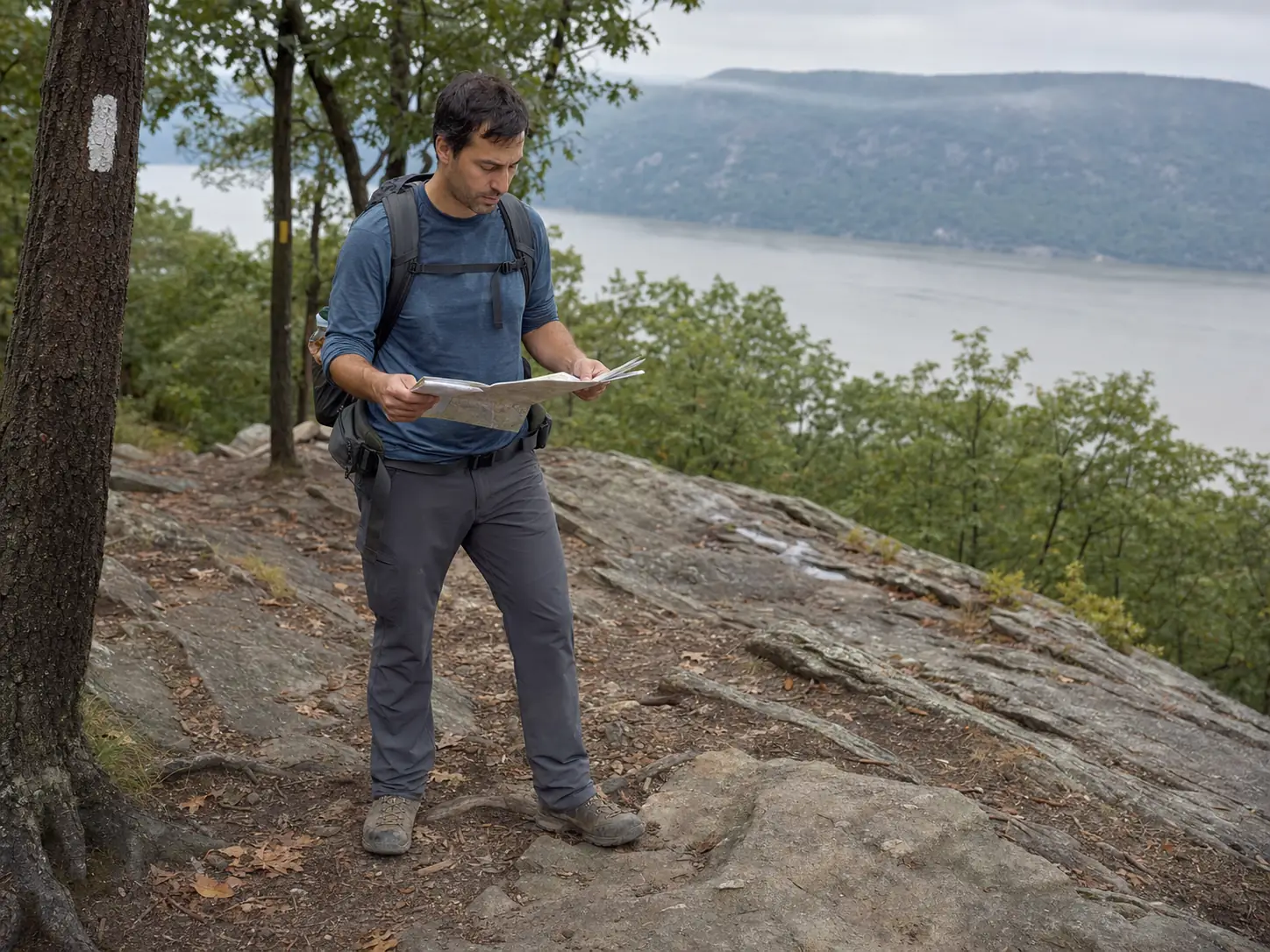
Trail blazes are the painted rectangles on trees and rock that tell you which trail you’re on. Around Cold Spring the white blazed trail is Washburn, and the blue blazed trail and yellow blazed trail carry the Notch and Cornish connectors, with red showing up on shorter spurs. The junctions where two of them cross are frequently unmarked by any sign.
The habit worth building: at every junction, find the next blaze in your color before you commit to a direction. Not the first blaze you see. The one in your color.
Two blazes stacked vertically means a turn is coming, with the top one offset in the direction of the turn. That’s the whole system, and it’s the difference between doing the Short Loop and accidentally doing the Full Loop with a half-liter of water and no snacks. Downloading the Avenza PDF Maps version of the park map before you lose signal covers the case where the blazes have faded and you can’t tell blue from a weathered green.
People get onto harder routes than they planned almost entirely this way. Nobody decides to add 800 feet of gain. They just follow the most-trodden path at a junction where the trodden path happens to belong to a different trail.
Hiking Cold Spring With Kids or a Dog
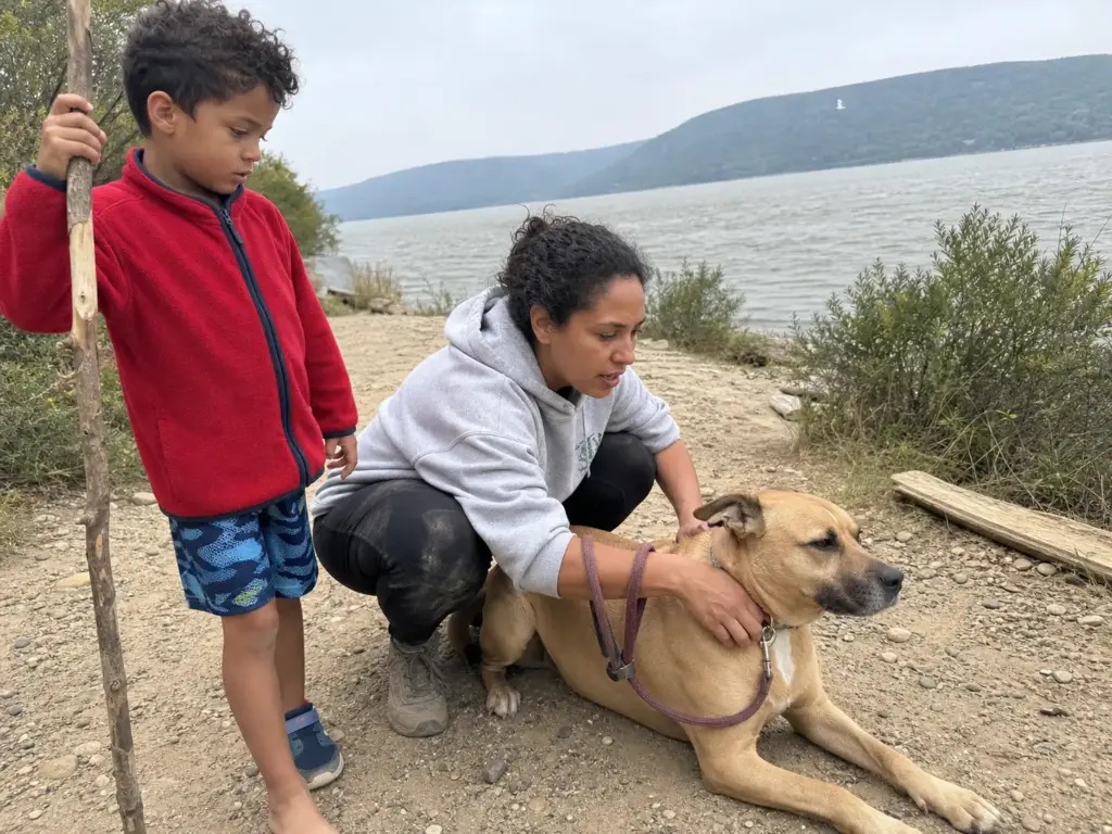
Two questions decide the trip for a big share of readers, and the sources around this area answer both badly.
Start with dogs, because there are two rules here and people find out about the second one at the gate. The baseline in Hudson Highlands State Park is that up to two leashed pets are allowed in day-use areas, on a leash no longer than six feet. That covers Bull Hill, Washburn, the Cornish Trail, Little Stony Point, all of it. Standard state park rules, nothing surprising.
Then there’s Constitution Marsh. The Audubon Center prohibits all dogs, full stop, with the only exception being certified ADA service animals.
Not emotional support animals. Not therapy dogs. Not small ones, not calm ones, not ones that stay in the car park area.
Constitution Marsh Audubon Center’s visitor guidelines lay it out plainly, and the reason is straightforward once you think about it: the boardwalk runs through nesting habitat and the whole point of the sanctuary is birds that don’t want a predator nearby.
“My dog is well behaved” is the wrong question there, and it’s the single most common mistake people make in this area. They’ve correctly researched the state park rule, correctly leashed up, and driven to the one trail where the state park rule doesn’t apply.
The six-foot leash rule is not decorative on Bull Hill. A dog on a retractable lead has enough line to get below you on loose rock, and a hard pull from an unexpected angle on a steep section is how handlers go down. Short leash, dog uphill of you on the steep bits.
Kids next, and this part is our judgment rather than any official designation, because no agency publishes kid ratings for these trails. Little Stony Point works with almost any age that can walk a mile. It’s short, it’s flat except for an optional bluff scramble you can skip entirely, and there’s a beach at the end, which is the kind of payoff that gets a seven-year-old through the walk without negotiation. The lower Washburn stretch up to the quarry overlook is the next step up: real climbing, real view, and a natural turnaround point that doesn’t feel like giving up.
What we’d keep kids off: the Bull Hill Full Loop and any exposed scramble section. The Full Loop is five miles with sustained gain and rocky footing, and the problem isn’t the distance so much as the last mile of descent when small legs are tired and the footing is loose. The scramble sections have real exposure, and a child who is fine going up may not be fine coming down the same rock, which is a discovery you make at the worst possible moment.
The broader point, and it holds for dogs as much as kids: a trail that reads moderate in an app can carry exposure that matters enormously with a six-year-old or a leashed dog and matters not at all to a fit adult alone. The rating was never measuring your group. If this is your first real hike, or the first one you’re leading rather than following, that gap between the number and your actual party is the thing to plan around.
The Rules That Actually Get Enforced Here
A few park rules around Cold Spring get treated as suggestions, and two of them aren’t.
No swimming in the Hudson from Little Stony Point or Dockside Park. The beach looks inviting on a July afternoon and the current past that peninsula is not what it appears from shore. Tidal flow through the Highlands narrows moves faster than the flat surface suggests, and this stretch of river has no lifeguards and no easy exit downstream. Wade, don’t swim.
The other one is trailhead parking. The 9D shoulder is a two-lane state road, and NYS Park Police and local enforcement do ticket and tow cars parked past the marked shoulder, on the pavement, or blocking the fire road gates. When the lot is closed, the answer is town parking or the train, not creative shoulder parking.
Beyond that it’s ordinary Leave No Trace practice, with one local wrinkle worth naming: there are no privies on any of these trails, and the Bull Hill Full Loop is long enough that this becomes a real question. Catholes dug well off-trail and away from water are the standard, and used toilet paper packs out rather than going in the hole. It’s an unglamorous paragraph in a trail guide, but the alternative is what you find behind the rocks near every popular overlook in the Highlands by November.
Stay on the marked trail while you’re at it. The NYS Parks trail system through Hudson Highlands runs across a patchwork of state land, and the herd paths cutting switchbacks on Washburn are doing visible erosion damage to a slope that was already loose. Save 90 seconds, cost the trail crew a season.
What to Bring for a Cold Spring Day Hike
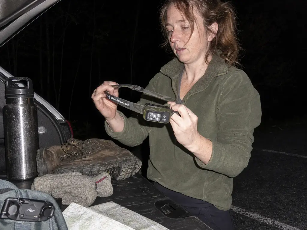
This isn’t a ten-essentials rehash. Every item below earns its spot because of something specific about this place: no potable water on any of these trails, rock that chews footwear, a shared lot that can add an unplanned mile on foot, and fall days that run out of light faster than the drive home suggests.
Pack, Boots, and Socks
A day here is a day hiking pack, not a weekend pack. Twenty liters or so covers water, layers, lunch and a jacket with nothing left rattling around. The Osprey Talon 22 / Tempest 20 (men’s · women’s) is the right size for exactly this kind of outing, and the hipbelt is the part that matters on Washburn’s steep lower section, since a pack riding on your shoulders for 1,300 feet of climbing is how you finish a five-mile hike with a sore neck. The women’s fit is a genuinely different frame and harness geometry rather than a color change, which is worth saying because plenty of “women’s” gear isn’t.
Footwear is where this terrain does its damage. The rock is fractured, uneven, and frequently damp in the shaded lower sections even on dry days. Waterproof hiking boots in a mid-cut, like the Oboz Bridger Mid B-DRY (men’s · women’s) handles that combination: the B-DRY membrane keeps the wet-leaf-litter sections from soaking through, and the mid-cut ankle support is doing real work on the loose stuff coming down from the quarry.
The honest countercase: if you’re doing the Cornish Trail to the ruins on a dry day, or Little Stony Point, trail runners are completely fine and lighter on your feet. Save the boots for the Full Loop, for scramble days, and for anything after rain. Buying mid-cut waterproof boots to walk a flat old carriage road is a solution looking for a problem.
Socks are the cheapest insurance in the pack. A non-cotton liner under your hiking sock, something like the Fox River Wick Dry Alturas liner crew socks, cuts the friction that turns into a hot spot around mile three of the Full Loop.
The liner moves against the outer sock instead of your skin moving against the sock. On a three-mile ruins walk you won’t notice. On the Full Loop descent, you will. A small first aid kit with blister dressings belongs in the same pocket, because a hot spot caught at mile three is a non-event and a blister found at mile four is the rest of your day.
Water, Light, and the Things People Forget
There is no potable water on any of these trails. No spring, no pump, no fountain at a halfway point, and nobody is filtering out of the Hudson. Whatever you carry from town is what you have.
Thirty-two ounces covers a half-day Bull Hill loop or the Cornish Estate walk for most people in shoulder season, and an insulated water bottle like the Hydro Flask 32 oz Wide Mouth earns its keep in two directions here, since the wide mouth takes ice for August humidity and the insulation keeps something hot drinkable on a February ruins walk. In real summer heat on the Full Loop, carry more than 32 ounces or plan a refill in town before you start.
A headlamp is the item people skip and then wish they hadn’t. Fall and winter day trips here end earlier than anyone plans for, because the Hudson Highlands are steep on both sides of the river and the light goes out of the valley well before the sun is technically down. Add a wrong turn at a junction, or an unplanned walk back to town because the lot was full, and a four-hour day becomes a six-hour day in November.
The Black Diamond Spot 400 is the standard answer at 400 lumens and dimmable, and it lives in the pack whether or not you expect to use it. Phone flashlights work until your phone is at 12 percent and you still need it for the train ticket.
Non-cotton clothing goes in for the reason covered in the scramble section: exposed rock is windy and there’s no canopy to dry you out. A light fleece, a packable rain jacket and a wind shell take almost no space and change the character of a summit stop in October.
Then the optional one, with the anti-sell attached. The whole draw of Cold Spring is visual, the Hudson widening below you, the NYC skyline on a clear day, the ruins with light coming through the empty windows. If you’re carrying an actual camera for that, a Peak Design Capture Clip V3 clamps to a pack strap and keeps the camera out of your hands, which loops back to the hands-free rule on the scrambles.
But if you’re taking photos with your phone, you do not need this. A phone in a zipped pocket works fine and weighs nothing. This is a purchase for people who already own a camera they’re tired of dangling from their neck, not an upgrade to your hiking day.
If that skyline view is what you’re chasing specifically, Cold Spring’s summits are one option among several, and there are other NYC-skyline hikes within a short drive that deliver it from different angles on days when the Hudson Highlands lots are hopeless.
Conclusion
Three things to carry out of this.
Breakneck is fenced until roughly mid-2027, and the Metro-North station serving it is closed too. Check the Trail Conference alert before you go, then plan around Bull Hill, Washburn, the Cornish ruins or Little Stony Point, which are all open and all good.
The parking lot is the day’s real bottleneck, not the trail. Be at the 9D lot by 8am on a fall weekend, or skip the whole problem: take the train and walk the 25 minutes in from town.
Dry rock and wet rock are two different hikes on the same trail. Read the surface, not the difficulty rating, and make the turn-around call at the bottom of an exposed section rather than in the middle of one.
Check the closure alert and the forecast the night before, pick the trail that matches the conditions you’re actually going to get, and leave the Full Loop for a dry day. The ruins are still there in the rain.
Frequently Asked Questions
01Is Breakneck Ridge open right now?
No. Breakneck Ridge, Wilkinson Memorial and Lower Brook trailheads are closed as of August 2026, with reopening expected around mid-2027. The Metro-North Breakneck Ridge Station is closed too. Construction on the Breakneck Connector and Bridge is active, so there is no way around the fencing.
02Is Bull Hill harder than Breakneck Ridge?
No. Bull Hill is longer but less technical, with sustained climbing on rocky footing instead of Breakneck’s sustained hands-and-feet scrambling. The Full Loop asks more of your legs and lungs; Breakneck asked more of your nerve and your grip.
03Can you get to the Cold Spring hiking trails by train?
Yes. Metro-North’s Hudson Line runs Grand Central to Cold Spring in about 1 hour 15 minutes, and the Bull Hill, Cornish Estate and Little Stony Point trailheads are roughly a 25-minute walk from the station. The Breakneck Ridge stop is closed.
04Are dogs allowed on the Cold Spring trails?
It splits two ways. Hudson Highlands State Park allows up to two leashed pets on a maximum six-foot leash, covering Bull Hill, Washburn, the Cornish Trail and Little Stony Point. Constitution Marsh bans all dogs except certified ADA service animals.
05When is the best time of year to hike in Cold Spring?
Late September through early November for foliage, though that is also when parking is worst and an 8am arrival becomes mandatory. Spring and early summer are quieter. Winter works on the flatter trails but freeze-thaw ice makes scramble sections a poor bet.
Risk Disclaimer: Hiking, trekking, backpacking, and all related outdoor activities involve inherent
risks which may result in serious injury, illness, or death. The information provided on The Hiking Tribe is for
educational and informational purposes only. While we strive for accuracy, information on trails, gear, techniques,
and safety is not a substitute for your own best judgment and thorough preparation. Trail conditions, weather, and
other environmental factors change rapidly and may differ from what is described on this site. Always check with
official sources like park services for the most current alerts and conditions. Never undertake a hike beyond your
abilities and always be prepared for the unexpected. By using this website, you agree that you are solely
responsible for your own safety. Any reliance you place on our content is strictly at your own risk, and you assume
all liability for your actions and decisions in the outdoors. The Hiking Tribe and its authors will not be held
liable for any injury, damage, or loss sustained in connection with the use of the information herein.
Affiliate Disclosure: We are a participant in the Amazon Services LLC Associates Program, an
affiliate advertising program designed to provide a means for us to earn advertising fees by advertising and linking
to Amazon.com. As an Amazon Associate, we earn from qualifying purchases. We are also an official affiliate partner
of Black Diamond Equipment via the AvantLink network. If you click on a Black Diamond affiliate link and make a
purchase, we may earn a commission at no additional cost to you. We also participate in other affiliate programs and
may receive a commission on products purchased through our links. Additional terms are found in the terms of
service.