In this article
You’ve got Saturday free, five browser tabs open, and every one of them is a numbered list of fourteen trails with no way to tell which one is yours. The highlands region of North Jersey holds 360+ miles of blazed trail, and the difference between a great Saturday and a wasted drive is almost never the trail itself. It’s whether you picked the right kind of trail and got to the lot in time.
So instead of ranking hikes in North Jersey by nothing in particular, this guide sorts them by what you want out of the day: a waterfall, an easy walk the whole family can finish, a skyline view, or a real scramble. Then it covers the parking, fee and cell-service traps that decide whether any of them works.
Start Here: Pick Your North Jersey Hike by Type, Not by Number
Nobody at a trailhead has ever asked you how many hikes you want. The question is always some version of what are you in the mood for, and how much time have you got. Every listicle answers the first badly and skips the second entirely.
Look at what a flat numbered list gives you. Eleven trails, twelve trails, fourteen trails, ranked by nothing and described in four lines each, so you pick whichever one had the best photo.
That’s how somebody ends up on the Giant Stairs with a six-year-old: a near-mile rock scramble photographs beautifully, and a numbered list has no space to warn you.
Four honest answers cover almost everybody who searches for this. Something with water at the end, something the kids will actually finish, a vista worth the drive, or something that makes you use your hands.
Pick one and most of the noise disappears.
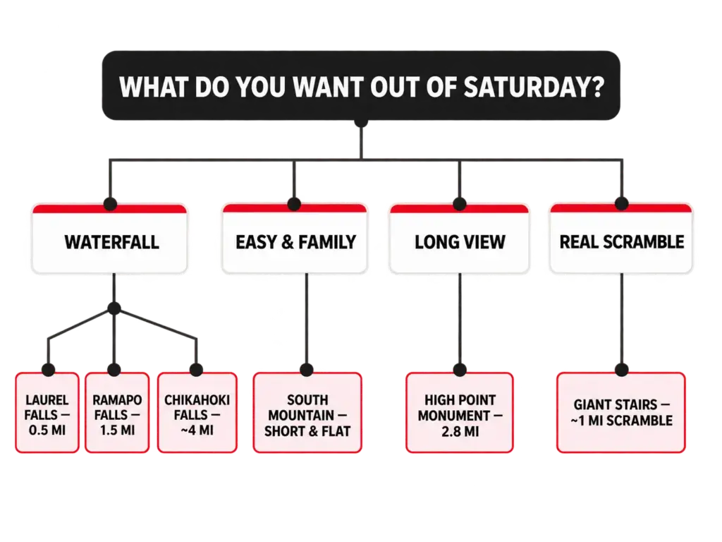
The second axis is time. A half-mile walk to Laurel Falls and a roughly four-mile push to Chikahoki Falls are both filed under waterfall hike. They are not the same Saturday.
One is a stop on the way to lunch; the other eats the whole morning. If you want the full version of building a day around a trail, we’ve covered how to plan a day hike from scratch separately.
Here’s the part that should make you suspicious of star ratings forever. Two trail reports on the same Giant Stairs section: one hiker called it much harder than expected, another called it easier than expected. Same rock, same mile, opposite verdicts.
A moderate difficulty label summarizes one person’s legs and one day’s weather. A description of what the trail asks you to do transfers between hikers. A rating doesn’t.
One more thing before the trail lists. This is the Highlands, not the Rockies. Short mileage with real elevation change and rocky, uneven footing is the regional default, which is why a two-mile hike here can hand you a harder afternoon than a five-mile trail somewhere flat.
The blazed network is maintained by the New York-New Jersey Trail Conference, which maintains the blazed trail network across the Highlands, and their map set covers 360+ miles of it across Bergen, Passaic and Sussex counties, from the Kittatinny Mountains in the northwest to the Hudson River cliffs in the east. That’s not a suburban park system. It’s a real trail network that happens to sit an hour from Manhattan.
The four types below cover the trails most people are actually searching for, but they don’t exhaust the region. Mount Tammany in the Delaware Water Gap and the Stairway to Heaven climb in Vernon are the two biggest names this article doesn’t sort into a type, because both are single destinations that deserve their own day rather than a line in a roundup.
A handful more are worth knowing by name. Hacklebarney State Park, Garret Mountain and the Watchung Reservation sit closer to the population centers with easier walking, while Sunfish Pond up in Worthington State Forest is the region’s glacial lake payoff and a longer commitment than anything in the waterfall list. Farther south, Sourland Mountain trades ridgelines for boulder fields. Any of them is a good Saturday, and none of them is a trail you should pick blind off a numbered list.
Waterfall Hikes in North Jersey
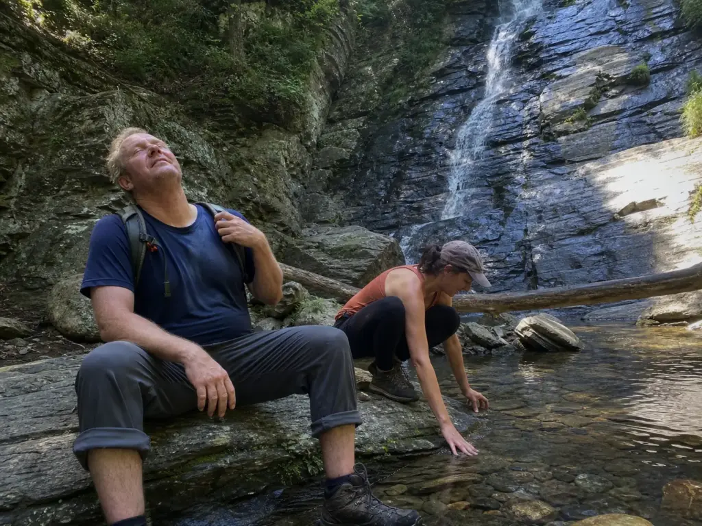
Everybody wants the waterfall photo. Almost nobody checks the mileage before loading the car. The three waterfall hike options that matter here sit at completely different effort levels, and picking wrong is the difference between a nice morning and a family mutiny at the halfway point.
Chikahoki Falls (Norvin Green State Forest)
Roughly four miles round trip, rated challenging, with real elevation gain on rocky terrain the whole way. Budget a half-day, not an hour. There’s a shallow swimming hole at the base, which is what makes the climb back out feel reasonable in July. The catch isn’t the trail, it’s the parking: Norvin Green’s Otter Hole lot is one of the most notorious small lots in the region, so read the parking section below before you set your alarm.
Ramapo Falls (Ramapo Mountain State Forest)
A roughly 100-foot waterfall at the end of a moderate 1.5-mile hike. This is the waterfall payoff without the half-day commitment, the right call when you’ve got a morning rather than a day, or a group with mixed enthusiasm. Ramapo Valley’s lot sits on the same fills-early list as Norvin Green: popular short hike, small lot, weekend crowd.
Laurel Falls (Worthington State Forest)
Half a mile from the trail parking lot. That’s the entire commitment. Laurel Falls is also one of the only waterfalls in New Jersey you can walk through rather than just look at, via the walkway between its upper and lower sections.
This is the pick when someone in the group is openly skeptical about the whole hiking idea. Half a mile in, they’re standing inside a cascade, and the drive home sounds different.
The mileage spread is the actual decision: 0.5, 1.5, 4. Nobody else lays it out that way, which is why people commit to a half-day hike when they wanted a photo stop. Volume is seasonal too, so spring melt and the days right after heavy rain are when these look like the pictures that made you search.
Short waterfall hikes are where people wear the wrong shoes, because “it’s only half a mile” reads as “it’s a sidewalk.” The last thirty yards to any of these falls is wet rock polished smooth by years of water. That’s the section that puts people on their backside, and it doesn’t care how short the approach was.
One clarification: Hemlock Falls doesn’t belong here. It’s a 25-footer inside a county reservation, a different kind of day entirely, and it shows up below with the family hikes. If you’ll drive further for water, there are more waterfall and ridge hikes just across the state line in Connecticut that run on the same logic.
Easy and Family-Friendly Hikes (Including Dog-Friendly Options)
The honest version of family-friendly has nothing to do with a difficulty rating. It’s three questions: is there a bailout point, is the dog legal here, and is anybody going to end up scrambling on their hands and knees. Most lists tag a trail easy hike and move on to the next entry.
South Mountain Reservation (West Orange / Maplewood / Millburn)
Leashed dogs are allowed, which makes this the genuinely dog-friendly trail answer within reach of a dense population center. No hour-long drive, no permit puzzle.
Hemlock Falls sits inside the reservation, a 25-foot waterfall that gives the walk a destination without adding difficulty. Low commitment, close in, easy to cut short when the six-year-old is done. For a lot of families that beats every prettier trail an hour north.
Dog rules vary by park system, and this is where people get turned around at the trailhead after driving fifty minutes. A county reservation, a state forest and a wildlife management area run three different rulebooks, and the sign at the lot is where many hikers find out. Check the park’s own page before you drive, not the listicle that recommended it.
What “Easy” Actually Means on Highlands Terrain
Easy here does not mean paved. Rocky, uneven footing is the regional default even on trails with no meaningful climb, and a flat mile of ankle-rolling rock is harder work than a graded slope somewhere else. Set that expectation before you park.
Bailout points and the loop-versus-out-and-back question matter more than raw mileage with a group. Loop trails win with kids because nobody has to hear “we’re only halfway, now we walk all the way back.” The trail keeps moving forward and so does everybody’s mood.
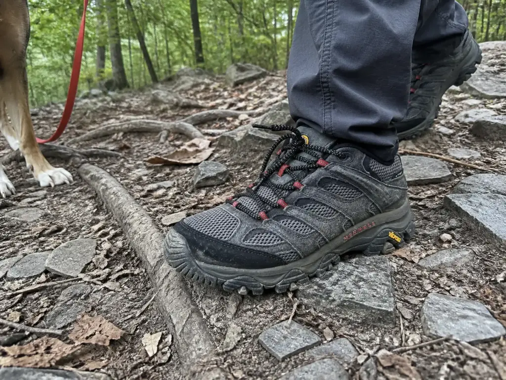
Since footing does more damage to a family hike than distance does, this is the one gear call worth making before you leave. A waterproof shoe with a grippy outsole and a real toe cap handles wet Highlands rock and the shallow stream crossing that shows up on half these trails. Nothing here needs a serious water crossing, but plenty of these trails ask you to rock-hop something ankle-deep. The Merrell Moab 3 Waterproof (men’s · women’s) is the budget-friendly default here for a reason: the Vibram TC5+ outsole holds on wet rock, the membrane keeps a creek crossing from ending the day, and the toe cap absorbs the rock you kick because you were watching the kids instead of your feet.
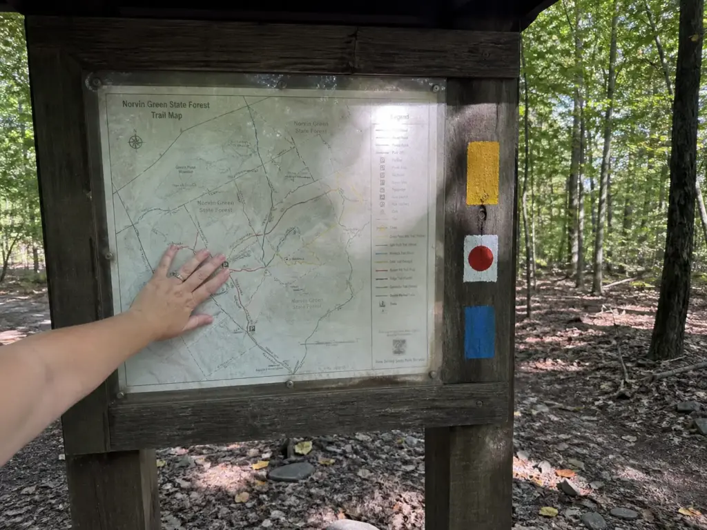
Blaze-following is the other thing worth teaching a first-timer in the parking lot, and it takes ninety seconds. Each trail carries a painted blaze in a set color, and around here you’ll be following a blue blaze, a yellow blaze or a red dot trail more often than not. Two stacked blazes mean a turn, and you should see the next one within a minute of walking.
No blaze in five minutes means you’re off-trail. That single rule removes most of the low-grade stress a nervous beginner carries all day. It’s also the quietest piece of leave no trace practice there is: hikers who know where the trail went stop cutting their own.
Say it plainly: a nervous first-timer’s real blocker is almost never fitness. It’s the fear of getting lost, of holding the group up, of being the reason everyone turns around. Fitness is just the socially acceptable version they’ll tell you about. If that’s who you’re bringing, our guide to hiking with anxiety helps them more than another trail recommendation.
The most common way a family hike in North Jersey goes wrong: somebody sees the Giant Stairs on a best-hikes list, brings the dog and a young kid, and discovers a mile of continuous boulder scrambling with no easy exit. That’s the entire reason this section exists. Best-hikes lists rank by scenery. They don’t rank by who can safely finish.
Skyline and Long-View Hikes
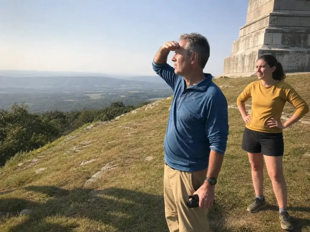
This is the type North Jersey is genuinely known for, and the reason is pure geography. You’re close enough to see Manhattan from a ridgeline and far enough away that it still feels like a hike rather than a rooftop. The trap is assuming a panoramic view requires a summit slog.
High Point Monument Trail (High Point State Park)
2.8 miles round trip, 501 feet of elevation gain, roughly an hour to an hour and a half. That’s it. The name says State Park and Monument sounds like a project, so people talk themselves out of it assuming an all-day commitment.
It’s genuinely moderate, and that 501-foot figure is the whole answer to “is this hard?” You can do it before lunch, and the payoff is the highest point in New Jersey with the monument standing on top of it. You’re also walking a section of the Appalachian Trail to get there, which is worth knowing while you’re on it rather than realizing later. The Appalachian Trail Conservancy’s guide to the High Point Monument section covers the routing.
Palisades Ridgeline Views
Cliff-top vantage over the Hudson, the classic NYC-adjacent long view people picture when they think of hiking near the city. You walk the top of the Palisades cliffs on the Long Path with the river below and the skyline across it.
Be clear about one thing: this is a completely different day from the Giant Stairs, which runs along the shoreline underneath these same cliffs. Same park, opposite experiences. One is a walk with a view, the other is an hour of climbing over boulders. For how the trails connect, we’ve got the full Palisades Interstate Park trail guide.
Photographing the View Without Being That Person
A crowded overlook has its own trail etiquette, unwritten until somebody violates it. The tripod parked at the best vantage for forty minutes at golden hour. The drone over a quiet ridgeline. The group shoot that turns a six-foot ledge into a closed set.
We’ve written up trail photography etiquette at a crowded overlook in more detail.
Golden hour at State Line Lookout is a parking problem before it’s a people problem. Everybody who wants the same light arrives in the same twenty-minute window, and the lot was already full from the afternoon crowd. If the photo is the point of your day, treat the lot as the harder objective.
View hikes and waterfall hikes want opposite weather. A waterfall after three days of rain is at its best. A skyline view in August haze is a gray smear where Manhattan should be, no matter what the forecast promised. Cold, dry air behind a front is when the nyc skyline actually looks like the photos, which makes this a fall and winter hike type far more than a summer one.
Challenging Hikes and Real Scrambles
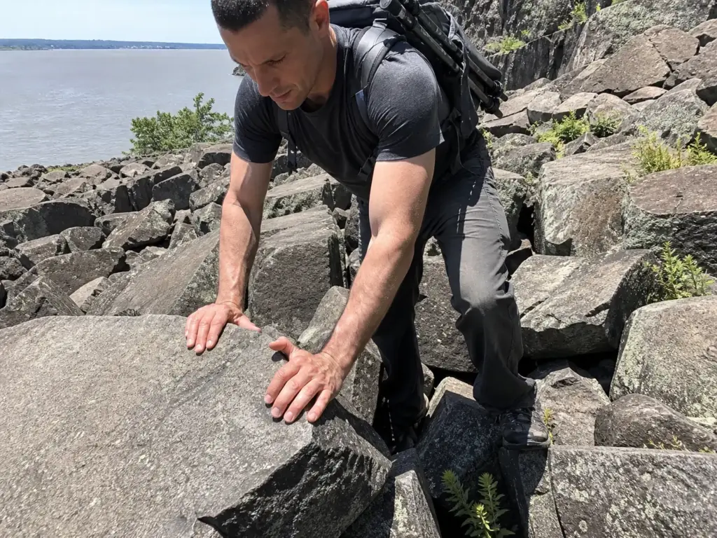
Nobody drives to New Jersey for elevation. So a difficult hike here means something specific: technical footing, hands-on rock, and long stretches with no easy way out. The Giant Stairs is the benchmark for it, and it deserves a straight description rather than a difficulty star.
The Giant Stairs (Palisades Shore Trail)
Nearly a full mile of continuous boulder field scrambling. Not a rocky section. Not a steep bit with some rocks. A mile of climbing over talus with your hands, picking a line boulder to boulder, where progress gets measured in careful moves rather than steps.
Poles get stowed, not used. Both hands stay free, and that one sentence tells you more than any rating will. It’s also why the honest advice is to skip it with young kids or dogs: there’s no shoulder to step onto and no shortcut back to the road.
Wet conglomerate rock turns slick, which changes the whole calculus. A dry Giant Stairs in October is a great hard day. The same rock the morning after rain, or with a skim of ice in the shoulder season, is a different proposition worth postponing without guilt.
Check the trail’s current status before you drive out. This section has closed for rockfall near State Line Lookout, and a best-hikes list without a status caveat sends people to a closed trailhead an hour from home.
Wyanokie High Point and the Norvin Green Network
Real elevation change on rocky terrain, and this is where navigation stops being automatic. Norvin Green’s network has overlapping and inconsistent blazes, several trails sharing a corridor in different colors, junctions that don’t look like junctions. The payoff at the top is an open rock summit looking out over the Wanaque Reservoir, which is the view most people came for without knowing its name.
High Mountain Preserve in Wayne runs the same play at lower elevation: a shorter climb, a skyline view from the top, and the same habit of blazes that stop agreeing with each other near the junctions.
The climbing isn’t what gets people here. It’s standing at a junction with three blazes on one tree and no signal on your phone. That’s a planning problem rather than a fitness one, which is why it lands in the logistics section below.
How to Read a “Challenging” Rating Honestly
Back to those two trail reports on the same Giant Stairs section: much harder than expected, and easier than expected. Neither hiker was wrong. A difficulty rating compresses too many variables into one word, and the variables differ from person to person.
Split it into two axes and the confusion clears. Time-on-feet is how long you’ll be working, and it tracks with mileage, elevation and pace. Technical difficulty is what the trail physically asks of you, a separate question entirely.
A six-mile graded fire road is high on the first and near zero on the second. The Giant Stairs is one mile, which sounds trivial, and near the top of the second axis, which is why it takes hours. A strenuous climb on a graded trail and a mile of talus are not the same kind of hard.
Separate the two and you can read any trail description honestly, including another trail where the honest difficulty call comes down to footing rather than distance. Ask what the trail requires, not how hard somebody found it.
“Requires both hands free” beats every difficulty label ever printed. When you’re reading a trail description, hunt for sentences like that one: what does the trail make you do? Hands on rock, a stream you have to wade, a mile with no exit. Those transfer between hikers. A star rating doesn’t.
If this is the section you keep rereading, the honest next step is a longer format rather than a harder single day. We’ve mapped what changes when you start moving from day hikes into real trekking, and most of it is logistics rather than fitness.
The Parking, Fees and Cell Service Traps Nobody Warns You About
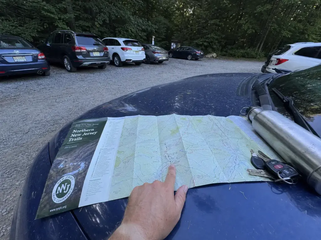
The most common way a North Jersey hike goes wrong has nothing to do with the trail. You drive an hour, roll in at 9:30, and the lot holds twelve cars. Every one of them arrived before you. This is the section every listicle skips and every local hiker could have covered in one sentence.
The Lots That Fill by 9am
Norvin Green’s Otter Hole lot holds roughly ten to twelve cars and is reported full by 8 to 9am on weekends. Ten to twelve. That’s not a parking lot, it’s a waiting list, and there’s no real overflow nearby that doesn’t involve a shoulder you’ll get ticketed on.
The Ramapo Reservation lot and State Line Lookout belong on the same list for the same reason: popular short hikes with big payoffs and small lots. “Lot’s full by 9” is local shorthand for exactly these three.
One hiker’s account of pulling into Norvin Green at 8am on a Sunday and finding two spots left isn’t a story about arriving late. It’s a description of arriving on time.
Be there by 8am on a weekend, or go on a weekday. There is no third option. Circling for twenty minutes isn’t a plan, and neither is hoping somebody leaves early, because the people who got there at 7:45 are doing a four-mile hike.
The crowded trailhead problem is the one variable you control completely, and it costs you an hour of sleep. The same math plays out at Lake George, so the habit transfers.
Which Parks Charge and When
The NJ State Park Pass runs $50 for residents and $75 for non-residents per calendar year. Walk-in and parking fees run $2 to $3 per person, charged Memorial Day through Labor Day at the parks that charge at all, per the NJ Department of Environmental Protection’s park fee schedule.
Run the math once and it changes how you plan a summer. A weekend visit to a fee park with a carful of people lands around $10 a vehicle in season. Six visits and the annual pass has paid for itself. Hike most weekends between June and August and buying the pass in May is obvious; get out four times a year and paying at the gate is cheaper.
The entrance fee split is also a real trail-selection factor nobody builds in. State forests and county reservations largely don’t charge; fee-charging state parks do, and only during that summer window. The same trail can be free in April and cost you $10 in July.
Where Your Phone Stops Working
Norvin Green and High Mountain both have stretches of genuinely dead cell service, and both have the overlapping-blaze problem. Either alone is an annoyance. Together they’re how people walk a mile the wrong way before they’re sure about it.
Download your offline map before you leave the car, not at the trailhead. This one catches experienced hikers, because the app opens fine, the map looks loaded, and you’re twenty minutes in when it turns out the tiles never cached.
Do it at home over wifi where you can confirm it worked. And don’t lean on gps alone in Norvin Green: a blue dot on a blank screen tells you where you are without telling you which of the three blazed trails you’re standing on.
Paper still earns its place. The NY-NJ Trail Conference’s Northern New Jersey Highlands map set covers those 360+ miles across Bergen, Passaic and Sussex counties plus adjacent New York, it never runs out of battery, and it shows the whole network at once instead of a phone-sized window of it. At a junction with three blazes on one tree, seeing the full picture is what gets you unstuck.
A weekday hike fixes all three of these problems at once. Empty lot, no fee-window crowd at the gate, and enough space on the trail that a wrong turn is easy to walk back without a queue behind you. If your schedule bends at all, one weekday off is worth more than three early weekend alarms.
When to Go and When to Skip It
Most trail articles bolt a generic check-the-weather line onto the end and call it seasonal advice. The useful version is per-trail. Specific North Jersey trails are excellent in October and a bad idea in March, and the reasons are concrete.
Season by Season, Trail by Trail
Spring is peak waterfall hike season: Chikahoki, Ramapo and Laurel all run at their highest volume with the melt and the rain. The trade-off is mud season on the Highlands rock trails through March and April, which turns Norvin Green and Wyanokie into a slog of slick rock and standing water. Tick season arrives by late spring.
Summer flips it. Exposed rock gets brutally hot on ridgeline sections with no canopy, haze flattens the skyline views to gray, and this is the window when the fee parks charge. Hiking here in July means going early, going shaded, and saving the Palisades overlooks for a clearer season.
Fall is the region’s best hiking, full stop. Fall foliage at peak color generally runs mid-to-late October, the air is dry enough that the skyline reads from the Palisades, and the rock is dry for scrambling. It’s also the most crowded parking of the year, which tightens the 8am rule closer to 7:30 at the popular lots.
One more fall variable: some sites run a seasonal closure rather than staying open year-round. The old mine workings scattered through the Highlands close seasonally to protect hibernating bats, so a mine ruins detour that worked in September may be gated in December.
Winter narrows the list to trails you can get traction on. Icy rock is the real constraint, not cold. The Giant Stairs and the steeper Norvin Green descents are where a warm day of melt followed by a freeze leaves a skim of ice over the exact rocks you need. Warmth and grip are separate decisions, so sort out insulated winter hiking boots first and traction second.
Hunting Season and Blaze Orange
Wildlife management areas including Sparta Mountain and Wildcat Ridge run active hunting seasons, most relevant fall through winter. Bright colors there aren’t a style choice. Blaze orange is how a hunter picks you out of brown woods at distance, and it works.
Know which land you’re on before you go, because the rules differ between a WMA, a state forest and a county reservation. We’ve covered hiking safely during hunting season in more depth, including the timing worth checking each fall.
Traction, Poles and Water for Shoulder Season
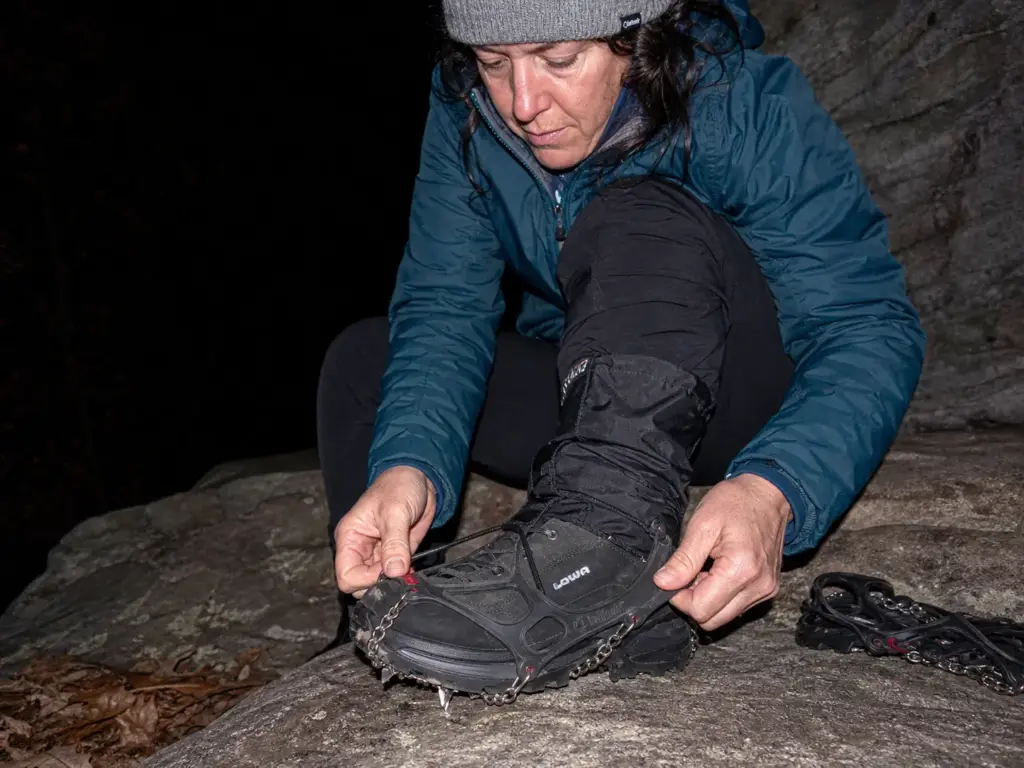
Shoulder season is where gear stops being optional on these trails. Icy patches on rock are exactly where traction devices earn their place, and microspikes are small enough to carry on spec.
The Kahtoola MICROspikes are the community default: twelve stainless steel spikes per foot on an elastomer harness, rated well below anything the Highlands will throw at you, and they go on over your regular boots in about thirty seconds at the trailhead. For where spikes stop being enough, we’ve broken down whether your boots are crampon compatible.
Trekking poles help more on the Highlands’ rocky descents than on the climbs, which is backwards from what most people expect. Going down loose rock with tired legs is where ankles roll, and poles give you two more points of contact right when you need them. The CASCADE Trekking Poles (Ultra Light 100% Carbon Fiber) are the budget-friendly pick that keeps showing up in packs around here, mostly because carbon fiber at that weight means you’ll actually bring them instead of leaving them in the car.
Poles get stowed, not used, on a true scramble like the Giant Stairs. You need both hands, and a pole dangling from a wrist strap while you’re reaching for a hold is worse than no pole at all. Collapse them and strap them to your pack before you hit the boulders, not halfway through when you’re already committed.
Hydration is the quiet one. People underpack water on hikes they’ve filed as short, and a four-mile Norvin Green loop with real elevation change in August empties a single bottle before you’re back.
A hydration pack removes the decision: you drink more when drinking doesn’t require stopping. The CamelBak M.U.L.E. 12 (Women’s) pairs a 100oz reservoir with a 12L pack, the sweet spot for a full day out here, with room left for layers, lunch and the spikes you’re carrying just in case.
Conclusion
Pick the type first and the trail chooses itself. Waterfall, family walk, long view, or hands-on rock — answer that one question and fourteen options collapse into two or three, which is a decision you can actually make on a Friday night.
The parking lot decides your day more often than the trail does. Be there by 8 on a weekend at Norvin Green, Ramapo Valley or State Line Lookout, or move the hike to a weekday and stop fighting for a spot at all.
“Challenging” in North Jersey means footing and hands-on rock, not elevation. Read what the trail asks you to do, not the star rating somebody gave it after one good day.
So pick one type for this Saturday, check the trail’s current status before you drive, and leave early enough to get a spot. And if North Jersey has you hooked, the Hudson Highlands just across the state line are worth the drive — Sam’s Point and its ice caves sit about the same distance from most of North Jersey as the Delaware Water Gap does, and the cliff-top views up there run on a different scale entirely.
Frequently Asked Questions
01What is the easiest hike in North Jersey with NYC views?
The Palisades ridgeline trails near State Line Lookout give you cliff-top Hudson and skyline views on flat, easy walking. The catch is parking: that lot fills by mid-morning on weekends and golden hour, so arrive early or come on a weekday.
02What are the best waterfall hikes in North Jersey?
Laurel Falls for minimal effort at half a mile, Ramapo Falls for a moderate 1.5-mile hike to a 100-footer, and Chikahoki Falls for a challenging four-mile half-day. The mileage spread is the whole decision — all three are real waterfalls at very different effort levels.
03Are dogs allowed on North Jersey hiking trails?
Yes at South Mountain Reservation and many county reservations, where leashed dogs are allowed. Rules vary by park system, so check the specific park before driving. Skip the Giant Stairs entirely with a dog — it is a near-mile boulder scramble.
04Do you have to pay to hike in North Jersey state parks?
Only at fee-charging state parks, and only from Memorial Day through Labor Day, at roughly $2 to $3 per person. State forests and county reservations are generally free. The annual State Park Pass runs $50 for residents and pays for itself in about six summer visits.
05When do North Jersey trailhead parking lots fill up?
By 8 to 9am on summer and fall weekends at Norvin Green’s Otter Hole lot, Ramapo Valley and State Line Lookout. Otter Hole holds only 10 to 12 cars with no nearby overflow. A weekday hike removes the problem completely.
Risk Disclaimer: Hiking, trekking, backpacking, and all related outdoor activities involve inherent
risks which may result in serious injury, illness, or death. The information provided on The Hiking Tribe is for
educational and informational purposes only. While we strive for accuracy, information on trails, gear, techniques,
and safety is not a substitute for your own best judgment and thorough preparation. Trail conditions, weather, and
other environmental factors change rapidly and may differ from what is described on this site. Always check with
official sources like park services for the most current alerts and conditions. Never undertake a hike beyond your
abilities and always be prepared for the unexpected. By using this website, you agree that you are solely
responsible for your own safety. Any reliance you place on our content is strictly at your own risk, and you assume
all liability for your actions and decisions in the outdoors. The Hiking Tribe and its authors will not be held
liable for any injury, damage, or loss sustained in connection with the use of the information herein.
Affiliate Disclosure: We are a participant in the Amazon Services LLC Associates Program, an
affiliate advertising program designed to provide a means for us to earn advertising fees by advertising and linking
to Amazon.com. As an Amazon Associate, we earn from qualifying purchases. We are also an official affiliate partner
of Black Diamond Equipment via the AvantLink network. If you click on a Black Diamond affiliate link and make a
purchase, we may earn a commission at no additional cost to you. We also participate in other affiliate programs and
may receive a commission on products purchased through our links. Additional terms are found in the terms of
service.