
In this article
You pull up the trail map for Sterling Forest State Park in Tuxedo NY and start counting names. Fire Tower, Bare Rock, Allis, Sterling Ridge, Doris Duke, Red Back, Sapphire, and about twenty more. Not one of them tells you which is yours.
Here’s what the trail data makes obvious once you line it up: four routes carry almost all the foot traffic in this park, and the gap between them is far wider than the word “moderate” suggests. This guide sorts those four by what they cost you and what they pay back, then covers the parts nobody bothers to put in one place: hunting season, beaver flooding, and the closures that send people home from the parking lot.
What Sterling Forest State Park Actually Is
Most people show up expecting a picnic pavilion and a signed loop around a pond. That is not what this is.
Sterling Forest holds more than 18,000 acres of forest, lakes and streams in the Ramapo Mountains of Orange County NY, and it still grows as new parcels get folded in. On a map it looks like a state park. On the ground it behaves like backcountry.
The park exists because a land trust outbid a bulldozer. In 1998, the Trust for Public Land and the Open Space Institute closed on roughly 15,280 to 15,805 acres for $55 million, shutting down a planned development of 13,000 homes and 20 million square feet of commercial space. That is the whole reason you get to walk here instead of driving past a subdivision.
Trailhead parking sits off 116 Old Forge Road in Tuxedo, with the Lautenberg Visitor Center as the front door and dawn to dusk hours across the park. An Empire Pass covers the day use fee if you already carry one. Address, hours and the current fee structure all live on the park’s official page from NY State Parks, and that page is worth a glance the week you go.
Geographically you’re in the southern end of the same Hudson Highlands and Shawangunk corridor that holds Sam’s Point and the wider Minnewaska preserve, which is useful context if you’re building a season of trips rather than picking one Saturday. Harriman State Park shares a boundary to the north, and the two together make up most of the protected ground in this corner of the Highlands.
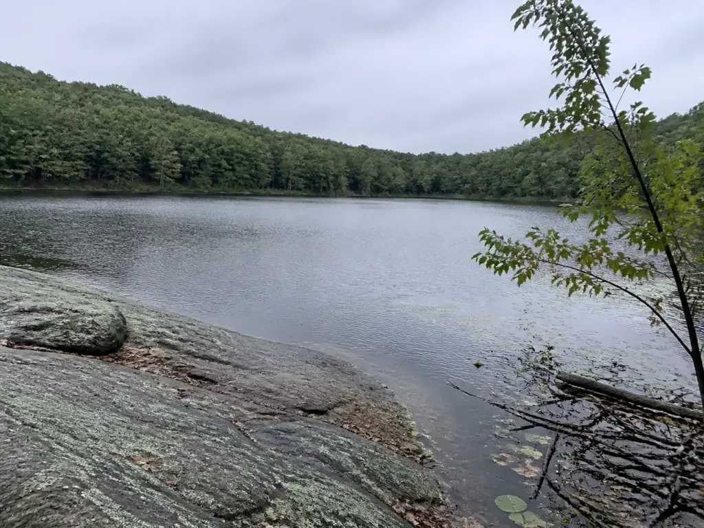
The water is part of the draw too. Sterling Lake anchors the middle of the park, with Blue Lake, Tuxedo Lake and Greenwood Lake filling out the map around it, and several of the best routes are built around reaching one of them.
Here’s what the acreage actually means for your day. Signage is thinner than at Harriman. Cell coverage on the ridges drops out with no warning. The gap between how this park reads on paper and how it feels at a four-way trail junction in November is exactly where most first visits go sideways.
The Four Trails Worth Your Drive
Every other guide to this park does one of two things. It lists all twenty-five trails alphabetically with a paragraph each, or it narrates one great eight-mile route in mile-by-mile detail. Neither helps the person deciding on a Thursday night with a weather app open in the other tab.
So here are the four. Between them they cover nearly everyone who drives out here.
To be clear about what’s being left out: the rest of the network is real and worth walking eventually. The Indian Hill Loop Trail, the Townsend Trail, the West Valley Trail, the Sterling Valley Loop Trail, the South Point Trail, the Hogback Mountain Trail, the Wildcat Mountain Trail and the Long Meadow Extension all exist and all have their day. None of them is the right answer for a first visit, and that’s the only question this section is trying to settle.
Fire Tower and Bare Rock Loop, the best payoff for the miles
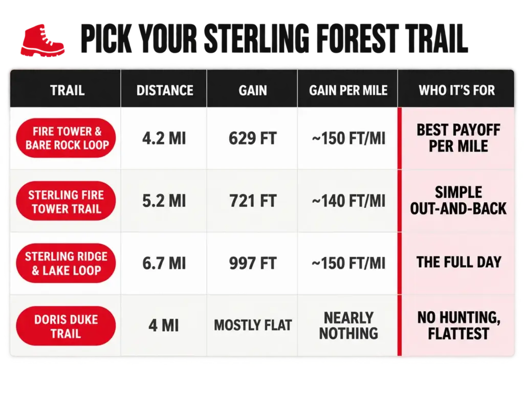
4.2 miles, 629 feet of gain, roughly two to two and a half hours. This loop stitches the Fire Tower Trail to the Bare Rock Trail and bags both marquee views in one walk: the 360-degree panorama from the Sterling Forest Fire Tower, and the Bare Rock overlook with its open granite shelf above Greenwood Lake.
If you only read one line in this article, read this one. This is the highest payoff-to-mileage ratio in the park. The tower-only route costs you a full extra mile and hands you one fewer view.
Sterling Fire Tower Trail, tower only, longer walk
5.2 miles, 721 feet of gain, also about two to two and a half hours. This is the straight out-and-back. More miles than the loop above, less variety in what you see along the way.
The honest read: pick this one if the tower is specifically what you came for and you like the psychology of an out-and-back you can bail on at any point. Some days that matters more than scenery, especially with a group whose stamina you can’t predict.
Sterling Ridge, Fire Tower and Sterling Lake Loop, the full day
6.7 miles, 997 feet of gain, three to three and a half hours moving. Tower, ridge and a lake circuit stitched into one route. This is the one that earns the word hike instead of walk.
Calibrate your expectations, though. Nothing here approaches what Breakneck Ridge asks of you in the way of hand-over-hand exposure. This is a long, rolling, rocky day rather than a technical one, and that’s the appeal.
Doris Duke Trail, the easiest, and the one with no hunting
A moderate 4-mile loop inside the 1,400-acre Doris Duke Wildlife Sanctuary. Flattest of the four, and hunting is banned outright within the sanctuary boundary, which makes it the default answer for anyone hiking between October and February who’d rather not think about it.
Locals call it “the DD.” One quirk worth knowing before you go: it isn’t blazed with the standard color system that marks the Allis, Sapphire and Sterling Ridge trails. It carries a yellow DD logo on a white field rather than a conventional yellow blaze, and people do stand at the trailhead hunting for a blue blaze that was never there.
Construction started in 2013 under the Sterling Forest Back Country Trails partnership, and the trail maps and hike reports from the New York-New Jersey Trail Conference are where the sanctuary boundaries and blaze details are documented properly.
How Hard These Trails Actually Are
The word “moderate” is doing an enormous amount of work in the trail descriptions for this park. A 4.2-mile loop with 629 feet of gain and a 6.7-mile loop with 997 feet both wear the same label. They are not the same day, and the difference shows up around hour three.
Line them up and the picture gets useful fast. Bare Rock combo, a loop hike: 4.2 miles, 629 feet. Tower solo, out and back: 5.2 miles, 721 feet.
Full ridge and lake: 6.7 miles, 997 feet. Doris Duke: 4 miles, mostly flat. All four wear the same moderate difficulty rating, which tells you how little that rating is worth here.
Divide gain by distance and you get the number that actually predicts how a day feels. Across these four routes that elevation gain per mile runs from nearly nothing to about 150 feet. That’s the same honest difficulty math that applies at Bear Mountain and every other Hudson Highlands climb, and it beats any adjective a trail database prints.
Now the rock scrambling, because everyone mentions it and nobody measures it. The approach to the tower has genuine hands-on-rock stretches, and they are short. This is not sustained Class 3 terrain, and anyone who can handle a steep rocky staircase without thinking about it will be fine.
What costs more than the numbers suggest is the footing on the ridge sections: rocky, uneven, ankle-turning stuff that grinds on you over six miles in a way that 997 feet of gain does not explain by itself.
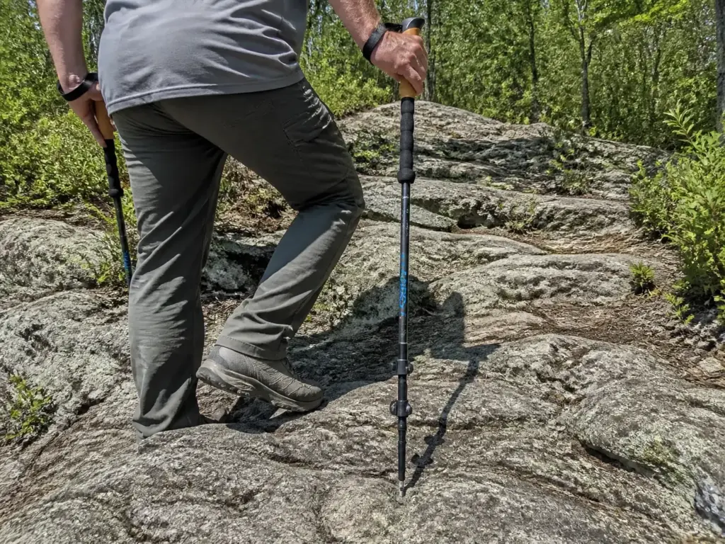
That’s where poles earn their weight rather than just riding on your pack. The Cascade Trekking Poles (Ultra Light 100% Carbon Fiber) are the budget-friendly, unfussy version of that fix (check them here), and they carry the load on descents through loose rock where your knees would otherwise take it. Not a must-buy. Just the difference between finishing the ridge tired and finishing it sore.
Collapse the poles and stow them before the scrambly stretch near the tower. Dangling poles from your wrists while your hands are on rock is how people end up wedging a tip in a crack and going down sideways. Ten seconds to stow, ten to redeploy.
The mistake that repeats here is treating “moderate” as one thing. Hikers pick the 6.7-mile combo expecting the 4.2-mile experience, start at two in the afternoon, and finish the last mile by phone light.
The Fire Tower and What You See From It
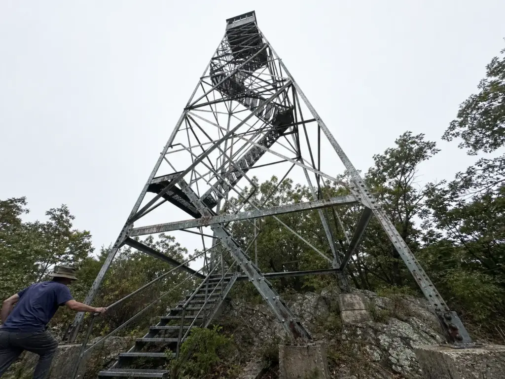
The tower is why most people make the drive, so it’s worth saying plainly what it gives you. Sterling Forest Fire Tower sits on top of Sterling Mountain, and the climb up its steps is the last thirty seconds of the hike and the only part anyone photographs. From the cab you get genuine 360 degree views over the Ramapos, down onto Sterling Lake, and on a clear cold day considerably further than you expect.
Bare Rock is a separate thing entirely and deserves its own mention. It’s an open granite overlook near the tower with the long view over Greenwood Lake, and locals treat it as a destination rather than a waypoint on the way to something better. The two viewpoints are different in character: the tower is a hard-earned vertical panorama, Bare Rock is a place you sit down on warm stone and stay for twenty minutes. If you’re collecting regional overlooks, it sits comfortably alongside the wide Hudson Highlands views you get from Storm King, with a fraction of the crowd.
Fire towers across New York were staffed lookouts long before aerial and satellite detection took over the job. Somebody sat up there through the dry months watching for smoke. This one outlived its purpose and survives as a viewpoint, which is a better second act than most industrial structures get.
One warning that belongs right here instead of buried in a conditions section: the tower can be closed. It has been roped off after fire damage with nothing at the trailhead to tell you. More on that below, because it’s the single most common way a good day at this park turns into a long drive for nothing.
The Iron Ruins You Walk Past
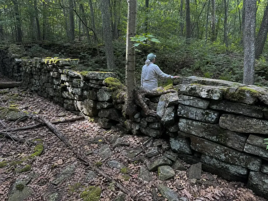
Somewhere on most of these routes you’ll step over a low stone wall or skirt a water-filled pit and file it away as old farm junk. It isn’t. Those are iron mining ruins, and you’re walking through the bones of an industrial company town. Knowing that changes the whole walk.
The Sterling Iron Works operated here for most of a century. The Southfields Iron Furnace went up in 1804 under Peter Townsend II and ran until it shut down in September 1887. Around it grew Lakeville, a company town with something like 140 worker houses and more than 500 residents at its peak, abandoned by the early 1900s and swallowed back by second-growth forest. What’s left is a genuine Lakeville ghost town, just one with trees growing through it.
The lineage matters too. This ironworks produced the Revolutionary War-era chain that was stretched across the Hudson at West Point to block British ships. That chain was forged by people who lived and worked in these woods.
A water-filled mine pit, the reconstructed Sterling Furnace and scattered stone foundations show up along several trails, with the Lakeville Ironworks Trail and the Furnace Loop Trail putting you closest to the densest concentration.
Look for straight lines and right angles in the forest floor. Nature does not build them. Once you start reading rectangular depressions as house cellars and long low ridges as foundation walls, the ghost town assembles itself around you and stops being a pile of rocks.
Read the stones and those five minutes become the best part of the hike. Skip that, and you walk straight through a vanished village of 500 people without ever noticing it was there.
Hunting Season, Explained for Hikers

Every official page mentions hunting permits and then leaves you to figure out what that means for a Saturday in November. Nobody writes the two paragraphs that actually answer the question, so here they are.
Start with the calendar. There is no hunting anywhere in the park during September. Deer seasons run in overlapping windows from roughly October into February, covering Early Bowhunting, Regular, Muzzleloader and Late Bowhunting, with another shorter window in May.
That’s the shape of it. Fall and early winter are the months that require a thought.
Now the part that changes how the risk reads. Hunting here is permitted, not open-access. Anyone hunting inside the park needs a $5 hunting permit from the park on top of a valid NYS DEC license, issued at the Visitor Center or by mail, and the terms are laid out in the park’s own hunting permit application.
That means a small, regulated, registered group of people spread across more than 18,000 acres. Not a forest full of rifles. Worth saying plainly, because the vague version of this fact keeps people home for no reason.
What you actually do about it is short. Wear blaze orange during the regular season. Stick to the busier marked routes rather than exploring faint connectors.
Hike mid-morning through mid-afternoon instead of at first and last light, which is when deer move and hunters are most active. That’s the whole protocol, and it’s worth knowing the mistakes that get hikers into trouble during hunting season if you hike the Northeast in the fall at all.
Orange is the cheapest safety layer you will ever put in a pack, and it weighs nothing. A Klarny Orange Safety Vest (here) throws 500-plus square inches of blaze over whatever you’re already wearing and lives in the lid of your pack the rest of the year. Put it on over the shell, not under it, which is the one detail people get wrong.
And if you want zero hunting-season calculation at all, the Doris Duke Wildlife Sanctuary bans hunting across its full 1,400 acres. Four flat miles, no orange required, no mental math. That’s the clean opt-out and it’s why the DD fills up in November.
Wet Feet, Beaver Dams and the Trails That Stay Flooded
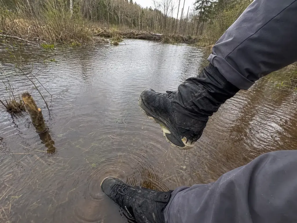
Standing water at Sterling Forest is not a check-the-forecast problem. Beavers built it, beavers maintain it, and it sits there through a dry week in August while you’re wondering why your socks are soaked.
The McKeags Meadow Trail and the Red Back Trail run through an active beaver zone, where a working beaver dam holds water across ground that would otherwise drain. Sections of both go under regularly, and mud is a baseline condition rather than a seasonal one. Local hikers don’t call these sections muddy. They call them beaver-flooded, which is a more accurate and more useful word for a wet trail that never dries out.
Get the distinction right, because it drives everything else. This is flooded-flat trail, not deep water crossings. You are walking through ankle-deep standing water spread across the trail’s entire width for stretches at a time.
You are not fording a river and you are not rock-hopping a stream. Nobody needs to turn back. Everybody gets wet.
That changes the footwear answer in a way most guides get backwards. Waterproof hiking boots are the wrong tool here. Water comes over the collar in the first flooded stretch, and then the membrane that was supposed to keep water out keeps it in for the next four miles.
What works is a grippy trail shoe with a rock plate that drains and dries as you walk, paired with low gaiters to keep debris out.
The Merrell Moab Speed 2 (men’s · women’s) is built around exactly that combination: Vibram TC5+ traction for wet rock and a full-length rock plate for the tower approach, at trail-runner weight. It’s the pairing this park asks for more than any premium waterproof boot does. Over the top, a set of Pike Trail Ankle Gaiters (here) stops the grit and leaf litter that standing water floats straight into your shoe collar. It’s the same low-gaiter approach that works on Long Island’s sandy and wet stretches, for the same reason: cheap, light, and it solves a problem that ruins the back half of a hike.
Add one more thing to the picture. Those same wet sections breed gnats and flies in spring and summer, thick enough that the mud stops being your main complaint.
The story that keeps repeating in trip reports is someone in regular trail shoes reaching the Red Back crossing, bracing for a two-step stream hop, and finding ankle-deep water across the full trail width with no dry line anywhere.
Closures, Conditions and the Drive You Don’t Want to Waste
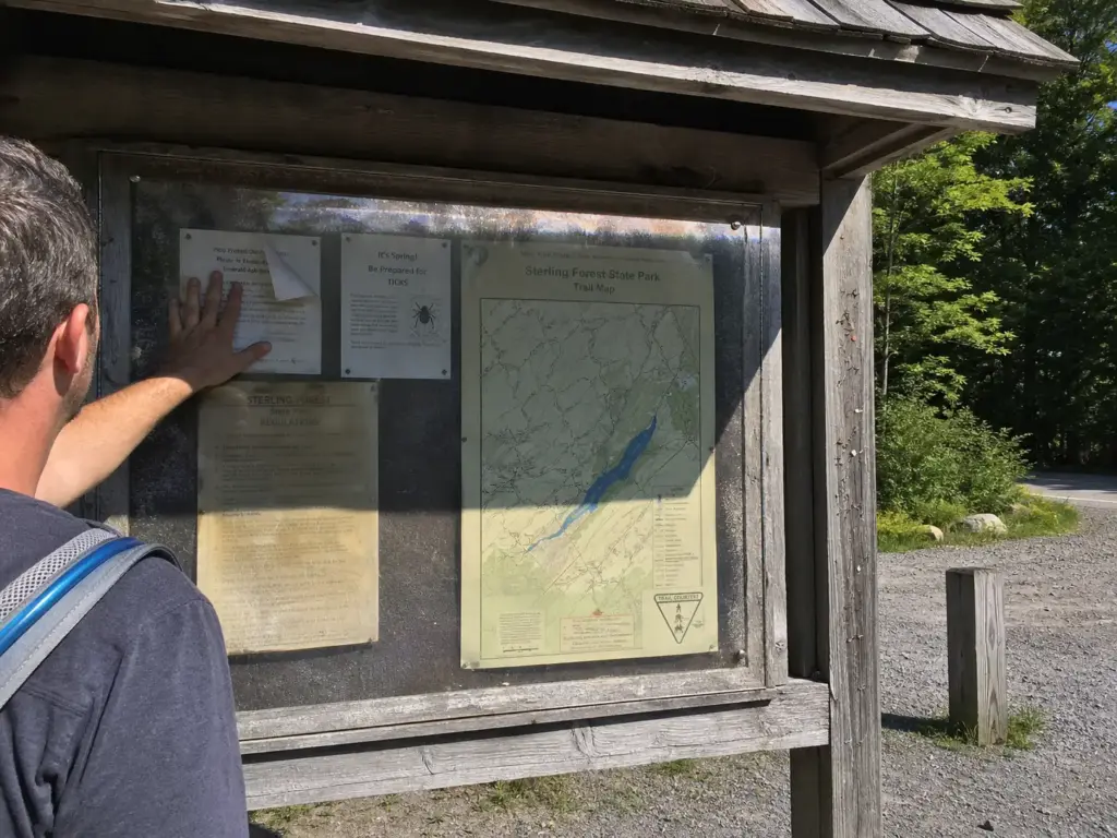
This park closes sections after fire damage and reopens them quietly. The trailhead kiosk is not where you learn about it.
Both the Fire Tower and the Bare Rock area have documented closures on record. People have driven out specifically for that 360-degree view and found the tower roped off with nothing anywhere on the approach warning them. That’s the failure mode this section exists to prevent.
Check two places before you leave the house. The NY State Parks page for the park carries official closure notices, and the NY-NJ Trail Conference’s trail conditions reporting catches the things that haven’t made it into an official notice yet. Both take about ninety seconds. It’s the same closure-awareness habit that Breakneck’s shutdown forced on Hudson Valley hikers, and it has quietly become standard practice across the region.
Beyond closures, several segments have turned into genuinely eroded trail, overgrowth swallows others, blazes fade, and reroutes happen without announcement. In a park this large with signage this thin, carrying an offline map is not an optional refinement.
Have a plan B route picked before you pull out of the driveway, not after you read the closure sign. If the tower is shut, the Doris Duke loop and the Sterling Lake circuit are both close enough to swap in without another twenty minutes of driving. A wasted trip is almost always a planning failure, not bad luck.
Then there’s the seasonal rhythm. Spring means mud and running water everywhere, and summer means heat on the exposed rocky ridge sections plus gnats in the wet zones. October brings the best conditions of the year and the fullest parking lots. Winter strips the leaves and opens sightlines that don’t exist in July.
Navigation, Blazes and Staying Found
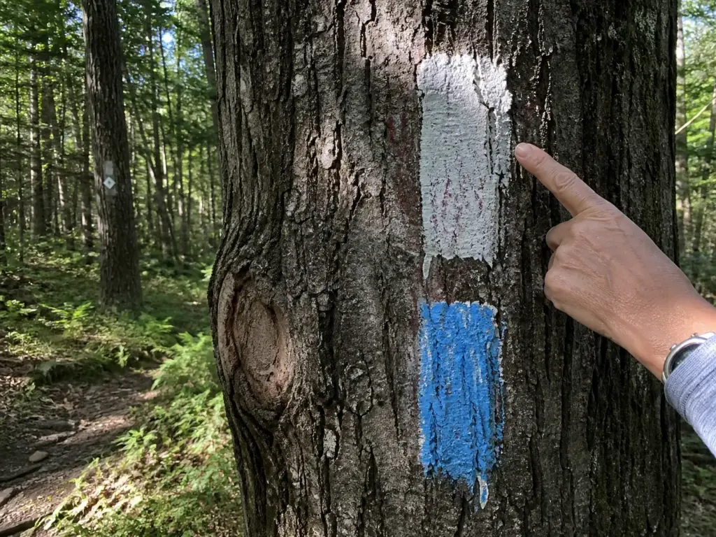
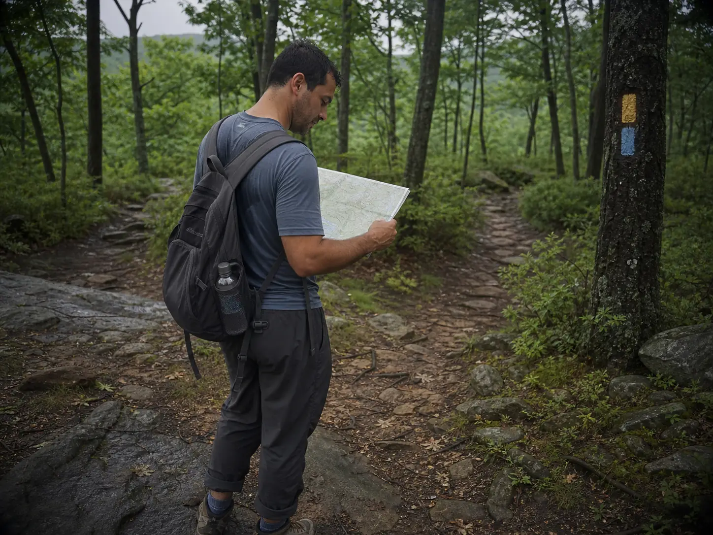
More than two dozen named trails cross each other in here, and the trail blazes aren’t uniform across all of them. That combination is how people end up walking a ridge they never meant to be on.
Most trails use the standard color-blaze system: the Allis Trail, the Sapphire Trail, Sterling Ridge and the rest all speak that language. The Doris Duke does not. It uses a yellow DD logo on white, which is a different alphabet printed on the same map. If you’re switching between them mid-route, that’s a real cognitive gear change, and it helps to understand how blaze systems actually work once you know what to look for rather than pattern-matching colors and hoping.
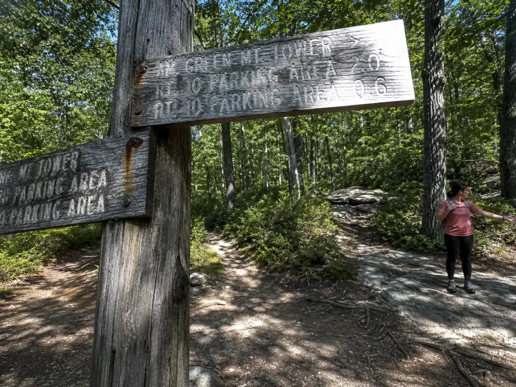
Junctions come often and signage is sparser than at Harriman or Bear Mountain. Trail intersections are where errors compound: one missed turn puts you on a parallel route heading the wrong way along a ridge that looks identical.
Cell coverage on the high ground is unreliable, so live GPS navigation is not the answer here. An offline trail map is. Avenza Maps carries the Trail Conference’s park maps, and downloading yours in the parking lot while you still have a bar or two is the last thing to do before you start walking.
The habit that separates people who never get lost here from people who lose forty minutes: check the map at every junction rather than every mile. In a network this dense, a wrong turn doesn’t announce itself. You notice it when the terrain stops matching your expectation, and by then you’ve walked a long way.
One more thing worth filing away. Both the Appalachian Trail and the Highlands Trail touch this park, with connector routes like the Sapphire and the AT Connector Trail linking in. That’s useful when you want to extend a day, and it’s also the easiest way in the park to walk considerably further than you planned.
Wildlife, Seasons and Picking Your Day
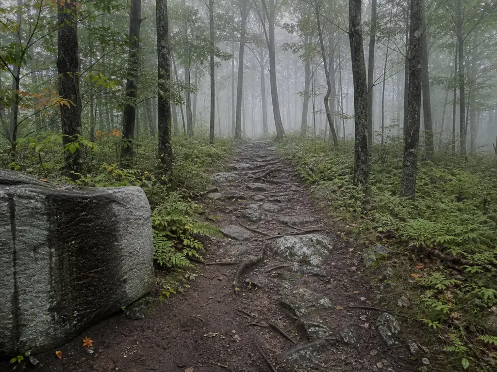
This is a large, quiet, genuinely wild forest sitting a short drive from the New Jersey line, which surprises people who expect suburbia. Black bears live here year-round.
Standard Northeast practice covers it. Make noise on blind corners, don’t leave a sandwich unattended while you’re taking photos at an overlook, and if you see one, give it a wide berth and an obvious exit route. Bears here want your food, not a confrontation, and knowing what a black bear encounter actually calls for removes most of the anxiety from the whole subject.
The park is a designated wildlife-viewing site, and it earns that. Songbirds and hawks work the ridges, and eastern ribbon snakes turn up in the wetland sections where the beavers have done their work. The DEC’s wildlife-viewing profile for Sterling Forest lists what’s resident here if you want to go in knowing what you’re looking at.
Season by season, the park changes more than the trail descriptions let on. Spring is mud and moving water, and summer brings real heat on the exposed rocky ridges plus the gnat problem in the wet zones.
Fall gives you the best hiking conditions of the year alongside the busiest parking lots, particularly in October. Winter opens the sightlines, quiets everything down, and brings cross country skiing and snowshoeing into play.
Which brings up the park’s actual selling point. Sterling Forest sees a fraction of the traffic that Bear Mountain and Breakneck absorb, and on a weekday morning the main lots stay open all day. That space also leaves room for the park’s other uses without crowding the trails: mountain biking on the designated routes and fishing on the lakes.
Regulars don’t keep coming back for the tower. They come back because you can walk a full loop here on a Saturday and pass six people, which is close to impossible anywhere else in the Hudson Highlands.
The Short Version
Four routes cover nearly every hiker who drives out here. Fire Tower and Bare Rock for the best payoff per mile, the tower out-and-back for a simpler day with an easy bail point, the full ridge-and-lake loop when you want a real hike, and the Doris Duke for flat miles with no hunting season to think about.
Check conditions before you leave. The tower and Bare Rock have both been closed, and the trailhead will not tell you.
Plan for wet feet on the beaver-flooded sections and blaze orange between October and February. Neither costs you anything, and both change how the day goes.
Pick your loop before you back out of the driveway, download the map while you still have signal, and let the rest of the park stay the surprise it’s supposed to be.
Frequently Asked Questions
01Is Sterling Forest State Park worth visiting?
Yes, particularly if you want Hudson Highlands scenery without Breakneck Ridge crowds. The fire tower and Bare Rock overlook deliver real 360-degree views for about four miles of walking, and the trail network stays quiet enough that a weekend loop can feel like a weekday one.
02How long does it take to hike to the Sterling Forest fire tower?
Roughly two to two and a half hours round trip. The Fire Tower and Bare Rock Loop covers 4.2 miles with 629 feet of gain and includes both viewpoints; the tower-only out-and-back runs 5.2 miles with 721 feet of gain.
03Can you hike in Sterling Forest during hunting season?
Yes. Hunting inside the park requires a $5 park permit on top of a NYS DEC license, so the hunting population stays small and regulated, and there is no hunting at all in September. Wear blaze orange during the regular season, or hike the Doris Duke Trail, where hunting is banned across the entire 1,400-acre sanctuary.
04What should you wear on Sterling Forest trails?
A grippy trail shoe with rock-plate protection handles the park’s two real problems better than heavy boots: rocky footing near the fire tower and standing water on the beaver-flooded sections. Add low gaiters if your route touches McKeags Meadow or the Red Back Trail, and blaze orange between October and February.
Risk Disclaimer: Hiking, trekking, backpacking, and all related outdoor activities involve inherent
risks which may result in serious injury, illness, or death. The information provided on The Hiking Tribe is for
educational and informational purposes only. While we strive for accuracy, information on trails, gear, techniques,
and safety is not a substitute for your own best judgment and thorough preparation. Trail conditions, weather, and
other environmental factors change rapidly and may differ from what is described on this site. Always check with
official sources like park services for the most current alerts and conditions. Never undertake a hike beyond your
abilities and always be prepared for the unexpected. By using this website, you agree that you are solely
responsible for your own safety. Any reliance you place on our content is strictly at your own risk, and you assume
all liability for your actions and decisions in the outdoors. The Hiking Tribe and its authors will not be held
liable for any injury, damage, or loss sustained in connection with the use of the information herein.
Affiliate Disclosure: We are a participant in the Amazon Services LLC Associates Program, an
affiliate advertising program designed to provide a means for us to earn advertising fees by advertising and linking
to Amazon.com. As an Amazon Associate, we earn from qualifying purchases. We are also an official affiliate partner
of Black Diamond Equipment via the AvantLink network. If you click on a Black Diamond affiliate link and make a
purchase, we may earn a commission at no additional cost to you. We also participate in other affiliate programs and
may receive a commission on products purchased through our links. Additional terms are found in the terms of
service.