In this article
You typed the park name into your phone, hit the first address that came up, and drove ninety minutes. Now you’re idling behind eleven cars at a gate, and the trail you actually wanted to hike starts at a different entrance twenty minutes away with a reservation system you didn’t know existed. That’s not a rookie mistake. Minnewaska State Park Preserve is administratively three separate access points, each with its own fee, its own hours, and in one case its own booked time slot, and almost nothing you’ll read about it says so up front.
By the end of this you’ll know which of the three areas fits the day you actually have, which trail matches your legs, and what the parking situation really looks like when you pull in.
Minnewaska State Park Is Really Three Parks
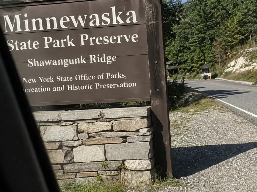
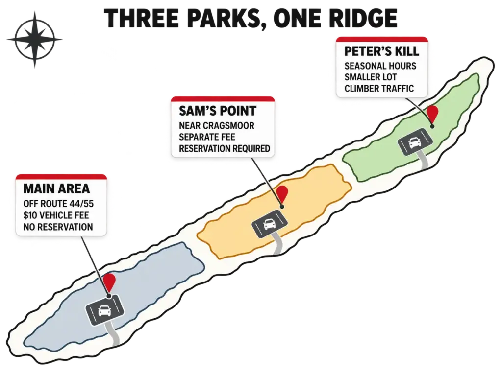
Before you type an address, answer one question: which Minnewaska are you going to? The preserve sits on the Shawangunk Ridge in Ulster County, a few miles west of New Paltz, NY, and its three entrances are spread far enough apart that picking the wrong one costs you real driving time. Most people find out there are three when they’re already parked at the wrong one, and by then the day has a hole in it.
The Main Area is what almost everyone means. You come in off Route 44/55, pay the vehicle use fee of $10, and park above Lake Minnewaska with the carriage roads spreading out below you. This is the default entrance, the one with the beach, the bathrooms, and the trailhead for Gertrude’s Nose. If someone tells you they hiked Minnewaska and doesn’t specify further, this is where they were.
Fees and seasonal hours shift, so it’s worth a minute to check current hours and fees on the official Minnewaska State Park Preserve page before you leave the house.
Sam’s Point is where the framework breaks for most first-timers. It isn’t a second parking lot at the same park. It has its own entrance near Cragsmoor, its own page on the state’s site, its own fee structure, and a parking reservation system that the Main Area doesn’t use. Drive to the Main Area expecting the Ice Caves Trail and you’re looking at a forty-minute reroute, assuming there’s still a slot open when you get there. If Sam’s Point is the one you want, the Sam’s Point area has its own planning guide and it’s worth reading before you commit the morning to it.
The third is Peter’s Kill Area, and it’s the one nobody mentions. Seasonal hours, a smaller lot, and a crowd that skews toward climbers working the cliff bands rather than hikers doing loops. It’s quieter than the Main Area on the same Saturday, which is either the point or a disappointment depending on what you drove up for.
Here’s the part that makes this more than trivia. The separation is legal and administrative, not editorial convenience. New York State Parks runs Sam’s Point with a distinct reservation requirement and posts it separately, which means “the park is open” and “you can get in” are two different statements. Show up at 10am on a good October Saturday and the wrong-area mistake compounds the parking mistake: you burn the drive, then you burn the reroute, then you find the correct lot full too.
Decide the area the night before, not in the car. The three entrances are 20 to 40 minutes apart by road even though they sit on the same ridge, and phone navigation will happily route you to whichever one it matched on the name.
Picking Your Trail by What You Actually Have
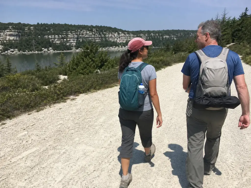
Nobody hikes “the park.” You hike one specific loop with one specific drive home waiting at the end of it. So sort by the hours you actually have, not by which overlook photographs best.
Under Two Hours: The Lake Minnewaska Loop
The lake loop is flat carriage road the whole way around, roughly two miles, and it’s the answer when you’ve got kids, a dog, or legs that just did three hours in a car. Crushed stone underfoot, no route-finding, and you can see the water from most of it. Nobody brags about this loop and everybody enjoys it.
Awosting Falls sits at the same difficulty tier. Short carriage-road walk down from the Main Area lot, a genuine waterfall at the end, and you’re back at the car inside ninety minutes. If someone in your group is having doubts about the whole hiking thing, this is the trail that converts them.
Half a Day: Awosting Falls and Rainbow Falls
String the waterfalls together and you’ve got a solid half day without the full commitment. Rainbow Falls takes more work than Awosting and rewards it, especially in spring when the flow is up. Late summer it can be a trickle, which is worth knowing before you plan the day around it.
The Full Day: Gertrude’s Nose
Gertrude’s Nose is the flagship, and it’s the one people consistently underestimate. Here are the numbers that matter. The version via Lake Minnewaska and the Millbrook Mountain Carriage Road runs about 6 miles with 761 feet of elevation gain, rated moderate, and takes most people 2.5 to 3 hours.
The Millbrook Mountain loop is the other animal entirely: combining Lake Minnewaska, Gertrude’s Nose and Millbrook Mountain makes a 10.9-mile loop trail with roughly 1,715 feet of gain, rated hard. That’s a full day, not a morning, and the same honest-difficulty math applies at Bear Mountain if you’re calibrating what “moderate” means in the Hudson Valley generally. Neither version is an out-and-back you can turn around on halfway without redoing the math on daylight.
The mistake shows up on the map. Two routes share a name and a destination, and a group that planned “just the Gertrude’s Nose view” ends up eleven miles in because they never differentiated the lines. Water runs out around mile seven. The mood goes shortly after.
There’s also a timing lie built into the mileage. Carriage roads let you cover ground fast, so six miles of crushed stone moves at a pace that flatters you. Six miles that includes cliff-edge footpath does not. Same number, different day.
If someone tells you they did Gertrude’s Nose in two hours, ask which version they did, because they did the short one.
Sam’s Point and the Ice Caves
The Ice Caves Trail is the one thing at Minnewaska that feels genuinely unlike anywhere else in the Hudson Valley. It’s also the one place where showing up unprepared means turning around.
You Reserve a Session, Not a Parking Spot
Locals call it an “ice caves session,” and the wording is precise. On weekends and holidays from April 18 through November 15, Sam’s Point runs two blocks per day: 9am to 2pm, and 2pm to close. You book one of them, up to 14 days ahead through ReserveAmerica, and the reservation windows are posted on the Sam’s Point area page.
The mistake here is treating early arrival as a substitute. It isn’t. At the Main Area, getting there at 8am genuinely solves the parking problem. At Sam’s Point, without a booked session, 8am gets you the same answer as 11am, which is that access isn’t guaranteed.
That distinction catches experienced hikers, because everywhere else in the Northeast, dawn beats the crowd.
The Lights Don’t Cover Everything
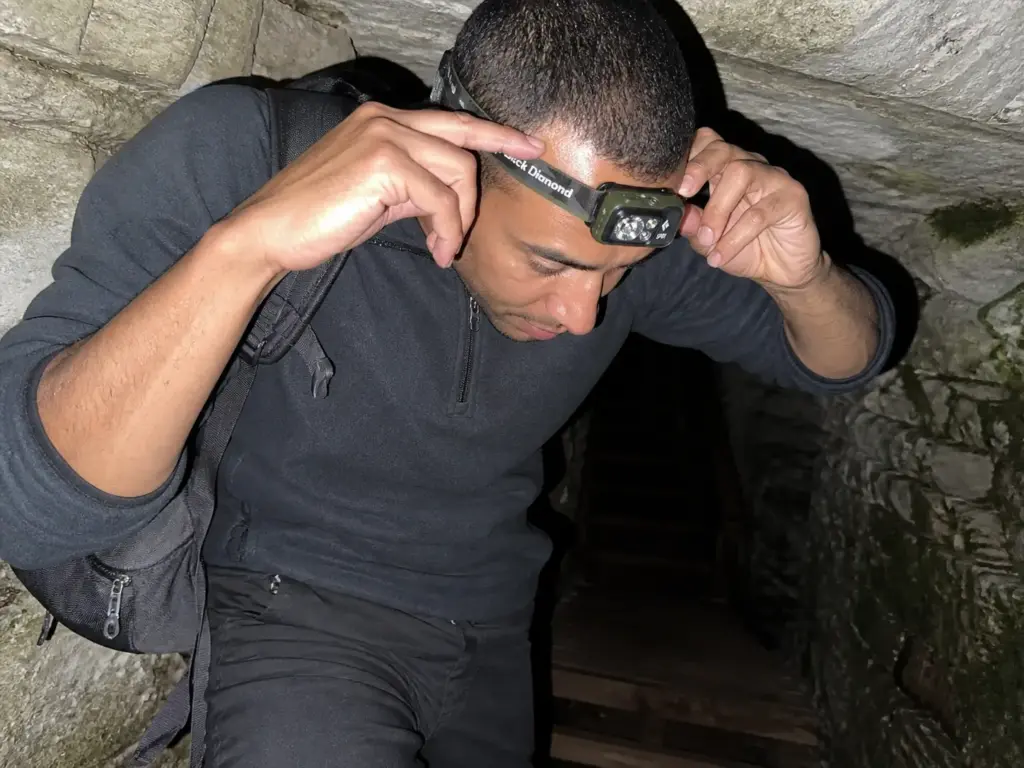
The Ice Cave Trail runs about three miles and includes narrow crevices, rock ceilings low enough to make you duck, metal stairs, and stretches where the daylight simply stops. Some zones have light sensors. Not all of them do, and the gaps are exactly where you’d want light most: the tight turns between boulders where your eyes haven’t adjusted yet.
Bring your own light and it becomes a non-issue. The Black Diamond Spot 400 Headlamp is the practical call here, not because it’s the brightest thing on Amazon but because a headlamp keeps both hands available for the stairs and the rock, and 400 lumens is plenty for a crevice. It’s dimmable, which matters more than it sounds when you’re a foot from a wall and full power just bounces back at you. Phone flashlights work in a pinch, but you’ll be holding a phone on wet stairs, and that’s how phones end up in crevices.
If you want the full route breakdown before you go, there’s a full walkthrough of the Ice Cave Trail covering the sequence section by section.
What the Dwarf Pines Actually Are
The stunted forest on the Sam’s Point plateau reads like poor soil and bad luck. It’s neither. Pitch pine (Pinus rigida) dominates the ridge, and it’s a fire-dependent species: thick insulating bark, the ability to resprout from the trunk after a burn, and serotinous cones that need heat before they’ll open and release seed.
The trees aren’t failing to grow. What you’re walking through is a pitch pine barrens — a fire-dependent ecosystem that evolved to burn periodically and come back — and the dwarf pine barrens here are rated globally rare (G1G2), which is a conservation ranking, not a tourism adjective.
Once you know that, the walk changes. The low canopy stops looking sad and starts looking like a system doing exactly what it’s built to do. Verkeerder Kill Falls sits further out on the same plateau, past the caves, if you want to see how far the barrens run before the terrain drops away.
Book the 9am to 2pm session rather than the afternoon block if you have the choice. The caves hold cold air, and the temperature difference between the plateau and the crevices is sharpest in the morning, which is the whole reason they’re called ice caves.
Carriage Roads and Footpaths Are Two Different Parks
Two people describe Minnewaska completely differently, and both are telling the truth. One of them never left the carriage roads. That single distinction determines your footwear, your pace, and whether the mileage on the map means anything.
The Carriage Roads: Wide, Graded, Fast
The carriage roads are the leftover infrastructure of the old mountain-house resort era, and they’re the reason this park is unusually forgiving. Wide crushed stone, gentle graded turns engineered for horse-drawn carriages, and consistent footing for miles. You can hold a conversation, look at the view instead of your feet, and cover six miles in a time that would embarrass you in the Catskills.
The Footpaths: Bedrock, Roots and White Blazes
Step off the crushed stone onto a blazed footpath and the park changes underneath you. Exposed bedrock, roots, cracks that eat a trekking pole tip, and real route-finding between blazes. There’s no cushion. The rock is the trail surface, and the cliff-edge sections near Gertrude’s Nose and Compass Rock run along an unfenced drop-off with nothing between you and a long fall but your own footing.
Your pace drops immediately, and you feel it in your ankles before you consciously register that the surface changed. That’s the honest tell. When your stride shortens on its own, you’re on footpath, and the mileage estimate you made in the parking lot just became optimistic by a third.
What the Rock Does to Your Footwear
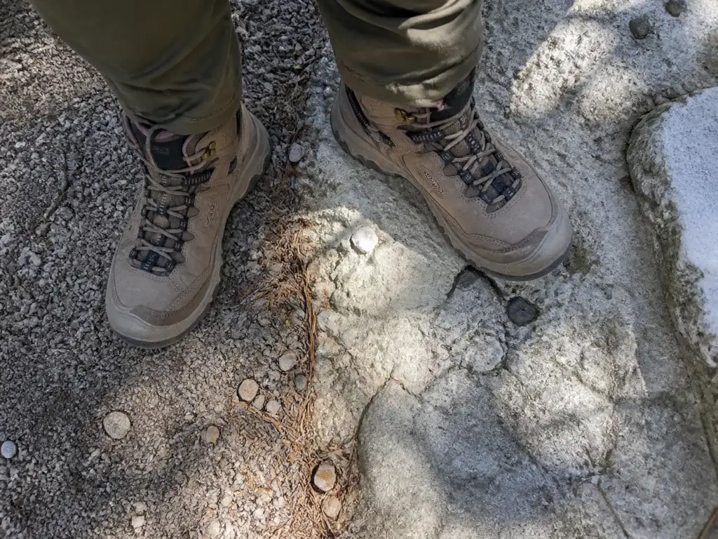
Shawangunk Conglomerate is quartz pebble rock and sandstone, and it behaves differently from the limestone or granite you might be used to. Dry, it’s abrasive and grippy, sandpaper that chews through soft outsoles over a season. Wet, that same quartz goes slick in a way that surprises people who’ve hiked plenty of granite. Both properties come from the same mineral.
For carriage-road-only days, grippy trail runners are genuinely fine and I’d rather see you comfortable than overbooted. For the footpath sections, the Ice Cave Trail, or anything approaching Gertrude’s Nose, sturdy hiking footwear stops being a preference and starts being the thing standing between you and a rolled ankle. A waterproof mid like the KEEN Targhee IV Mid (men’s · women’s) covers that range without going full backpacking boot: mid-height collar for the ankle rolls that bedrock invites, waterproof for the seeps that never quite dry on north-facing rock, and enough outsole to trust on damp conglomerate.
The rock story doesn’t stop at the park line either. The same conglomerate shows up in the Lemon Squeeze at Mohonk, where it gets a lot more vertical and a lot less forgiving.
The Geology That Explains the Whole Ridge
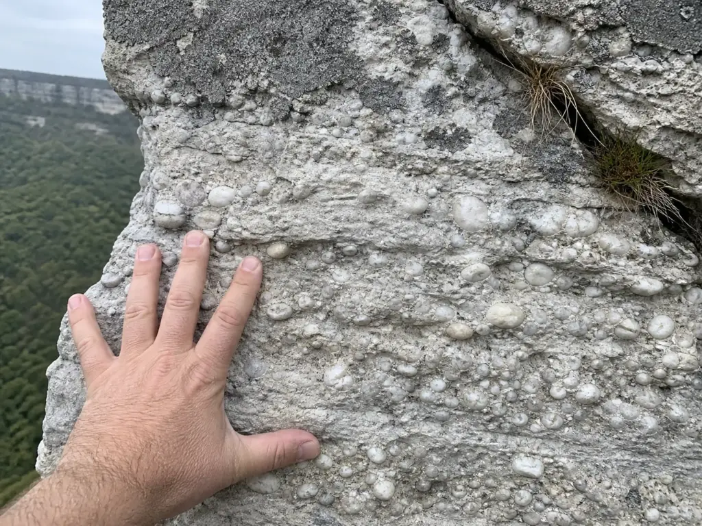
Once you know what you’re walking on, the white cliffs and the odd lakes perched on top of a ridge stop being scenery and start making sense.
The Shawangunk Formation is Silurian rock, roughly 440 to 417 million years old, made of quartz conglomerate and sandstone laid down from the erosion of the ancient Taconic Mountains. That’s the whole ridge, and the New York State Museum’s geology of the Shawangunk Ridge has the detail if you want the full stratigraphy. It’s also why the ridge looks nothing like the Catskill Mountains you can see from the overlooks on a clear day: different rock, different age, different shape. That composition is the direct cause of everything your feet noticed on the footpaths: quartz is hard, so the cliffs resist weathering and stay pale, and quartz is smooth-fracturing, so wet rock turns treacherous while dry rock grips like a file.
The sky lakes are the other payoff. Lake Minnewaska and Lake Awosting sit near the top of the ridge rather than in a valley, which means no major inflow stream is feeding them sediment and runoff. That’s why they’re startlingly clear and cold, and why they’re also acidic and low in nutrients compared to a lowland lake.
Clear water on a ridgetop isn’t luck. It’s the absence of a watershed above it.
Locals call the whole thing the Gunks, and the shorthand covers more than this park. Minnewaska, Mohonk Preserve, and the climbing cliffs near New Paltz all sit on the same formation, which is why the rock looks familiar as you drive between them. From the Gertrude’s Nose overlooks, the white cliff bands read sharper than anything else on the horizon, and that’s the quartz again holding its color where surrounding rock weathers grey.
Parking, Fees, and the Plan B Nobody Mentions
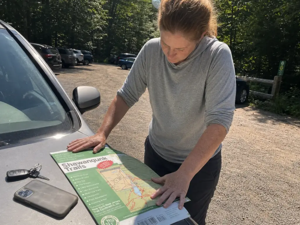
The trail report nobody writes is the one about the parking lot. This is the section that saves your Saturday.
What You’ll Pay and How
The vehicle use fee at the Main Area is $10 per vehicle, collected at the gate. An Empire Pass covers it and skips the reservation fee on top, which changes the math fast if you’re a repeat visitor. Two or three trips a season and it’s roughly break-even. Five and you’re clearly ahead, and you stop doing the “is it worth ten dollars today” calculation every time the weather looks marginal.
Jenny Lane and the Overlook
The Jenny Lane parking lot is the park’s only free lot, and it holds about eight cars. Eight. On a decent weekend those spots are gone early, and if you’re rolling up after 9am on a Saturday in October with the fall foliage at peak, plan as if it’s already full, because it is. Cold Spring has the same shared-lot problem if you want to see the pattern repeat elsewhere in the Hudson Valley.
The plan C locals actually use is the overlook about three-quarters of a mile past Jenny Lane. There’s room to pull off, and it works. What nobody tells you is that the distance and elevation from that overlook aren’t in any trail’s official specs, so your real day is longer than the map says.
The hiker who arrives confident at 10am on a good October Saturday, finds the Main Area lot and Jenny Lane both full, and ends up at the overlook has just added roughly a mile and a half of road walking before touching a trail. Round trip, that’s a bonus three miles on a six-mile hike. Factor it in or turn it into a shorter day on purpose.
Where the Signal Dies
Cell service drops out across parts of the park, which is fine right up until you’re standing at an unmarked junction with a tile map that won’t load. The free fix is downloading offline maps before you leave the car, and Avenza Maps handles that well enough.
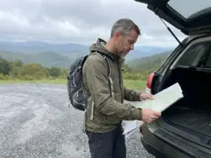
The better fix costs about as much as lunch. A paper trail map doesn’t care about signal, and the Shawangunk Trails Map from the NY-NJ Trail Conference is printed on waterproof Tyvek and made by the organization that maintains these trails, which means the junctions on it match the blazes you’re standing under. It doesn’t run out of battery, it works in rain, and it shows you the whole ridge at once instead of a phone-sized window of it. Paper maps and navigation sit inside a bigger kit, and the Ten Essentials framework covers the rest of it if you want to audit what’s in your pack.
If the Main Area gate has a line of cars visible from the road, that lot is already at or near capacity. Turning around before you commit to the queue saves you fifteen minutes and puts you at Jenny Lane while there’s still a chance.
The Rattlesnake Question, Answered Honestly
Somebody always brings it up in the parking lot, usually secondhand and usually wrong in both directions: either there’s nothing out there, or the ridge is crawling with them. Here’s the actual situation.
Where They Actually Are
Timber rattlesnakes (Crotalus horridus) live here, and they concentrate on the rocky western slopes of the park, away from the climbing corridors nearer New Paltz. They’re a New York State protected threatened species, which shapes both the ethics and the law of any encounter. The terrain tells you where to pay attention: open rock, sun-warmed ledges, and the shaded gaps underneath overhangs where a snake goes to cool off in the afternoon.
Why the Fear Is Worse Than the Risk
They’re docile animals. They distinguish prey from non-prey, they don’t want anything to do with something your size, and their default response to a hiker is to hold still or retreat. Bites are extremely rare, and the Gunks Climbers Coalition’s field notes on Shawangunk timber rattlesnakes document both the geographic concentration and the behavior in more detail than most state pages bother with.
The practical read: informed respect works better as a guide than generic fear. Fear makes people freeze in bad spots or leave the park entirely. Respect makes them look before they reach.
The Two Habits That Handle It
The first habit is simple and it’s where nearly everyone slips. Don’t put a hand under a rock overhang or into a crevice you haven’t looked into. That’s the common mistake, and it happens on exactly the sections where you’re scrambling and want a handhold without breaking rhythm.
Look first. It costs a second.
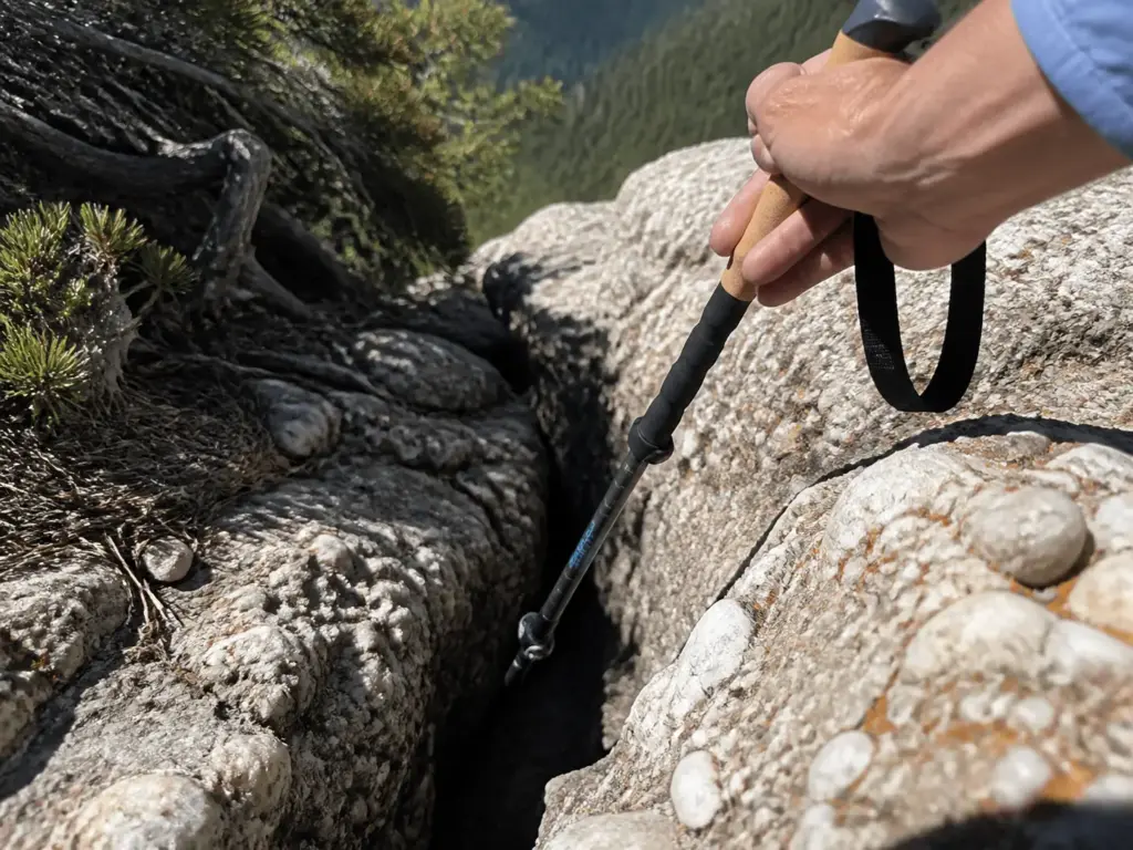
The second is using trekking poles on rocky ground. A pole lets you probe a crack or a gap before you commit a foot or a hand to it, and it takes load off your knees on the bedrock descents where the footing is uneven anyway. The Cascade Trekking Poles in the ultralight carbon fiber build are the sensible version of this: light enough that you’ll actually carry them the whole day instead of strapping them to the pack at mile two, which is the failure mode with heavier aluminum pairs.
They’re not a talisman. They’re a way to touch the ground before your hand does.
Protected status means leaving the animal alone isn’t just decent behavior, it’s the regulation. Give it distance, let it move, keep walking. The Major Welch Trail asks for the same hands-on-rock caution for slightly different reasons, and the habit transfers cleanly.
Rules That Actually Get Enforced
Every park has a sign covered in rules. These are the four that patrol actually acts on, and the full set is posted on the park’s current regulations page.
Dogs and the Six-Foot Rule
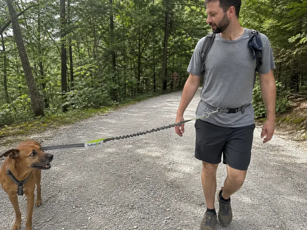
Minnewaska is an on-leash park, and the length is specified: six feet or less. Not “under voice control,” not “leashed if someone’s coming.” Six feet or less, and they’re not permitted in buildings, camping and picnic areas, bathing areas, or on the beaches. This one gets enforced, and the fine is real.
The practical version of compliance is a hands-free waist leash, because a six-foot leash in your hand and a pair of trekking poles are mutually exclusive. The Tuff Mutt Hands-Free Waist Dog Leash solves that with a bungee section and a double handle: it clips at your waist within the legal length, the bungee absorbs the lunge when your dog spots a chipmunk on a ledge, and the handle near the collar lets you choke up for short control at a trail junction or a cliff edge. Lake George runs a similar mix of dog rules and seasonal closures if the dog comes on most of your trips.
No Swimming, No Drones, No Grills
The no-swimming rule is the one that surprises people most. Swimming is restricted to designated lifeguarded areas in season, which means the waterfall pools you’ll pass are off limits no matter how good they look in August. The no-drone rule is absolute across the preserve. The no-BBQ rule covers charcoal grills, which matters more here than it sounds: this is a fire-dependent ridge where the management burns are planned and the accidental ones are not.
People plan around all three wrong every summer, usually arriving with a cooler and a plan that quietly assumed otherwise. The preserve is co-managed by New York State Parks with support from the Palisades Parks Conservancy, and the rare-species side of it sits with the NYS Department of Environmental Conservation, which is why the rules here run tighter than at a standard state park with a swimming beach and a picnic pavilion.
Carry In, Carry Out
There are no trash cans at the trailheads. That’s policy, not neglect: carry-in carry-out is the Leave No Trace principle written into the park’s own regulations rather than left as a suggestion. Whatever comes up the ridge with you goes back down in your pack, including the banana peel and the dog waste bag you were hoping to drop at the car. Bring a spare zip bag for the drive home and it’s a non-issue.
The rules read as bureaucratic paperwork right up until you understand what’s on this ridge. A fire-dependent forest community that’s globally rare, a protected snake population, and a set of ridgetop lakes with no watershed to flush them. The regulations aren’t there to manage hikers. They’re there to keep the thing you drove up to see from wearing out.
Conclusion
Three things worth carrying out of here. Decide which of the three areas you’re going to before you decide which trail, because the reservation rules and the fees aren’t the same and the entrances are half an hour apart. Carriage road or footpath is the real difficulty question, not the mileage, so read the surface before you read the numbers. And get there early enough that the parking plan doesn’t become the hike.
Pick the area that fits the hours you actually have this weekend. Book the session if it’s Sam’s Point. Leave the 11-mile loop for a day you’ve got the whole day.
Frequently Asked Questions
01Do you need a reservation to hike Minnewaska State Park?
Not for the Main Area, where you simply pay the vehicle fee at the gate. Sam’s Point is different: on weekends and holidays from April 18 through November 15 you need a booked session, either 9am to 2pm or 2pm to close, reservable up to 14 days ahead.
02How much does it cost to park at Minnewaska State Park?
The vehicle use fee is $10 per car at the Main Area. An Empire Pass covers that and skips the reservation fee, which pays for itself if you come back several times a year. Jenny Lane is the only free lot, with about eight spaces.
03Are dogs allowed on trails at Minnewaska State Park?
Yes, on a leash of six feet or less. Dogs are not allowed in buildings, camping, picnic or bathing areas, or on the beaches. The leash length is enforced rather than advisory, so a hands-free waist leash within that limit is the easiest way to comply.
04What is the best hike in Minnewaska State Park?
Gertrude’s Nose is the flagship, but best depends on your day. The short version runs about 6 miles with 761 feet of gain in 2.5 to 3 hours. The full loop with Millbrook Mountain is 10.9 miles and roughly 1,715 feet, which is a full day.
05Are there rattlesnakes at Minnewaska State Park?
Yes. Timber rattlesnakes live on the rocky western slopes and are a state-protected threatened species. They are docile, they retreat from people, and bites are extremely rare. Watch where you put your hands on rock and you have handled it.
Risk Disclaimer: Hiking, trekking, backpacking, and all related outdoor activities involve inherent
risks which may result in serious injury, illness, or death. The information provided on The Hiking Tribe is for
educational and informational purposes only. While we strive for accuracy, information on trails, gear, techniques,
and safety is not a substitute for your own best judgment and thorough preparation. Trail conditions, weather, and
other environmental factors change rapidly and may differ from what is described on this site. Always check with
official sources like park services for the most current alerts and conditions. Never undertake a hike beyond your
abilities and always be prepared for the unexpected. By using this website, you agree that you are solely
responsible for your own safety. Any reliance you place on our content is strictly at your own risk, and you assume
all liability for your actions and decisions in the outdoors. The Hiking Tribe and its authors will not be held
liable for any injury, damage, or loss sustained in connection with the use of the information herein.
Affiliate Disclosure: We are a participant in the Amazon Services LLC Associates Program, an
affiliate advertising program designed to provide a means for us to earn advertising fees by advertising and linking
to Amazon.com. As an Amazon Associate, we earn from qualifying purchases. We are also an official affiliate partner
of Black Diamond Equipment via the AvantLink network. If you click on a Black Diamond affiliate link and make a
purchase, we may earn a commission at no additional cost to you. We also participate in other affiliate programs and
may receive a commission on products purchased through our links. Additional terms are found in the terms of
service.