In this article
The Alum Cave Trail isn’t just a path; it’s a premier mountain experience in the Great Smoky Mountains National Park, celebrated for its unique geology, rich history, and spectacular views. It stands as one of the most popular and rewarding hikes in the park. However, its fame creates significant logistical challenges, such as parking and crowding, that demand strategic planning for a successful trip. This guide serves two purposes: to be an exhaustive resource for the day hike to Alum Cave Bluffs and for the epic continuation to the summit of Mount LeConte, covering everything from logistics to mile-by-mile descriptions.
The Vitals: Two Hikes in One
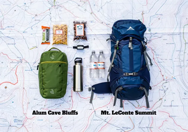
This section provides a clear, scannable comparison of the two primary hiking objectives—Alum Cave Bluffs and the Mount LeConte summit—to help hikers choose their adventure based on key statistics like distance, elevation, and time.
Alum Cave Bluffs vs. Mt. LeConte Summit
Choosing your destination on the Alum Cave Trail depends on your goals, fitness, and available time. The data below, synthesized from the official park service trail overview and experienced hiker reports, helps clarify the commitment for each. While GPS tracks may vary slightly, these figures represent a reliable baseline for planning your day. Properly understanding how to pace yourself is key to enjoying either option.
| Feature | Alum Cave Bluffs | Mount LeConte Summit |
|---|---|---|
| Roundtrip Distance | 4.6 miles | 10-12 miles |
| Total Elevation Gain | ~1,130 feet | ~2,700-3,100 feet |
| Average Hiking Time | 3-4 hours | 6-8 hours |
| Difficulty Rating | Moderate | Strenuous |
Key Landmarks (Bluffs Objective):
- Arch Rock
- Inspiration Point
- Alum Cave Bluffs
Key Landmarks (Mt. LeConte Objective):
- All of the above, plus:
- Gracie’s Pulpit
- Cliff Top
- High Top
- Myrtle Point
- LeConte Lodge
The Pre-Hike Playbook: Logistics for the Most Popular Trail

Addressing the single greatest hurdle for hiking Alum Cave—the logistics—is the first step to a great day. This strategic guide helps you navigate parking, permits, and transportation to ensure your hike starts smoothly.
Trailhead Location and Directions
Finding the trailhead is straightforward, but it’s the first step in a day that requires precise timing. For easy navigation, plug this physical address into your GPS: Alum Cave Trailhead Parking Area, 3639 Newfound Gap Rd, Gatlinburg, TN 37738.
For those coming from the Tennessee side, the trailhead is located approximately 8.7 miles south of the Sugarlands Visitor Center on Newfound Gap Road (US-441). If you’re arriving from the North Carolina side, it’s about 20 miles north of the Oconaluftee Visitor Center on the same road. Look for the large, clearly marked sign and the two parking areas on either side of the road. You can review driving directions and trail location details before you leave.
Solving the Parking Predicament
Let’s be direct: parking is the greatest logistical challenge for this hike due to extreme crowding and limited parking. The two lots have a combined total of only 69 parking spaces, a number completely insufficient for the daily demand.
The most critical piece of advice is to arrive at sunrise or dawn. On weekends and during peak seasons like summer and October, these lots can be completely full as early as 8:30 AM, making an early start essential for securing a spot. Roadside parking is strictly prohibited. The National Park Service has installed fences and boulders to prevent this, and vehicles parked illegally risk warnings, citations, or being towed at the owner’s expense.
Your Required “Park It Forward” Parking Tag
The “Park It Forward” program was implemented on March 1, 2023, to manage intense visitor pressure on popular areas like Alum Cave. This is a mandatory paid parking tag required for any vehicle parked for more than 15 minutes. It is not an entrance fee, and the funds directly support park maintenance and operations.
The costs are $5 for a daily tag, $15 for a weekly tag, and $40 for an annual tag. Interagency Passes, such as the Senior, Access, or America the Beautiful Pass, do not provide a discount or substitute for the parking tag. You can find all details in the official park fees and passes information. Tags can be purchased online at recreation.gov (must be printed beforehand), in-person at visitor centers, or at 24/7 automated kiosks. Paper tags must be displayed on the passenger-side dashboard, while annual clings go on the front passenger-side windshield.
The Shuttle: A Stress-Free Alternative
A highly recommended alternative that completely eliminates parking stress is the shuttle service. This is an increasingly popular and practical solution that removes the need for an ultra-early arrival. NPS-authorized shuttle companies like A Walk in the Woods, RockyTop Tours, and Smoky Rides typically operate from March through October.
It’s best to book your transport in advance directly with an authorized provider. A common and convenient pickup location is the Ober Mountain parking lot in Gatlinburg (309 Long Branch Road), which serves as a central hub for many services. Even LeConte Lodge provides LeConte Lodge parking and shuttle advice for hikers heading to the top.
The Journey to the Bluffs: A Mile-by-Mile Guide
This section offers a narrative walkthrough of the 2.3-mile hike to Alum Cave Bluffs, describing the terrain, environment, and key geological landmarks hikers will encounter.
Miles 0 – 1.3: The Forested Path to Arch Rock
The trail begins as a gentle grade, a pleasant warm-up for a beginner hiker, following the beautiful, boulder-strewn Alum Cave Creek. You’ll pass through a magnificent old-growth hardwood forest, where towering hemlocks and yellow birch trees provide ample shade. This section is particularly lovely in late spring and early summer when the thickets of rosebay rhododendron are in full bloom. You’ll cross Alum Cave Creek and its tributary, Styx Branch, on picturesque log bridges.
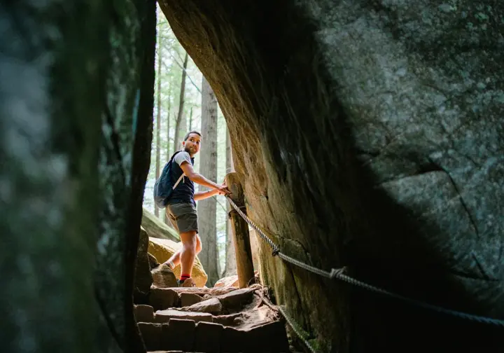
At the 1.3-mile mark, you’ll reach Arch Rock, the first major landmark. This impressive feature formed as freezing and thawing cycles eroded the softer slate rock beneath a harder layer. The experience is unique, as you ascend stone steps with a cable handrail directly through the arch itself.
Miles 1.4 – 2.0: To Inspiration Point and the Eye of the Needle
After passing through Arch Rock, the trail’s character changes. The grade steepens considerably, and the path becomes more rugged and rocky. This section prepares you for the increased physical demand of the climb ahead. Having trekking poles for stability on the rugged path can be a huge help here.
At the 2.0-mile mark, you are rewarded with Inspiration Point. This heath bald offers the first truly commanding panoramic views of the hike. From here, you can see Little Duck Hawk Ridge to the west and the peaks of Anakeesta Ridge and Chimney Tops. Look closely for the Eye of the Needle, a distinct hole near the top of Little Duck Hawk Ridge. An expert tip: the view of this feature is often even clearer just a tenth of a mile farther up the trail.
Miles 2.0 – 2.3: The Final Push to Alum Cave Bluffs
The final push to the bluffs involves a steep climb up a series of well-constructed log steps. A sturdy cable handrail provides welcome stability and support during this final, breathless ascent. Proper hiking footwear with good traction is essential for this part of the trail.
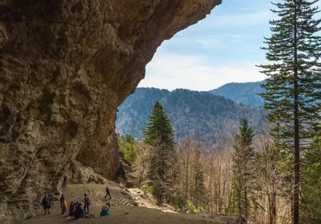
At mile 2.3, you arrive at your destination. It’s a common misconception, but Alum Cave is not a true cave. It is a massive, concave bluff, or rock shelter, towering 80 feet high and stretching 500 feet long. The bluffs have a rich history; the Epsom Salts Manufacturing Company mined minerals here in 1838, and the Confederate Army later mined saltpeter for gunpowder during the Civil War. For most visitors, this is the turnaround point.
Beyond the Bluffs: The Epic Ascent to Mount LeConte
For ambitious hikers, the journey continues past the bluffs. This section details the more strenuous part of the trail, the landmarks you’ll encounter, and the unique experience awaiting you at the top of Mount LeConte.
Ledges, Cables, and Gracie’s Pulpit
Be prepared: the trail’s difficulty increases significantly after the bluffs, gaining over 1,000 feet in the next section alone. This is a serious mountain ascent. At the 2.6-mile mark, you’ll pass Gracie’s Pulpit, the halfway point to LeConte Lodge. The landmark is named for Gracie McNichol, who famously climbed the mountain 244 times, including on her 92nd birthday, adding an inspirational touch to your climb.
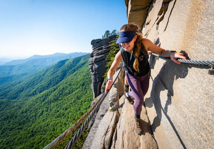
Soon after, you’ll enter the most adventurous phase of the hiking to Mt. LeConte via the Alum Cave trail. The path narrows to a ledge that hugs a sheer cliff face. Cable handrails are installed for safety and are especially helpful in wet or icy conditions. Be mindful of the constant water seepage from the rock, which can make the path slippery.
The Summit Experience: High Top, Cliff Top & Myrtle Point
Near the summit, the trail finally levels out and enters a dense, fragrant spruce-fir forest. The Alum Cave Trail officially ends at its intersection with the Rainbow Falls Trail. Here, you’ll turn right to continue toward the summit area.
Mount LeConte doesn’t have a single, obvious peak. Instead, it offers three distinct points of interest. High Top is the true, wooded summit at 6,593 feet, marked by a large rock cairn. Cliff Top, a 0.2-mile spur trail to the right just before the lodge, is the premier spot for watching the sunset. For the best sunrise views, continue past High Top on the Boulevard Trail for 0.2 miles, then take the 0.2-mile spur to Myrtle Point. Having a reliable headlamp for navigation is a must if you plan to catch either.
LeConte Lodge: A Mountaintop Oasis
Accessible only by foot, LeConte Lodge is the highest guest lodge in the eastern United States. It’s a rustic, off-grid haven that provides a welcome respite for tired day hikers. Publicly accessible amenities include drinking water, bathrooms, and a small office where you can purchase items like sack lunches, baked goods, and hot chocolate (bring cash).
For those interested in planning for an overnight stay in the backcountry, reservations are notoriously difficult to get. They are often booked a year in advance via a lottery system or waitlist. For current information, visit the official LeConte Lodge website or call the reservation office at 865-429-5704. A unique treat for visitors is seeing the llama pack train that delivers fresh supplies, typically on Mondays, Wednesdays, and Fridays, weather permitting.
A Trail for All Seasons: Gear & Strategy
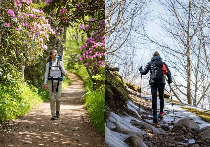
This section provides a crucial, season-by-season breakdown of trail conditions, weather expectations, and essential gear, with a special emphasis on the unique hazards and preparations required for winter hiking.
A Four-Season Comparison
A critical safety consideration is the temperature differential; it can be 15-20°F cooler near Mount LeConte than in Gatlinburg. Dressing in layers is always the best strategy. The unique appeal of each season—spring wildflowers, summer rhododendrons, fall foliage, and winter ice—makes the trail a year-round destination for the well-prepared. Considering a proper layering system for women and men is vital for comfort and safety.
| Season | Avg. High-Elevation Temp | Key Conditions & Highlights | Essential Gear |
|---|---|---|---|
| Spring | 40-60°F | Wildflowers, unpredictable weather, mud | Rain gear, layers, waterproof boots |
| Summer | 60-75°F | Lush greenery, pop-up thunderstorms | Extra water, rain jacket, sun protection |
| Fall | 45-65°F | Peak fall colors, cool and clear days | Warm layers, hat, gloves |
| Winter | 20-40°F | Ice, snow, trail closures, solitude | Microspikes, trekking poles, helmet, warm layers |
A Special Focus on Winter Hiking: Ice, Gear & Closures
Hiking Alum Cave in winter is a serious undertaking. Water seeping from the rock faces transforms into massive, dangerous icicles, some two to three feet long. These pose a significant falling ice risk, especially beneath the bluffs and along the upper ledges.
Specific gear is mandatory, not optional. For anyone attempting the trail in frozen conditions, Traction devices such as microspikes are absolutely essential. Trekking poles provide critical stability, and a helmet is strongly recommended for protection from falling ice. Always check for closures before you go; winter weather can shut down both the trail and Newfound Gap Road. The most reliable source for real-time information is the official park X (formerly Twitter) account, @SmokiesNPS. Have a backup hike planned at a lower elevation.
Hiker Safety and Responsibility
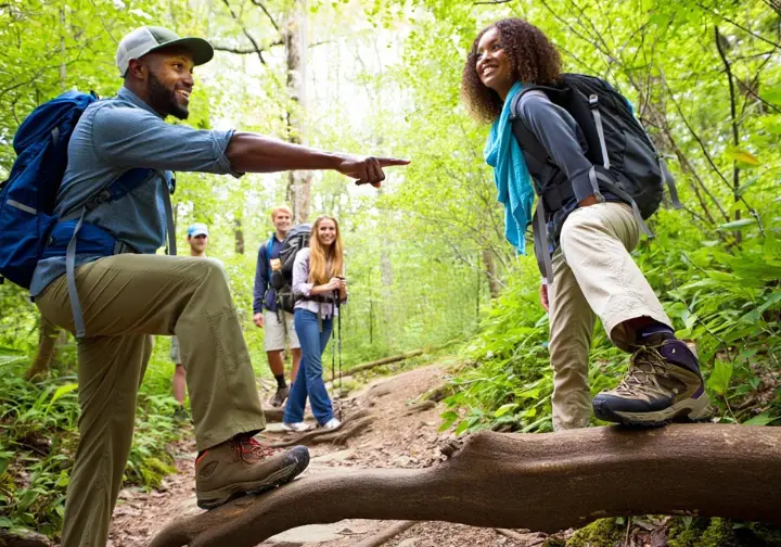
This section covers critical safety protocols and responsible hiking ethics, including wildlife encounters, navigating trail hazards, and practicing Leave No Trace principles to protect the park.
Coexisting with Wildlife
If you encounter a black bear, stay calm. Do not run. Make noise to announce your presence and slowly back away to maintain a safe distance. Park regulations require staying at least 50 yards away from bears, and it is illegal to feed any wildlife.
On a more positive note, keep an eye out for rare Peregrine Falcons, which are known to nest on the high cliffs near the bluffs. This area is also known as the “Salamander Capital of the World,” so look closely in the damp areas around creeks and rocks to appreciate the park’s smaller, unique inhabitants. You can learn more about safety tips for seeing wildlife before your hike.
Navigating Trail Hazards & Leave No Trace
The primary physical dangers on this trail include steep drop-offs on the upper sections, slippery rocks and roots, and the potential for high water at stream crossings. Using the provided cable handrails and wearing proper footwear are your best defenses. Always check for current park cautions and closures before heading out.
Protecting this beautiful place is a shared responsibility. The core Leave No Trace principle is to pack out all of your trash. This includes organic waste like apple cores and banana peels, which are not natural to the ecosystem and attract wildlife. Stay on the designated trail to prevent erosion and damage to fragile plants, and leave what you find—avoid picking wildflowers or stacking rocks. Following these guidelines is a key part of practicing Leave No Trace ethics.
Conclusion: Your Adventure Awaits
The Alum Cave Trail offers two distinct but equally rewarding adventures: the moderately challenging and geologically fascinating hike to the bluffs, and the strenuous, epic ascent of Mount LeConte. The most critical takeaway is that success and enjoyment on this popular trail are directly tied to meticulous pre-hike planning, especially regarding parking, seasonal conditions, and gear. A successful hike is a safe one. Respect the trail’s challenges, practice Leave No Trace, and act as a responsible steward of this iconic national park treasure.
Frequently Asked Questions about Hiking the Alum Cave Trail
Are dogs allowed on the Alum Cave Trail? +
Is the hike to Alum Cave Bluffs good for beginners or families? +
Is there reliable cell phone service on the trail? +
Can I drink the water from the streams along the trail? +
We are a participant in the Amazon Services LLC Associates Program, an affiliate advertising program designed to provide a means for sites to earn advertising fees by advertising and linking to Amazon.com. As an Amazon Associate I earn from qualifying purchases. We also participate in other affiliate programs. The information provided on this website is provided for entertainment purposes only. We make no representations or warranties of any kind, expressed or implied, about the completeness, accuracy, adequacy, legality, usefulness, reliability, suitability, or availability of the information, or about anything else. Any reliance you place on the information is therefore strictly at your own risk. Additional terms are found in the terms of service.


