In this article
You drop off the ridge into a slot canyon, glance at your phone, and the little blue dot is suddenly guessing. The accuracy circle balloons from eight feet to sixty, the arrow spins, and the app that got you here just quietly stopped being trustworthy. That moment is exactly where a dedicated unit earns its keep, and it is also where most roundups stop being honest, burying the one thing that matters under spec sheets nobody bothers to explain. The truth about the best handheld GPS for hiking is a short list of units that actually hold a fix under canopy and in canyons, plus a bigger question about whether you need one at all. Here is which one to buy, when your phone is genuinely enough, and why a previous-generation brick still nails the core job for less.
Here are the four picks at a glance before we get into who each one is actually for.
| Unit | Best For | Key Strength |
|---|---|---|
| Garmin GPSMAP 67i | Best Overall | Multi-band accuracy plus built-in satellite SOS in one device |
| Garmin eTrex 22x | Best Budget | Simple, AA-powered, does waypoints and tracks properly |
| Garmin GPSMAP 65s | Best Backcountry | Flagship canyon accuracy without the messaging premium |
| Garmin Montana 700i | Best Satellite SOS | Big 5-inch touchscreen with two-way SOS baked in |
Do You Actually Need a Handheld GPS
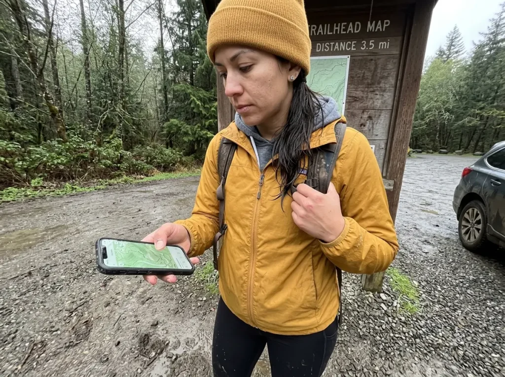
Start here, because the honest answer for a lot of hikers is no. If your weekends are spent on marked, well-traveled trails within a few miles of a trailhead, the phone already in your pocket does almost everything a dedicated unit does. A good offline map app plus a battery bank covers established day hiking without a second purchase, and pretending otherwise just sells hardware nobody needs.
Where a dedicated unit starts to matter is a specific short list of conditions: multi-day trips, off-trail navigation, terrain with no cell signal for days, cold weather that murders phone batteries, or simply wanting something that runs without a subscription. Those are the real triggers, not “serious hikers carry one.” If none of those describe your hiking, the honest recommendation is to save your money and read up on how a dedicated unit fits among all five hiking navigation devices before you spend anything, because a handheld is only one option among watches, satellite messengers, and phone apps.
The one field advantage worth naming is battery independence. A dedicated GPS doesn’t share its power budget with your camera, your messages, and a screen you keep waking up to check the time. In true no-signal country that separation is the whole point, and it is the argument that survives even after you admit a phone is fine for most day hikes. If you want the complete breakdown, we lay out the full case for whether your phone is enough in its own comparison, and for a lot of people a solid free hiking app that works offline is the smarter first move.
There is a mistake that shows up constantly in gear threads: someone buys a flagship for well-marked weekend hikes, then realizes months later a phone app would have covered nearly all of it. Buy for the conditions you actually hike, not the ones you imagine. And whatever you carry, remember the National Park Service’s own Ten Essentials checklist still tells you to carry a paper map as backup even when you have a GPS, because no electronic unit is a complete navigation plan on its own.
How GPS Accuracy Really Works Under Canopy and in Canyons
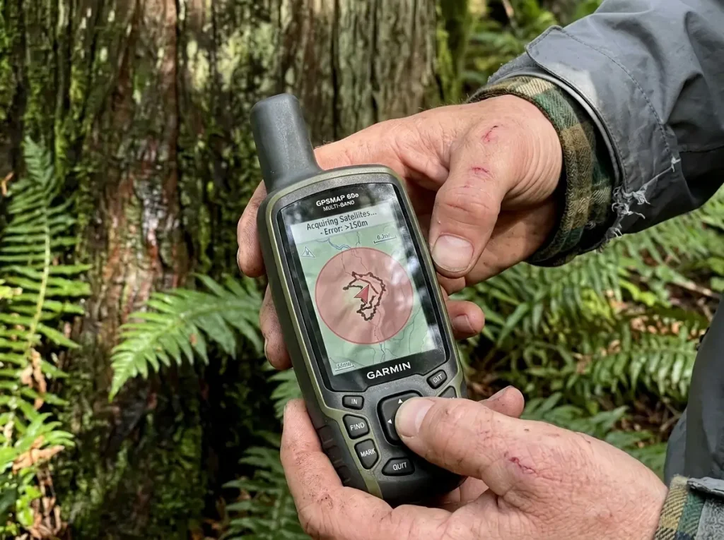
The dot on your screen isn’t magic, it’s math. As the USGS explains, your GPS fix is just triangulation against a minimum of three visible satellites, which is exactly why fewer satellites in view means a worse fix. Stand on an open ridge and your unit sees the whole sky. Drop into a canyon or under old-growth timber and those walls and branches start blocking the very signals it needs.
This is not a small effect. Dense forest canopy can knock out roughly ninety percent of GPS signal at only twenty meters of canopy depth, so old-growth cover doesn’t just shade you, it starves the receiver. That is the mechanism behind the spinning arrow: the unit is trying to solve its position from a handful of weak, bouncing signals instead of a clean set, and the accuracy circle grows to show it is guessing. It is also why a cold start, when the unit hunts for a fix from scratch with no recent satellite data, can take minutes under heavy cover instead of seconds in the open.
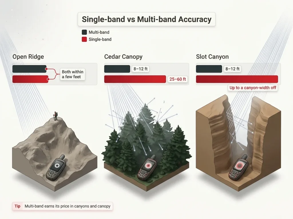
Here is where the money actually goes. Field tests put multi-band multi-GNSS units holding tracks within roughly eight to twelve feet under cedar canopy, while single-band units drift twenty-five to sixty feet off. On an open ridge that gap barely matters. In timber it is the difference between “on the trail” and “wandering the wrong drainage,” and in a slot canyon a single-band unit can put you a full canyon-width off, enough to send you up the wrong fork.
Multi-band means the receiver listens on two satellite frequencies at once, the L1 and L5 bands, which is what lets it reject the bounced, canyon-wall signals that throw a single-frequency unit off. Multi-GNSS stacks the constellations on top, pulling GPS, GLONASS, Galileo, BeiDou, and QZSS satellites at once so the receiver gets more chances to thread a lock through a narrow gap in the trees. Older units lean on WAAS correction alone, which sharpens an open-sky fix but can’t rescue one starved of satellites. A quad-helix antenna, the kind in the GPSMAP-class units, helps here too versus the flat patch antennas in cheaper gear.
Drop a waypoint at the last spot you had a confirmed fix, right before you enter the canyon or thick canopy. When the arrow starts spinning, stop trusting it and fall back to a compass bearing and dead reckoning until it settles. That known-good point is what gets you back if the signal never recovers.
Knowing this changes how you shop. If you mostly hike open ridgelines and marked trails, a single-band budget unit is genuinely enough and paying up for multi-band is wasted money. If you hike canyons or dense timber, multi-band is the one upgrade worth the premium. Either way, the fix can still go down, so knowing the navigation errors that put hikers on the wrong drainage and being ready to fall back to a compass bearing and dead reckoning matters more than any spec on the box.
What to Look For in a Handheld GPS
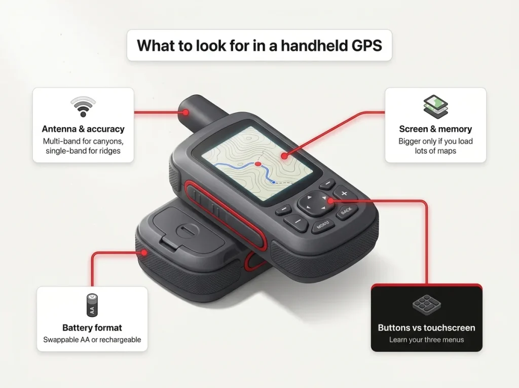
Once you know accuracy comes down to the antenna, the rest of the buying decision gets simple. Ignore the marketing features and focus on the four things you will actually deal with on trail.
Antenna and accuracy
This is the one spec that changes with terrain, so decide it first. Multi-band with a quad-helix antenna for canyon and canopy hikers, single-band for open ridges and marked trails. Don’t let a roundup upsell you into multi-band you will never benefit from, and don’t cheap out on single-band if your hiking lives in the trees.
Battery and power
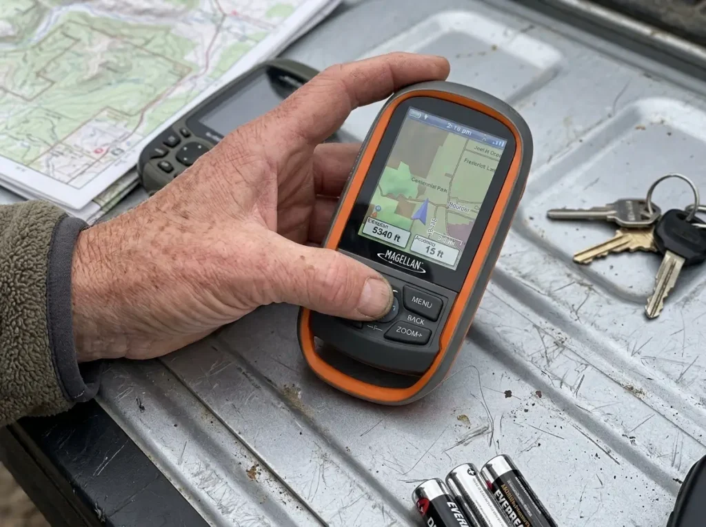
There are two camps here. AA-swappable units like the eTrex and GPSMAP 65s let you restock at any gas station and carry cheap spares, which is a real backcountry advantage on longer trips. Rechargeable flagships like the 67i trade that for much longer battery life on a single charge. Either way, cold weather cuts battery hard, so carry spares or a charged power bank, and if you record long tracks it is worth knowing how to squeeze more life out of the battery on long track-recording days.
For any AA unit heading into the cold, load it with lithium AA batteries instead of alkalines. Lithium holds its voltage far better in freezing temperatures and weighs less, and it is the difference between a unit that quits at the saddle and one that finishes the loop. Keep a fresh pair in an inside pocket close to your chest where they stay warm.
Screen, memory, and maps
Bigger screens and more internal memory matter for loading large raster map sets, not for basic point-to-point navigation. This is the spec people most overpay for. Long-time owners routinely report they can’t tell a GPSMAP 64s from a 66i in actual field navigation, only in screen resolution and how many maps they can store. If you load a lot of imagery, buy the bigger screen. If you just follow a route, save the money.
Interface (buttons vs touchscreen)
Button-only units, the “bricks,” have a learning curve that catches every beginner. A touchscreen like the Montana’s is friendlier but eats battery and gets fussy with wet or gloved fingers. Whichever you pick, the fix is the same: practice the three functions you will actually touch before your first trip. If you are weighing a wrist unit instead, it is worth seeing where a GPS watch instead of a handheld makes sense, because the form factor trade-off is real. One thing you don’t need to overthink is ruggedness: any unit worth buying is already waterproof to at least IPX7 and built to MIL-STD-810 shock standards, so a rainstorm or a drop onto rock isn’t the deciding factor.
Best Overall Handheld GPS (Garmin GPSMAP 67i)
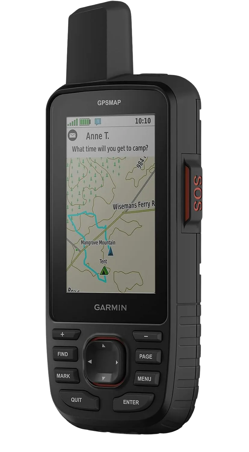
The Garmin GPSMAP 67i wins this category by collapsing two purchases into one. Instead of carrying a mapping GPS and a separate satellite communicator, you carry a single unit that does multi-band navigation and two-way inReach messaging, with a battery that stretches to a genuinely long life between charges. For a multi-day, off-trail, no-signal trip where both accuracy and an SOS lifeline matter, nothing else on this list is as complete.
The honest counterpoint is the price of that convenience. If you don’t need built-in messaging, you are paying a premium for a radio you won’t use, and the backcountry pick below gets you the same accuracy for less. Buy the 67i when SOS and mapping in one device is the point, not just because it sits at the top of the list.
Best Budget Handheld GPS (Garmin eTrex 22x)
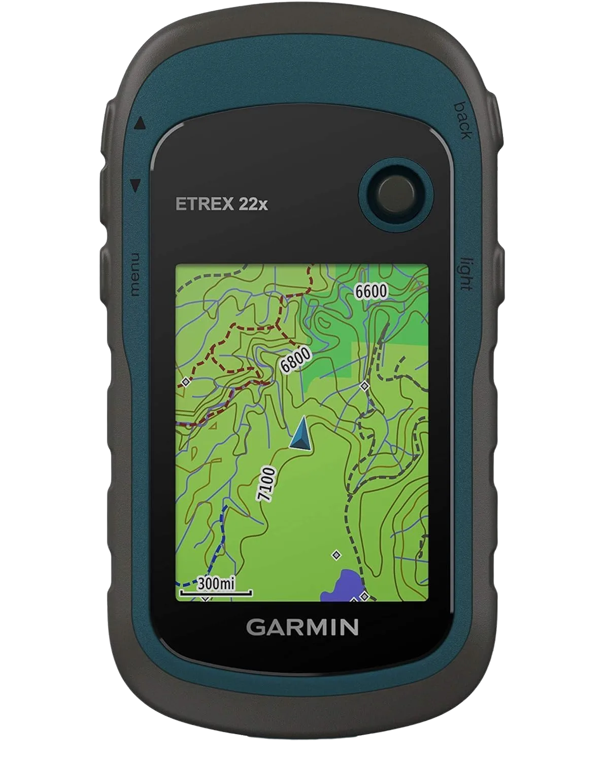
The Garmin eTrex 22x is the unit you buy when you want a dependable trail dot without a small fortune. It runs on two AA batteries, carries a preloaded worldwide basemap, and handles waypoints and tracks without fuss. For marked-trail hiking, single-band accuracy is genuinely enough, so don’t let a roundup talk you into multi-band you won’t use out here.
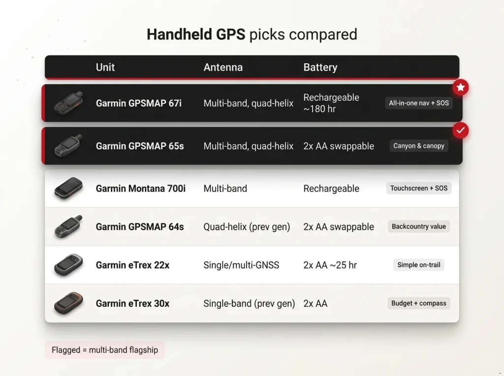
If even the eTrex feels like more than you want, the Bushnell BackTrack Mini GPS strips it down to the one job most people actually want, which is “take me back to the trailhead.” There is no mapping screen and no menu to learn, just point-and-return simplicity in a unit smaller than a matchbook. It is the right call for hikers who find a full GPS intimidating.
The value pick hiding in plain sight is the previous-generation Garmin eTrex 30x, the older model plenty of hikers still carry. It adds a three-axis compass and a barometric altimeter over the base eTrex, and because the satellite-lock physics hasn’t changed, it does the core job for less than the current lineup. Pairing a budget unit with a good phone app makes an even more capable setup, and our Gaia and AllTrails comparison shows which app is worth adding.
Best Handheld GPS for Backcountry and Off-Trail (Garmin GPSMAP 65s)
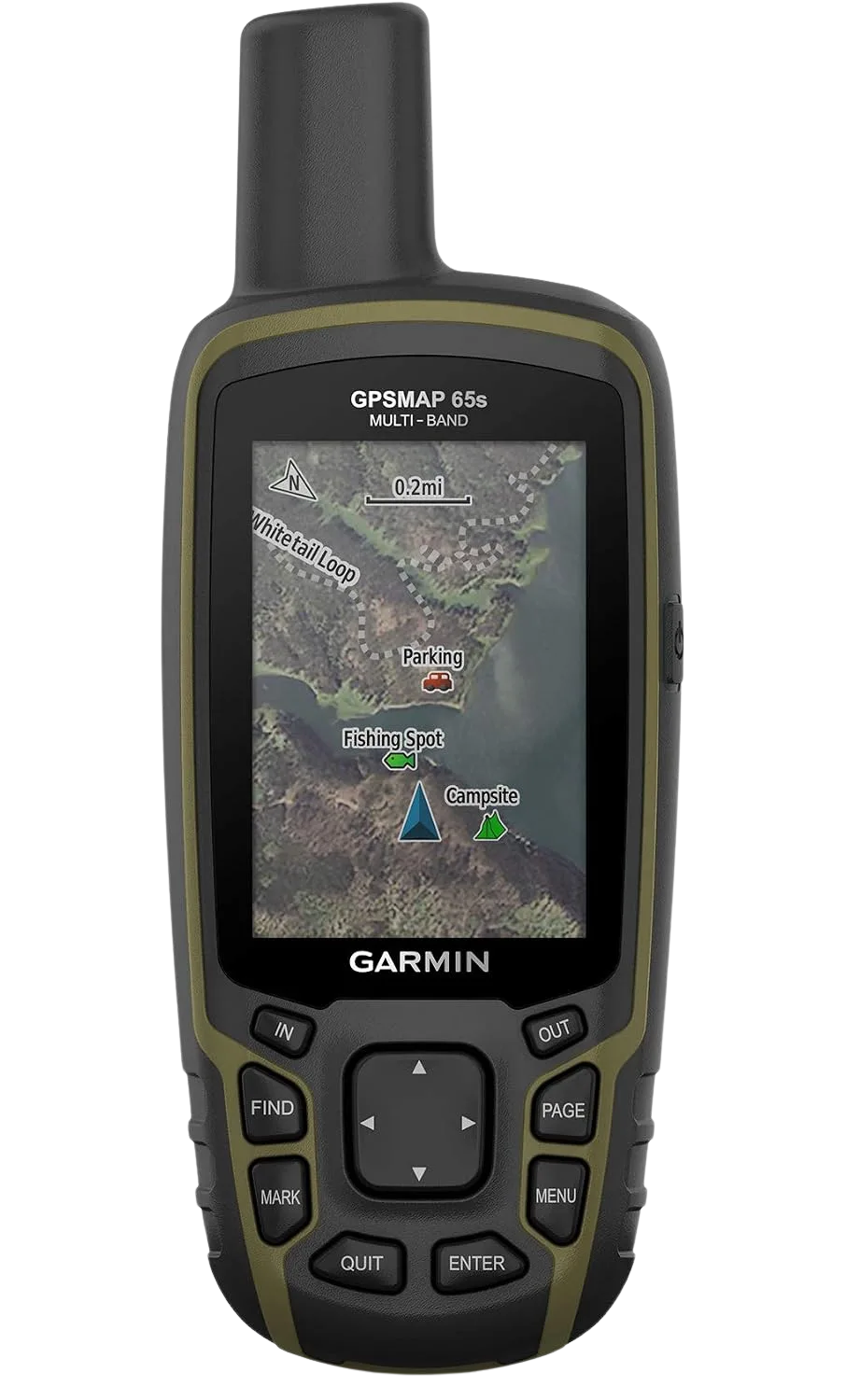
The Garmin GPSMAP 65s is the pick for hikers who spend their time in dense timber and canyons but already carry a phone or a PLB for communication. It gives you the same multi-band, quad-helix accuracy as the flagship without the built-in messaging premium, so your money goes toward the fix instead of a radio you don’t need. Running on two swappable AA batteries is the real backcountry edge, since you can restock at any store instead of hunting for a charge on day four.
For a tighter budget, the previous-generation Garmin GPSMAP 64s keeps the same quad-helix reception physics one generation back. Owners consistently report they can’t tell it apart from a 66i in actual field navigation, only in screen resolution and how many maps it stores. You give up a sharper screen and memory, not accuracy, which makes it the honest value play for canyon and canopy hikers who watch their spending. Whatever you carry off-trail, carry a map-and-compass backup for when the fix goes down, because redundancy is non-negotiable once you leave marked trail.
Best Handheld GPS with Built-In Satellite SOS (Garmin Montana 700i)
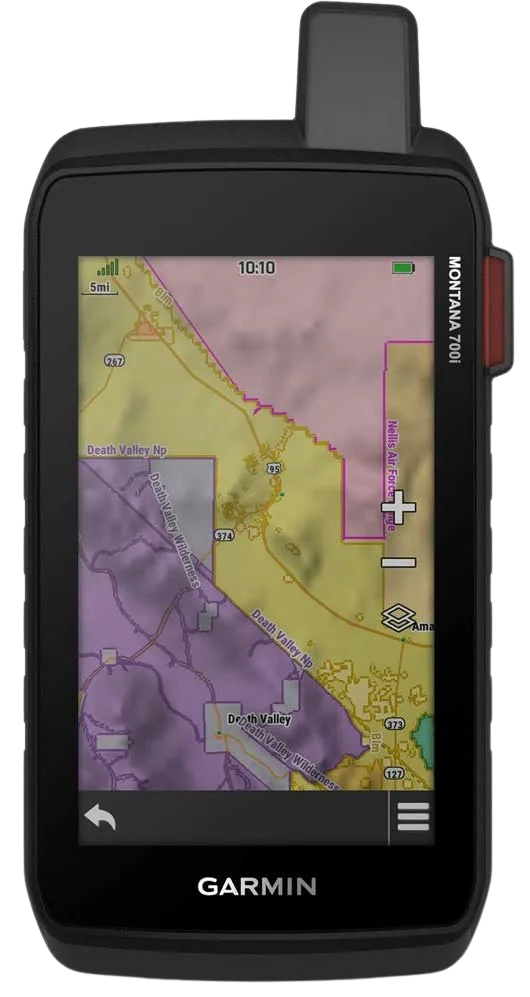
The Garmin Montana 700i earns its own slot because it is not just another flagship. Where the 67i is a button-driven brick, the Montana is touchscreen-first with a large 5-inch display, so if you would rather not thumb through menus and want to read a map at a glance, this is the ergonomics you want. It carries the same built-in two-way inReach SOS, so you still get one device for navigation and emergencies.
Two honest notes. The big touchscreen draws more power and can get fussy with wet or gloved fingers, so it suits glove-off day use better than deep-winter mitts. And built-in messaging means an ongoing subscription, which is worth understanding before you commit, since it runs on the Iridium network that gives Garmin’s inReach devices true pole-to-pole coverage. If you are weighing this against a standalone safety device, see how a dedicated PLB compares to built-in messaging, and if the network matters to you, which satellite network actually gets your message through is the context behind both the 67i and the 700i.
How the Picks Compare
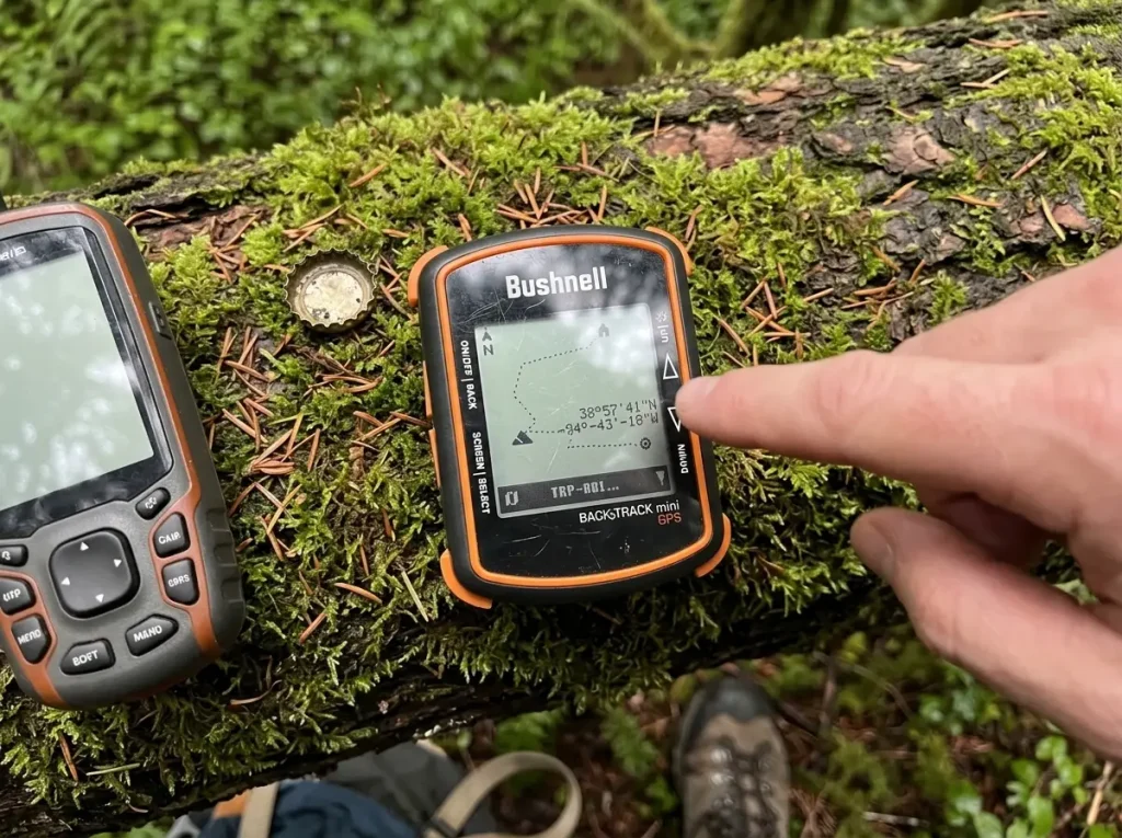
Here is every pick side by side on the specs that decide the buy. Match the antenna to your terrain and the battery format to your trip length, and the rest sorts itself out.
| Unit | Antenna | Battery | Best For |
|---|---|---|---|
| Garmin GPSMAP 67i | Multi-band, quad-helix class | Rechargeable, ~180 hr | All-in-one nav plus SOS |
| Garmin Montana 700i | Multi-band | Rechargeable | Touchscreen plus built-in SOS |
| Garmin GPSMAP 65s | Multi-band, quad-helix | 2x AA, swappable | Canyon and canopy accuracy |
| Garmin GPSMAP 64s | Quad-helix (previous gen) | 2x AA, swappable | Backcountry value |
| Garmin eTrex 22x | Single/multi-GNSS | 2x AA, ~25 hr | Simple on-trail budget |
| Garmin eTrex 30x | Single-band (previous gen) | 2x AA | Budget with compass plus altimeter |
| Garmin Foretrex 401 | Single-band, WAAS | 2x AAA, wrist-worn | Hands-free minimalist |
| Bushnell BackTrack Mini | Basic GPS | Rechargeable, compact | Point-and-return only |
| Magellan eXplorist 310 | Basic WAAS (legacy) | 2x AA | Bare-bones legacy option |
Two picks sit outside the mainstream and are worth a mention. The Garmin Foretrex 401 is wrist-worn rather than handheld, a minimalist strap-on unit for hikers who want their hands free and don’t care about a mapping screen. It is a genuinely different form factor, closer to a data readout than a brick. And the Magellan eXplorist 310 is the bare-bones non-Garmin option some readers already own or find secondhand, worth setting honest expectations about: it does basic waypoints and tracks, but it is dated next to the current Garmin lineup, so buy it only if the price is right or you already have one.
Getting Routes Onto Your Device and Learning the Menus
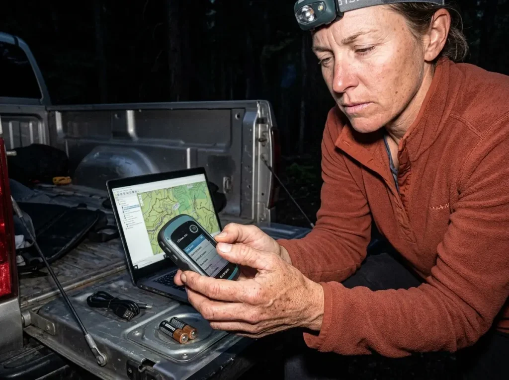
The part nobody warns you about is what happens after the box arrives. The most common first-trip failure is showing up at the trailhead having never loaded maps, then discovering the base map is a blank grid with no topo detail. The unit works fine, you just never gave it anything to show you. Ten minutes at home would have fixed it.
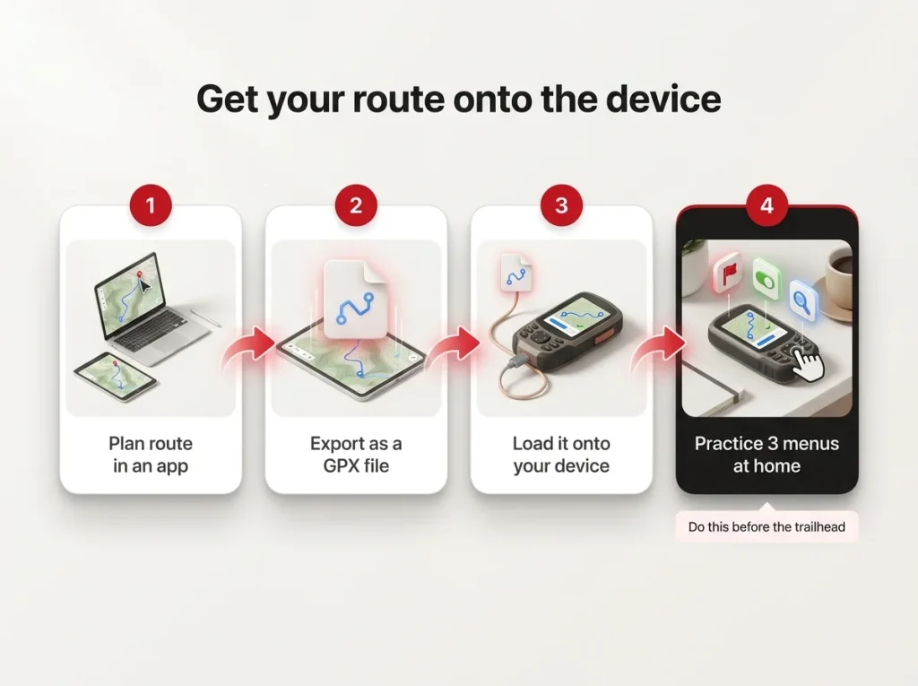
The workflow itself is straightforward once you have done it once: plan a route in an app like Gaia or CalTopo, export it as a GPX file, and load that file onto the device before you leave. It is worth learning the mechanics properly, and rather than repeat it here, our guides on planning a route from idea to a GPX file you can load and the step-by-step for creating and transferring a GPX file walk through every step.
Spend fifteen to twenty minutes at home practicing the three functions you will actually use on trail: marking a waypoint, toggling track recording, and zooming the map. The first time fumbling through a button menu should not be at a trail junction with the light fading. It takes three seconds once you know it and forever when you don’t.
Turn on track recording at the trailhead so the unit lays down a breadcrumb trail you can follow back if you ever need to retrace your exact route out. It is the single most reassuring feature on a button-only unit, and it costs you nothing but a toggle at the start of the hike.
Two more habits save trips. Don’t skip firmware updates, since a ten-minute update fixes bugs and adds accuracy improvements you already paid for. And keep the handheld as your primary navigation in true no-signal terrain so it doesn’t compete with your phone’s battery for photos and messages. That separation is the whole reason you bought a dedicated unit, so let it do its job.
Final Word
Three things decide this buy. Match the antenna to your terrain, because multi-band earns its premium in canyons and canopy while single-band is genuinely enough on marked trails. Be honest about whether you need a dedicated unit at all, since a phone and a battery bank cover most day hiking and the real triggers are multi-day, off-trail, no-signal, and cold. And don’t overlook a previous-generation brick, because the satellite-lock physics hasn’t changed and units like the 64s and eTrex 30x nail the core job for less.
Whichever unit you land on, load one route and practice the three menus at home before your next trip. That twenty minutes is what turns a boxed gadget into a tool you actually trust when the arrow starts spinning.
Frequently Asked Questions
01Do I need a handheld GPS for hiking if I already have a phone?
For most established-trail day hikes, a phone with an offline map app and a battery bank is genuinely enough. A dedicated handheld earns its place on multi-day trips, off-trail navigation, no-signal terrain, and cold weather where phone batteries fade fast.
02Is a handheld GPS more accurate than a phone?
Under open sky they are close, but under dense canopy or in canyons a multi-band handheld with a quad-helix antenna holds a far tighter fix, roughly 8 to 12 feet where a phone or single-band unit can drift 25 to 60 feet. The gap shows up exactly where you need accuracy most.
03Are older or previous-generation GPS units still worth buying?
Yes, for the core job. Units like the Garmin GPSMAP 64s and eTrex 30x keep the same satellite-lock physics as their current successors. You give up screen resolution and stored-map capacity, not accuracy, for a meaningfully lower cost.
04Handheld GPS or a GPS watch for hiking, which should I get?
A handheld gives a bigger screen, better mapping, swappable batteries, and a stronger fix under cover. A GPS watch wins on convenience and always-on wear. If navigation is the priority go handheld, and if tracking and glanceability matter more go with the watch.
05Do handheld GPS units work without cell signal?
Yes, that is the whole point. They receive satellite signals directly and need no cell coverage to fix your position or follow a loaded route. You just have to load your maps and routes before you lose signal, not after.
Risk Disclaimer: Hiking, trekking, backpacking, and all related outdoor activities involve inherent
risks which may result in serious injury, illness, or death. The information provided on The Hiking Tribe is for
educational and informational purposes only. While we strive for accuracy, information on trails, gear, techniques,
and safety is not a substitute for your own best judgment and thorough preparation. Trail conditions, weather, and
other environmental factors change rapidly and may differ from what is described on this site. Always check with
official sources like park services for the most current alerts and conditions. Never undertake a hike beyond your
abilities and always be prepared for the unexpected. By using this website, you agree that you are solely
responsible for your own safety. Any reliance you place on our content is strictly at your own risk, and you assume
all liability for your actions and decisions in the outdoors. The Hiking Tribe and its authors will not be held
liable for any injury, damage, or loss sustained in connection with the use of the information herein.
Affiliate Disclosure: We are a participant in the Amazon Services LLC Associates Program, an
affiliate advertising program designed to provide a means for us to earn advertising fees by advertising and linking
to Amazon.com. As an Amazon Associate, we earn from qualifying purchases. We are also an official affiliate partner
of Black Diamond Equipment via the AvantLink network. If you click on a Black Diamond affiliate link and make a
purchase, we may earn a commission at no additional cost to you. We also participate in other affiliate programs and
may receive a commission on products purchased through our links. Additional terms are found in the terms of
service.