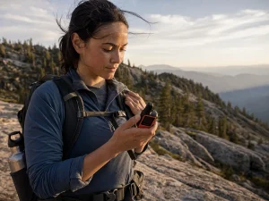




















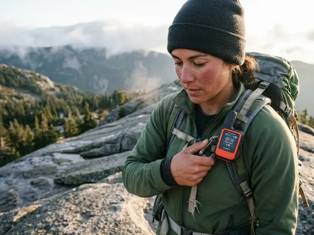
You press the check-in button under a stand of dense pines, watch the little “sending” indicator, and slide the device back into your hip belt. What you do not know, standing there in the trees, is that the message will not actually leave your pack for another eight hours.
That gap between “sent” and “received” is the whole story of inReach vs SPOT, and it is the part most comparisons skip. Ask anyone who has spent real time in the backcountry with both brands: the spec sheets look close, but the two devices fail you in very different ways when the sky gets narrow. Here is what each one actually does, where SPOT quietly comes up short, what you are really paying Garmin for, and the one genuinely new 2026 capability that changes the math for some hikers.
Here is the head-to-head in one look before we get into where each side wins or loses on trail:
| What matters | Garmin inReach | SPOT |
|---|---|---|
| Satellite network | Iridium, 66 satellites, mesh | Globalstar, ~24 satellites, bent-pipe |
| Messaging | True two-way, delivery confirmation | Gen4 one-way, SPOT X limited two-way |
| Coverage | Global, including poles | Gaps in far north, southern hemisphere |
| Subscription | Month-to-month, free pause up to 12 mo | Cheaper monthly, yearly account fee on Flex |
| Best for | Confirmation, canyons, forest, abroad | Lowest up-front cost, US and Canada trips |
How inReach and SPOT Actually Work
Both devices do the same job on paper. They bounce a short message off a satellite when you have no cell service, so someone back home, or a rescue center, hears from you. The difference is which satellites they use, and that difference decides whether your message gets out of a canyon or dies in the trees.
Iridium’s 66-Satellite Mesh (Garmin)
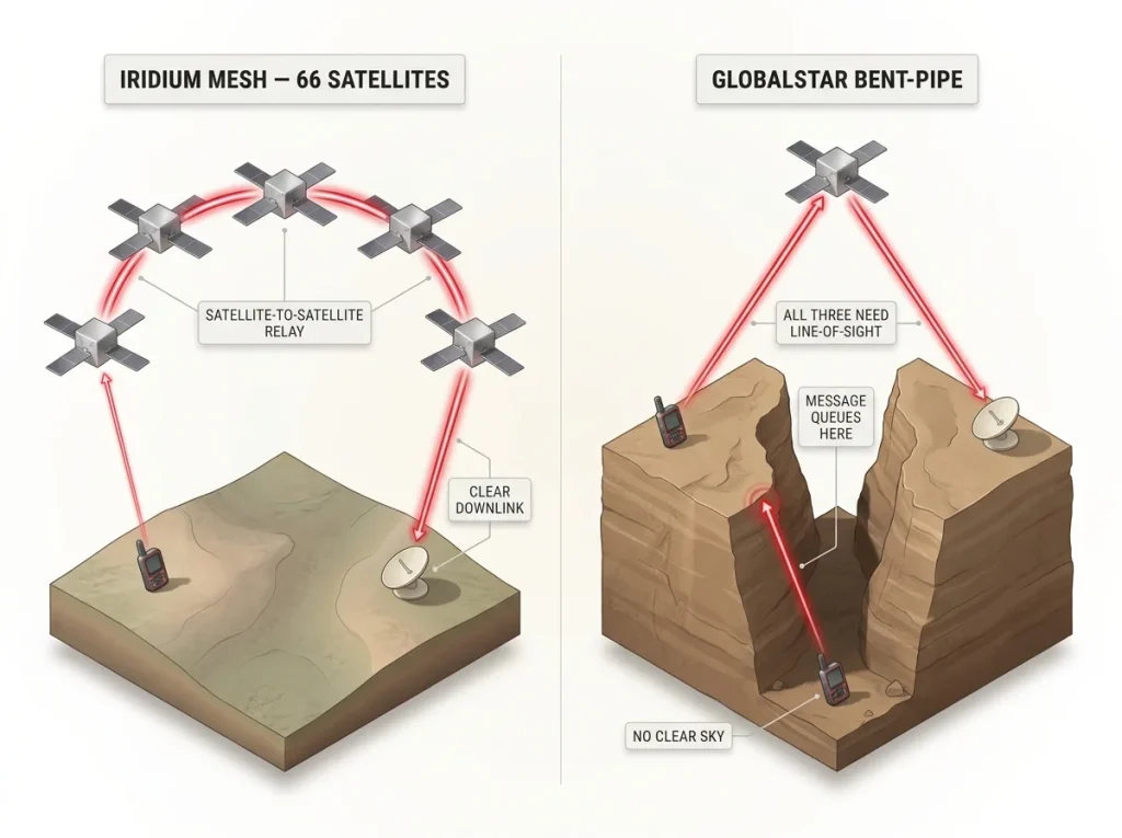
Garmin inReach devices ride the Iridium satellite network, 66 low-earth-orbit satellites (LEO for short) arranged in a mesh network. The word mesh is the important part. When your message hits one satellite, that satellite can hand it off to the next one overhead, and the next, until one of them has a clear downlink.
You do not need a ground station in view for the handoff to start. That is why Garmin can claim true global coverage, including the poles and the middle of an ocean.
For a hiker, the practical payoff is simple. More satellites overhead at any given moment means more chances for your signal acquisition to succeed before you give up and put the device away. In open country you rarely think about it. In a steep drainage, it is the whole ballgame.
Globalstar’s Bent-Pipe Network (SPOT)
SPOT runs on Globalstar, roughly 24 satellites using what the industry calls a bent-pipe architecture. Picture a literal bent pipe. Your message goes up to a satellite and has to come straight back down to a ground station in the same pass.
The satellite does not route it to a neighbor. It needs to see you and a ground station at the same time, or the message waits.
That design keeps SPOT hardware cheaper, and in wide-open North America with ground stations nearby, it works fine most of the time. The trouble starts when the geometry gets tight, or when you travel somewhere Globalstar’s ground network thins out, like parts of the far north, southern Africa, or the southern hemisphere.
What a Silent Message Failure Looks Like on Trail
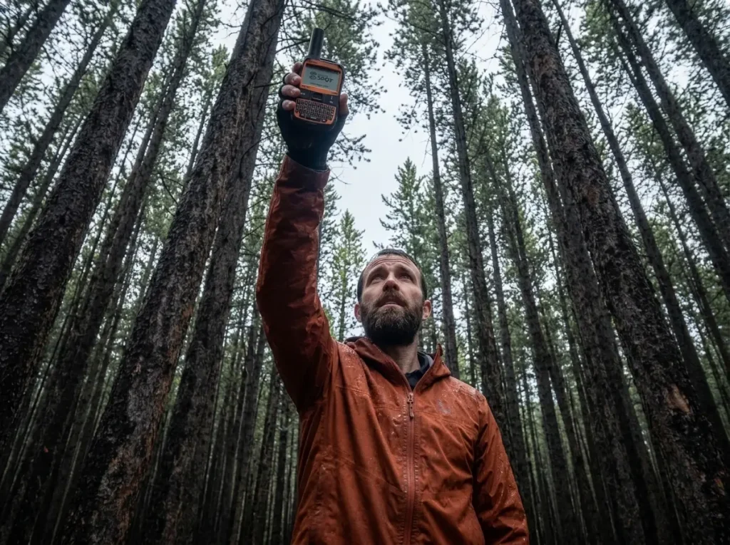
Here is the piece no competitor explains in plain terms. When a bent-pipe message cannot complete that up-and-down handshake, it does not warn you. It queues.
On a one-way SPOT device you get no reply channel, so you have no way to know the message is stuck. You walk on thinking your family got the “camp for the night” check-in, and they are staring at a map with no update.
This is not a theoretical gripe. In one documented five-day field test, a SPOT X sat unable to push messages for about eight hours while camped under heavy pine canopy, while a Garmin device on the same trip kept getting through. Slot canyons do the same thing. Drop into a narrow sandstone corridor and the strip of sky above you may not line up with a satellite and a ground station at once, so your SOS or check-in waits until you climb back out, maybe hours later.
The failure mode is the point. A device that cannot tell you it failed is worse than one that makes you wait, because you make decisions on bad information.
If you are still sorting out how a satellite messenger fits next to the map app, GPS watch, and phone you already carry, our guide to choosing among all the navigation tools a hiker actually needs lays out where each one earns its weight.
If your route threads canyons, tight drainages, or unbroken forest canopy, favor the Iridium network. This is not brand loyalty. More satellites overhead means a bigger window for your signal to escape narrow terrain before the geometry closes on you.
Two-Way vs One-Way Messaging
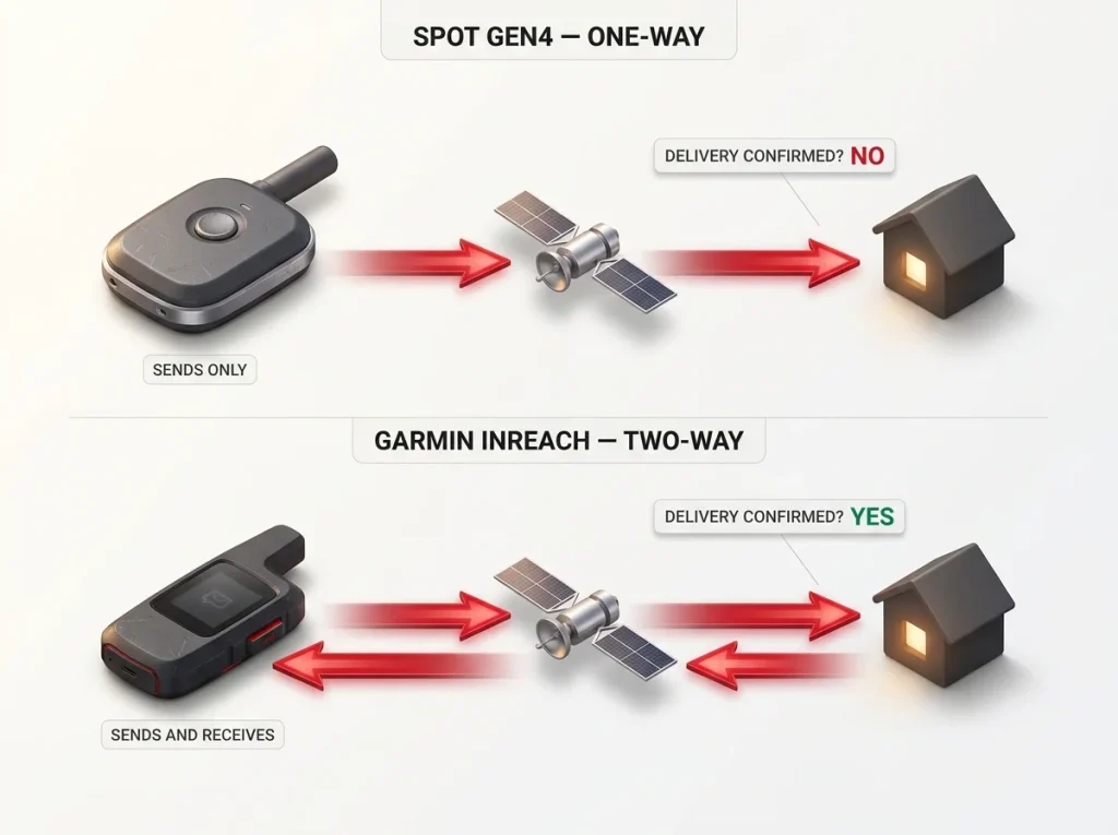
This is the single most-searched difference between the two brands, and it comes down to one question. When you hit send, does anything come back? On a Garmin, yes. On a SPOT Gen4, no.
That reply channel is not a luxury feature. It is the difference between knowing help is moving and guessing.
Garmin’s True Two-Way Messaging
Garmin inReach is a two-way messaging device in the full sense. You send a text to any phone number or email, and they can text you back, and you see it on the device. You get delivery confirmation. In an emergency that means you learn that rescue got your coordinates and is on the way, instead of pressing a button into the void and hoping.
The natural starting point on the Garmin side is the compact one that does this well without the newest bells and whistles.
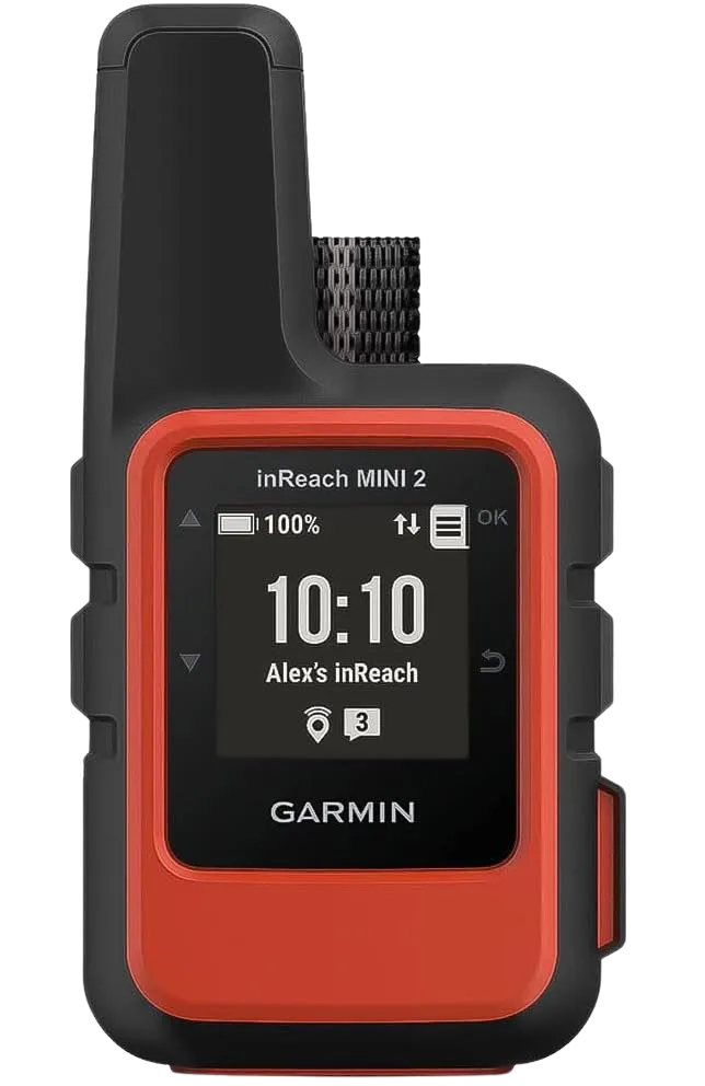
The Mini 2 leans on your phone for the comfortable typing experience through the Garmin Messenger app, but it can send preset and freeform messages on its own if your phone dies. For most hikers who want the confirmation without the newest hardware, it is the honest default pick on the Garmin side.
SPOT Gen4 One-Way and SPOT X’s Keyboard
The SPOT Gen4 is a one-way messenger. It fires preset OK, HELP, and SOS messages plus limited custom text, and that is the end of the conversation. Nothing comes back.
The people at home cannot tell you they got it, and you cannot tell them the plan changed. For a lot of casual trips that is acceptable, right up until the day it is not.
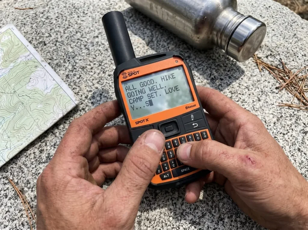
SPOT’s answer to the two-way gap is the SPOT X, which adds a physical QWERTY keyboard and its own dedicated phone number so people can text it directly, no paired smartphone required.
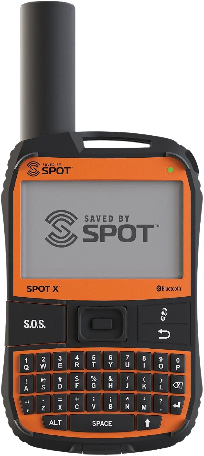
The SPOT X closes part of the gap, but the two-way experience still trails Garmin. Messages move slower, the network limits still apply, and the keyboard that looks handy in the store gets fiddly with cold fingers.
If You Just Want Reliable Two-Way Text
Not every Garmin pick is a premium one. If photo and voice mean nothing to you and you only want dependable two-way text with global coverage, the Garmin inReach Messenger is the honest middle. It skips the extras, runs a long battery, and does the one thing that matters most, letting you confirm that your message landed and read the reply.
The common mistake here is trusting a “sent” indicator on a one-way device. Sent is not received. On the Gen4, sent only means the device tried.
Signal Speed and Battery in the Cold
Two numbers on the box lie to you more than any others: how fast the device connects, and how long the battery lasts. Both fall apart in exactly the conditions where you need the device most, under canopy and in the cold.
Signal Acquisition Under Canopy
In clear conditions a Garmin inReach Mini 2 typically locks a satellite pass in about 30 to 60 seconds. A SPOT X often takes 60 to 120 seconds or more. That does not sound like much reading it here. Standing in the wind at 11,000 feet with numb hands, waiting to confirm a message got out, the extra minute feels much longer and burns more battery.
Under dense canopy both devices slow down, but the bent-pipe network struggles harder, for the same geometry reason from earlier. Thick trees plus a network that needs a ground-station line of sight is a bad combination. Garmin’s higher transmission wattage helps here too, roughly 1.6 watts against SPOT’s lower output, so its signal pushes through wet foliage with more force.
Real Cold-Weather Battery Numbers
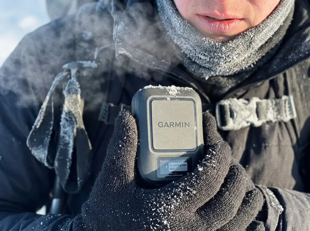
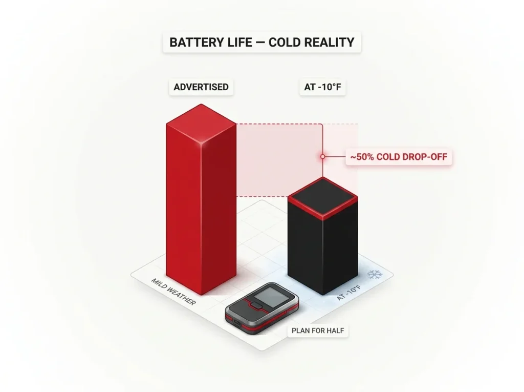
Here is a practical detail most of the top results skip entirely. Battery ratings are measured at comfortable temperatures. Take a lithium battery into real cold and the chemistry slows down, so the “up to X days” figure on the box quietly becomes a best-case number you will rarely see in winter.
One of the few independent cold-weather tests put a Garmin inReach at roughly six to seven real days of life at minus ten Fahrenheit, well under its much higher rated figure in mild weather. SPOT’s cold-weather performance is less independently documented, which is its own warning: treat its rated life with the same skepticism, because nobody has published a clean number to trust. The honest planning rule for shoulder season, winter, or altitude is to budget for something closer to half the advertised days and carry a way to recharge.
The same cold-battery reality bites the GPS watches many hikers pair with a messenger, which is why our breakdown of which GPS hiking watches actually hold a satellite SOS leans on the same winter math.
How to Stretch Battery in Winter
Keep the device warm. A lithium cell near freezing reports a lower charge than it truly holds, and warming it back up against your skin often recovers usable life. Turn off continuous GPS tracking when you do not need a breadcrumb trail, since sending a track point every few minutes is the fastest drain there is.
The two brands also split on battery design, and it matters more than the spec sheets let on. The SPOT Gen4 runs on replaceable AAA batteries, so you can carry spares and swap them cold, dead, or on day twelve with no outlet in sight. Garmin’s inReach devices use an internal rechargeable battery instead, which makes a power bank mandatory kit on any trip that outlasts a single charge.
On cold trips, sleep with the device inside your quilt against your chest, the same place you stash your phone and a spare battery. A messenger that read half-dead at dusk will often show a healthier charge by morning once the cell warms up.
Living With the Device Day to Day
Specs cannot tell you what it feels like to send a message with cold fingers and a dying phone. That is where these two brands diverge in daily use, one built around a physical keyboard, the other around your smartphone.
SPOT X’s Physical Keyboard
The SPOT X keyboard is a real advantage on paper. No smartphone, no pairing, no dead-phone problem. In a downpour or on day nine when your phone finally quits, thumbing a message straight into the device feels reassuring.
The catch is that the keys are small and the entry is slow, so real conversations turn into a chore. It is best thought of as a way to send short, deliberate messages, not to chat.
Garmin’s App-Based Messaging
Garmin flips the model. Typing happens on your phone through the Garmin Messenger or Earthmate app over Bluetooth, then the device does the sending. The experience is smoother and faster to type, with your real keyboard and autocorrect, as long as your phone stays alive.
That dependency is the tradeoff. Many hikers already carry a phone for maps, so pairing a messenger with a mapping app to split the load makes sense, and our comparison of the mapping apps worth running alongside a satellite device covers which ones play nicest offline.
Weight, Durability, and Water Rating
The Garmin inReach Mini 2 is the featherweight at about 3.5 ounces, small enough to clip and forget. The SPOT X is larger and heavier, because the keyboard needs the real estate. Both modern devices carry an IPX7 water rating, which means they shrug off rain and a brief dunk in a creek crossing, not that you should take them swimming. Whichever you pick, the smart move is to test it before the trip that counts.
Send a real check-in from your backyard before the trip, not just a power-on test. It forces you to finish account activation, pair the app, and add contacts at home, where a missed step is an annoyance instead of a problem at the trailhead with no signal to fix it.
What Actually Happens When You Press SOS
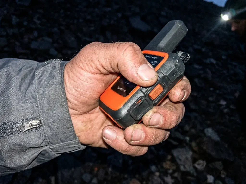
When you lift that SOS cover, you are not texting a friend. You are waking up a 24/7 rescue-coordination center that decides who comes for you and how fast. Here is the part almost every comparison name-drops and never explains, because the two brands do not route the same way.
Garmin Response Explained
A Garmin SOS goes to Garmin Response, Garmin’s own around-the-clock monitoring center. They receive your coordinates, open a two-way line to you when the device supports it, and handle search and rescue (SAR) coordination with local teams where you are. Because it is Garmin’s own operation tied to your device data, the dispatch and the messaging sit inside one system.
GEOS IERCC and SPOT’s Pathway
SPOT and a number of other brands route through the GEOS IERCC, the International Emergency Response Coordination Center. Here is the twist competitors leave muddy: Garmin acquired GEOS back in 2021, and Garmin Response is essentially that same coordination lineage, rebranded and pulled deeper into Garmin’s own systems.
So this is not two rival safety nets facing off. It is closer to one professional dispatch center, now Garmin-owned and Garmin-integrated, versus the same organization’s services offered to other devices. What actually differs today is dispatch speed and how tightly your device data feeds the responders, not whether one has a secret better rescue network.
A personal locator beacon takes a third road entirely. A PLB skips the private centers and fires straight into the government system, coordinated through NOAA’s SARSAT program, which handles emergency-beacon rescues in the US, with no subscription and no monitoring company in between.
The Difference That Matters in a Real Rescue
The device is only half the system. The other half is the boring paperwork you do at home. Your registered contacts, your medical notes in the profile, and a trip plan left with a real person are what turn a set of coordinates into a fast rescue.
A perfect two-way message to an empty contact list still leaves you waiting. Solo hikers especially should build that plan before they need it, and our guide to staying safe when you hike alone walks through the trip-plan habit that makes any of these devices worth carrying.
The 2026 Difference Photo and Voice Over Satellite
For years, every comparison of these brands centered on the same devices, as if the lineup froze in place. It did not. The newest Garmin hardware added a capability no SPOT device offers, and nobody has judged it honestly against the current SPOT lineup yet. This is the freshness gap worth reading for.
What Messenger Plus Actually Does
The Garmin inReach Messenger Plus is the first satellite communicator that sends photos and 30-second voice memos over satellite, on top of long text, using Iridium Certus. Sending a photo from a ridge with no cell service genuinely felt like science fiction the first time it shipped.
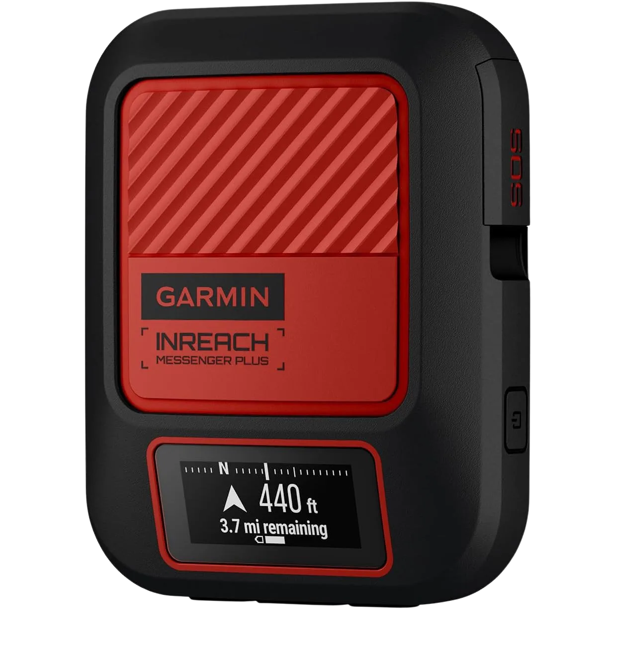
The honest catch: your recipients need the Garmin Messenger app installed to open a photo or voice memo. Contacts on plain SMS only get a text link, so the upgrade is worth exactly as much as your emergency contacts are willing to install an app. Send times are real too, roughly one to two minutes for a photo in open sky and ten or more under dense forest. This is not phone-fast.
The Same Features in a Mini Body
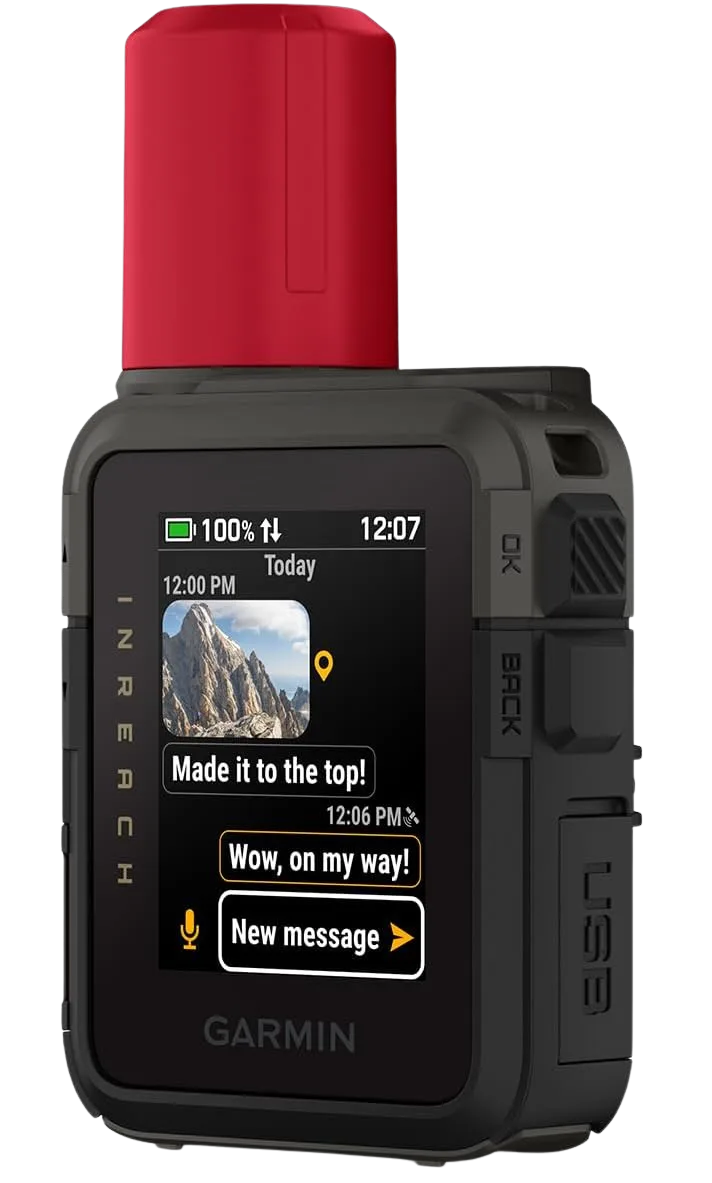
If you want the new photo and voice capability but refuse to give up the tiny form factor, the Garmin inReach Mini 3 Plus packs a touchscreen and the same class of features into the compact Mini shell.
Is It Worth It for a Hiker
Straight answer: it depends on the trip, not the marketing. For expedition documentation, coordinating a group across a big route, or reassuring family with a real photo instead of a canned check-in, photo and voice is a real upgrade. For a weekend solo who needs “I’m OK” and a working SOS button, it is closer to a nice extra than a reason to spend more. No SPOT device offers anything like it as of this writing, so if the feature matters to you, the decision is made for you.
Cost, Subscriptions, and Which One Fits Your Trips
The sticker price is the smallest number in this whole decision. The one that actually bites is the recurring cost, and this is where SPOT’s budget reputation gets complicated.
Device Cost and Subscription Plans
Up front, SPOT wins the price tag. SPOT devices run cheaper to buy, with cheaper base monthly plans, and the budget anchor of the whole lineup is the one-way SPOT Gen4, not the pricier SPOT X. Garmin devices cost more to buy and their plans start higher. If your only filter is the lowest number at checkout, SPOT looks like the easy call.
The Cancellation and Pause Fine Print
Read the plans closely and the story shifts. SPOT’s Flex plan carries a fixed yearly account-holding fee, on top of the monthly charge for any month you activate. So even the “no annual contract” option has a set yearly cost baked in, which quietly erodes the budget argument for anyone who only hikes part of the year.
Garmin’s 2025 overhaul went the other direction and removed its biggest old objection: plans are now month-to-month with a 30-day commitment, you can suspend service for up to 12 months with no reactivation fee, and there is no annual contract. For a seasonal hiker, being able to truly pause and pay nothing in the off months is worth real money over a few years.
If X Get inReach, If Y Get SPOT
Skip the buyer personas. Here is the direct call. If you are still unsure you even need a dedicated device instead of your phone, our breakdown of when a standalone unit beats a phone is the place to start. Once you know you want one:
- Get Garmin inReach if you need guaranteed delivery confirmation, travel internationally or into the far north, hike canyons and dense forest, or want the new photo and voice capability.
- Get SPOT if your trips stay in the US and Canada, you want the lowest up-front cost, and you can live with one-way or limited two-way messaging.
- Get a personal locator beacon if you only want the SOS safety net with zero monthly bill.
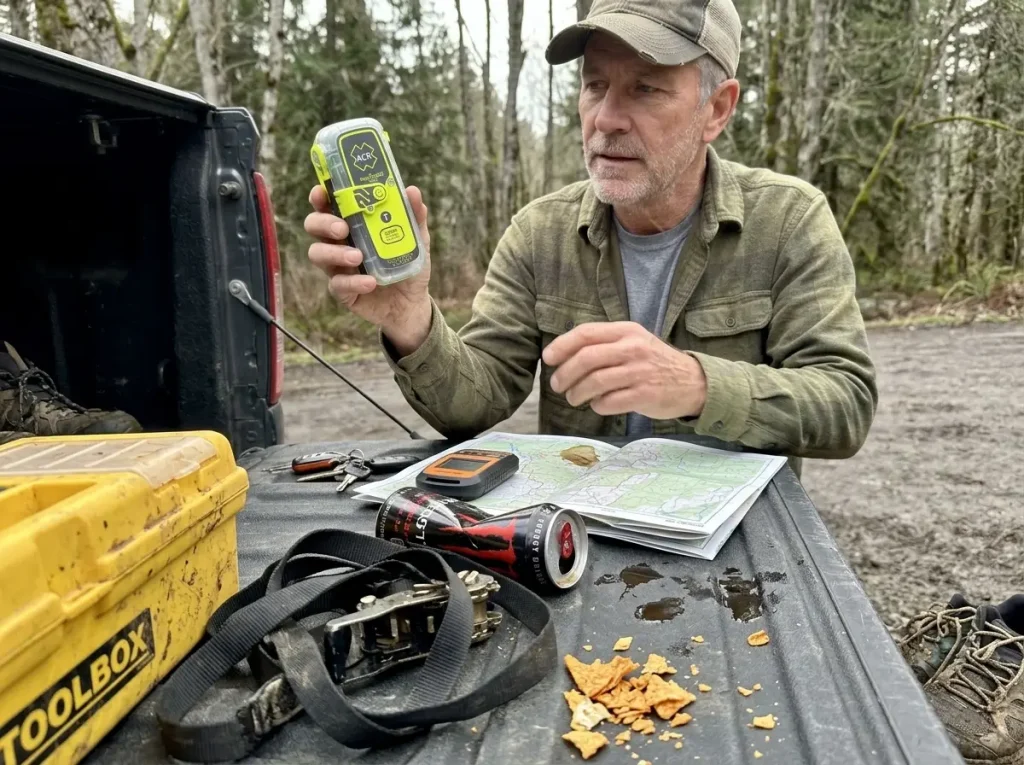
That last branch is the one this blog will not let you skip. If a subscription is the dealbreaker, the ACR ResQLink 400 registers free with the government beacon system and needs no plan at all. Just know a PLB is SOS-only, with no check-ins and no two-way messaging, and that a PLB has to be registered for free with NOAA before you carry it. For a hiker who only wants the one button that calls for help, a dedicated personal locator beacon is worth a closer look than either subscription messenger.
Run the three-year math, not the checkout price. Add device cost plus every month of subscription you will actually use, and include SPOT’s yearly account fee. For part-year hikers, Garmin’s free pause often closes most of the gap SPOT opens at the register.
The Bottom Line
The network decides whether your message ever leaves the trees. Iridium and Garmin hold the structural edge in canyons, dense forest, and anywhere far from a ground station, while Globalstar and SPOT can queue a message silently and never tell you.
Two-way confirmation is the line between knowing help is coming and guessing in the dark. That reply channel, not the price tag, is what you are really buying with Garmin.
Run the full cost with SPOT’s yearly fee in it and the budget gap narrows fast, and if a monthly bill is the real objection, a PLB may beat both. Before your next trip, send a test check-in from home and leave a trip plan with someone who will notice if you go quiet. The device is only half of what keeps you found.
Frequently Asked Questions
01Is Garmin inReach better than SPOT?
For most hikers, yes. Garmin inReach leads on network reliability, true two-way messaging, and global coverage. SPOT wins mainly on lower up-front cost, so it fits budget-focused trips in North America.
02Does SPOT have two-way messaging?
Partly. The SPOT Gen4 is one-way only and cannot receive replies. The SPOT X adds two-way texting through a physical keyboard, but it is slower and more limited than Garmin’s two-way messaging.
03Which satellite messenger has the best coverage?
Garmin inReach, because it uses the Iridium network of 66 satellites for true global coverage, including polar and ocean regions. SPOT’s Globalstar network has known gaps in the far north and parts of the southern hemisphere.
04Is a subscription required for SPOT or Garmin inReach?
Yes, both require an active service plan to send messages or trigger SOS. If you want no monthly bill, a personal locator beacon like the ACR ResQLink 400 is the only subscription-free option, though it is SOS-only.
05Can you use a satellite messenger without a subscription?
Not the messengers themselves, since both Garmin and SPOT need an active plan. The subscription-free path is a personal locator beacon, which registers free with NOAA and sends an SOS without any monthly fee, but offers no check-ins or two-way texts.

I've spent more than a decade researching hiking gear and trail technique. I read the specs, the forum threads and the long-term reviews, and every pick here comes with what it gets wrong.
End of the trail
You read every mile of this one. Here's where the trail goes next.