In this article
You have a phone, a browser full of open tabs, and five overlapping device categories all claiming to be the one thing that keeps you found. Most hikers end up buying two more than they need.
The honest truth about hiking navigation devices is that the right setup depends far more on how you hike than on which gadget scored highest in some roundup. Marked day trails, multi-day backcountry, and off-trail solo travel each ask for a different answer. This guide walks every category in plain language, then tells you which ones you can skip.
GPS Handhelds
The question a hiking partner really asks after their phone dies on a cold ridge is not “which handheld is best,” it is “do I still need one at all in 2026.” For a lot of people the answer is no. A dedicated GPS handheld is a backcountry and off-trail tool, and if your hiking lives on marked trails, it is likely overkill.
When You Actually Need a Handheld
The case for a handheld is a battery-math problem more than a features problem. A dedicated unit runs 20 to 40 hours on AA batteries, while a smartphone with GPS active typically manages 8 to 12. Once a trip runs longer than a hard day hike, a phone alone cannot out-last a purpose-built device. If you want the full side-by-side reasoning, our breakdown of a dedicated GPS unit versus your phone digs into exactly where each one wins.
Accuracy is the other half. Modern multi-band units land around 6 to 9 feet of accuracy in the open, a real jump from the 30 to 50 feet these units managed just three years ago, helped by a quad-helix antenna that improves signal acquisition in rough terrain. That precision matters when you are marking a waypoint or picking a route across trailless terrain, not just confirming you are somewhere near the trail. GPS track data is legitimate navigation information, not marketing noise; NPS researchers have even mapped how backpackers actually move through Denali using recorded tracks.
The Backcountry Do-It-All
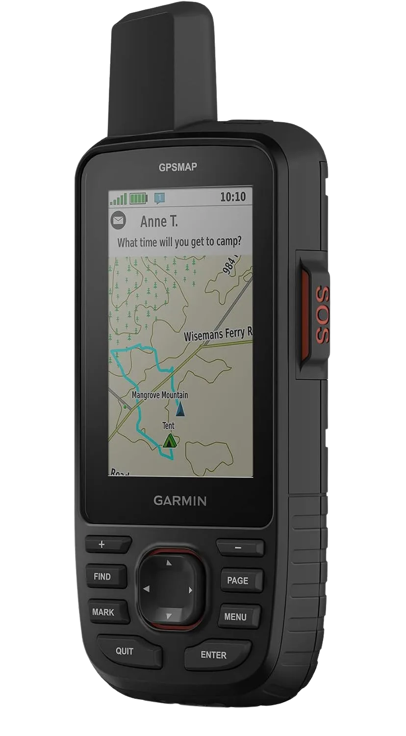
Community consensus lands in a consistent spot on a unit like this: it is worth the extra weight only when the large mapping display combined with satellite messaging is the specific reason you are buying it. Physical buttons are the quiet advantage here. They work in rain and with gloves, where a touchscreen turns useless right when a cold front makes navigation matter most.
Do not buy the biggest handheld for its own sake. If you are not going to use the mapping screen to route across open terrain, a smaller unit or a watch does the same navigation job for less weight and money.
The Budget Way In
If you want a dedicated unit without the flagship price, the Garmin eTrex 22x is the entry point that shows up across nearly every gear guide. It carries multi-GNSS support and preloaded topo maps, and that alone used to be a premium-only feature two years ago. The entry price for good-enough accuracy has quietly dropped, which is genuinely good news for anyone dipping into dedicated GPS for the first time.
Hiking Watches with GPS
Your wrist is the one place you will actually glance at data mid-stride, without stopping or digging through a pack. But a lot of hikers pay for GPS watch features they never touch when a simpler watch would have covered the job.
What the Watch Is Really For
The real hiking value of a watch is the ABC set: altimeter, barometer, and compass. An altimeter watch tells you your elevation and, more usefully, the trend of the barometric pressure, which is an early read on weather turning. Multi-band GPS and tracking are the add-on that puts navigation on your wrist so you pull out your phone less. Our real-world hiking-watch battery and GPS testing breakdown ranks specific models if you want to go deeper than the category view here.
One honest caveat on battery claims. Cold cuts a hiking watch’s range by up to 30 percent, and running the altimeter in continuous mode alone can burn roughly 30 percent extra. That 24-day battery figure on the box is a three-season number, not a winter one. A barometric altimeter also drifts as pressure changes, so it needs recalibration; our guide to why an altimeter drifts and how to recalibrate it covers the fix.
The Rugged GPS Pick
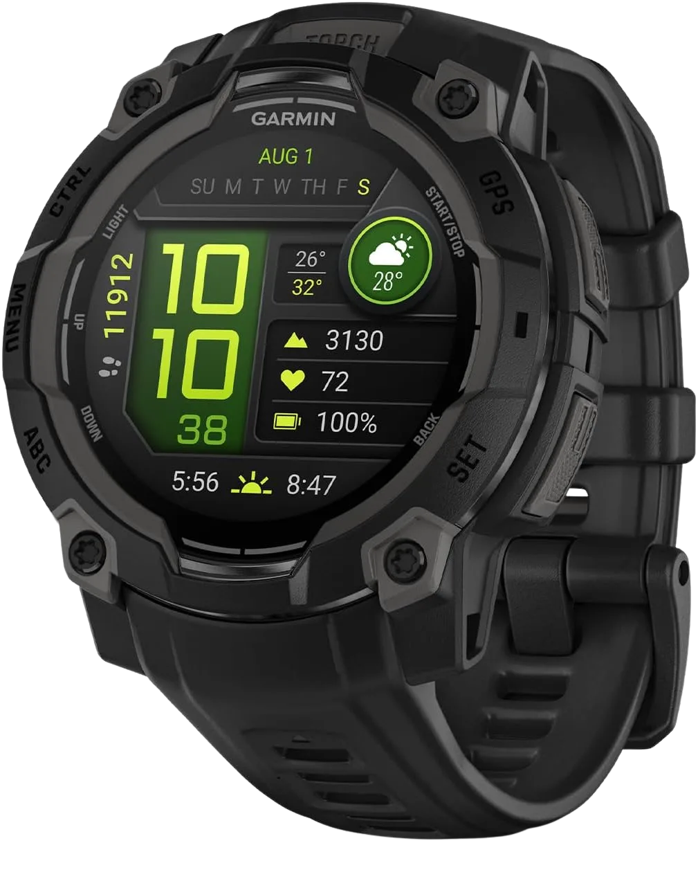
The MIL-STD-810 and 10 ATM ratings are not spec-sheet filler, and neither are the water resistance ratings (IPX7, IP67, or IP68) you will see on GPS units and phones. In cold-weather testing, devices built to those standards held up through drops, immersion, and freeze cycles far better than consumer-grade electronics. Those acronyms are the actual predictor of whether the watch survives you dropping it on frozen scree.
When a Simpler Watch Wins
If you just want elevation and a weather-trend read, you do not need GPS on your wrist at all. The Suunto Core is the classic no-GPS ABC watch, giving you altimeter, barometer, and compass without GPS-watch pricing. For hikers who mostly want a rugged timepiece that shrugs off abuse, the titanium Bertucci A-2T is a durable field-watch reference, though it is honest to say it carries no GPS or ABC sensors. It is a watch, not a navigation tool.
Satellite Messengers and PLBs
This is the category people buy out of fear and then overspend on. The real fork is simple. Do you want to text “running late, I’m fine,” or do you only ever want a break-glass SOS button. Getting that distinction right before you buy saves you from paying a monthly bill you do not need.
Two-Way Messenger vs One-Way Beacon
Start with the foundational split, the one nearly every guide treats as step one. A GPS receiver only receives; it tells you where you are and broadcasts nothing. A satellite messenger transmits to a satellite, which is what lets it send texts and an SOS from off-grid. That transmit capability is the whole reason a messenger needs a satellite network behind it.
Then the money fork. A satellite messenger (Garmin inReach, ZOLEO, SPOT) does two-way texting but requires an active subscription. A personal locator beacon (a PLB like the ACR ResQLink) has zero monthly plan and does one thing: a one-way SOS to search-and-rescue, no conversation.
If the only feature you want is the emergency button and zero ongoing cost, a PLB is the honest answer. You are paying the messengers’ monthly fee for the ability to text that you are okay, not for the SOS itself. An SOS from a messenger routes to a round-the-clock emergency coordination center (Garmin Response, or services like GEOS, Global Rescue, and FocusPoint International), while a PLB’s one-way alert reaches government search-and-rescue only after you register it with NOAA SARSAT. Our head-to-head on how the leading beacons and messengers compare breaks down the picks in each camp.
The Messenger Most Hikers Reach For
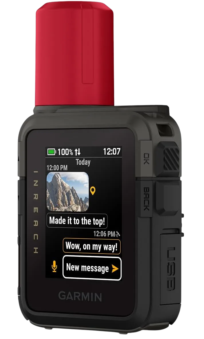
If you watch backpacking forums, the prior-generation Garmin inReach Mini 2 keeps coming up as the value pick when it goes on sale, especially for solo and thru-hikers who want two-way SOS on a budget. It is the same core idea a generation back, and it is a smart buy when the newest model’s price is the only thing stopping you.
The Flexible-Plan Alternatives
Garmin is not the only network. The ZOLEO Satellite Communicator pairs with your phone and blends satellite, cellular, and Wi-Fi messaging, with an entry plan that appeals to hikers who want flexibility. In side-by-side forum tests it often sends messages faster, though testers also flag the occasional message that fails to deliver, which is exactly the kind of real trade-off a spec sheet will not show you.
On the other network, the SPOT X runs on Globalstar and is frequently cited for the lowest recreational monthly plan among two-way messengers. Which one fits comes down to coverage and plan cost, and our full inReach versus SPOT breakdown compares the two ecosystems head-to-head.
Smartphone Navigation Apps
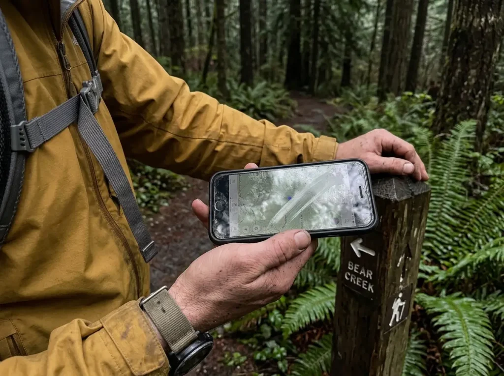
Here is the part the gear industry is quiet about. For most hikers, the honest first recommendation is not a pricey device. It is a free or cheap app on the phone already in your pocket, plus offline maps downloaded before you reach the trailhead.
Why Your Phone Is the Right Default
With offline topo maps cached, a smartphone GPS app covers marked-trail navigation for the large majority of day and weekend hikers. Gaia GPS, AllTrails, CalTopo, onX, Avenza, and FarOut all do this well, and our head-to-head of Gaia, AllTrails, and the rest sorts out which fits which hiker. The phone’s weakness is real but specific: 8 to 12 hours of active GPS, and fast drain in the cold. For most outings that is plenty, and for the ones where it is not, the fix is redundancy, not a second full device.
Offline Maps Are the Whole Game
The single most common phone-navigation failure is assuming cell coverage and never downloading maps for offline use. The app is only as good as the maps you cached before you lost signal. GPS itself does not need cell service to work, so once your maps are downloaded, airplane mode keeps the location dot alive while dramatically extending battery.
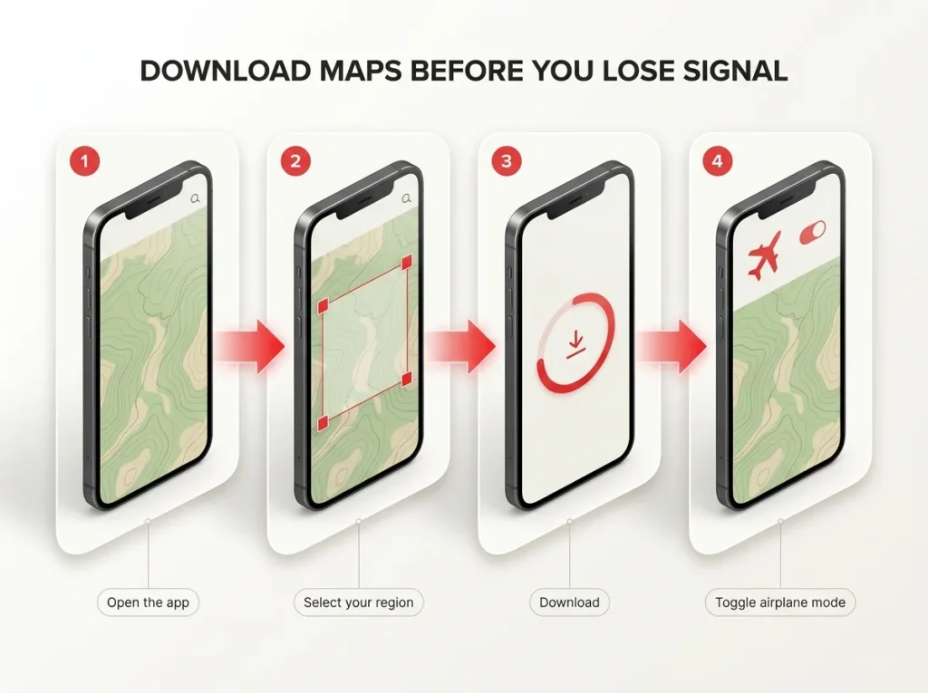
Download your maps and flip the phone to airplane mode at the trailhead. GPS still works without a signal, and cutting the constant hunt for cell towers is the biggest battery saver you have.
Free vs Paid App Tiers
A paid tier like AllTrails Pro or Gaia Premium is worth it for serious hikers who want layered maps and better offline control. A casual hiker does not need to start there. The best genuinely free hiking apps will get a weekend hiker on trail and back without a subscription. Do not stack a recurring plan you will not use, which is a theme worth holding onto for the subscription math later.
GPS Fundamentals: Accuracy, Multi-GNSS, and Cold-Weather Battery
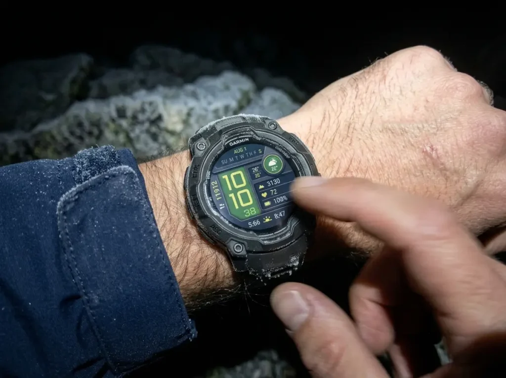
This is the section that makes you smarter than the spec sheet. Once you understand how GPS accuracy works and why cold wrecks batteries, every buying decision above stops being intimidating and starts being obvious.
Multi-GNSS vs Multi-Band, Plainly
Forums blur these two terms constantly, so here is the clean version. Multi-GNSS means the receiver uses more than one satellite constellation, GPS plus GLONASS, Galileo, BeiDou, QZSS, and others. Multi-band means it receives on two frequencies at once, which sharpens accuracy in tricky conditions.
More constellations help it find satellites; dual-frequency helps it trust the fix. Most modern units do both, and that combination is why 2026 accuracy figures beat what premium gear delivered a few years back.
Why Accuracy Drops Under Canopy and in Canyons
Even a top multi-band unit loses accuracy under dense tree canopy and in deep canyons. Those are the two conditions gear testers flag every single time, because tree cover and canyon walls block and bounce the satellite signal. Budget more drift there and do not expect open-sky numbers in a slot canyon or old-growth forest. As the NPS notes for backcountry Alaska, most of the area has no cell service and GPS accuracy can degrade in steep terrain, which is a blunt reminder that electronics get weakest exactly where remote travel makes them matter most.
Cold Kills Batteries
The clearest argument for a dedicated device in winter is a single field comparison. At minus 10 degrees Fahrenheit, an iPhone 15 Pro died in four hours, dropping 42 percent in the first hour alone, while a Garmin GPSMAP 67i used only 2 percent over the same four hours with no performance loss. That gap does not show up on a spec sheet. It shows up on a cold morning at mile eight.
The reason is chemistry. Lithium-ion loses up to 40 percent of its effective capacity at minus 20 degrees Celsius, and even sturdier LiFePO4 cells give up range in deep cold, which is why the box’s battery rating is a three-season promise. If you want to squeeze more runtime out of a phone in the cold, our notes on GPS track recording and cold-weather battery optimization cover the settings that help.
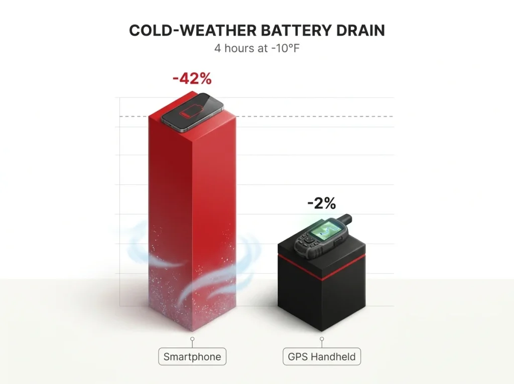
In cold weather, keep your phone in an inside jacket pocket against your chest and only pull it out to check position. That trapped warmth alone noticeably extends how long the battery lasts on a freezing day.
Which Device Do You Actually Need
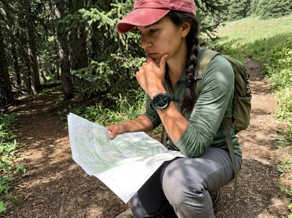
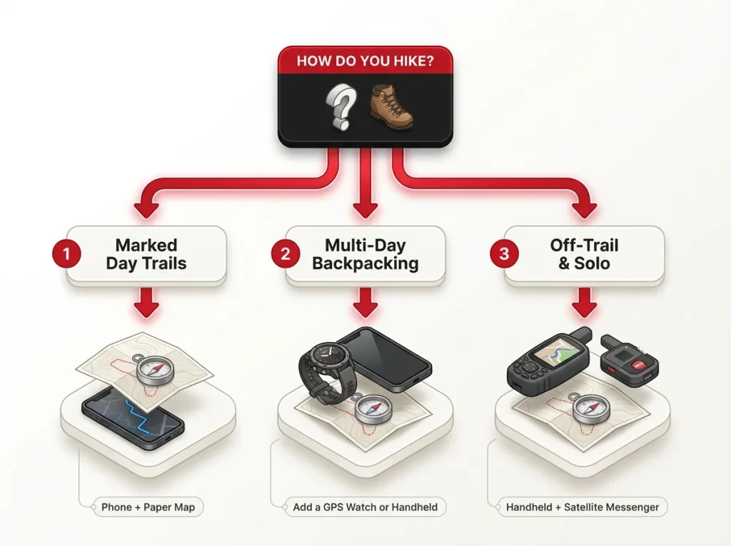
This is the section the whole guide has been building toward. A veteran would not hand you five categories and say go pick. They would ask what kind of hiking you do, and answer in one breath. So match the stack to the hiker.
Tier 1 — The Marked-Trail Day Hiker
If you hike established, marked trails on day trips, your phone with a good app and cached offline maps is genuinely enough, backed by a paper map. That is the whole kit. The National Park Service still lists a map and compass as non-negotiable, GPS or not, so the paper backup is not old-fashioned, it is the official baseline.
Most weekend hikers live in this tier and never need anything else. Permission to not buy the rest is the honest message the gear world skips.
Tier 2 — The Multi-Day Backpacker
Once you are out for multiple days, battery resilience and at-a-glance data start to matter. This is where a GPS watch or a basic GPS handheld earns a place, giving you navigation that outlasts a phone and does not require pulling it out in weather. You are not replacing the phone, you are adding a layer that survives longer.
Tier 3 — Off-Trail, Remote, and Solo
For off-trail, cross-country, or solo remote travel, a handheld GPS plus a two-way satellite messenger stops being optional. The “I’ll just use my phone” assumption breaks down precisely where it matters most: remote, steep, and off-grid. A solo hiker also needs a plan on the ground; the trip-plan protocol search-and-rescue teams want from solo hikers is as important as the device. And when the electronics fail off-trail, knowing how to triangulate your position with map and compass is the skill that gets you home.
The Subscription Cost Reality
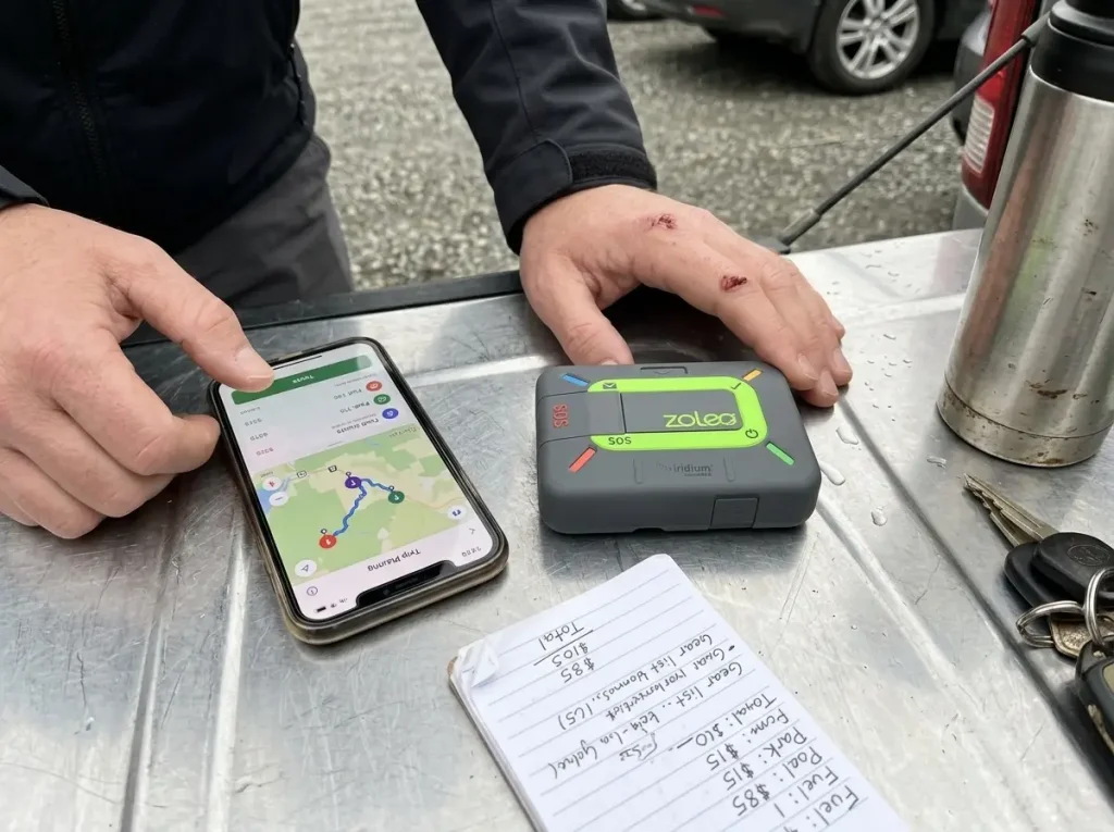
Everyone budgets the device price and forgets the device is the small number. The plan is what you pay every month for years, and stacking three of them is how a just-in-case setup quietly costs real money.
The Monthly Number Is the Real Price
The monthly reality looks like this: Garmin inReach plans start around 8 dollars a month on pay-per-message tiers, ZOLEO from about 20, SPOT Gen4’s recreational plan runs 17.95, and Iridium GO! starts near 65 plus per-text charges. Now run the two-year math, and the ranking flips.
Over two years of device plus a mid-tier plan, an inReach Mini 2 lands near 1,190 dollars, ZOLEO near 680, and SPOT Gen4 near 581. The messenger you almost skipped for costing a little more upfront can end up hundreds cheaper overall. Compare the two-year number, not the box price.
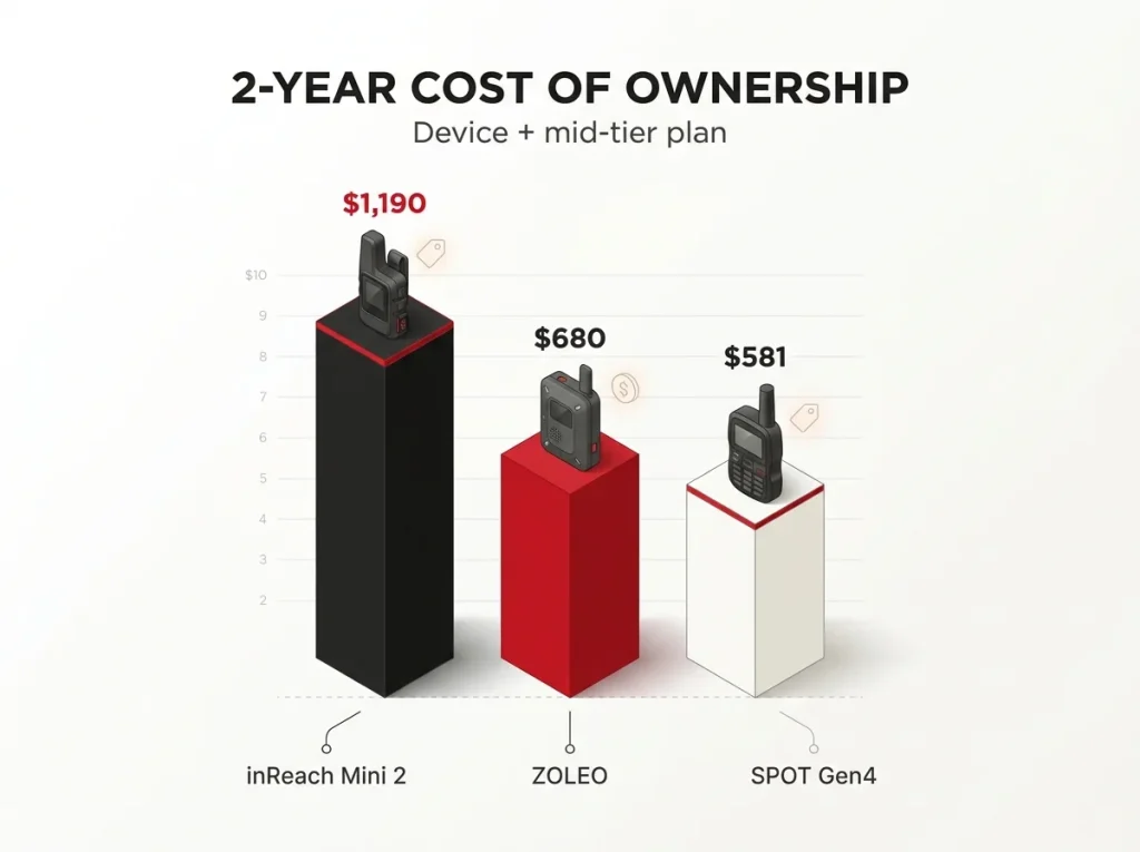
Before you buy a messenger, add up two years of the plan you will realistically use and compare that total, not the sticker prices. The device that looked expensive on the shelf is often the cheapest one to own.
When Stacking Plans Stops Making Sense
Here is the mistake nobody budgets for. A satellite messenger plan, plus a paid map app like Gaia or AllTrails Pro, plus a GPS-watch app tier, quietly adds up to a recurring cost that rivals a phone plan. That subscription fatigue is a real trap, and a casual hiker does not need all three. Pick the one layer your hiking actually requires and let the others go.
Free Carrier SOS as a Backstop
Newer phones muddy the picture in a good way. Carrier satellite SOS on an iPhone 14 or later, Google Pixel, and T-Mobile Starlink gives you a free emergency backstop when you have no cell signal. Treat it as exactly that, a bonus, not a plan. It is not a substitute for two-way messaging or for off-trail navigation, and leaning on it as your only off-grid safety net is a gamble.
Building Your Redundancy System
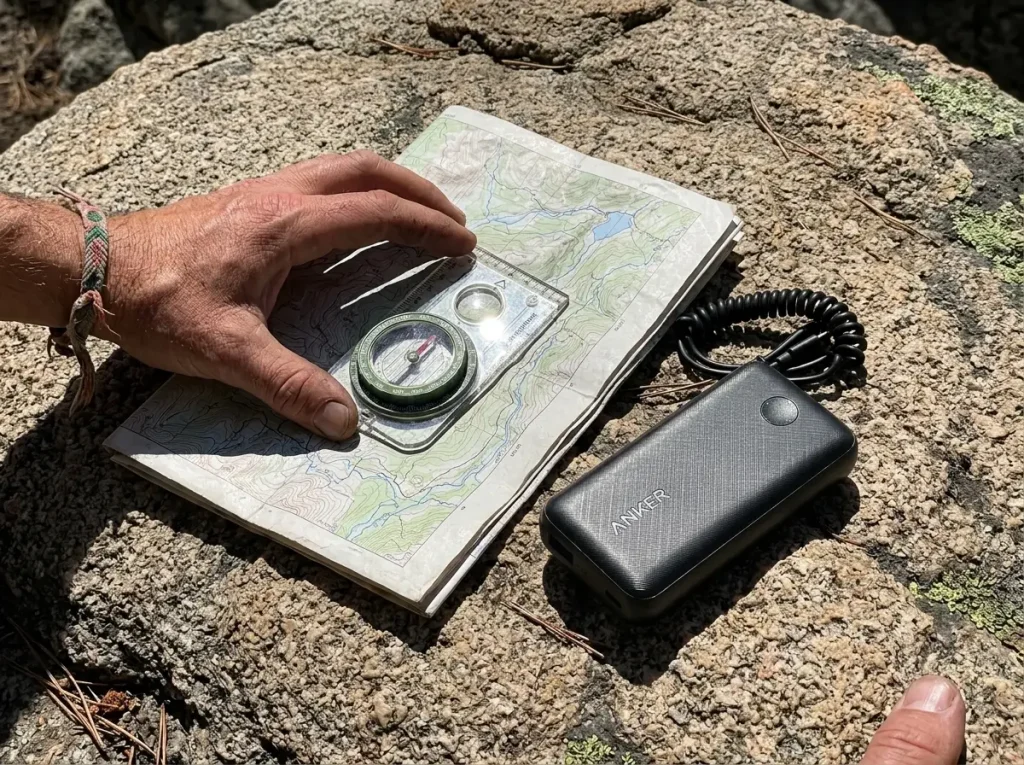
Every guide preaches redundancy in the abstract. A hiking partner tells you what actually fails and what you do the moment it happens. That is the difference between a layered system and a slogan.
The Three-Layer Stack
The framework is three layers: a primary (your GPS device or phone), a backup (a second device or spare power), and an emergency layer (paper map and compass, the base that never dies). Each layer covers the failure of the one above it. You do not need expensive gear for all three, you need each layer to fail in a different way than the others.
What Actually Fails, and What You Do
The failure modes are concrete, not hypothetical: a frozen touchscreen you cannot operate with cold fingers, a dead battery at mile eight, a lost signal in a slot canyon. The single cheapest, highest-leverage backup for a phone-primary hiker is a compact power bank. The Anker PowerCore II 10000 recharges a phone or a GPS unit mid-trip and weighs almost nothing, which beats buying a whole second device for redundancy. Most of what gets hikers lost traces back to a handful of avoidable errors; the navigation mistakes that most often get hikers lost are worth reading before you rely on any single gadget.
Map and Compass Never Run Out of Battery
The base layer holds because a map and compass never need charging. That is the NPS’s own fallback plan, not a nostalgia move. A physical map, a magnetic compass, and one no-device skill turn a dead battery from an emergency into an inconvenience. Learning to orient yourself by reading terrain when the device quits is itself a redundancy layer, and it is the one that weighs nothing and never fails.
Conclusion
Three things to walk away with. Most hikers need one device, their phone with offline maps, plus a paper backup, and everything past that is for backcountry and off-trail travel. The device price is the small number; the subscription is the real cost, so compare the two-year total before you buy. And redundancy is not buying more gear, it is layering what you already carry down to a map and compass that never dies.
Before your next trip, do the honest triage. Figure out which tier you actually hike in, and buy for that, not for the trip you might take someday.
Frequently Asked Questions
01What is the difference between a GPS device and a satellite messenger?
A GPS device is a receiver that only tells you where you are, while a satellite messenger transmits, so it can send texts and an SOS from off-grid. Many handhelds now combine both jobs in one unit.
02Do I need a GPS device if I have a smartphone for hiking?
For marked day and weekend hikes, a phone with offline maps is genuinely enough. A dedicated GPS earns its place on multi-day, off-trail, or cold-weather trips, where battery life and durability outrun a phone.
03Is a personal locator beacon better than a satellite messenger?
Neither is better outright. A PLB is a zero-subscription, one-way SOS button, while a messenger costs a monthly plan but lets you text two-way. Choose by whether you want conversation or only the emergency alert.
04How accurate are handheld GPS units for hiking?
Modern multi-band handhelds reach roughly 6 to 9 feet of accuracy in the open in 2026. Expect more drift under dense canopy or in deep canyons, where terrain blocks the signal even on multi-GNSS units.
05Do phone satellite SOS features replace a satellite messenger?
No. Carrier satellite SOS on newer iPhones, Pixels, and T-Mobile is a genuine free emergency backstop, but it is not a substitute for two-way messaging or off-trail navigation. Treat it as a bonus, not a plan.
Risk Disclaimer: Hiking, trekking, backpacking, and all related outdoor activities involve inherent
risks which may result in serious injury, illness, or death. The information provided on The Hiking Tribe is for
educational and informational purposes only. While we strive for accuracy, information on trails, gear, techniques,
and safety is not a substitute for your own best judgment and thorough preparation. Trail conditions, weather, and
other environmental factors change rapidly and may differ from what is described on this site. Always check with
official sources like park services for the most current alerts and conditions. Never undertake a hike beyond your
abilities and always be prepared for the unexpected. By using this website, you agree that you are solely
responsible for your own safety. Any reliance you place on our content is strictly at your own risk, and you assume
all liability for your actions and decisions in the outdoors. The Hiking Tribe and its authors will not be held
liable for any injury, damage, or loss sustained in connection with the use of the information herein.
Affiliate Disclosure: We are a participant in the Amazon Services LLC Associates Program, an
affiliate advertising program designed to provide a means for us to earn advertising fees by advertising and linking
to Amazon.com. As an Amazon Associate, we earn from qualifying purchases. We are also an official affiliate partner
of Black Diamond Equipment via the AvantLink network. If you click on a Black Diamond affiliate link and make a
purchase, we may earn a commission at no additional cost to you. We also participate in other affiliate programs and
may receive a commission on products purchased through our links. Additional terms are found in the terms of
service.