In this article
The highest natural point on Long Island is Jayne’s Hill, and the full loop to the top gains 209 feet. That’s less climbing than walking up to a sixth-floor office. None of which disqualifies the island, but it does change what you should go looking for once you get there.
Ask around in any r/longisland thread about trails and the same frustration surfaces: people show up expecting mountains, get a wooded ramble, and decide the whole island is a bust. The locals who hike here a lot draw a line the guidebooks blur, between a nature walk and a hike, and that line is the whole game. This guide covers the three terrain zones that hold every worthwhile trail, what each park costs to enter, and the two things that ruin more days on Long Island hiking trails than weather ever will.
What “Hiking” Actually Means on Long Island
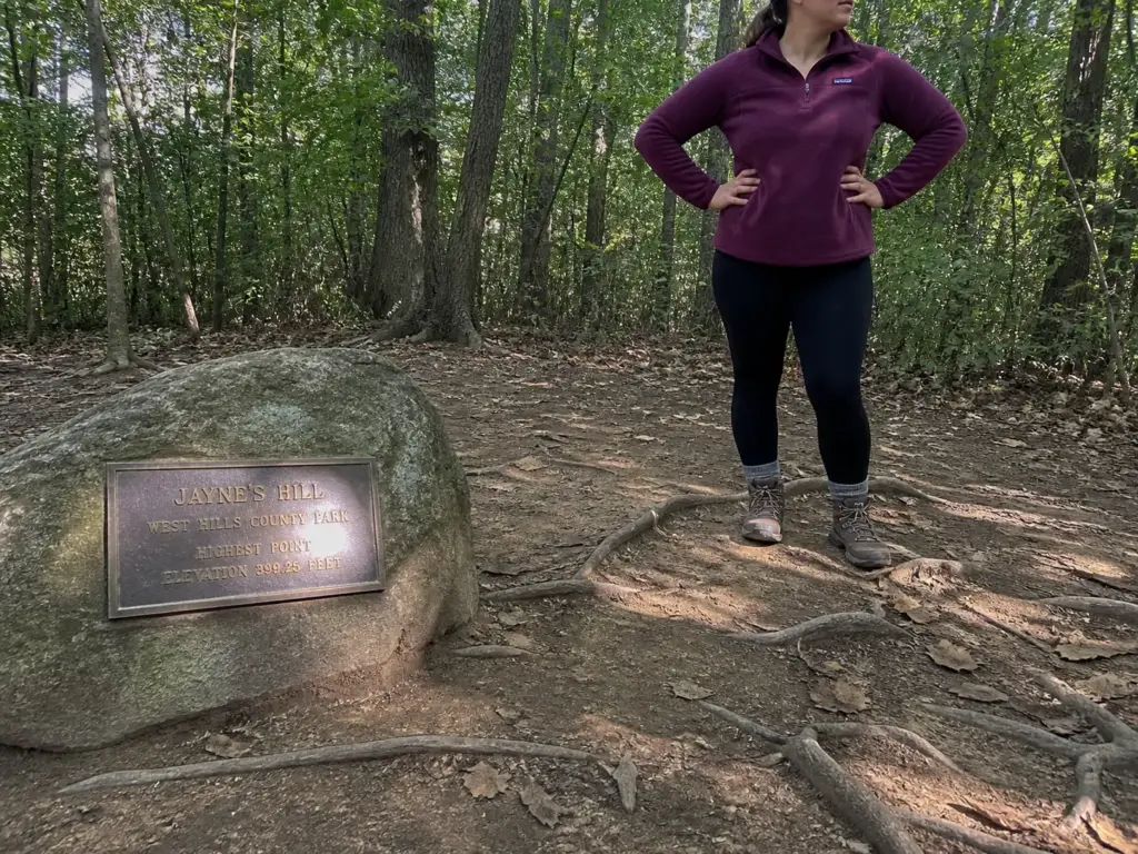
Start with the number that resets everything. The Jayne’s Hill Loop in West Hills County Park runs 2.4 miles and gains 209 feet, and AllTrails rates it easy.
That is the summit of Long Island. Not the warm-up, not the family option. The top.
The hardest thing on the island is the Nissequogue River Loop at Sunken Meadow State Park: 4.2 miles, 423 feet of gain, including a bluff climb of roughly 100 feet with genuinely steep footing near the cliff edge. That’s the ceiling.
If you’ve been reading trail descriptions here and wondering how they compare to what a genuinely tough New York day hike asks of you, the honest answer is that they don’t compare at all, and that’s fine once you stop expecting them to. The recalibration veteran hikers keep passing along is blunt: a Long Island moderate difficulty rating with 400 feet of gain is closer to a long walk around the neighborhood than a climb. Go in expecting good woods, not a workout, and you’ll have a good day.
The other distinction matters more than trail difficulty ratings do. Long Island hikers separate a nature walk from a hike, and they mean something specific by it. A nature walk is flat, often paved or on a boardwalk trail, stroller-friendly, and pleasant. A hike has dirt under your feet, roots to trip on, and real mileage.
Several of the popular roundups pour both into one list under the same heading, which is why so many people drive forty minutes for a “hike” and end up on a paved loop behind a parking lot. Nothing wrong with either one. Everything wrong with not knowing which you’re getting.
The terrain itself explains why the numbers are what they are. Long Island is a glacial moraine, a pile of rock and sand and clay bulldozed south by an ice sheet and abandoned when it melted. It was never folded, never uplifted, never carved.
That origin story is written into everything you’ll walk on. The low rolling ridges along the North Shore are the moraine’s spine; the kettle holes scattered through Muttontown and Blydenburgh County Park are depressions left by buried ice blocks that melted out, some of them holding a kettle pond at the bottom; and the sand under the pine barrens is glacial outwash that washed south off the melting front. Understanding that is the difference between reading the island as a failed mountain range and reading it as what it is.
Which is a genuinely good thing, once the expectation is set right. Twenty minutes from most driveways in Nassau or Suffolk there is mature hardwood forest with no road noise in it. In a metro area of eight million people, that’s not a consolation prize.
Read Long Island trail ratings by mileage, not by the difficulty label. A 6-mile “easy” loop through Connetquot will work you harder than a 2-mile “moderate” at West Hills, because on this island distance is the only variable that ever really moves. Elevation is noise here. Miles are signal.
North Shore Hills and Hardwoods
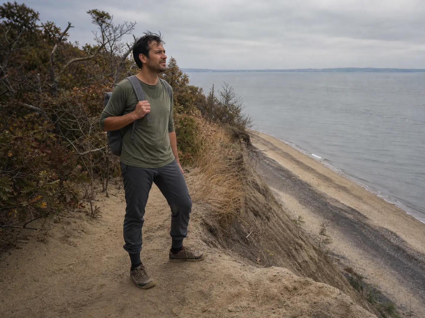
This is where you go when you want your legs to know you walked. The North Shore sits on the moraine, so it climbs and drops in short pitches, throws roots across the tread, and holds the oldest oak and beech woods left on the island. Every so often the trees open and you get Long Island Sound through the gap, gray and flat and busy with boats.
Caumsett State Park in Lloyd Harbor is the most complete day out here. It’s a former Marshall Field estate, which means wide bridle paths through open meadow, real woods on the interior trails, and a bluff that drops to the Sound at the north end. You can put together anywhere from three to seven miles depending on how you stitch the loops, and the terrain shifts often enough that it never gets monotonous. There’s a seasonal vehicle fee.
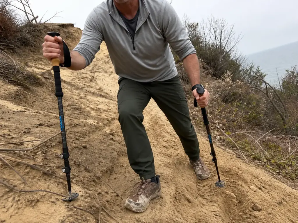
Sunken Meadow State Park holds the one segment on this island worth calling a climb. The Greenbelt section that goes up the bluff gains about 100 feet, which sounds like nothing until you’re on it, because the pitch is steep, the surface is a mix of loose sand and eroded soil, and the drop-off sits close to the trail in a few places. Local runners call it cardiac hill and they’re not entirely joking. It’s the one spot where poles earn their keep on this island: they give you something to push against on the way up and take the sting out of a slick, sandy descent, which is where people actually get hurt here. A light pair like the Cascade Trekking Poles does the job without weighing down a daypack — carbon shafts, adjustable, under a pound for the pair, which matters when you’re only deploying them for one section of the hike and strapping them to your pack the rest of the time. The full Nissequogue River Loop here is 4.2 miles and 423 feet, the toughest stat line on the island.
West Hills County Park gives you Jayne’s Hill and the Walt Whitman Trail, and it costs nothing to walk. The summit sits right around 400 feet above sea level, marked with a plaque and a stone, and surrounded by trees, so the view is more idea than panorama. The woods on the way up are legitimately nice, and the park connects into a wider trail network if you want to extend the day past the standard 2.4-mile loop.
Muttontown Preserve in Syosset is the one that surprises people. It’s free, it’s one of the largest preserves in Nassau County, and the trail signage is thin enough that hikers genuinely get turned around in there. It’s not a hazard, the preserve isn’t big enough to be one, but you will spend twenty minutes going the wrong way on your first visit. The King Zog ruins, what’s left of the estate the exiled Albanian king bought and never lived in, sit crumbling in the woods and are worth finding.
Cold Spring Harbor State Park, Sands Point Preserve and Target Rock National Wildlife Refuge round out the shore, along with smaller nature preserve parcels like Shu Swamp and Stillwell Woods that the North Shore Land Alliance and the county keep open and largely unadvertised. Cold Spring Harbor is short but steep by local standards, a quick, honest climb up from the road. Sands Point is manicured, historic, and gorgeous, with a parking lot that fills early. That’s the pattern people repeat about this whole shore, and it’s the part the roundups skip: pull into Caumsett or Sands Point on a July Saturday at eleven and you’re circling, or you’re being turned away at the gate. The trails aren’t crowded. The lots are.
If the 423-foot ceiling starts feeling like a ceiling, the fix is a drive rather than a different park. Two hours north, the Shawangunk ridge trails around Sam’s Point deliver the sustained climbing, exposed conglomerate, and long sightlines the moraine simply cannot produce. Same state, entirely different geology.
South Shore Dunes, Bays and Boardwalks
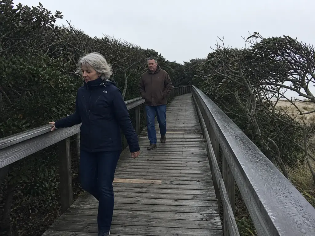
The South Shore doesn’t give you elevation. It gives you exposure. Wind coming straight off the Atlantic with nothing to break it, sun with no canopy over it, and soft sand that tires your legs in a way dirt never does. It’s the best winter walking on the island and the worst place to be at noon in August.
Fire Island National Seashore holds the Sunken Forest, a maritime holly forest growing in the swale behind the primary dune, protected from salt spray by the dune itself. It is genuinely one of the strangest and best places on the island, 300-year-old holly and sassafras twisted into a low canopy you walk through on a boardwalk. It’s also, honestly, a nature walk. About a mile and a half, flat, elevated planking the whole way. Go for what it is.
Robert Moses State Park deserves a straight answer, because it gets recommended constantly to people who want quiet. It pulled roughly 3.9 million visitors in 2024. It is a beach park with trail access attached, and if you check the official NYS Parks page for Robert Moses State Park for hours and fees, the framing there tells you the same thing. Great sunset walk in October. Wrong pick entirely for a solitary Saturday in July.
Massapequa Preserve works as the entry point for this shore. It’s flat, part paved, follows a chain of ponds and streams north from the bay, and it’s free. Families use it, runners use it, birders use it, and it’s the natural first outing for anyone easing into day hike distances, or the safest family hike on this whole list. Walk it as an out and back and you control the length exactly, which is the right call with kids. It also anchors the southern end of the Nassau-Suffolk Greenbelt Trail, so you can walk a piece of a serious long-distance route without committing to one.
Jones Beach State Park and Heckscher State Park sit at the coastal end of the Greenbelt system, with Heckscher serving as the southern terminus of the full 31.8-mile route. Up on the North Fork side, Wildwood State Park in Wading River gives you bluff-top woods dropping to a Sound beach, which is the closest the island comes to combining both shores in one walk. Hither Hills State Park out in Montauk is the outlier and the best pure sand hike on the island: the walking dunes are migrating parabolic dunes that bury the forest as they move, and walking among them is the closest thing New York State offers to hiking in a desert. The trees at the leading edge are half-buried and dead standing. It’s a strange, quiet place.
Walk the south shore on the falling tide and you get a firm, packed strip of wet sand to travel on instead of the loose stuff above the wrack line. The difference over three miles is enormous. Soft dry sand costs you roughly a third more effort per mile, and you feel every bit of it in your calves the next morning.
The mistake people make down here is footwear, and it’s the most common one on the island. Light mesh trail runners look like the obvious choice for flat coastal miles, and then the sand pours straight through the upper, settles under the arch, and sands your sock down over four miles. The soft foam midsole that feels great on pavement compresses into the sand instead of pushing off it, so every step gives a little back.
If you want the opposite of all this, trade the dunes for actual mountains up in the Adirondacks, where the trails go up for hours and the sand is a memory.
The Pine Barrens and the Island’s Quiet Interior
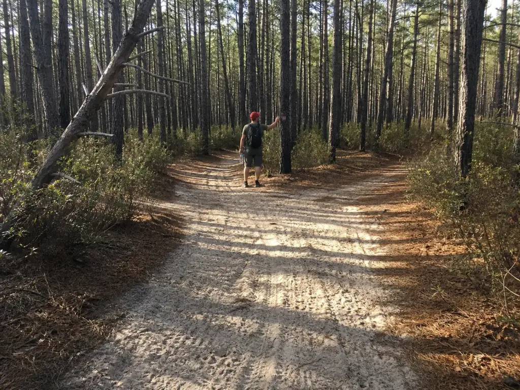
The interior is sand, stunted pine, and silence. It’s the part of Long Island where you can walk ten miles without crossing a road, and it’s also where you need to take ticks more seriously than anywhere else on this list. Nobody writes about it because it doesn’t photograph like a coastline, which is exactly why it stays empty.
Rocky Point Pine Barrens State Forest is the anchor. The Paumanok Path loop segment through it runs roughly 9.9 miles over sandy, needle-carpeted tread that stays close to flat the entire way. It’s the longest continuous hiking you’ll find on the island without leaving one property, and the character is completely different from the North Shore: open pine canopy, no understory to speak of, and the acoustic deadening that a thick needle layer produces. Your footfalls stop making noise. Hikers notice it within the first mile.
The pine barrens ecosystem here is a fire-dependent system, which is why the pitch pines look the way they do, and it has a much more famous cousin upstate. If you’ve walked the dwarf pine barrens up on the Shawangunk ridge, you already know the feel: sand, low pine, exposed sky. Rocky Point is that at sea level.
Cathedral Pines County Park in Middle Island is tall white pine rather than scrub, planted and grown into a genuine cathedral of a canopy. It’s also one of the densest tick season zones on the island, which is the trade you’re making by walking there in May.
Connetquot River State Park Preserve and Caleb Smith State Park Preserve are the managed end of the interior. Both are built around trout streams, both have real trail networks, and Connetquot requires you to sign in at the entrance, which keeps numbers down and makes it one of the quieter places to walk on a weekend. Quogue Wildlife Refuge and Edgewood Oak Brush Plains Preserve are flat, calm, and free.
The spine of all of it is the Greenbelt, and this is where nearly everyone online gets confused, because there are two of them. The Nassau-Suffolk Greenbelt Trail runs 19.5 miles from Cold Spring Harbor to Massapequa, completed in 1986 and designated a National Recreational Trail in 1992. The Long Island Greenbelt Trail runs 31.8 miles from Sunken Meadow to Heckscher State Park and was completed in 1982.
Different routes, different lengths, different orientations across the island. Online they get used interchangeably, so a trip report about “the Greenbelt” might be describing either one, and if you plan a shuttle around the wrong one you’ll be very confused at the far end. The Long Island Greenbelt Trail Conference maintains both and runs a guided hike calendar year-round, which is the low-friction way to walk an unfamiliar segment without solving the car problem yourself.
Nobody local hikes the Greenbelt end to end in a day. They hike it in segments, using two cars or a drop-off, and they say “the Greenbelt” to mean the whole system rather than a specific route. If someone tells you they did the Greenbelt on Sunday, ask which segment before you assume anything about their weekend.
Walking sand for nine miles also does something specific to your pace. It flattens it. There’s no climb to slow you and no descent to speed you up, so you settle into one rhythm and hold it for hours, which is either meditative or monotonous depending on the day and your mood. Bring more water than the elevation profile suggests, because the pine canopy is thin and the sand reflects heat back at you.
The quiet is also what makes the interior the best birdwatching on the island, and it’s the reason to slow down rather than push miles. Red-tailed hawks work the open pine canopy at Rocky Point, osprey nest on platforms along the Connetquot and the bay edges from April onward, and a bald eagle over the Peconic watershed stopped being a rare sighting years ago. White-tailed deer are everywhere and are worth watching for a less pleasant reason: they are the transport system that moves adult ticks around, so a heavily browsed section of trail is a section to walk down the middle of. Down at Montauk Point State Park the seal haul out on the rocks below the lighthouse runs through the cold months, and Tackapausha Preserve and Hubbard County Park are the small, quiet places to go when the named parks are full.
Ticks Are the Real Hazard Here
Here’s the part every other guide gives one sentence. Between 2019 and 2022, the CDC recorded more Lyme disease cases in Suffolk County than in any other county in the United States. Not the highest rate in New York. The highest count in the country, ahead of everywhere in New England.
The trend is going the wrong way, too. Suffolk reported 3,152 Lyme cases in 2024, up from 433 in 2019. Nassau County reported 521, up from 136 over the same span.
Those are reported cases, which by definition undercount. Whatever the true number is, it’s larger.
The timing surprises people. The riskiest window isn’t high summer, it’s spring. Deer tick nymphs emerge from March through May, and a nymph is about the size of a poppy seed, which means you will not feel it and you may not see it on a first glance. Adults in fall are far easier to spot and far less likely to go unnoticed long enough to transmit anything.
According to the New York State Department of Health’s Lyme disease fact sheet, a tick generally needs to stay attached for 36 hours or more before transmission becomes likely, which is the entire reason the post-hike check matters so much. Find it same-day and you’ve almost certainly avoided the problem.
The three-stage protocol. The New York State DEC’s tick-prevention guidance lays out the layered approach, and the order matters:
- Permethrin at 0.5% on fabric only. Clothing, shoes, gaiters, pack. Spray it, hang it, let it dry fully before wearing. It bonds to fibers and survives multiple washes. Never on skin.
- DEET on exposed skin. Ankles, lower legs, wrists, neckline. This is the layer that covers what fabric doesn’t.
- Pants tucked into socks. Unglamorous, completely effective. Ticks climb upward from the ground, and this closes the door at the bottom.
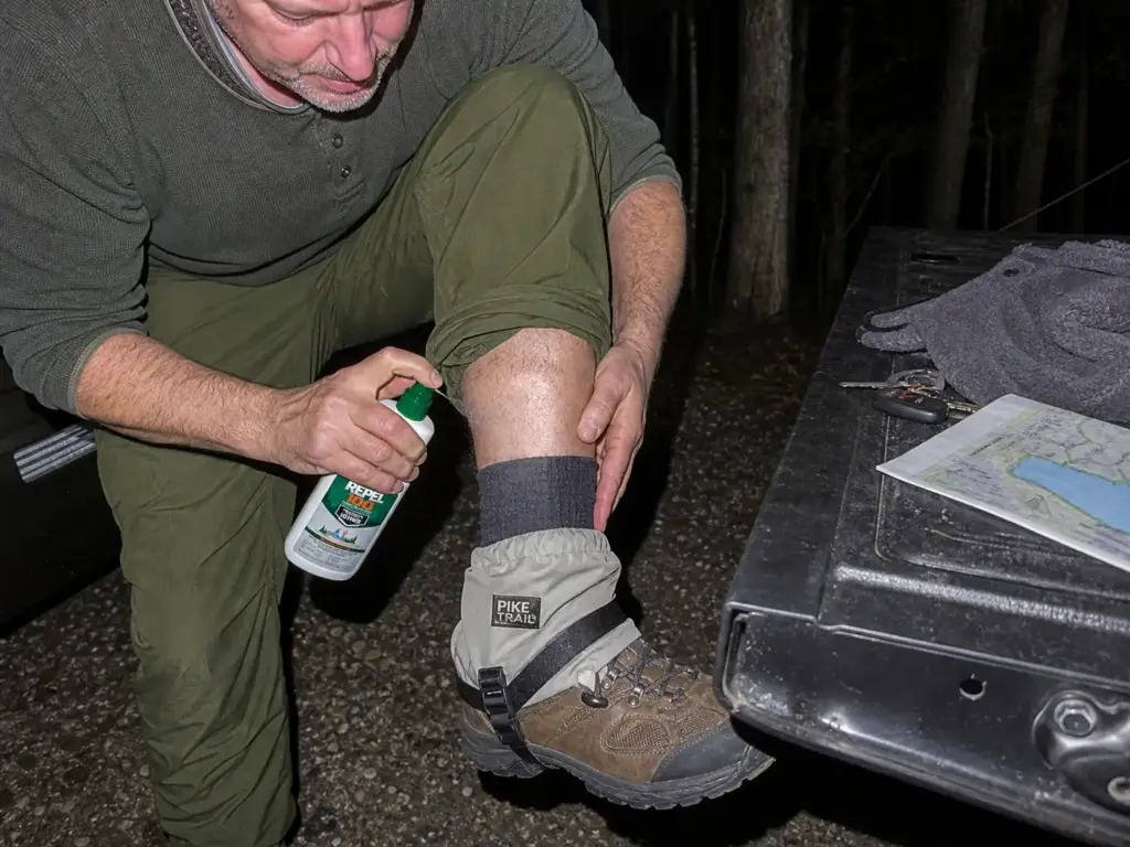
For the skin layer, a high-concentration DEET spray like Repel 100 is the straightforward pick — it runs 25 to 30% DEET with around ten hours of protection, which covers a full day in the pine barrens on one morning application. Lower-concentration sprays aren’t weaker in effect so much as shorter in duration, and reapplying at mile six in Rocky Point is exactly the thing you’ll forget to do.
That ankle gap is worth closing physically, not just chemically, because it’s where ticks board you. They quest from the tips of grass and low brush at roughly knee height and lower, waiting to grab whatever brushes past, then climb. A low gaiter like the Pike Trail Ankle Gaiters sits over the sock and pant cuff and gives them nothing to grip at the exact height they’re working. It does double duty on this island, since the same piece of fabric keeps sand out of a low-cut shoe on the Rocky Point and Fire Island stretches.
If you want the reasoning laid out properly, the full three-stage tick defense system breaks down how the layers stack, and how far treated pants actually get you covers what permethrin on fabric does and doesn’t accomplish on its own.
The free habit is the highest-leverage one on the list: walk the middle of the trail. Ticks are on the vegetation at the edges, not in the packed dirt down the center. The DEC puts this first among its non-clothing recommendations because it costs nothing and cuts contact substantially. On a narrow pine barrens track where the grass leans in, it means accepting that you’ll get brushed and treating your ankles accordingly rather than pretending you can dodge it.
Then there’s the mistake that undoes all of it, and it’s the one people make most: getting the two products backwards. Permethrin sprayed on skin, or skin repellent used alone with untreated clothing.
Permethrin belongs on fabric because that’s where it bonds and stays effective against ticks for weeks. DEET belongs on skin because it repels rather than neutralizes, and washes off. Swap them and you’ve got a weaker system than either one used correctly.
The part everyone skips is at home. A head-to-toe tick check before the shower, with real attention to the places nymphs favor: behind the knee, the groin, the waistband line, the armpit, behind the ears and along the hairline.
Then take the clothes you hiked in and put them in the dryer on high heat for ten minutes before they go anywhere near the washing machine. Washing alone does not reliably finish off a tick, which survives a wash cycle without much trouble. Ten minutes of dry high heat it cannot survive. That single step is the one most casual hikers have never heard of, and it’s the reason a tick that rode home in a pant cuff turns up on a bedroom floor three days later.
Treat light-colored hiking pants as a tool rather than a fashion call. A poppy-seed nymph on tan fabric is findable at arm’s length; the same nymph on black leggings is invisible until it’s attached. Half the tick check happens on the trail, every time you sit down for water, and pale fabric is what makes that possible.
If one does attach, the removal technique matters more than most people realize. Fine-tipped, steady, straight up, gripping right at the skin rather than higher up. Squeeze the swollen part or twist it and you can push contents back into the bite or leave the mouthparts embedded, which turns a clean removal into a local infection.
Household tweezers are too blunt at the tip to grip a nymph, which is why people end up pinching and pulling instead. A proper kit like the TickCheck Premium Tick Remover Kit bundles a stainless removal hook, fine-point tweezers, and an ID card, and the ID card is more useful than it sounds: knowing whether you pulled off a deer tick or a dog tick changes how closely you watch the site over the following weeks. It lives in the glovebox, not the pack.
The community’s own story about this is worth repeating because it undercuts every assumption. The people who report pulling an engorged tick off a sock are almost never the ones who went crashing through tall meadow grass.
They’re the ones who walked Rocky Point or Cathedral Pines on a clean, sandy, needle-carpeted trail, felt entirely fine about it, and did a lazy check. The pine barrens look harmless. That’s the trap.
Footwear, Sand and What the Trails Do to Your Shoes
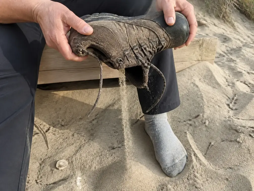
Everyone tells you sand hiking is harder. Almost nobody explains what it actually does differently, which is why people keep making the same equipment choice and keep being annoyed by the result.
Sand punishes two specific things. First, the upper. Fine, dry sand moves through mesh the way water moves through a screen door, and once it’s inside the shoe it does not come out on its own. It migrates under the arch and along the seam line, so every step grinds it against your sock until you have a hot spot in a place nothing was rubbing at mile one.
Second, the midsole. Soft, high-stack foam works by compressing and rebounding, and that requires a firm surface to push against. In soft sand the foam and the ground compress together, so a chunk of every step gets absorbed instead of returned. Cushioned shoes feel wonderful on a boardwalk and mushy across a dune.
The rule breaks down cleanly by region. For North Shore dirt and roots, almost anything with a tread pattern works, since the surface is packed and the grades are short. For the sandy stretches on the south shore and through the pine barrens, you want a low-cut, breathable hiking shoe with a tight, closed upper and a midsole firm enough to hold shape, plus a low gaiter over the top. Low-cut rather than a boot because these trails are hot, flat and long, and a tall boot buys ankle support you don’t need in exchange for heat you’ll definitely feel.
Sandals are the trap here, and they fail for a reason worth naming. On a beach, sand that gets under an open sandal falls back out with the next step.
On a sandy trail with any grit or pine debris in it, the sand works under the footbed and stays there, held in place by the straps, and it abrades exactly along the strap line where your skin is already damp. An hour is fine. Six miles is not.
The low-cut choice also lines up neatly with the tick protocol from the last section, which is the part that makes it more than a comfort decision. Less fabric surface around the ankle means fewer places for a tick to grab on the way up, and a gaiter over a low shoe seals the sock-to-cuff seam completely. Add the tuck and you’ve closed the whole lower system. On that note, it’s worth taking a minute to pick pants that close the gap at the ankle rather than fighting a wide, flapping cuff every time you try to tuck it.
The mistake to avoid is specific and common: lightweight mesh trail runners at Rocky Point, on the Fire Island trails, or on the sand-heavy stretches around Robert Moses. They’re the right shoe for the North Shore woods and the wrong shoe for anything sandy, and the failure isn’t dramatic. You just finish the day with a shoe full of grit and a sore spot you can’t place.
Fees, Parking and When to Actually Go
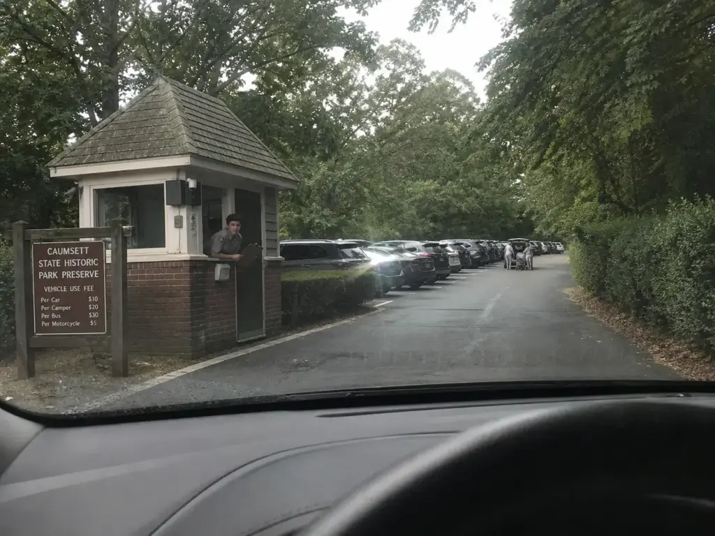
This is the piece no list organizes, and it’s the piece that decides whether the day goes well. A full Long Island hiking weekend can cost you nothing at all, or it can cost you half a morning circling a lot that filled up before you left the house.
Free, no vehicle fee: Muttontown Preserve, Massapequa Preserve, West Hills County Park and Jayne’s Hill, Edgewood Oak Brush Plains Preserve, Quogue Wildlife Refuge.
Seasonal vehicle fee: Caumsett State Park, Sunken Meadow State Park, Robert Moses State Park, Sands Point Preserve, Heckscher State Park.
Two things about that second list. The fee is charged per vehicle, not per person, so a carpool of four splits one entrance fee and a solo hiker pays the same as a full car. And it’s seasonal at most state parks, which means the same lot that costs you money on a June Saturday is often free on a Tuesday in November. If you plan on more than a handful of state park visits in a year, the annual Empire Pass pays for itself quickly, and it covers vehicle entry across the NYS Parks system rather than just here.
Trailhead parking capacity is the real constraint and nobody publishes numbers on it. What hikers here consistently report is that Caumsett, Sands Point and Target Rock fill by mid-morning on summer weekends, and that the fix is never a different park. It’s a different hour.
Arrive by eight and Caumsett is a different place than it is at eleven, same trails, same fee, a tenth of the people. Go on a weekday, or lean into off-season hiking from November through March, and the whole calculation disappears.
Season changes which shore you want. Spring is peak nymph season, which doesn’t mean staying home, it means the full protocol on every hike from March through May. Summer belongs to the North Shore woods, where the canopy holds the heat down, and the south shore turns unpleasant in the middle of the day.
Fall is the best hiking of the year on the moraine, hardwood color through October and cool enough for long miles. Winter is when the south shore comes into its own: empty parking, hard-packed sand, no bugs, and harbor seals hauled out on the rocks at Montauk Point State Park from roughly December through April, which is a genuinely good reason to drive that far in the cold.
One more thing that decides how a day goes, and it isn’t in any list: you are almost never alone on the tread here. Suffolk County Parks and Nassau County Parks run most of these trails as shared corridors, so the wide bridle path at Caumsett carries horseback riding traffic, the Massapequa and Bethpage corridors are a cyclist shared trail, and much of the island is dog-friendly trail if the dog is leashed. Trail etiquette sorts it out cleanly: hikers yield to horses, bikes yield to hikers, and everyone yields downhill to uphill on the few pitches where that even applies. Step off on the downhill side for a horse and talk to the rider as they pass, so the animal hears a person rather than a shape.
The same goes for trail conditions and Leave No Trace, which on a sandy, heavily used island mostly means one thing: stay on the blazed tread. Cutting a corner in the pine barrens breaks a soil crust that takes years to knit back, and off the packed center is exactly where the ticks are waiting anyway. Pack out what you carried in, keep the speaker in your pocket, and check the park’s page for closures after a storm, because the low-lying South Shore boardwalks flood and the moraine trails hold blowdowns for weeks.
If you’re assembling gear for your first few outings rather than pulling from a closet full of it, a starter kit that covers a day like this without overspending will get you further than any single expensive purchase. For this island specifically, the money is best spent on tick protection and a shoe that handles sand. Everything else can wait.
Conclusion
Recalibrate before you pick a park. The island’s ceiling is 423 feet of gain, and knowing that going in is what turns a disappointing afternoon into a good one.
Choose by terrain, not by list position. North Shore for woods and short climbs, south shore for coast and wind, pine barrens for distance and quiet. Those three zones are the actual structure of hiking here, and every worthwhile trail sits in one of them.
Handle ticks the way you handle weather, as a condition you prepare for rather than a risk you hope to dodge. Permethrin on the fabric, DEET on the skin, walk the center of the trail, dryer on high for ten minutes when you get home.
The simplest version of all of it: pick a free North Shore park for this Saturday, be at the trailhead by eight, and do the check before you shower. That’s the whole system, and it works the first time you run it.
Frequently Asked Questions
01What is the longest hike on Long Island?
The full Long Island Greenbelt Trail is the longest at 31.8 miles, running from Sunken Meadow State Park south to Heckscher State Park. The separate Nassau-Suffolk Greenbelt Trail covers 19.5 miles. Almost everyone hikes both in segments rather than end to end.
02Where can I hike on Long Island for free?
Muttontown Preserve, Massapequa Preserve, West Hills County Park, Edgewood Oak Brush Plains Preserve and Quogue Wildlife Refuge all have free trail access. The parks that charge, including Caumsett, Sunken Meadow and Sands Point, bill a seasonal fee per vehicle rather than per person.
03What is the highest elevation hike on Long Island?
Jayne’s Hill in West Hills County Park is the highest natural point on Long Island at roughly 400 feet above sea level. The loop to reach it runs 2.4 miles with 209 feet of elevation gain and is rated easy. Parking and access are free.
04Do you really need to worry about ticks hiking on Long Island?
Yes. The CDC recorded more Lyme disease cases in Suffolk County than any other US county between 2019 and 2022, and Suffolk reported 3,152 cases in 2024. Treat clothing with 0.5% permethrin, use DEET on skin, walk the trail center, and run hiking clothes through a hot dryer for ten minutes afterward.
05Is hiking on Long Island actually hard?
Not by mountain standards. The toughest trail on the island is Sunken Meadow’s Nissequogue River Loop at 4.2 miles and 423 feet of gain, which would rate as easy in the Catskills. Difficulty here comes from distance, soft sand and heat rather than from climbing.
Risk Disclaimer: Hiking, trekking, backpacking, and all related outdoor activities involve inherent
risks which may result in serious injury, illness, or death. The information provided on The Hiking Tribe is for
educational and informational purposes only. While we strive for accuracy, information on trails, gear, techniques,
and safety is not a substitute for your own best judgment and thorough preparation. Trail conditions, weather, and
other environmental factors change rapidly and may differ from what is described on this site. Always check with
official sources like park services for the most current alerts and conditions. Never undertake a hike beyond your
abilities and always be prepared for the unexpected. By using this website, you agree that you are solely
responsible for your own safety. Any reliance you place on our content is strictly at your own risk, and you assume
all liability for your actions and decisions in the outdoors. The Hiking Tribe and its authors will not be held
liable for any injury, damage, or loss sustained in connection with the use of the information herein.
Affiliate Disclosure: We are a participant in the Amazon Services LLC Associates Program, an
affiliate advertising program designed to provide a means for us to earn advertising fees by advertising and linking
to Amazon.com. As an Amazon Associate, we earn from qualifying purchases. We are also an official affiliate partner
of Black Diamond Equipment via the AvantLink network. If you click on a Black Diamond affiliate link and make a
purchase, we may earn a commission at no additional cost to you. We also participate in other affiliate programs and
may receive a commission on products purchased through our links. Additional terms are found in the terms of
service.