















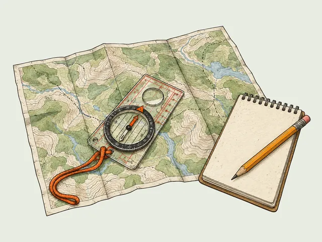








You are five miles from the trailhead, the fog has dropped visibility to fifty feet, and the trail junction you expected ten minutes ago hasn’t appeared. Your phone battery is dead, leaving you with a paper map and a compass. If you haven’t accounted for the invisible 15-degree pull of magnetic declination, you aren’t just slightly off course—you are walking a mathematically divergent path driven by the Earth’s magnetic field that widens with every step.
Understanding magnetic declination is the difference between a confident walk out and becoming a search-and-rescue statistic. True outdoor competence isn’t just about hiking fast; it’s about aligning your tools with the physical realities of geophysics and cartography.
In this guide, we will decode the “Three Norths,” navigate the 2026 World Magnetic Model (WMM) update, and master the “Hybrid Sync” protocol to lock your digital GPS and analog compass into perfect alignment.
What Is Magnetic Declination and Why Does It Matter?

Magnetic declination is the angular difference between True North (geographic north) and Magnetic North (where your compass points). It is not a static number but a dynamic, shifting physical reality of the geomagnetic field that varies depending on your location. Declination is simply a manifestation of the complexity of the geomagnetic field.
Why are there three different “Norths” in navigation?
To navigate with precision, you must distinguish between three distinct vectors to plot a correct azimuth. True North (or Geographic North) is the static point where the Earth’s axis of rotation meets the surface, marked by Polaris (the North Star). Magnetic North is the direction your magnetic needle actually points, aligning with magnetic field lines converging in the Arctic. Finally, Grid North refers to the vertical lines on your topo map (UTM grid or State Plane), which differ slightly from True North due to the flattening of the map projection.
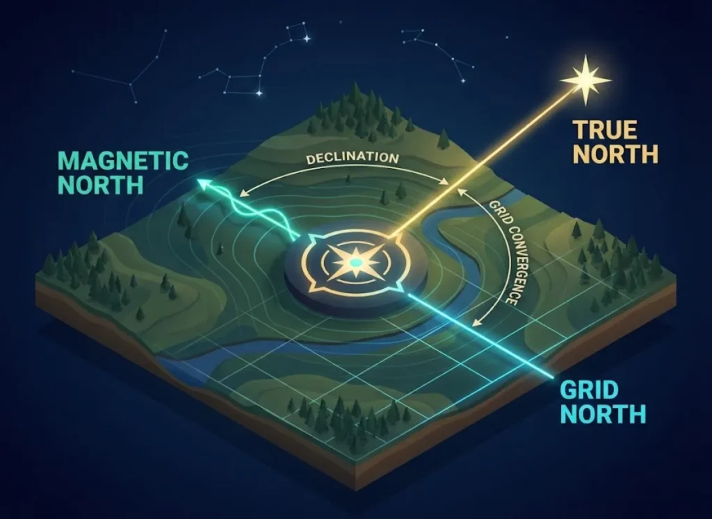
The Declination Diagram found in the map margin of topographic maps is your visual key to deciphering these angles. Magnetic Declination is specifically the angle between True North and Magnetic North at your location. Advanced navigators also track the Grid-Magnetic (G-M) Angle—sometimes referred to as the convergence angle—a critical variable for military operations and SAR teams when converting map azimuths to magnetic bearings.
Confusing these “Norths” leads to significant angular error. A single 1-degree error results in drifting 92 feet off course for every mile traveled. In the continental US, this magnetic variation can be extreme. On the West Coast, you might face a 16 degrees East declination, while Maine navigators deal with 16 degrees West. Visualizing the differences between True, Magnetic, and Grid North is the first step toward mastering analog navigation skills that work when the batteries die.
Why is the North Pole moving toward Siberia?
The Earth’s magnetic field is generated by the geodynamo—the churning of molten iron and nickel in the Earth’s iron core. This fluid motion creates geomagnetic secular variation, the scientific term for the slow change of the magnetic field over time. Currently, the North Magnetic Pole is drifting rapidly from the Canadian Arctic (near Ellesmere Island) toward Siberia at approximately 55km per year, a shift captured in the World Magnetic Model (WMM) 2025.

Because of this drift, the Agonic Line (the line of zero declination) sweeps westward across the United States. This creates a dangerous trap for hikers using old maps. A 1990 USGS quad might list a declination value that is now degrees off due to declination drift. You must understand Isogonic Lines—declination contours connecting points of equal magnetic declination—and recognize that “geomagnetic jerks” or magnetic storms can cause unpredictable surges.
Monitoring the secular variation of the magnetic field ensures you aren’t navigating with obsolete declination maps. While natural navigation techniques can help, relying on a 20-year-old map legend is a recipe for getting lost.
How Do I Find the Correct Declination Number?

You cannot rely on the printed diagram on an old map. You need to source the WMM 2025 values for your specific trip dates and location to ensure temporal accuracy.
Where can I find the most accurate current data?
The “Source of Truth” for planning any trip is the NOAA NCEI online declination calculator (using data from the USGS geomagnetism program). You input your specific Latitude/Longitude (from a map or app) and the specific date of your trip. The output provides the computed declination value in Degrees and Minutes (e.g., 14° 20′ E). Never use the “Center of Sheet” value on a paper map without verifying the print date against the rate of change.
For a quick “ballpark” estimation when a digital calculator isn’t available, you can use Isogonic Charts. However, be aware of the variance across the Continental US, ranging from roughly 16° East in Washington State to 16° West in Maine. While map margins often include an “Annual Drift” note to help you mathematically update the numbers, calculating magnetic declination for specific coordinates online is far safer. This step is a critical part of the route planner’s blueprint before you ever leave the house.
Pro-Tip: If you are traveling to high latitudes like Alaska or Northern Canada, check the declination daily. The proximity to the magnetic pole means the variance can be extreme and change over short distances, and you may also encounter significant magnetic inclination (or dip) that affects the needle balance.
How Do I Calculate Declination? (The Mathematics)

If you don’t have a compass with an adjustable declination mechanism, you must perform mental math to translate the map to the real world.
What is the “West is Best, East is Least” rule?
This mnemonic applies primarily when converting a True Bearing (Map) to a Magnetic Bearing (Field).
- “West is Best”: If your local declination is West, you Add the value to your map bearing.
- “East is Least”: If your local declination is East, you Subtract the value from your map bearing.
For example, if your map bearing is 90° and your declination is 10° West, you set your compass to 100°.
However, this rule contains a “Reverse Trap.” When converting a Magnetic Bearing (Field) back to a Map, the rule flips (East becomes Add, West becomes Subtract). This confusion is a common cause of error under stress. Always perform a visual check: Does the magnetic needle point Left (West) or Right (East) of True North? In regions with East Declination, subtracting moves the compass dial “Counter-Clockwise.”
The NWCG offers guidance on applying declination adjustments for fire line navigation, emphasizing why getting this computational logic right is vital. A calculation error here is often the first domino in a sequence that ends with a hiker needing our lost, injured, or stuck guide.
How does the Military “LARS” rule work?
Military navigators often prefer the LARS rule: Left Add, Right Subtract. This method relies on the visual Declination Diagram rather than a rhyme. Look at the diagram: Is the Magnetic North (MN) arrow to the Left or Right of the Grid North (GN) arrow?
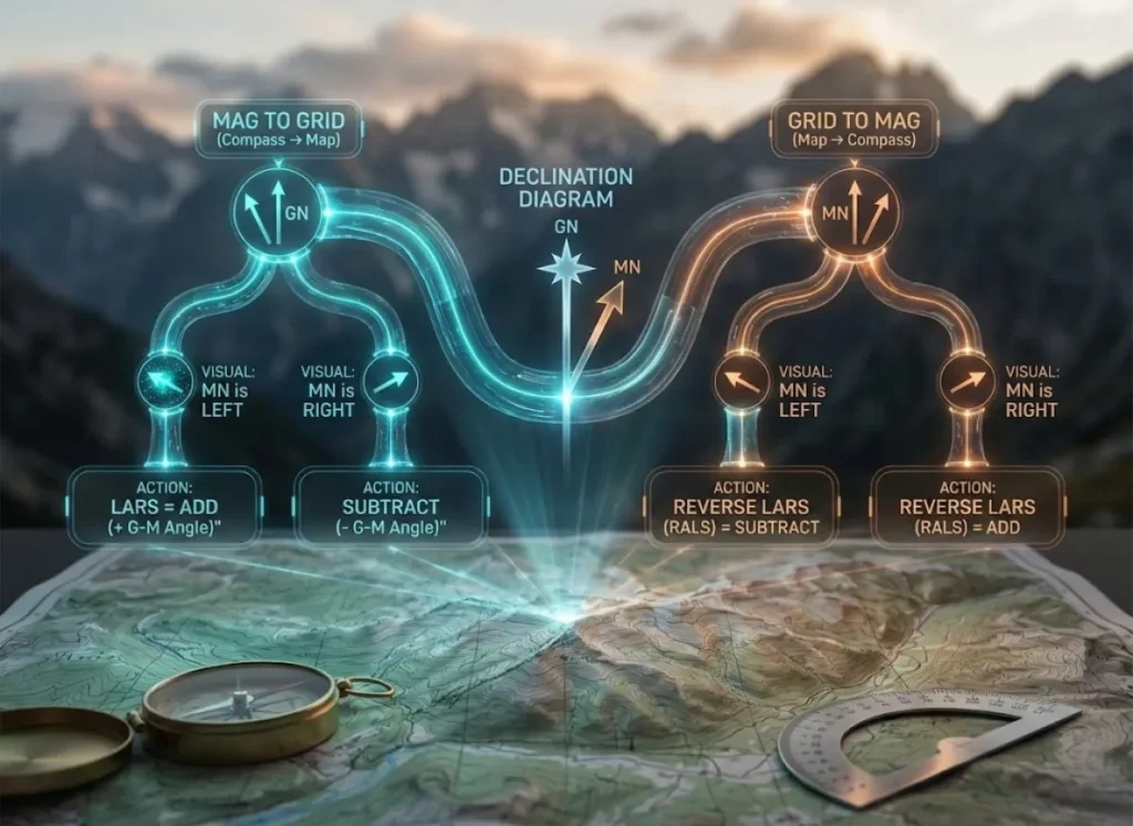
For Mag to Grid (Compass to Map), if MN is Left (West), Add the G-M angle. If MN is Right (East), Subtract it. For Grid to Mag, the rule reverses (“LARS implies RALS”). The advantage here is relying on the visual diagram printed on the map, reducing cognitive load when you are tired.
You can learn more about converting azimuths using the LARS rule in Army Field Manuals. This level of precision is often associated with non-technical mountaineering, where off-trail wilderness land navigation is mandatory.
How Do I Adjust My Compass? (The Hardware)
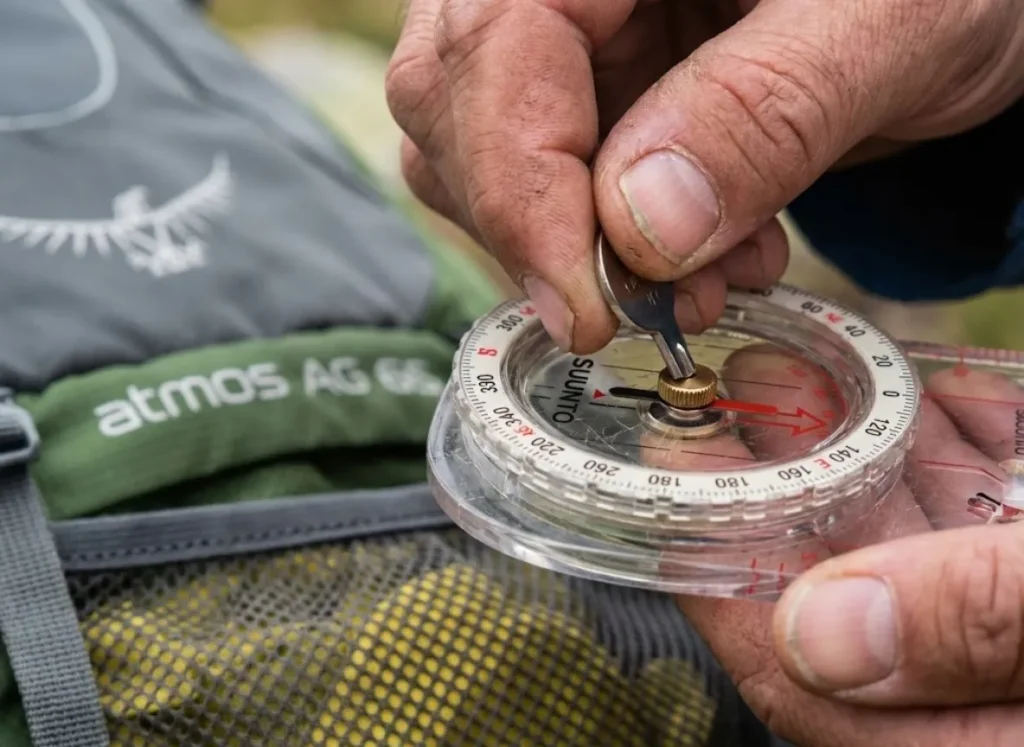
The most effective way to handle declination is to remove the math entirely by adjusting your hardware.
What is the difference between fixed and adjustable compasses?
Baseplate compasses without adjustment (like the Suunto A-10) have the orienting arrow painted directly on the capsule. You are forced to use “The Tape Method” or mental math for every single magnetic heading.
Adjustable Declination Compasses (like the Suunto MC-2 or Silva Ranger) feature an inner floor that rotates independently of the bezel. Using a small key to turn the declination screw, you physically rotate the “Shed” (Orienting Arrow) to your local offset (e.g., 14° East). Once set, the compass reads “True North” directly. This is a “Set and Forget” system for the duration of your trip.
Some models, like the Brunton TruArc, use a Tool-less Friction Adjustment, where you squeeze and twist the capsule. While faster, these are prone to “drift” or slipping over time. Regardless of the mechanism, checking your setting is one of the hiking gear must-haves routines before any expedition. For a deeper look at the mechanics, the Wisconsin State Cartographer provides excellent resources on understanding magnetic declination mechanics.
The 2026 Hybrid Workflow: How Do I Sync GPS and Compass?
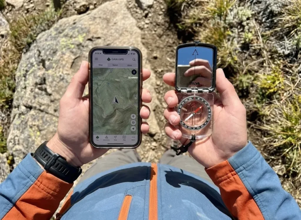
Modern navigation is not about choosing between digital and analog; it is about syncing them so they speak the same language using a digital-analog hybrid workflow.
How do I configure Gaia GPS and CalTopo to match my compass?
The safest method for the modern hiker is the “Unified Truth Protocol”—a core part of our navigation-safety framework: standardize all devices to True North. Printed maps are oriented to True/Grid, and SAR teams communicate in Grid/True.
Step 1 (Analog): Mechanically adjust your compass to offset for local declination so it reads True North.
Step 2 (Digital): Go into your App Settings (e.g., Gaia GPS > Map Controls > Compass) and toggle “Compass” to True North (not Magnetic).
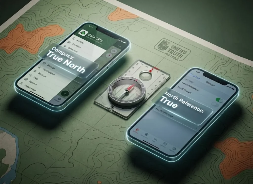
Once configured, perform a Field Sync Check. Calibrate your phone with a figure-8 wave to reset the internal magnetometer, then place it on a flat surface next to your compass (at least 12 inches apart to avoid interference). The phone’s bearing line and the compass needle should point in the exact same direction. Mismatched settings lead to “Trust Paralysis,” where your phone and compass disagree by 15 degrees in a whiteout.
For those comparing the best hiking apps of 2025, check if your chosen app (like AllTrails) supports this toggle. The NPS also advises on integrating compass use with modern mapping to ensure safety.
Troubleshooting: What If My Compass Is Acting Strange?

Sometimes your math is perfect, but the needle is wrong. This is usually due to environmental factors or local anomalies.
What causes magnetic deviation and local interference?
Magnetic Deviation is error caused by local magnetic fields near the compass, not the Earth’s field. Common culprits include the hood of a car at the trailhead, high-voltage power lines, and magnetic ore deposits containing magnetite.
You must maintain an Electronics Bubble. Keep your compass at least 20 inches away from smartphones, radios, and digital watches. If the needle dips, stutters, or swings erratically, you are likely experiencing deviation or a magnetic anomaly.
Pro-Tip: Watch out for “Reverse Polarity.” If a compass is stored too close to a speaker magnet, the magnetization can flip, causing North to point South. This requires replacement or careful re-magnetization.
The FAA provides the gold standard for identifying magnetic compass errors and deviation. Checking your compass for these errors is a key part of the 10 essentials explained.
Conclusion
Magnetic declination is the invisible variable that dictates the accuracy of every step you take off-trail. Whether you rely on the “West is Best” rhyme, the military LARS rule, or a mechanically adjusted compass, the goal is the same: to align your perception with the physical reality of the terrain.
Before your next departure, open the NOAA calculator, find your number, and practice the “Hybrid Sync.” When the fog rolls in and the trail disappears, you won’t be hoping for the best—you’ll be navigating with certainty.
FAQ – Frequently Asked Questions
Do I add or subtract magnetic declination?
It depends on your direction of conversion. For Map-to-Compass (Map to Field), use West is Best (Add West) and East is Least (Subtract East). For Field-to-Map (Plotting), the rule reverses.
How often does magnetic declination change?
The magnetic field changes constantly, but significant declination values usually shift over 1-5 years. Always check the current WMM 2025 data if your map is more than 5 years old.
Does my phone’s compass account for declination?
Yes, most smartphones have an internal magnetometer, but you must check the settings. Ensure you know if your specific app (Gaia or AllTrails) is set to display True North or Magnetic North to match your paper map.
Is magnetic declination the same as magnetic deviation?
No. Magnetic declination is the angle between magnetic north and true north globally. Deviation is a local error caused by nearby metal (cars, watches) or magnetic rocks interfering with the needle.

I've spent more than a decade researching hiking gear and trail technique. I read the specs, the forum threads and the long-term reviews, and every pick here comes with what it gets wrong.
End of the trail
You read every mile of this one. Here's where the trail goes next.