

In this article
Finding the right trail near Nashville involves navigating varied terrain. Whether you prefer popular parks or quiet preserves, this guide explores the top places to hike in nashville. We cover premier places like Radnor Lake & Warner Parks, hidden gems like Beaman Park and Harpeth River’s secluded sections, plus waterfall hikes to discover in the area.
We’ll explore the unique character of each location, from lakeside strolls to challenging ridge climbs. We will also touch upon planning your adventure, considering everything from managing crowds and parking to safety and finding accessible routes. Ready to discover your next favorite hike in the Nashville area? Let’s step onto the path.
Nashville’s Premier Hiking Destinations

Nashville’s most beloved parks offer stunning natural beauty and well-kept hiking trails right within reach. These spots are popular for good reason, showcasing the region’s landscapes. Knowing them provides a great starting point, though be prepared for company, especially during peak times, and sometimes tricky parking lot situations.
Radnor Lake State Park Insights
Radnor Lake operates differently than many parks; it’s a Class II Natural Area focused on wildlife. This means jogging, biking, and pets are restricted on most trails to protect the serene environment. Only Otter Creek Road permits these activities. This conservation focus offers great wildlife viewing but limits some recreation. Plan your visit understanding these rules are strictly enforced.
The Lake Trail is central to the Radnor experience. This 1.35-mile path offers an easy walk around the northern part of the lake on mulch, gravel, or paved surfaces. Some sections are even ADA accessible via available all-terrain wheelchairs. It’s perfect for gentle strolls and observing nature, connecting easily to other trails near the Visitor Center.
For those seeking a challenge, the Ganier Ridge Trail provides a strenuous 1.65-mile hike. It features significant elevation gain and switchbacks, reaching steep grades. Views from the ridge can be limited by trees, and online sources sometimes conflict on difficulty; trust official park info. This trail reveals the park’s rugged side.
Access the park via two main entrances: Granny White Pike (Visitor Center) or Franklin Road (East lot). Parking fills extremely quickly, particularly on weekends, so arriving early is vital. The west-side Visitor Center has restrooms and information. Consider rideshares during busy periods to avoid parking headaches.
Expect considerable crowds, especially in good weather, which can detract from the quiet atmosphere some seek. Trails often get muddy after rain, so wear appropriate footwear. The strict no-pets rule is a common point mentioned by dog owners who cannot bring their companions here.
Percy & Edwin Warner Parks Overview
The Warner Parks complex is a vast urban oasis, covering over 3,100 acres southwest of downtown Nashville. As one of Tennessee‘s largest municipal park systems managed by Nashville Metro Parks, it offers an extensive network: primitive hiking trails, paved paths, horse trails, and mountain biking areas, plus a Nature Center and picnic spots. This variety caters to nearly every outdoor interest.
Navigating the large system with its interconnected trails and varied rules (hiking vs. paved vs. equestrian) can be confusing initially. Using maps and planning your route is wise. Highlighting specific trails like the Mossy Ridge Trail or the paved loops simplifies choices. Knowing permitted uses ensures a smooth visit.
Percy Warner’s Mossy Ridge Trail, or “Red Loop,” is a 4.5-mile moderate primitive trail often cited among the best day hikes in Nashville. It winds through woods and hollows, accessed from Deep Well or Chickering Road trailheads. It offers a classic Middle Tennessee hiking experience and is a good representation of the park’s natural terrain.
Two paved loops (5.8-mile and 11.2-mile options), former scenic drives now closed to cars, are incredibly popular for walking, running, and cycling. They are stroller-friendly but rated moderate due to hills, offering accessible recreation and reaching overlooks like Luke Lea Heights according to the Friends of Warner Parks trail information. These are a major draw for fitness buffs and families.
Edwin Warner’s Harpeth Woods Trail (“Blue Loop”) is a 2.5-mile moderate trail following part of the historic Natchez Trace national scenic trail. It passes an old quarry and features vigorous hills, making for a good workout. Access it from the Nature Center or Woolwine Trailhead. This path blends natural beauty with history.
Key amenities include the Warner Park Nature Center (WPNC) in Edwin Warner, restrooms at WPNC and major Percy Warner trailheads, and ample parking. Leashed dogs are welcome on most hiking trails and paved roads but are banned on the Burch Reserve Trail and shared equestrian trail, as detailed in the Warner Parks Info & Rules. Always keep pets leashed where allowed.
These parks are very popular, drawing significant crowds, especially on paved loops and near main trailheads. While trails are generally well-kept, checking recent user reports on platforms like MTB Project for current conditions can provide updates. The vast network means quieter sections exist if you venture further out. Have you explored the less-traveled corners here?
Shelby Bottoms Greenway Features
Shelby Bottoms provides over 950 acres of greenway space along the Bells Bend River floodplain, conveniently located just a few miles east of downtown Nashville, providing easy access to nature within the city. It features paved multi-use trails and unpaved primitive paths. Its convenience makes it a favorite for quick city escapes.
The main path is a 9.7-mile paved, ADA-accessible greenway trail, ideal for walking, running, and biking. It winds along the Cumberland River with overlooks, connecting Shelby Park to the Stones River Greenway via a pedestrian bridge. Its mostly flat terrain suits all fitness levels and families, forming a key part of Nashville’s larger greenway network.
For a more natural surface, approximately 5 miles of unpaved primitive trails wind through the park’s woods and meadows. These offer a quieter experience away from the busier paved sections. These paths provide a chance to explore the floodplain ecosystem more intimately. They offer a good contrast to the main walkway.
The Shelby Bottoms Nature Center acts as a hub, offering exhibits, restrooms, program space, gardens, and even free bike rentals. It’s an excellent starting point for exploring the park. Parking is available at the Nature Center and various trailheads. The center adds value beyond just the trails.
The greenway is open dawn to dusk. Leashed pets are permitted, and standard greenway etiquette applies (keep right, pass left, yield). Due to its urban setting and ease of access, the paved trails can be quite busy, especially evenings and weekends. It functions as a vibrant community space as much as a nature park.
Long Hunter State Park Details
Located about 30 minutes east of Nashville on J. Percy Priest Lake, Long Hunter State Park offers over 30 miles of hiking trails alongside lake activities like boating and fishing. Its location provides beautiful water views, but some trails are prone to closure from lake flooding. Always check the trail status before visiting.
The Volunteer/Day Loop is a 4 to 5.5-mile moderate hike following the shoreline and accessing backcountry campsites. Often recommended as a less crowded alternative to Radnor, leashed pets are permitted here. However, this great trail frequently closes due to high water levels, making status verification essential. It offers classic lake scenery when open.
The Couchville Lake Trail is a highly accessible, 2.1-mile paved loop around the smaller Couchville Lake. Easy, flat, and mostly shaded, it features an arboretum with labeled trees, popular for families. Crucially, pets are not allowed in the Couchville Recreation Area, including this trail, according to Long Hunter hiking details. This is a major restriction for dog hikers.
Long Hunter has specific pet rules that cause confusion: leashed pets are allowed on trails like the Volunteer/Day Loop, Bluffs/Inland Trail, and Deer Trail, but are strictly prohibited in the Couchville Recreation Area (including Couchville Lake Trail) and the Bryant Grove Recreation Area (including Bryant Grove Trail and swim beach), as outlined in the Long Hunter park brochure. Visitors with dogs must carefully plan their route. Double-check maps and signage.
Amenities include a Visitor Center, restrooms near picnic areas, multiple parking lots (one for Volunteer Trail), boat ramps, a swim beach (no pets), and hike-in campsites. Potential trail closures due to flooding are the biggest challenge; check the official park website or call ahead for current conditions. Despite this, the park offers diverse lakeside recreation.
Nashville’s Hidden Gem Hikes
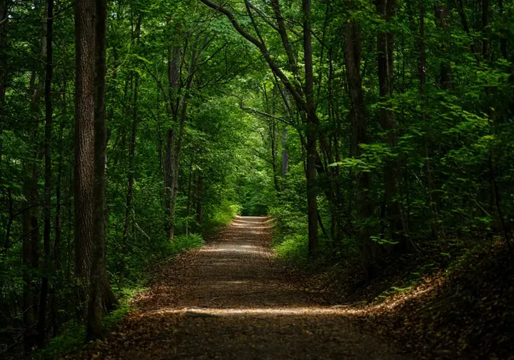
Ready to step off the main path? Escape the crowds and discover lesser-known parks near Nashville. These spots offer unique landscapes, welcome solitude, and sometimes more challenging terrain. These “secret spots” provide rewarding journeys for hikers willing to explore a bit further.
Beaman Park Exploration
In northwest Davidson County, about 30 minutes from downtown, Beaman Park protects nearly 1,700 acres of Highland Rim forest. It offers a genuinely less crowded, more rugged hiking experience than central parks. Its steep ridges, hollows, and clear creeks provide challenging terrain and a wilderness feel close to the city. It’s a top pick for seeking peace.
The Henry Hollow Loop is a popular 2-mile trail from the Creekside Trailhead. It follows Henry Creek through a hollow before climbing steeply to the ridges, involving stream crossings and elevation gain (moderate difficulty). It showcases the park’s topography and clear streams, as described on the Beaman Park Hiking and Trails page. Be prepared for potentially wet feet using appropriate footwear.
For a true backcountry feel, the Laurel Woods Trail offers a remote 12.5-mile loop (7.5-mile shortcut available). It winds through deep hollows and over high ridges, taking about 6 hours. Due to length and remoteness, hikers need solid preparation: water, food, navigation tools, and informing someone of plans. This is for experienced hikers seeking challenge.
The park has three trailheads (Nature Center, Creekside, Highland) accessing different areas. Google Maps directions to the Nature Center can be unreliable; follow posted signs. The Nature Center has restrooms and exhibits. Leashed pets are permitted on trails. What preparations do you find most essential for longer, remote hikes?
Visitors consistently praise Beaman Park for its solitude and quiet trails, offering a perfect day hike contrast to busier Nashville parks. The hilly terrain offers a good workout, and the mature forest and creek scenery are highlights. It’s a favorite among local nature lovers seeking tranquility.
Bells Bend Outdoor Center Trails
West of Nashville, in a large bend of the Cumberland River, Bells Bend Park offers a quieter experience. Focused on open spaces, it transforms historic farmland and native grasslands beside the tranquil river. Its 808 acres feel different from heavily wooded parks, attracting those seeking peace along the water. It’s known for being relatively undiscovered.
The park features about 6 miles of trails. A primary route is often described as a 2.3-mile loop crossing old farmland transitioning to native grasslands, with connections to the Cumberland River. Some sources mention a longer 6-mile option covering more area, potentially detailed on Nashville’s hiking trails page. Trails are likely natural surface, offering easy to moderate hiking.
The Bells Bend Outdoor Center is the main hub, likely offering restrooms and information. Parking is available at the Outdoor Center trailhead. Trails are open dawn to dusk, and leashed pets are permitted under Metro Parks rules. Access is straightforward via Old Hickory Boulevard.
Bells Bend is valued for its quiet, riverside trails providing solitude. It offers a chance to experience the Cumberland River landscape in a less developed setting, away from city bustle but still convenient. It’s a good choice for easy walks free from crowds with pleasant views, focusing on open space rather than dense forest.
Specific details on trail surfaces, exact routes, and scenic points might require checking the official park map directly, as some source documents were inaccessible. Consulting the Metro Parks website is recommended for the latest map and information before your visit.
Harpeth River State Park Sections
Harpeth River State Park manages sites along the river west of Nashville (30-40 min drive). The Narrows and Hidden Lake sections are popular, often less crowded hiking spots. The Narrows boasts a dramatic bluff overlook and historic tunnel, while Hidden Lake offers a secluded lake with fascinating ruins. Both blend natural beauty with intriguing history.
Two main short trails start from the Narrows trailhead. The steep half-mile roundtrip Bluff Trail climbs to a limestone bluff with panoramic views (use caution near edges). The easy half-mile Tunnel Trail leads to Montgomery Bell’s historic 1818 tunnel cut through rock, a significant industrial landmark highlighted in guides to Nashville-area state park hikes. These offer high reward for minimal distance.
The Hidden Lake section features about 3 miles of interconnected trails around a small lake. These showcase ruins from a 1930s resort and quarry. The main Hidden Lake Trail is an easy path to the lake (approx. 1 mile out). The Ridge Loop Trail involves a steep climb to overlooks with potential drop-offs, making it one of Nashville’s best trails you’ve never heard of. History adds a unique element here.
Parking is available at both Narrows and Hidden Lake trailheads. Restroom availability seems inconsistent in reports; be prepared for potentially limited facilities (portable toilets). Confirm status with the park if needed. Leashed pets are permitted on trails per state park pet rules. Park hours vary seasonally, closing between 4:30 PM and 7:00 PM.
The Narrows offers impressive views quickly. Hidden Lake provides a peaceful setting with unique historical context. Both are good alternatives to crowded Nashville parks. Some older reports mentioned potentially sparse signage at Hidden Lake, making a map or GPS app advisable. The historical elements are a major draw.
Timberland Park on Natchez Trace
Timberland Park is a 72-acre Williamson County park directly off the Natchez Trace Parkway (mile marker 437.2). This makes it an exceptionally convenient stop for drivers on the scenic route south of Nashville. It offers over 5 miles of quiet hiking trails through rolling forested hills, using old logging roads and featuring a modern interpretive center.
The park contains 9 distinct trails totaling over 5 miles, including a dedicated ADA-accessible trail leading to an overlook pavilion, providing options for various abilities, as shown in the Timberland Park brochure. Other trails wind through the hilly, wooded terrain typical of Middle Tennessee, offering a peaceful hiking experience. Complimentary walking sticks are often available.
Features include a solar-powered Interpretive Center with exhibits and restrooms, parking (including RV spots), picnic tables, an overlook pavilion, and a butterfly garden. The park is easily accessed directly from the Natchez Trace Parkway near the Highway 96 bridge. Hours vary seasonally (closing 6 PM warmer months, 4 PM colder months).
Timberland Park is consistently described as offering a quiet, uncrowded hiking environment, ideal for escaping bustle. Its easy access from the Parkway makes it a perfect nature break for travelers. The interpretive center adds educational value about local history and ecology. It’s praised for tranquility and convenience.
There is no entrance fee, and leashed pets are permitted on the trails. The park may close during inclement weather like heavy rain or ice, so checking conditions is advisable if weather is poor. It provides a well-maintained and welcoming environment for hikers.
Marcella Vivrette Smith Park Trails
South of Nashville in Brentwood, Marcella Vivrette Smith Park spans over 400 acres. It offers rugged hiking trails (over 6 miles), newer mountain bike trails, athletic fields, and the historic 1825 Ravenswood Mansion. It’s often noted as less crowded than Nashville‘s main parks like Radnor Lake. Its blend of history, nature, and recreation makes it versatile.
The park features over 6 miles of color-coded hiking trails ranging from easy to difficult, traversing fields with old stone walls and climbing steep wooded hills to scenic overlooks. The Red Trail (1.5 miles, Difficult) and Blue Trail (2.25 miles, Easy-Difficult) are popular choices offering good workouts and views. A unique Enchroma viewfinder helps those with color blindness see landscape colors.
Recently opened mountain bike trails add another dimension. Amenities include ample parking, restrooms (near hiking trailhead and fields), the historic mansion (event rental), a playground, and connections to Brentwood’s trail system. This variety caters to families, hikers, bikers, and history buffs, offering something for many interests.
Smith Park provides a solid alternative for fewer crowds and varied terrain, including challenging hills. Wildlife sightings (deer, turkeys) are common, enhancing the natural experience. Some users find trail signage initially confusing, so grabbing a map is helpful. What features do you look for in a less-crowded park?
The park is open dawn to dusk with no entrance fee. Pets are generally allowed (implied by user accounts). It serves as a major recreational hub for the Brentwood community while remaining accessible to visitors from Nashville seeking different hiking options less than an hour away. Its combination of features makes it a valuable local resource.
Nashville Area Waterfall Hikes
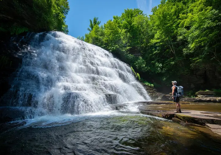
While Nashville itself lacks major waterfalls, stunning cascades await on day trips (1-2+ hours drive) to the Highland Rim and Cumberland Plateau. Plan for travel time and prioritize safety. Waterfall trails often involve steep, slippery terrain and potential water hazards. Remember your rain jacket just in case!
Closer Waterfall Options (Under 1.5 Hours)
Jackson Falls, off the Natchez Trace Parkway (45 mins SW), is reached by a short, paved walk down steps. It’s highly accessible but small, a convenient scenic stop. Machine Falls (near Tullahoma, 1 hr 15 mins SE) requires a moderately difficult loop hike through Short Springs SNA to reach its scenic cascade, often listed among the best trails to hike around Nashville.
Stillhouse Hollow Falls (Summertown, 1 hr 15 mins S) features a picturesque 75-foot waterfall accessed by a short trail (<1 mile). It showcases Western Highland Rim geology and is highlighted in guides to fall hikes near Nashville. Hidden Lake Falls (Harpeth River SP) is a very small cascade near the historic Narrows tunnel, more a minor feature than a destination.
Greeter Falls (Savage Gulf SP area, ~1.5 hrs SE) involves a loop trail with a spiral staircase to reach upper and lower falls plunging into a swimming hole. It offers a beautiful experience within the expansive Savage Gulf wilderness. Always check park status before heading out.
Destination Waterfalls (1.5 – 2+ Hours Drive)
Fall Creek Falls State Park (2 hrs SE) boasts one of the highest free-falling waterfalls east of the Mississippi (256 ft), plus others like Piney Falls. Trails range from overlooks to strenuous gorge descents (check for storm damage closures). It’s an iconic Tennessee park.
Rock Island State Park (1.5 hrs SE) features Great Falls and unique Twin Falls. CRITICAL SAFETY WARNING: Water levels below the TVA dam can rise suddenly. Check TVA schedules, heed warnings, swimming is prohibited downstream of the powerhouse. Gorge hiking is steep and rocky.
Burgess Falls State Park (1.5 hrs E) showcases four waterfalls, culminating in the 136-foot Burgess Falls via the River Trail (considered relatively strenuous). Cummins Falls State Park (1.5 hrs NE) has a stunning tiered waterfall flowing into a gorge. Gorge access requires a permit and involves a strenuous, rugged hike with flash flood risks. An easier overlook trail exists.
Foster Falls (South Cumberland SP, 1.5-2 hrs SE) is an 80-foot waterfall popular for hiking and climbing. Ozone Falls (2 hrs E) is a dramatic 110-foot waterfall (Jungle Book filming location). The trail to the base is short but exceptionally steep. Virgin Falls (2 hrs E) requires a strenuous 9-mile roundtrip hike to see the unique waterfall emerging from one cave and vanishing into another, often discussed in local hiking forums. This is for experienced hikers.
Planning Your Nashville Hike
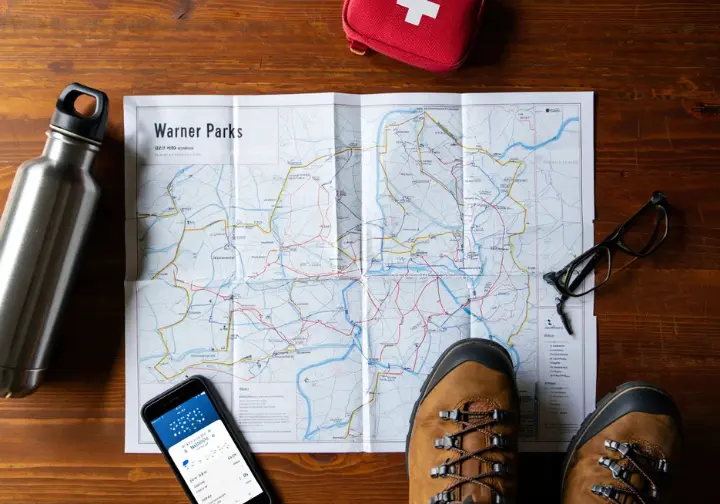
Successful Nashville hiking involves preparation. Consider seasonal changes, local safety concerns, accessibility, and reliable information sources. Addressing common challenges like crowds and parking beforehand smooths the path for your adventure. Proper gear is also essential.
Addressing Hiker Challenges
Popular parks like Radnor Lake and Warner Parks get crowded, especially weekends and peak seasons. For solitude, visit weekdays, arrive very early, or choose less-visited alternatives like Beaman Park or Bells Bend. Setting realistic expectations for popular spots is important. Have you found a favorite time to visit busy parks?
Parking is a major issue at Radnor Lake and can be tough at popular Warner Park trailheads (Deep Well) and state park spots, a frequent topic in discussions about Nashville trails. Arrive early (before 9 AM weekends), consider carpooling/rideshares for places like Radnor, and use overflow lots. Weekday visits usually offer easier parking.
Trails get muddy after rain (Radnor, Beaman). Some parks face closures from flooding (Long Hunter) or storm damage. Always check the official park website (e.g., Tennessee State Parks, Nashville Metro Parks) for current alerts, closures, and advisories before leaving home. Wear appropriate footwear for potentially wet conditions.
Pet policies vary widely. Radnor prohibits pets on most trails; Long Hunter has area restrictions; Warner Parks ban dogs in Burch Reserve/equestrian trails. Verify rules beforehand. Choose broadly dog-friendly spots like Beaman, Bells Bend, or most other Metro/State Park trails (unless posted) if hiking with a pet.
While most trails are well-marked, some report confusing signage (Harpeth River Hidden Lake, Smith Park). Downloading offline maps from park websites or using reliable GPS hiking apps (AllTrails, Hiking Project, TN State Parks Avenza maps) is recommended, especially for longer or less-trafficked trails. Don’t rely solely on spotty cell service.
Essential Safety Considerations
Water safety is critical near dams/rivers, especially Rock Island SP, where sudden water releases are hazardous. Check TVA schedules, heed warnings. Be aware of flash flood risks (Cummins Falls, streams during rain). Never underestimate moving water. One common mistake is assuming calm water is always safe near dams.
Expect uneven footing, roots, rocks on natural trails. Paths near waterfalls/creeks are often slippery. Steep drop-offs exist on bluff trails (Narrows, Hidden Lake Ridge); use extreme caution near edges. Wearing sturdy hiking shoes with good tread is vital for stability.
Deer and turkeys are common; coyotes, bobcats, foxes, and venomous snakes (Copperheads, Rattlesnakes) are present but less seen. Stay on trails, be aware, avoid reaching into unseen areas, never feed wildlife. Observe animals from a safe distance. Being mindful prevents most negative encounters.
Middle Tennessee weather changes quickly. Check forecasts. Prepare for rain, heat, or cold. Summer needs ample water, sun protection, heat awareness. Winter may bring ice/mud. Layering clothing is wise. Proper hydration is key year-round.
Cell service is often unreliable in remote areas. Don’t depend on it. Download offline maps, carry physical maps/compass for long hikes, inform someone of your plans, pack essentials: water, snacks, first-aid, flashlight, as recommended on Nashville’s hiking trail resources. Preparation is crucial for a safe return.
Finding Accessible Trails
Several parks offer designated ADA trails. Radnor Lake‘s Lake Trail has accessible sections (all-terrain wheelchair available). Timberland Park has a paved ADA trail to an overlook. Shelby Bottoms features an extensive paved greenway. These are reliable starting points for accessibility needs.
Nashville‘s paved greenway systems (Shelby Bottoms, Mill Creek, Richland Creek) offer miles of relatively flat, smooth surfaces suitable for wheelchairs, strollers, and easy walking. The paved former scenic drives in Warner Parks also fit, though they have significant hills. Greenways provide excellent urban accessible recreation.
Some unpaved trails might work for those needing easier terrain, like Long Hunter’s paved Couchville Lake Trail (no pets), shorter loops near Edwin Warner Nature Center, or Smith Park’s Green Trail through fields. Assess surface consistency, grades, and potential barriers carefully.
Detailed info on grades, surfaces, and restroom proximity for trails labeled “easy” or “paved” is often lacking. Users with specific accessibility needs should contact the park directly for accurate, current information before visiting. Verification ensures a suitable experience.
The 5.8-mile and 11.2-mile paved loops in Percy Warner Park are excellent accessibility options. Formerly scenic drives, they offer smooth surfaces for wheelchairs/strollers, though moderate hills are involved. They provide significant mileage in a beautiful park setting and are very popular.
Your Nashville Hiking Adventure
Nashville offers a rich tapestry of hiking experiences. You can explore popular urban parks like Warner and Shelby Bottoms, discover quieter “secret spots” such as Beaman Park and Harpeth River, or venture out to chase stunning waterfalls just a drive away. Each path presents its own unique journey.
Before setting out, always consult the official park website (TN State Parks or Metro Parks). Check for current trail conditions, alerts, specific rules (especially regarding pets!), and parking advice. This simple step can prevent unexpected hurdles.
Choose trails that align with your desired adventure. Consider factors like potential crowds, difficulty level, scenic features (views, water, history), distance, and any accessibility requirements you might have. Matching the trail to your goals ensures a more rewarding hike.
Remember to pack the essentials: sufficient water, energy-boosting snacks, a reliable map (offline or physical), appropriate footwear, sun and insect protection, and a basic first-aid kit. Being prepared allows you to focus on the experience.
Don’t hesitate to explore beyond the most famous names. Lesser-known parks often reveal equally beautiful scenery with the added benefit of greater tranquility. Sometimes the best discoveries lie off the beaten path.
Finally, always respect the natural environment. Adhere to park rules, stay on marked trails, practice Leave No Trace principles, and prioritize safety, particularly around water hazards and challenging terrain. Now, go discover the natural beauty surrounding Music City!
Frequently Asked Questions
What are the best places to hike in Nashville for beginners? >
Are dogs allowed on hiking trails near Nashville? >
Where can I find waterfalls near Nashville? >
How can I avoid crowds on Nashville hiking trails? >
We are a participant in the Amazon Services LLC Associates Program, an affiliate advertising program designed to provide a means for sites to earn advertising fees by advertising and linking to Amazon.com. As an Amazon Associate I earn from qualifying purchases. We also participate in other affiliate programs. The information provided on this website is provided for entertainment purposes only. We make no representations or warranties of any kind, expressed or implied, about the completeness, accuracy, adequacy, legality, usefulness, reliability, suitability, or availability of the information, or about anything else. Any reliance you place on the information is therefore strictly at your own risk. Additional terms are found in the terms of service.


