

In this article
- Why Approach Hiking as a Skill-Based Practice?
- What Core Knowledge Must SoCal Hikers Master?
- Which Beginner Trails Build the Strongest Foundation? (<5 miles, <1000 ft gain)
- Which Moderate Trails Help You Hone Your Craft? (5-10 miles, 1000-3000 ft gain)
- Which Difficult Trails Help You Master the Mountains? (>10 miles, >3000 ft gain)
- How Do You Plan the Logistics for a SoCal Hike?
- Conclusion
- Frequently Asked Questions about Hiking in Southern California
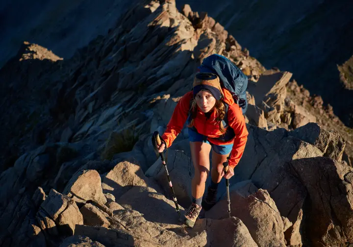
Southern California offers a lifetime of epic hikes, but simply ticking off a list of pretty trails only scratches the surface. This guide reframes the iconic landscapes of SoCal as your personal training ground, showing you not just where to hike, but how to use each hiking trail to systematically build your confidence and competence as a hiker. Forget passive sightseeing; this is about active mastery. These trails become your classroom, the peaks your milestones, and every step an investment in your outdoor education.
Here’s what this guide will help you master:
- Foundational Knowledge: Learn why framing trails as skill-builders is the key to true mastery and cover the essential knowledge—like permits and ethics—needed before you hit the trail.
- A Progressive Trail Guide: Discover curated lists of beginner, moderate, and difficult hiking destinations, each detailed with a unique “Skill Focus” to guide your development.
- Mastering the Mountains: Identify the ultimate challenge hikes that test advanced skills in endurance, navigation, and high-altitude trekking.
- Planning & Logistics: Get clear, actionable answers to the most common logistical questions, including a definitive guide to the confusing permit system.
Why Approach Hiking as a Skill-Based Practice?

To establish the article’s unique value proposition by explaining the benefits of moving beyond simple trail lists to a more purposeful, skill-oriented approach to hiking.
What is the “Trails as Training Grounds” Philosophy?
This philosophy transforms every hike into a deliberate lesson by shifting your goal from merely reaching a destination to consciously practicing a specific competency in a real-world environment. A steep, grueling path is no longer just “hard”; it becomes a focused opportunity for Endurance Training. A trail with unmarked junctions becomes an invaluable chance for Navigation Practice. This approach fosters a deeper connection with the landscape, forcing you to analyze its features and challenges, making you a more observant and engaged hiker.
Adopting this mindset accelerates skill development, builds confidence for more ambitious objectives (like a multi-day backpacking trip or even a thru-hiking adventure), and fundamentally increases your safety and self-reliance in the backcountry. It’s the critical step in transitioning from a day hiker to a self-reliant backpacker, turning passive recreation into active skill acquisition. This is the gap left by competitors who only describe trails without explaining how those trails make you a better, more capable hiker.
What Core Knowledge Must SoCal Hikers Master?
To provide foundational safety and ethical knowledge that is essential for responsibly hiking in Southern California’s unique and often fragile environments.
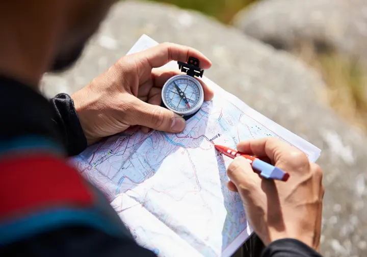
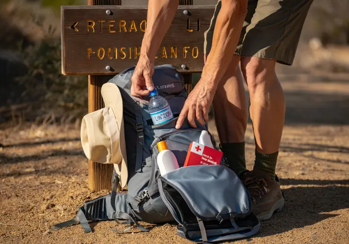
How Do You Apply The Ten Essentials to SoCal’s Diverse Terrains?
The Ten Essentials are not a rigid checklist but ten flexible “systems” for safety, and the key is adapting them to Southern California’s specific hazards. Two systems, Hydration and Sun Protection, are paramount. Due to the relentless heat and exposure on many loop trails, you must carry more water than you think you’ll need and consistently use UPF-rated clothing, hats, and sunscreen.
Navigation is also critical, as desert or chaparral trails can become indistinct and easy to lose. A GPS device or phone app is standard, but it must be backed up by a physical map and compass—and the knowledge to use them. Finally, Insulation is the most frequently underestimated system. A sunny 75-degree day at a trailhead can become a dangerously cold and windy 45-degree emergency at a 10,000-foot peak, even on a simple day hike. Always pack extra insulating layers, no matter how good the forecast looks. For a complete breakdown, refer to The National Park Service’s official Ten Essentials system and build your kit using our comprehensive day hiking checklist.
What Do Leave No Trace Principles Mean in Fragile Desert & Alpine Zones?
Leave No Trace (LNT) is a set of seven principles forming the backbone of outdoor ethics, and in SoCal’s unique ecosystems, certain principles demand special attention. The principle of Traveling on Durable Surfaces is vital. In the California desert, this means staying strictly on established trails to avoid crushing fragile cryptobiotic soil, a living crust that can take decades to recover from a single footstep. In alpine zones, it means never cutting switchbacks, an act that creates erosion scars and degrades the trail for everyone.
Properly Disposing of Waste goes beyond packing out wrappers. In these arid environments, you must pack out everything, including organic waste like apple cores and orange peels. They do not decompose quickly and can attract and harm wildlife. This directly connects to Respecting Wildlife, which includes observing animals like rattlesnakes, bighorn sheep, and bears from a safe distance and never, ever feeding them. Mastering these principles is non-negotiable for responsible hiking, as detailed by the official The 7 Principles of Leave No Trace and explored in depth in our guide to mastering outdoor ethics.
Which Beginner Trails Build the Strongest Foundation? (<5 miles, <1000 ft gain)
To provide a curated list of accessible trails perfect for new hikers, framing each one around the foundational skills it helps develop.
Barker Dam & Hidden Valley (Joshua Tree): The Perfect Intro to Desert Navigation?
Trail Snapshot: This pair of short, easy loops provides a perfect introduction hike to the park’s iconic monzogranite rock formations, twisted Joshua trees, and unique desert flora.
Iconic Feature: The historic Barker Dam, which can hold a surprising amount of water after seasonal rains, creates a surreal desert oasis that attracts birds and other wildlife. Nearby, Hidden Valley is a stunning, self-contained bowl completely enclosed by massive rock formations, and the Hidden Valley Trail is a must-do.
Skill Focus – Basic Navigation & Trail Awareness: While well-marked, these interconnected trails are excellent for practicing basic map reading and landmark identification. The landscape can appear uniform, training you to pay close attention to trail signs and distinctive rock shapes to stay oriented.
Logistics: The trails are located inside Joshua Tree National Park and require a park entrance fee for access. To avoid dangerously high temperatures, these Joshua Tree hikes are best hiked between October and April. Always check the official hiking information for Joshua Tree National Park before you go.
| Feature | Details |
|---|---|
| Location | Joshua Tree National Park, CA |
| Trail Name(s) | Barker Dam Nature Trail & Hidden Valley Nature Trail |
| Roundtrip Length | Barker Dam: ~1.1 miles; Hidden Valley: ~1.0 mile |
| Elevation Gain | Minimal (less than 100 ft for each loop) |
| Difficulty | Easy |
| Skill Focus | Basic Navigation & Trail Awareness |
| Cost/Fees | National Park Entrance Fee |
| Dog-Friendly | No (dogs not permitted on trails) |
| Key Features | Historic Dam, Desert Oasis, Unique Rock Formations, Joshua Trees, Wildlife, Enclosed Valley |
| Best Season | October – April |
| Key Risks | Extreme Summer Heat, Lack of Shade |
[PRO-TIP]: Even on short desert trails, carry at least two liters of water per person. The dry air causes you to lose moisture through respiration far faster than in other climates. If you want more guidance, check out these more essential tips for beginner hikers.
Solstice Canyon (Malibu): Best for Learning Trail Etiquette and History?
Trail Snapshot: This is an easy, mostly paved out-and-back trail located in the Santa Monica Mountains. The path follows Solstice Creek inland to the ruins of a famous mid-century home and a seasonal waterfall, a prime example of coastal California hiking.
Iconic Feature: The primary draw is the stone and brick ruins of the “Tropical Terrace” house, designed by renowned architect Paul Revere Williams. After exploring the ruins, a short spur trail leads to the base of the waterfall, which flows best after winter and spring rains.
Skill Focus – Trail Etiquette & Historical Context: As a very popular hike, Solstice Canyon is a perfect classroom for practicing trail etiquette. You’ll have plenty of opportunities to yield to uphill hikers, manage your pace around other groups, and learn to be a considerate visitor. The ruins also provide a unique chance to hike through a piece of California history.
Logistics: The trail is managed as part of the Santa Monica Mountains National Recreation Area. The main parking lot is small and fills extremely quickly on weekends, so an early start is essential. You can find more details by exploring the Santa Monica Mountains on the NPS website.
| Feature | Details |
|---|---|
| Location | Santa Monica Mountains National Recreation Area, Malibu, CA |
| Trail Name | Solstice Canyon Trail |
| Roundtrip Length | ~3 miles (variable based on exploration) |
| Elevation Gain | Minimal (less than 150 ft) |
| Difficulty | Easy |
| Skill Focus | Trail Etiquette & Historical Context |
| Cost/Fees | None (free) |
| Dog-Friendly | Yes (on leash) |
| Key Features | Historic “Tropical Terrace” Ruins, Seasonal Waterfall, Solstice Creek, Coastal California Flora |
| Best Season | Year-round (waterfall flows best in winter/spring) |
| Key Risks | Limited Parking (fills quickly), Summer Heat (less shaded) |
Which Moderate Trails Help You Hone Your Craft? (5-10 miles, 1000-3000 ft gain)
To guide hikers to the next level with a selection of moderately challenging trails, focusing on the intermediate skills they teach, such as pace management and basic altitude acclimatization.
Mishe Mokwa to Sandstone Peak: Your Introduction to Pace Management?
Trail Snapshot: This fantastic loop trail in the Santa Monica Mountains is a good intermediate hike, delivering on all fronts: varied scenery, unique geology like Balanced Rock, and panoramic ocean and island views.
Iconic Feature: The undisputed highlight is the 360-degree view from the summit of Sandstone Peak. At 3,111 feet, it is the highest point in the Santa Monica Mountains, offering some of the best mountain views in Southern California.
Skill Focus – Pace Management & Hydration Strategy: The trail’s ~6-mile length and respectable ~1,600 feet of elevation gain require you to consciously manage your energy and hydration. It’s the perfect environment to learn how to find a sustainable rhythm over a longer distance, a critical skill you can perfect by mastering the art of hiking pace.
Logistics: The trailhead is conveniently located off Yerba Buena Road, with no fees required for parking. The trail is very exposed to the sun, making ample water and sun protection absolutely essential. While part of the Santa Monicas, this area falls under the jurisdiction of hiking opportunities in California’s State Parks.
| Feature | Details |
|---|---|
| Location | Santa Monica Mountains, California State Parks |
| Trail Name | Mishe Mokwa to Sandstone Peak Loop |
| Roundtrip Length | ~6 miles |
| Elevation Gain | ~1,600 feet |
| Difficulty | Intermediate |
| Skill Focus | Pace Management & Hydration Strategy |
| Cost/Fees | None (free parking) |
| Dog-Friendly | Yes (on leash) |
| Key Features | Varied Scenery, Balanced Rock, Panoramic Ocean & Island Views, Sandstone Peak Summit (highest point in Santa Monica Mountains) |
| Best Season | Year-round (cooler months are preferable due to sun exposure) |
| Key Risks | Significant Sun Exposure, Requires Ample Water |
Strawberry Peak (Mountaineer’s Route): A Safe Intro to Scrambling?
Trail Snapshot: A challenging hike to the highest summit in the front range of the San Gabriel Mountains. While the standard trail is a solid moderate hike, the optional “Mountaineer’s Route” offers a thrilling taste of real adventure for those ready to use their hands.
Iconic Feature: The final ridge to the summit is a legitimate Class 2/3 scramble. This involves sustained sections where you must use your hands for balance and to pull yourself up and over rock obstacles.
Skill Focus – Introduction to Scrambling & Route Finding: This route provides a controlled environment to learn basic scrambling techniques on solid, grippy rock without the severe exposure of more advanced climbs. It forces you to think three-dimensionally about hand and foot placement and to analyze the rock for the safest path forward. It’s a perfect primer before diving into our complete guide to scrambling.
Logistics: An Adventure Pass is required for parking at the trailhead at Red Box Picnic Area. You can find official information on San Bernardino National Forest permits to ensure you have what you need. This route should only be attempted in dry conditions.
| Feature | Details |
|---|---|
| Location | San Gabriel Mountains, Angeles National Forest, CA |
| Trail Name | Strawberry Peak (Mountaineer’s Route) |
| Roundtrip Length | ~5.5 – 6 miles (for Mountaineer’s Route) |
| Elevation Gain | ~1,200 – 1,500 feet (for Mountaineer’s Route) |
| Difficulty | Difficult (Class 2/3 scramble) |
| Skill Focus | Introduction to Scrambling & Route Finding |
| Cost/Fees | Adventure Pass required for parking |
| Dog-Friendly | Yes (on leash, but scrambling may be challenging for some dogs) |
| Key Features | Class 2/3 Summit Scramble, Panoramic Views, Highest Summit in Front Range |
| Best Season | Spring and Fall (dry conditions are essential) |
| Key Risks | Loose Rock, Exposure (moderate), Requires Dry Conditions |
Which Difficult Trails Help You Master the Mountains? (>10 miles, >3000 ft gain)
To showcase the pinnacle of Southern California day hiking, presenting elite-level trails that test a wide range of advanced skills and physical conditioning.
Mt. Baldy via Ski Hut Trail: The Gold Standard for Endurance & Altitude?
Trail Snapshot: This is the classic and brutally steep route to the summit of Mt. San Antonio (Mt. Baldy) via the Ski Hut Trail, a must-hike peak for any serious SoCal hiker. Gaining nearly 4,000 feet in just over four miles, this challenging hike is a true benchmark.
Iconic Feature: The hike has two main payoffs: standing on the 10,064-foot summit, the highest in the San Gabriel mountain range, and surviving the thrillingly narrow “Devil’s Backbone” ridge on the descent loop.
Skill Focus – Advanced Endurance & Altitude Acclimatization: This trail is a masterclass in physical and mental endurance. More importantly, hiking above 8,000 feet provides a crucial lesson in managing the physiological effects of high altitude, a necessary skill for any aspiring mountaineer. The rugged terrain also forces a decision on choosing between trail runners and hiking shoes.
Logistics: A National Forest Adventure Pass is required for parking at Manker Flats. Be aware that this route is extremely dangerous in winter conditions and requires legitimate mountaineering skills and equipment (ice axe, crampons, and the knowledge to use them). Always check for current Passes and Permits for the Angeles National Forest.
| Feature | Details |
|---|---|
| Location | San Gabriel Mountains, Angeles National Forest, CA |
| Trail Name | Mt. Baldy via Ski Hut Trail (Loop) |
| Roundtrip Length | ~8.2 miles (loop) |
| Elevation Gain | ~3,900 feet |
| Difficulty | Challenging / Strenuous |
| Skill Focus | Advanced Endurance & Altitude Acclimatization |
| Cost/Fees | Adventure Pass required for parking |
| Dog-Friendly | Yes (on leash) |
| Key Features | Mt. Baldy Summit (10,064 ft), Devil’s Backbone Ridge, Ski Hut |
| Best Season | Late Spring to Fall (dry conditions) |
| Key Risks | Extreme steepness, high altitude effects, highly dangerous in winter (requires mountaineering gear) |
San Gorgonio Peak: The Ultimate Test of High-Altitude Trekking?
Trail Snapshot: This long trek to the summit of San Gorgonio Mountain is a massive undertaking. The Vivian Creek route is the shortest path to the top, but at 16+ miles, it is one of the most demanding day hikes available.
Iconic Feature: The true reward is standing on the 11,503-foot summit of “Old Greyback.” On a clear day, the panoramic view can stretch from the distant Sierra Nevada to the north to the Mexican border to the south.
Skill Focus – Multi-Day Logistics & High-Altitude Management: This hike is so long it requires the same logistical planning as an overnight backpacking trip in terms of food, water calculation, and timing. It’s the ultimate classroom for understanding personal limits and managing energy in the thin, unforgiving air above 11,000 feet. The long mileage makes footwear critical; check our review of the best trail runners for backpacking.
Logistics: This is a critical point: a free, mandatory Wilderness Permit is required for entry into the San Gorgonio Wilderness. This is separate from and in addition to the Adventure Pass needed for parking. For examples of these systems, see the Mount San Jacinto State Park permit details.
| Feature | Details |
|---|---|
| Location | San Gorgonio Wilderness, San Bernardino National Forest, CA |
| Trail Name | San Gorgonio Peak (Vivian Creek Route) |
| Roundtrip Length | ~16.5 miles |
| Elevation Gain | ~5,300 feet |
| Difficulty | Strenuous / Extremely Difficult |
| Skill Focus | Multi-Day Logistics & High-Altitude Management |
| Cost/Fees | Free Wilderness Permit (mandatory) + Adventure Pass for parking |
| Dog-Friendly | Yes (on leash) |
| Key Features | San Gorgonio Summit (11,503 ft, highest in Southern California), Panoramic Views |
| Best Season | Late Spring to Fall (after snowmelt, before significant snowfall) |
| Key Risks | High Altitude Sickness, Extreme Length & Elevation Gain, Rapid Weather Changes, Limited Water Sources |
How Do You Plan the Logistics for a SoCal Hike?
To provide a clear, actionable guide that resolves the most common and confusing logistical hurdles hikers face in Southern California, directly addressing the “Information Gaps” identified in the research.
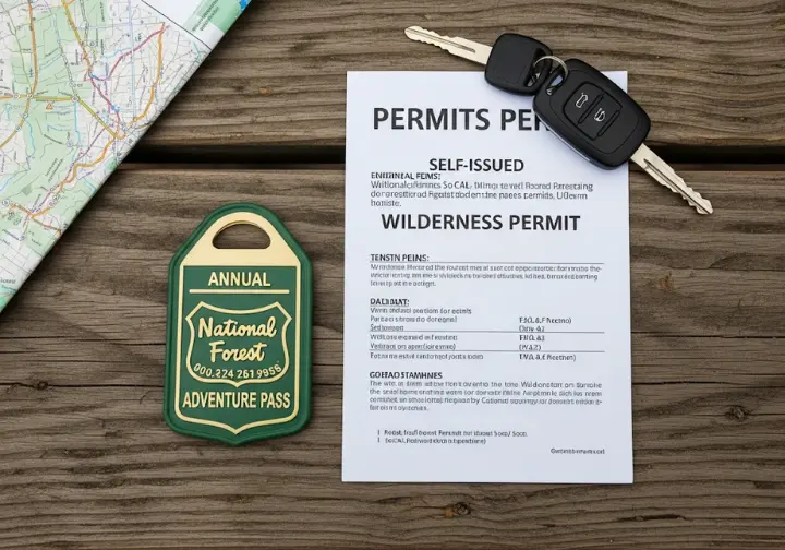
What’s the Difference Between an Adventure Pass and a Wilderness Permit?
This two-tiered system is a major source of confusion for hikers, but it’s simple once you understand the distinction. Think of it as a pass for your car versus a pass for your person.
The National Forest Adventure Pass is essentially a parking pass. It is required when you park your vehicle in a designated fee site within the four National Forests in Southern California, including the Angeles National Forest and the San Bernardino Mountains. It costs $5 for a day pass or $30 for an annual pass.
[PRO-TIP]: Always check the current status of your intended trailhead and route on the official US Forest Service website before you leave. Seasonal closures for fire danger, especially during wildfire season, or storm damage are common. For hikes like San Gorgonio or Cucamonga Peak, you need both: an Adventure Pass to park your car and a Wilderness Permit to legally walk onto the trail. Mastering these requirements is a key skill, similar to navigating complex permit systems in places like Glacier National Park.
A Wilderness Permit is an entry permit, completely separate from the Adventure Pass. It is required for you to legally enter a federally designated Wilderness Area, such as the San Gorgonio Wilderness or Cucamonga Wilderness. These permits are typically free but are mandatory for tracking visitor usage and promoting LNT principles.
| Feature | Adventure Pass | Wilderness Permit |
|---|---|---|
| What it is | A parking pass for your vehicle | An entry permit for your person |
| Where it’s needed | Designated fee sites within Southern California National Forests (e.g., Angeles National Forest, San Bernardino Mountains) | Federally designated Wilderness Areas (e.g., San Gorgonio Wilderness, Cucamonga Wilderness) |
| How to get it | Purchase at ranger stations, visitor centers, or authorized vendors; $5 daily, $30 annual | Typically free; obtained through online reservation or at a ranger station/kiosk (check specific wilderness area requirements) |
Conclusion
The best hiking trails in southern california offer more than just postcard views; they are practical, accessible environments where you can systematically develop the skills of a truly competent hiker. From learning navigation in Joshua Tree to mastering high-altitude endurance on San Gorgonio, each hike is an opportunity to progress.
- Mastering the “Big Three” SoCal challenges—Mt. Baldy, San Gorgonio, and San Jacinto—is a true test of a hiker’s physical and logistical preparedness.
- Successful and responsible hiking in this region requires a deep understanding of Leave No Trace ethics and proactive safety planning using the Ten Essentials system.
- A critical and often confusing logistical step is understanding the permit system: you often need both an Adventure Pass for parking and a separate, free Wilderness Permit for entry into protected areas.
Use this guide to choose your next adventure, and explore our full library of hiking skill guides to prepare for the challenge.
Frequently Asked Questions about Hiking in Southern California
What are the hardest hikes in Southern California?
The three most commonly cited hardest day hikes are Mount San Gorgonio via Vivian Creek, Mount San Antonio (Baldy) via the Ski Hut Trail, and San Jacinto Peak via the Cactus to Clouds trail. These hikes are defined by extreme elevation gain (over 10,000 ft for Cactus to Clouds), high altitude, and long distances.
Do I always need a permit to hike in Southern California?
No, but you frequently need one for the most popular mountain trails. A National Forest Adventure Pass is required for parking at many trailheads in the National Forests, while a separate, free Wilderness Permit is often required for entering designated Wilderness Areas.
What is the best season for hiking in Southern California?
Southern California offers year-round hiking, but the best season depends entirely on the location. High-elevation peaks in the snow-free mountains are best hiked from late spring to fall, while desert hikes like those in Joshua Tree or Anza-Borrego are best hiked in the winter and early spring to avoid dangerous heat.
Are there any good waterfall hikes for beginners?
Yes, several excellent beginner-friendly waterfall hikes exist. Eaton Canyon Falls near Pasadena and Sturtevant Falls in the San Gabriel Mountains are two of the most popular hikes, featuring relatively flat trails and impressive seasonal southern california waterfalls.
Risk Disclaimer: Hiking, trekking, backpacking, and all related outdoor activities involve inherent risks which may result in serious injury, illness, or death. The information provided on The Hiking Tribe is for educational and informational purposes only. While we strive for accuracy, information on trails, gear, techniques, and safety is not a substitute for your own best judgment and thorough preparation. Trail conditions, weather, and other environmental factors change rapidly and may differ from what is described on this site. Always check with official sources like park services for the most current alerts and conditions. Never undertake a hike beyond your abilities and always be prepared for the unexpected. By using this website, you agree that you are solely responsible for your own safety. Any reliance you place on our content is strictly at your own risk, and you assume all liability for your actions and decisions in the outdoors. The Hiking Tribe and its authors will not be held liable for any injury, damage, or loss sustained in connection with the use of the information herein.
Affiliate Disclosure: We are a participant in the Amazon Services LLC Associates Program, an affiliate advertising program designed to provide a means for us to earn advertising fees by advertising and linking to Amazon.com. As an Amazon Associate, we earn from qualifying purchases. We also participate in other affiliate programs and may receive a commission on products purchased through our links, at no extra cost to you. Additional terms are found in the terms of service.


