

In this article
- Why the Laurel Falls Trail is Closed: A Case Study in Park Management
- Your Definitive Guide to the Best Laurel Falls Alternatives
- The “Park It Forward” Program: Your Guide to Parking in the Smokies
- The Future of Laurel Falls: What to Expect in 2026
- Conclusion: A Responsible Path Forward for a Smoky Mountain Icon
- Frequently Asked Questions about the Laurel Falls Trail
CRITICAL UPDATE: As of January 6, 2025, the popular Laurel Falls Trail in the Smoky Mountains is completely closed to all public access for a major rehabilitation project. This extensive closure of the hiking trail is expected to last approximately 18 months, with a potential reopening in mid-2026. The National Park Service (NPS) initiated this project within the Great Smoky Mountains National Park to address severe trail degradation, improve visitor safety, and protect the surrounding forest and natural resources from decades of heavy use. This guide has been fully updated to provide the most current and authoritative information: we will explain the reasons behind the closure, offer a detailed guide to the best NPS-recommended alternative waterfall hikes, and give you a look at what the new-and-improved Laurel Falls will offer when it reopens.
Why the Laurel Falls Trail is Closed: A Case Study in Park Management


The closure of such a popular trail can be disappointing, but it’s a crucial act of stewardship by the National Park Service. Understanding the reasons reveals a commitment to preserving this beloved Smoky Mountains icon for future generations, addressing issues of safety, overcrowding, and long-term sustainability across the park.
Severe Trail Degradation and Safety Hazards
The trail’s original pavement, a 1963 solution to combat erosion, has deteriorated significantly. Over decades of use, this asphalt trail developed extensive cracks and uneven surfaces, creating serious trip-and-fall hazards along the mountain path. This created a frustrating paradox for families, as the once-easy paved path was no longer safe or genuinely accessible for strollers.
Beyond the issues with the trail surface, fundamental support structures like retaining walls were failing. These problems, combined with a steep drop off the side of the cliff in some sections, presented a major safety risk. For the most up-to-date information on park-wide alerts, always check the NPS page for current conditions and trail closures. Part of responsible hiking is starting with well-marked trails suited to one’s fitness level, and this project aims to restore the Laurel Falls Trail to that standard.
Overwhelming Crowds and Resource Damage
Laurel Falls simply became a victim of its own fame and beautiful scenery. With over 375,000 visitors in a single year, the trail experienced unsustainable levels of congestion. The walkway bridge at the falls area was often a shoulder-to-shoulder crowd, which diminished the natural experience. This was a key factor in the park’s 2021 congestion management pilot program.
This intense foot traffic also caused significant resource damage in the surrounding woods. To escape crowds, visitors created “social trails,” trampling fragile vegetation and accelerating erosion. The park is dedicated to managing visitor impact to prevent long-term damage, a lesson reinforced by recovery efforts in areas affected by events like the Cove Mountain fire. The crowds also led to unsafe parking along the narrow shoulders of Little River Road. Adhering to and practicing Leave No Trace principles is vital to protect these spaces, and you can learn more from the NPS’s guide to the Leave No Trace principles.
The Laurel Falls Trail Management Plan
The current closure is the culmination of a formal, multi-year planning process. The NPS developed this long-term solution, documenting it in the official Laurel Falls Trail Management Plan. When planning any hike, relying on official government sources like this provides the most accurate information.
The plan’s primary goals are clear: protect park resources, improve the visitor experience, rehabilitate the trail surface of the Laurel Falls hiking trail, and reduce safety risks. A key element is constructing approximately 50 new, paved parking spaces near the trailhead. This will formalize parking and improve the flow of traffic along the Laurel Branch of the Little River.
Your Definitive Guide to the Best Laurel Falls Alternatives

Just because the Laurel Falls Trail is temporarily unavailable doesn’t mean your quest for a stunning Smoky Mountains waterfall has to be put on hold. The National Park Service recommends several fantastic alternatives, each offering its own unique character and beauty within the Great Smoky Mountains.
For a Unique Experience: Grotto Falls
This 2.6-mile roundtrip hike is considered moderate and is famous for a feature that sets it apart: the trail actually passes behind the 25-foot waterfall. This creates an incredible experience in the mountains. You can find detailed information on the hike to Grotto Falls on the NPS website.
The path follows the Trillium Gap Trail, an unpaved route through a beautiful hardwood forest. It features rocky paths and is frequently muddy. Sturdy, waterproof hiking footwear is essential for a safe and comfortable trek here. The trailhead is located on the one-way Roaring Fork Motor Nature Trail, which is closed to vehicles in winter.
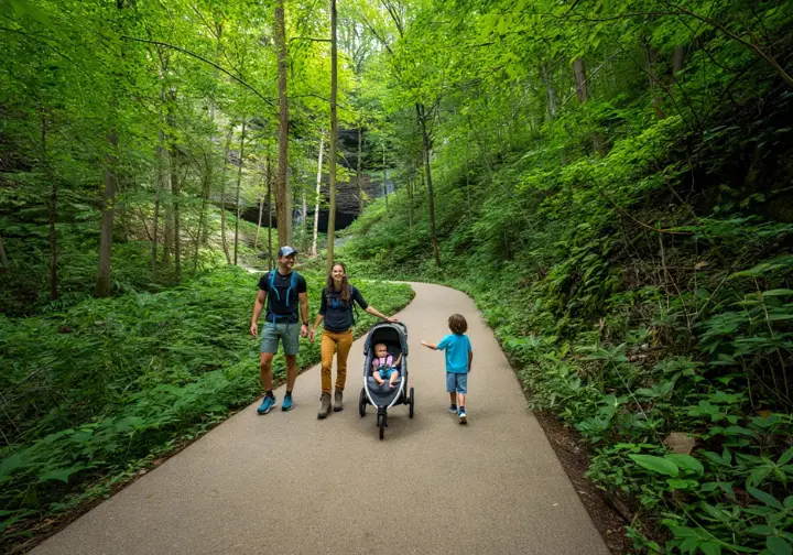
For an Easy Family Stroll: Lynn Camp Prong Cascades
For families or anyone looking for a gentler walk, this is an outstanding choice. The hike is a 1.4-mile roundtrip with very little elevation change through a scenic valley. The trail is wide and follows the tumbling cascades of the Lynn Camp Prong river. The NPS provides a good overview of the hike to Lynn Camp Prong Cascades.
The trail itself is a historic gravel railroad bed, which makes it much wider and smoother than typical mountain paths. This quality makes it one of the best options for a relaxed woodland stroll with children. The area is especially beautiful during the spring wildflower season and offers a different kind of scenery than the higher elevations.
For Maximum Convenience: Cataract Falls
At just 1.0 mile roundtrip, Cataract Falls is the most accessible waterfall on this list, making for a nice hike. It is an ideal pick for those with very young children. Its trailhead is just steps from the Sugarlands Visitor Center, which removes any anxiety about finding parking.
While not as tall as Laurel Falls, the 40-foot Cataract Falls is a lovely, multi-tiered cascade. The short walk is a perfect introduction to the beauty of the Smokies. It’s a great starting point for any itinerary beginning at Sugarlands Visitor Center.
The “Park It Forward” Program: Your Guide to Parking in the Smokies

Any alternative hike you choose will require you to understand the park’s parking tag system. This program is not only mandatory for parking but is also a primary funding source for maintaining park trails throughout the Smoky Mountains.
How the “Park It Forward” Program Works
The Great Smoky Mountains National Park is unique in that it does not charge an entrance fee. However, since March 2023, it requires a valid parking tag for any vehicle parked for more than 15 minutes. This program was created to generate revenue that directly supports park operations. For official details, see the official park fees and passes information.
A parking tag allows you to park but does not guarantee a space. Arriving early remains the best strategy. The program has been a success; a report on the first year of parking tag proceeds shows over $12 million generated, which is being reinvested into the park.
Parking Tag Costs and How to Purchase
The program offers three convenient options for visitors: a $5 Daily Tag, a $15 Weekly Tag, and a $40 Annual Tag. The daily and weekly options are paper printouts, while the annual tag is a decal for your windshield.
You can buy tags through several channels. To purchase online, you can use Recreation.gov, but you must print the tag before you arrive. You can purchase online through Recreation.gov for daily and weekly passes. Annual tags can be purchased from the park’s non-profit partner, Smokies Life, and will be shipped to you. For in-person purchases, you can visit any of the park’s main visitor centers.
How to Display Your Tag and Key Exemptions
Proper display of your parking tag is mandatory to avoid a citation. Paper daily and weekly tags must be placed face-up on the passenger side of the dashboard. The annual tag is a sticker that must be affixed to the lower passenger-side corner of the front windshield.
Parking tags are non-transferable. There is an important exemption: vehicles displaying valid, state-issued disabled placards or license plates do not need to purchase or display a park-issued parking tag.
The Future of Laurel Falls: What to Expect in 2026
The current closure is paving the way for a much-improved Laurel Falls experience. When the trail reopens, visitors will find significant upgrades that address the core issues of safety, accessibility, and overcrowding at this Smoky Mountain landmark.
A Safer, More Durable Trail Surface
The main goal of the rehabilitation is to replace the old, broken asphalt trail with a more durable surface, creating a proper paved hiking trail. The new path will be engineered to manage water drainage, which will prevent the erosion that destroyed the old pavement. When it reopens, you can check the official hike to Laurel Falls page for details.
This new surface will be graded to meet modern standards, making the complete trail genuinely safer and a paved trail suitable for visitors of all abilities, including those with strollers. The project also involves stabilizing the trail’s foundation, ensuring the long-term stability of the path for years to come.
Enhanced Viewing Areas and Better Parking
The project includes plans to improve the falls area around the spectacular 80-foot-high Laurel Falls. This will likely involve redesigning the area around the walkway bridge to reduce bottlenecks and create more room for visitors to enjoy the actual falls.
The trail gets its name Laurel from the dense mountain laurel, a type of evergreen shrub, that blooms beautifully along the path, particularly near the Laurel Branch stream that feeds the falls. A huge improvement will be the formalized parking near the trail entrance. The plan calls for approximately 50 new, designated spaces at the trail head, eliminating the dangerous parking along Little River Road.
Conclusion: A Responsible Path Forward for a Smoky Mountain Icon
The 18-month closure of the Laurel Falls Trail marks a pivotal moment of stewardship for the Great Smoky Mountains National Park. It is a necessary step to ensure this classic hiking trail survives for generations to come.
While the trail is closed, hikers have excellent, NPS-recommended alternatives. You can enjoy the unique experience of Grotto Falls, the family-friendly Lynn Camp Prong Cascades, or the convenient Cataract Falls. Remember that the “Park It Forward” parking tag program is required for these hikes. We look forward to the grand reopening in mid-2026, when we can all return to a safer and more enjoyable Laurel Falls.
Frequently Asked Questions about the Laurel Falls Trail
Is the Laurel Falls Trail really closed? I see recent pictures online. +
Do I still need to buy a “Park It Forward” parking tag to hike the alternative trails? +
After it reopens, will the new Laurel Falls Trail be stroller and wheelchair accessible? +
Why was the trail paved in the first first place? +
We are a participant in the Amazon Services LLC Associates Program, an affiliate advertising program designed to provide a means for sites to earn advertising fees by advertising and linking to Amazon.com. As an Amazon Associate I earn from qualifying purchases. We also participate in other affiliate programs. The information provided on this website is provided for entertainment purposes only. We make no representations or warranties of any kind, expressed or implied, about the completeness, accuracy, adequacy, legality, usefulness, reliability, suitability, or availability of the information, or about anything else. Any reliance you place on the information is therefore strictly at your own risk. Additional terms are found in the terms of service.


